defining the edges of Hampton Roads, determining which jurisdictions to include/exclude, is a judgment call
Source: ESRI, ArcGIS Online
defining the edges of Hampton Roads, determining which jurisdictions to include/exclude, is a judgment call
Source: ESRI, ArcGIS Online
Hampton Roads is named after the Earl of Southampton, a leader in the London Company that financed English colonization in Virginia between 1607-1624. The "roads" refers to a roadstead, a sheltered place where a ship could ride at anchor relatively safe from displacement by strong currents or storms.1
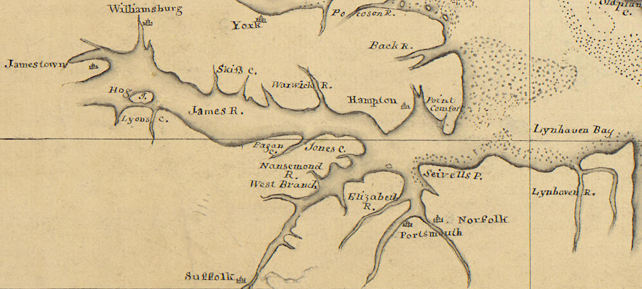
at the start of the American Revolution, all major settlements in Virginia were located in or near Hampton Roads
Source: University of Michigan, William L. Clements Library, A map of the Delaware and Chesapeak bays with the peninsula between them (by Andrew Skinner, 1780)
Sailors who crossed the Atlantic Ocean welcomed the security of the roadstead at the confluence of the James, Nansemond, Elizabeth, and Hampton rivers. In 2019, the US Navy alone generated 15% of the economic activity in Hampton Roads. The Navy "homeported" 54 ships plus 18 more Military Sealift Command ships, and 35 aircraft squadrons, between Yorktown and Virginia Beach.2
State and Federal agencies draw different boundaries for the water component of the Hampton Roads region.
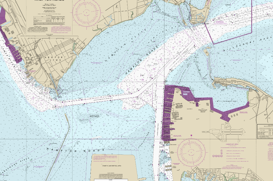
The Virginia Marine Resources Commission considers the Monitor-Merrimac Bridge-Tunnel to be the upstream edge on the James River. The Virginia Pilot Association, the guides for ships using the navigation channels, uses the James River Bridge where Route 17 crosses the James River. The Virginia Port Authority has chosen not to draw any lines, and the nautical charts produced by the National Atmospheric and Oceanic Administration (NOAA) also have no lines demarking the edges of "Hampton Roads." The Hampton Roads Bridge-Tunnel may serve as a de facto downstream end, but that is unofficial.
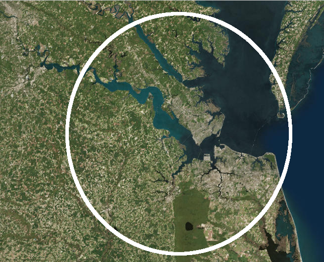
the sheltered waters of Hampton Roads extend roughly from the Hampton Roads Bridge-Tunnel to the Nansemond River
Source: National Oceanic and Atmospheric Administration (NOAA), Office of Coast Survey, Hampton Roads
The Code of Virginia had defined "Tidewater" in multiple places, including the Chesapeake Bay Preservation Act and for management of fisheries:3
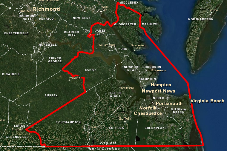
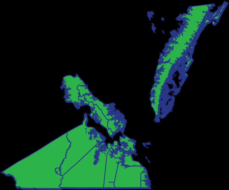
Today Hampton Roads is a cultural region. Its boundaries are not fixed by law, as are the boundaries of a county or city. It is a judgment call on which jurisdictions belong to Hampton Roads. Different regional organizations have defined the edges in different ways.
Narrow definitions exclude some jurisdictions on the Peninsula north of the James River, and draw the western boundary at the Blackwater River. The broadest definitions include counties north of the York River and south of the Virginia border, incorporating two counties in North Carolina. Hampton Roads is at the end of the "crescent of dense population, stretching from Northern Virginia through Richmond. Civil leaders worry that it is at the end of a cul-de-sac, with no population center to the east due to the Atlantic Ocean.
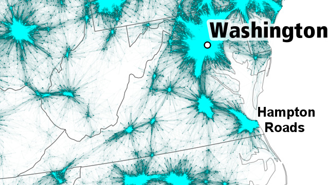
Hampton Roads is on the edge of the continent, with no population center to the east
Source: Garrett Dash Nelson, Alasdair Rae, An Economic Geography of the United States: From Commutes to Megaregions (PLoS ONE, 2016)
The Eastern Shore is not considered part of Hampton Roads - yet. Northampton County is less than 15 miles away from Virginia Beach, but major transportation links are limited to the Chesapeake Bay Bridge-Tunnel and the Bay Coast Railroad rail barge. Vacationers drive between Northampton County and Virginia Beach, but commute-to-work patterns are not strong enough for the Bureau of Census to include Northampton County in the Virginia Beach-Norfolk-Newport News, VA-NC Metropolitan Statistical Area.
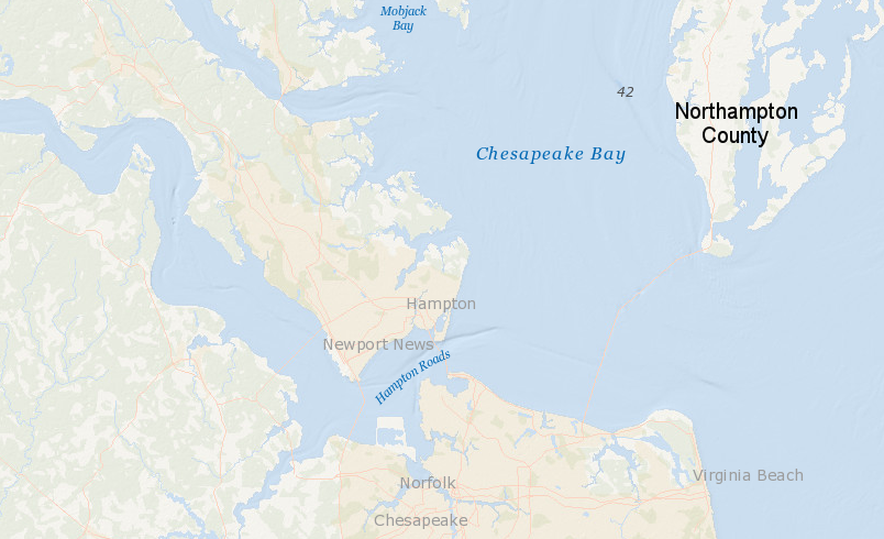
the Eastern Shore is a separate region from Hampton Roads, and Northampton County is not part of the Virginia Beach-Norfolk-Newport News, VA-NC Metropolitan Statistical Area
Source: ESRI, ArcGIS Online
A regional economic strategy group known as the Hampton Roads Partnership existed for 17 years between 1996-2013. By the time it dissolved, the Hampton Roads Partnership included Gloucester County on the Middle Peninsula, but not adjacent Mathews County.4
jurisdictions belonging to the Hampton Roads Partnership in 2014
Source: ESRI, ArcGIS Online
The boundaries of the Hampton Roads Sanitation District (HRSD) are much broader. That agency handles wastewater, and was originally established in 1940 because health officials had banned harvest from oyster beds. Shellfish had absorbed untreated sewage, and become too polluted for consumption.5

the wastewater utility for Hampton Roads (HRSD) also services the Middle Peninsula, north of the York River
Source: HRSD, Service Area
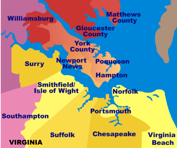
Economic leadership in Hampton Roads is divided. The Virginia Peninsula Chamber of Commerce focuses on businesses north of the river in the cities of Newport News, Hampton and Poquoson, and in James City County and York County. Williamsburg has created a separate Greater Williamsburg Chamber & Tourism Alliance.
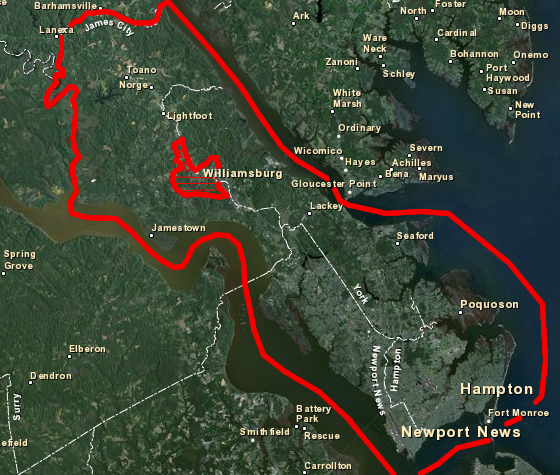
the City of Williamsburg is not included in the Peninsula Chamber of Commerce jurisdictions
Source: ESRI, ArcGIS Online
The Hampton Roads Economic Development Alliance, which largely replaced the Hampton Roads Partnership, shrank its boundaries in 2017. Gloucester County (north of the York River) and Surry County dropped out. On the Peninsula, York County, James City County, and the City of Williamsburg formed a separate Greater Williamsburg Partnership.
Membership in regional economic development partnerships changes regularly. The extra costs of membership, beyond the costs of each jurisdiction's individual economic development department, are clear but the benefits to a particular jurisdiction are hard to quantify. By 2022, the organization was known as the Hampton Roads Alliance. Williamsburg, James City County and York County on the Peninsula became members again in 2021, but the City of Portsmouth decided not to pay the required dues ($1 per resident).
The City of Virginia Beach considered withdrawing, but was convinced to stay. As reported in The Virginian-Pilot:6
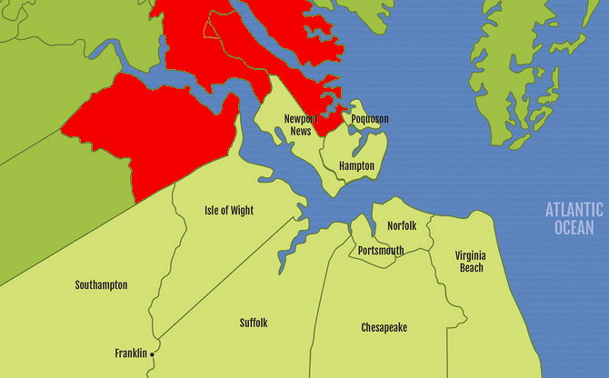
Surry County, Gloucester County, York County, James City County, and Williamsburg withdrew from the Hampton Roads Economic Development Alliance
Source: Hampton Roads Economic Development Alliance, Map Center
The Hampton Roads Chamber of Commerce uses the broadest boundaries to define the region, based primarily upon the Virginia Beach-Norfolk-Newport News, VA-NC Metropolitan Statistical Area defined by the Bureau of Census in 2013. The Hampton Roads Chamber continued to include Surry County as a part of the region, through the Bureau of Census dropped it from the metropolitan statistical area after the 2010 Census.
The metropolitan statistical area and the Hampton Roads Chamber both include Mathews and Gloucester counties, north of the York River, plus Gates and Currituck counties in North Carolina. The two North Carolina counties describe themselves as part of the Hampton Roads region. Using boundaries based on the 2010 Census, the Hampton Roads Chamber notes that the region is:7
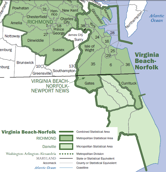
the Hampton Roads Chamber of Commerce shows Surry, Mathews, and Gloucester counties plus the City of Williamsburg as part of Hampton Roads
Source: Bureau of Census, State-based Metropolitan and Micropolitan Statistical Areas Maps (February 2013)
the Hampton Roads Chamber of Commerce shows Surry, Mathews, and Gloucester counties plus the City of Williamsburg as part of Hampton Roads
Source: Hampton Roads Chamber of Commerce
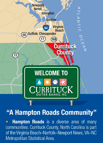
according to Currituck County and the Bureau of Census, portions of North Carolina are part of the Hampton Roads region
Source: Currituck County, Take a walk through Currituck's business economy
The founding chair of the Hampton Roads Center for Civic Engagement had served as city manager for Norfolk, Portsmouth, and Hampton during his career, providing him a deep understanding of the challenge:8
Hampton Roads Economic Development Alliance jurisdictions (2014)
Source: Hampton Roads Economic Development Alliance
One challenge to establishing a sense of identity, and to create regional unity for legislative objectives in the General Assembly, is that numerous rivers divide Hampton Roads. Only a limited number of bridges and tunnels allow vehicles to cross the water barriers; physical barriers reinforce jurisdictional boundaries.
Downstream of the 4.5 miles long James River Bridge, major bridge-tunnels in the region include:
- Monitor-Merrimac Bridge-Tunnel, I-664 connecting Suffolk to Newport News (4.6 miles long)
- Hampton Roads Bridge-Tunnel, I-64 connecting Norfolk to Hampton (3.5 miles long)
- Downtown Tunnel, I-264 connecting Portsmouth to Norfolk (0.75 miles long)
- Midtown Tunnel, US 58 connecting Portsmouth to Norfolk (0.75 miles long)
- Chesapeake Bay Bridge-Tunnel, US 13 connecting Virginia Beach to Northampton County (17.6 miles long)
Leaders on either side of the James River in "North" and "South" Hampton Roads disagreed for decades on the priorities for transportation projects, and how to fund them. Widening I-64 would benefit only the jurisdictions on the Peninsula, widening US 460 would benefit only the jurisdictions south of the James River, and different options for a new bridge and/or tunnel to create a "Third Crossing" of the James River focused benefits on different portions of both North and South Hampton Roads.
The Federal government mandates regional planning for transportation projects that receive Federal funding. The Hampton Roads Transportation Planning Organization (HRTPO) was created to broker deals, but the political differences between the jurisdictions created shifting priorities that undercut efforts to get new road/bridge/tunnel projects funded and built.
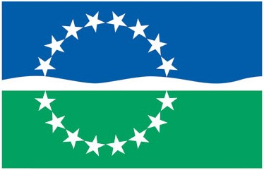
the Hampton Roads Chamber of Commerce and the Hampton Roads Partnership adopted a flag with 16 stars, but the interpretation of which jurisdictions should be included in the region is fluid
Source: Hampton Roads Chamber of Commerce
The problem of setting transportation priorities came to a head after the General Assembly raised taxes in 2013 and created a dedicated source of funding for new roads and bridges. In 2014, the General Assembly broke the regional deadlock on transportation planning by creating a new Hampton Roads Transportation Accountability Commission (HRTAC). The state legislature gave that organization the authority to spend the new revenues directed into the new Hampton Roads Transportation Fund.9
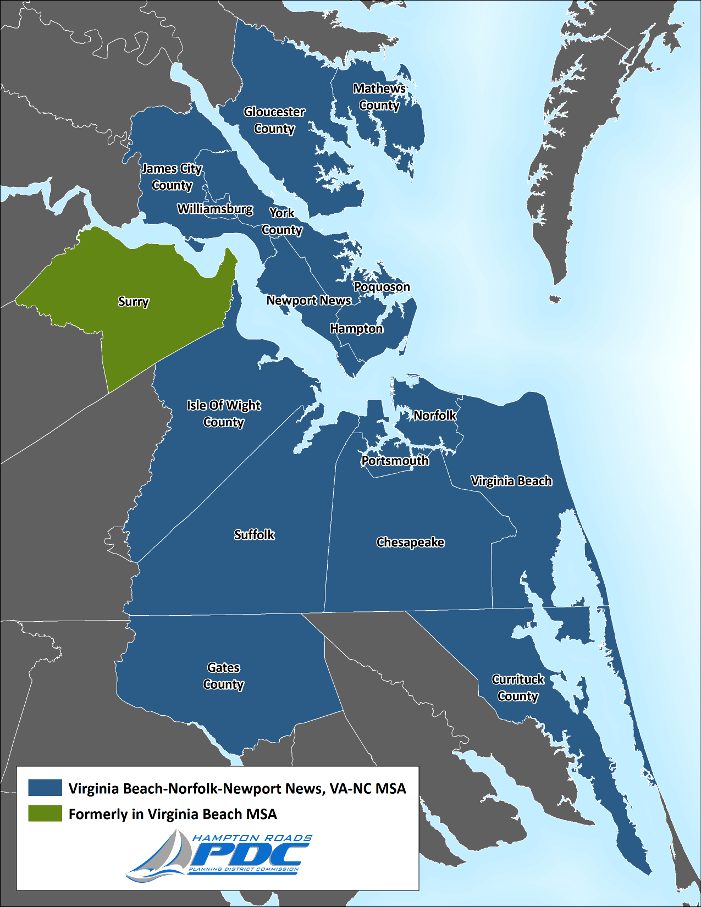
in 2013, the Bureau of Census redefined the boundaries of the Virginia Beach-Norfolk-Newport News, VA-NC Metropolitan Statistical Area, adding Gates County in North Carolina while dropping Surry County)
Source: Hampton Roads Planning District Commission, Hampton Roads MSA: Analysis of Recent Delineation
the Bureau of Census defined Williamsburg and portions of James City County as "urbanized areas" in 2013, and dropped the classification of Surry County as an "outlying county" of the Metropolitan Statistical Area
Source: Hampton Roads Planning District Commission, New Business Item - Revised Delineation of the MSA
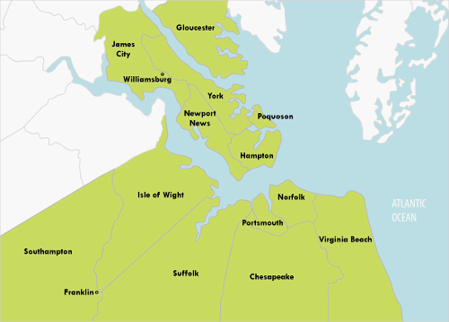
After the Hampton Roads Planning District Commission led an effort in 2014 to re-examine the name "Hampton Roads" to enhance tourism, local jurisdictions formed the Coastal Virginia Tourism Alliance. Membership stretched on the western edge of the Peninsula to include Williamsburg as well as York County, but the group excluded Gloucester County north of the York River.
On the south side of the James River, Southampton, Surry, Isle of Wight, and the two counties on the Eastern Shore joined with the cities of Suffolk, Chesapeake, Norfolk, and Virginia Beach in the Coastal Virginia Tourism Alliance.10
One technique for defining the Norfolk/Virginia Beach/Hampton/Williamsburg area without giving one place name any priority is to use the telephone area code. That choice has been adopted by the #757collective on Twitter and Instagram.11

Instagram posts and tweets based on the area code is one way to define the region, while avoiding debates over place names
Source: Twitter, 757 Collective
In 2018, Bruce Thompson, a key developer in the region, repeated the call for relabeling Hampton Roads:12
Two other civic leaders responded with a suggestion that the New York and Los Angeles regions be used as a model:13
Tourism officials proposed rebranding the region "Coastal Virginia," but business leaders emphasized including a place name such as "Greater Norfolk Region" because:14
in 2018, hotels in Virginia Beach provided tourism materials highlighting the Coastal Virginia term
The Coastal Virginia label still gained traction. In the November 2018 election, a Democratic candidate defeated the Republican incumbent for the Second Congressional District of the US House of Representatives. In her speech claiming victory, soon-to-be-Representative Elaine Luria noted:15
A month later, however, the Hampton Roads Chamber of Commerce declared it would take the lead role in rebranding the region. There was no consensus initially on any of the various choices - Hampton Roads, Southeast Virginia, Tidewater, Coastal Virginia, The 757, or Seven Cities.
The "Seven Cities" option dated back to 1983. When the US Postal Service consolidated its mail processing facilities in 1983, letters were no longer postmarked with the individual names of Newport News, Hampton, Norfolk, Virginia Beach, Portsmouth, Chesapeake, or Suffolk. The Federal agency chose "Tidewater Va." Local officials complained that the label applied to the entire Coastal Plain, as far north as Alexandria.
The Virginian-Pilot proposed with a smile that the Postal Service should combine the names of Norfolk, Portsmouth, Chesapeake, and Virginia Beach and adopt "Norportapeake Beach."
After all seven cities agreed on "Hampton Roads," the Postal Service changed the postmark and has used that term ever since 1983.16
The Envision 2020 branding study ended up recommending in December, 2019 that Hampton Roads should be rebranded as "757." That was based on the area code used for new telephone numbers in the area.
A priority of the branding exercise was to identify a term that appealed to young talent who might otherwise leave the region. One of the supporters for the selection of "757," the chair of the young professional organization for the Hampton Roads Chamber, noted:17
Editorial writers at the Daily Press were less sanguine. They commented:18
The 757 area code was created in 1996, when available numbers for the 804 area code were near exhaustion. The 757 area code was used for new phones between Williamsburg and the Eastern Shore, but all of its available numbers were expected to be assigned by the end of 2021. In 2020 the North American Numbering Plan Administrator announced that new phones would be assigned a 948 area code. Hampton Road's unique association with "757" would blur, as 948 numbers became more common.
Advocates for the "757" identifier emphasized that they saw it as a tool for coordinated regional branding, not as a replacement for other regional names. They suggested each jurisdiction could add 757 to various tourism outreach channels, on which the different cities/counties spent $50 million annually, to create a common regional identity.
The use of the 757 area code as a regional identifier was complicated in 2022, when the 948 area code finally was utilized. A story about the new 948 area code in The Virginian-Pilot suggested the "Region That Has No Name" as a descriptor.19

the Virginian-Pilot chose to add a 757 identifier to its regional coverage of sports news
Source: The Virginian-Pilot, 757Teamz
Size matters, when it comes to marketing a region. By population, in 2018 Hampton Roads was the 37th largest metro area and Richmond was the 44th. Business leaders from both regions renewed a decade-old initiative in 2018 and explored merging into one region. Consolidating would create the 17th largest region in the country, comparable to Denver or Tampa.20
Consolidating was not just an exercise so executives and political leaders could claim greater importance because they were associated with a "bigger" region; it was to attract more economic development. Business executives may be more inclined to locate new facilities, or transfer a headquarters or other offices, if a region is recognized to have a critical mass of skilled workers, suppliers, energy resources, and transportation capacity. Areas of greater population can offer more amenities, including high-end restaurants, expensive car dealerships, exclusive private schools, and one-of-a-kind houses that might attract top executives.
The corporate headquarters of three Fortune 500 companies were located in the region in 2018: Dollar Tree in Chesapeake, Huntington Ingalls Industries in Newport News, and Norfolk Southern in Norfolk. Economic development leaders in state government provided over $4 million in incentives to get Norfolk Southern to add 165 jobs in Norfolk, after the railroad closed its Roanoke office building and cut over 400 jobs there in 2015.
In 2018, Norfolk Southern was offered incentives to move its corporate headquarters from Norfolk and consolidate it with the railroad's operational headquarters already located in Atlanta. Georgia officials highlighted how Atlanta Hartsfield-Jackson International Airport (ATL) offered far more direct flights than Norfolk International Airport (ORF).21
The inability of the multiple jurisdictions in South Hampton Roads, North Hampton Roads, and Richmond to combine the three airports, creating a single market that would justify more flights, constrains the economic potential of the southeastern and central Virginia regions. Efforts to market a single, consolidated region might have some positive impact for attracting or retaining businesses. Creating an airport authority equivalent to the Port of Virginia, with its control over the public shipping terminals from Richmond to Norfolk, might have even greater impact.
the Go Virginia council boundaries for Region 5 included the Eastern Shore, but not Surry County
Source: Go Virginia, About Region Five
For decades, separate newspapers served the northern and southern portions of the region. The Daily Press highlighted the Peninsula, while The Virginian-Pilot was based in Norfolk. Separate news outlets, each with their own distinct focus, provided a separate sense of identity for the two major portions of Hampton Toads.
In 2018, as the printed newspaper business declined and staffing levels were cut, the company which owned the Daily Press acquired The Virginian-Pilot. In 2020, it sold that paper's headquarters in Norfolk and consolidated both operations at the Daily Press facilities.
One former reporter for The Virginian-Pilot commented:22
Though Hampton Roads may be one region, under whatever name is preferred, the cultural dividing line between the Peninsula and the area south of the James River remains. In 2015-16, the Virginia Department of Transportation conducted an archeological excavation prior to a road project on the Eastern Branch of the Elizabeth River at the site of the colonial "New Town" which was later eclipsed by Norfolk.
The artifacts were given to Coastal Virginia Church, which owned the property. The church considered what institution might use the artifacts best for research and public interpretation, and gave them to Old Dominion University, rather than to Colonial Williamsburg or the College of William and Mary. The head of special collections at Old Dominion University revealed her regional perspective when commenting:23
The competition for state funding between Hampton Road and Northern Virginia was revealed clearly after the 2023 elections for the Genral Assmbly Democrats retained cotrol of the State Senate, and the election for Majority Leader was a contest between Scott Surovell from Northern Virginia and Louise Lucas from Hampton Roads. Surovell won, and Lucas then became chair of the Senate Finance and Appropriations Committee.
Soon afterwards, the Wizards basketball team and the Capitals hockey team announced plans to move from Washington DC to Alexandria. Construction of a new $2.2 billion arena would require $1 billion in public financing. Lucas quickly announced she would oppose the deal, based on regional rather than policy concerns:24
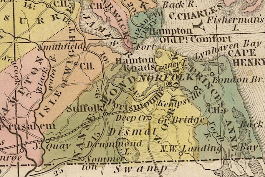
Hampton Roads in 1845
Source: David Rumsey Map Collection, New Map Of Virginia (Henry S. Tanner, 1845)
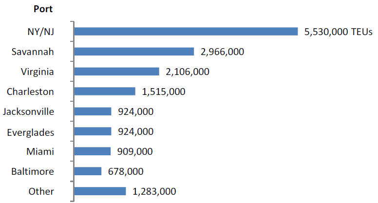
in 2012, the Port of Virginia in Hampton Roads was the third largest container port on the East Coast
Source: Joint Legislative Audit and Review Commission, Review of the Virginia Port Authority's Competitiveness, Funding, and Governance (2013)