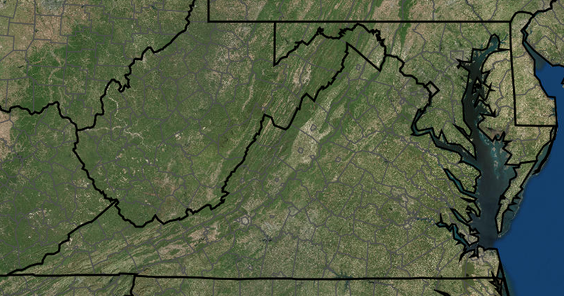
Virginia's corners are clear on two, maybe three sides, but the northwest corner is not obvious
Source: ESRI, ArcGIS Online
Virginia's corners are clear on two, maybe three sides, but the northwest corner is not obvious
Source: ESRI, ArcGIS Online
Virginia has a relatively clear "corner" on the southeast edge, False Cape State Park. On the southwest edge of the state, Cumberland Gap National Historical Park is easy to identify as the corner.
You can drive from the southeast to the southwest corners on Route 58, the longest road in Virginia. It stretches from the city of Virginia Beach to Cumberland Gap in Lee County.
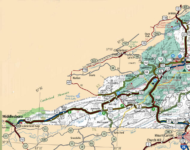
Route 58 - western edge
Source: Virginia Department of Transportation
The contrast in the physical environment from the Atlantic Ocean to Cumberland Gap is obvious, even through a bug-encrusted windshield at 55 miles per hour. If you visit in person, there are also obvious differences between the politics, economics, and basic cultural lifestyles in Virginia Beach vs. Lee County.
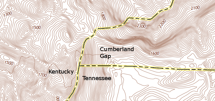
Cumberland Gap, the mountain pass through which Daniel Boone led colonists into Kentucky along the Wilderness Road, is not at the exact southwest corner of Virginia
Source: US Geological Survey (USGS), Middlesboro South 7.5x7.5 topographic quadrangle (2013)
Can you spot the southwestern tip of Virginia
without the political boundaries drawn on the image?
(the US Geological Survey Middlesboro
South topographic quad might help)
What about the other corners of Virginia? One possibility for the northeast corner: the City of Alexandria.
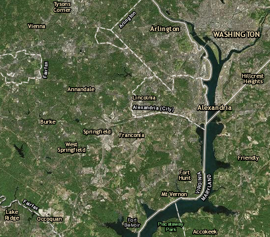
is Alexandria (or National Airport in Arlington County, or a chunk of Fairfax County near Mount Vernon) the northeast corner of Virginia?
Source: ESRI, ArcGIS Online
Another option: chose a point on the Atlantic Ocean near Chincoteague.
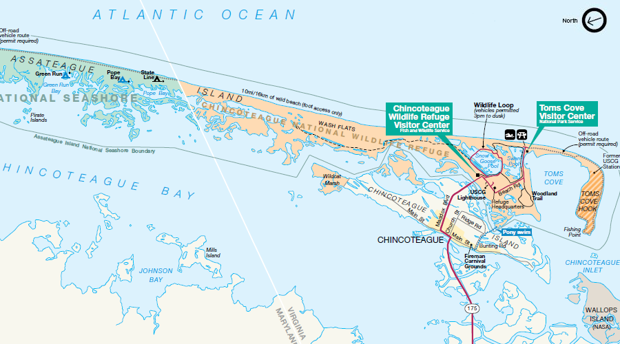
is this the northeast corner of Virginia?
Source: National Park Service, Assateague Island National Seashore Park Map
![]() NOTE: on the map above, north is to the left, not towards the top of the map. If you persist in thinking that all maps must be oriented with north at the top, just like the ones on the wall in elementary school, then turn your head or swivel the computer monitor 90 degrees to the right. John Smith's maps drawn in the early 1600's are also oriented so north is to the left.
NOTE: on the map above, north is to the left, not towards the top of the map. If you persist in thinking that all maps must be oriented with north at the top, just like the ones on the wall in elementary school, then turn your head or swivel the computer monitor 90 degrees to the right. John Smith's maps drawn in the early 1600's are also oriented so north is to the left.
Finding the eastern edge of the state, much less the northeastern corner, may be confusing on maps that simplify the geography of the state. Some maps fail to identify the two counties on the Eastern Shore (east of the Chesapeake Bay) as part of Virginia:
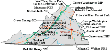
Question: what's missing from this map showing National Park Service units in Virginia?
Answer: the Eastern Shore
The Encyclopedia Virginia "rebranded" in 2018, and adopted a new logo. That happened after a new goveror was inaugurated, and he was the second in the state's history to come from the Eastern Shore. Perhaps not coincidentally, the outline of the state used in the new logo included a triangle for the Eastern Shore:

the Eastern Shore is represented in the Encyclopedia Virginia logo
Source: Encyclopedia Virginia
If you are looking for the extreme compass points, the Extreme Geography Virginia wbsite identifies the most-southern edge of Virginia as a point (36°32'27.1"N, 79°28'10.3'W) just west of the city of Danville. For nearly 60 miles, the Virginia-North Carolina border is at almost the exact same latitude:1
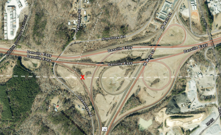
the most southern point in Virginia is on a highway overpass outside of Danville
Source: ESRI, ArcGIS Online
Determining the northwestern tip of Virginia - well, that's the hardest choice...
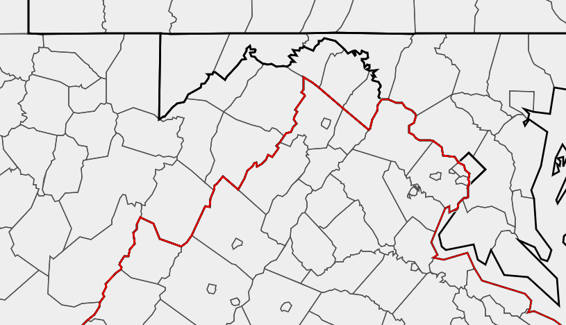
where is Virginia's northwest corner?
Source: ESRI, ArcGIS Online
The geographical center of the state is in Buckingham County. A historical marker says the spot is latitude 37° 30.6' North, 78° 37.5 West.2
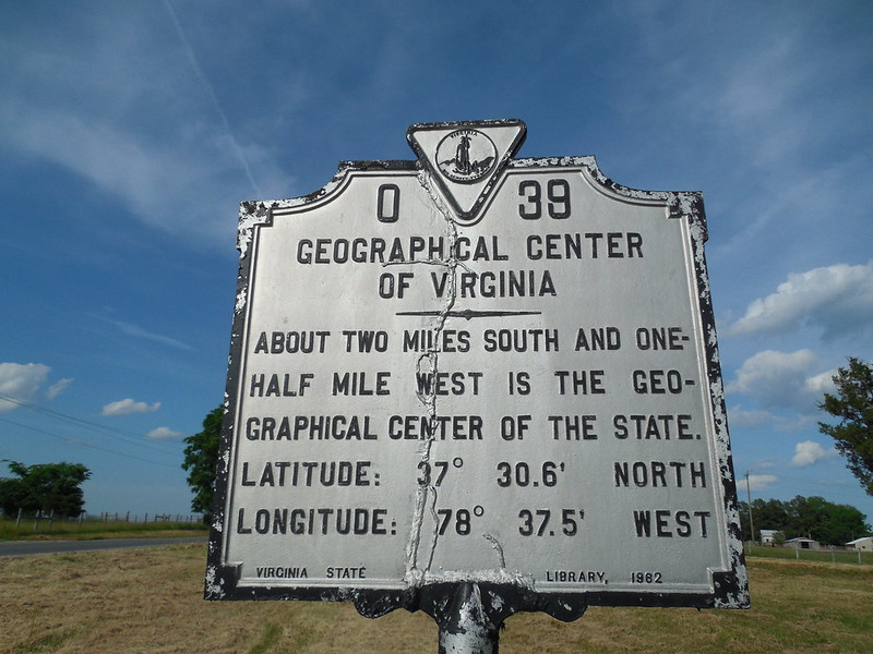
the geographic center of Virginia is near the intersection of US 60 and VA Route 24 in Buckingham County
Source: Jimmy Emerson, DVM, Geographical Center of Virginia Marker
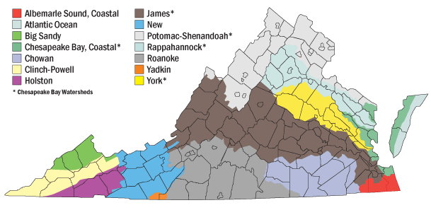
Virginia and its watershed boundaries
Source: Virginia Department of Conservation and Recreation, Soil and Water Conservation Programs