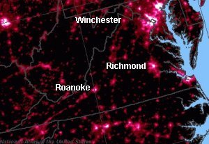
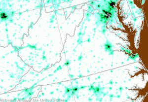
image and reverse image of Virginia night lights
The land use in Virginia ranges from a few remaining rural areas to dense urban areas, as revealed by the satellite images of nighttime lights.
This far into the semester, you should be able to recognize the dense urban concentrations (of people and thus lights...) for Northern Virginia, Roanoke, Richmond, and Hampton Roads. Look closely, and you can see other cities where people and development are concentrated - Fredericksburg, Lynchburg, Charlottesville, Waynesboro, Staunton, Harrisonburg, and Winchester.
image and reverse image of Virginia night lights
One way to relate the lights and the urban centers: add county boundaries to the night lights:
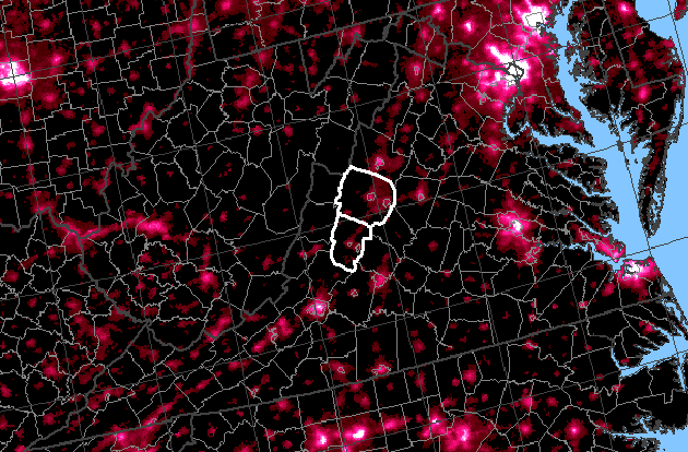
(to orient yourself, remember that both Augusta and Rockbridge counties have independent cities within their county boundaries)
Your early childhood memories of your home and yard may be special - but as an adult, do you really go visit anyone's backyard now? When you go to someone's house, are you going to see the people more than the place? Many backyards are so similar to each other that they are not special destinations to visit. Once you have seen one backyard, you may decide that you've seen enough...
If Virginia was homogenous in its physical characteristics, and every place was like every other place in the state, then no one would travel to see the vista from the Peaks of Otter, canoe the Shenandoah River, swim at Virginia Beach, or hike the Appalachian Trail to the top of Dragon's Tooth. Drive through Kansas sometime, and you'll see a far-more monotonous landscape. There's little diversity in the color, form, line, and texture that creates the visual landscape.
 landscape at Manassas Battlefield | 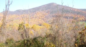 Blue Ridge near Pipers Gap | 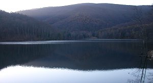 Charlottesville Reservoir in Sugar Hollow |
Professional "visual resource management" specialists conduct visual landscape inventories to identify and classify scenic views. Landscape architects know that we prefer a view with:
That's one reason that visitors enjoy the open space at Manassas National Battlefield Park, even if they don't have any appreciation of the historical or cultural events that make the place special. Modern advertising may reshape our different perspectives of what is beautiful, and one day 100% of the people in the world might have the same answer to the question "what is your favorite color?" In the meantime, however, an attractive landscape can still be evaluated by the characteristics of color, form, line, and texture.
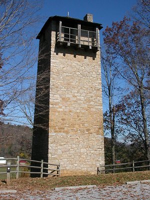
Shot Tower State Park on New River
"Celebrate diversity" applies to more than just social interactions among different groups on campus; an appreciation of diversity may be connected in some way to our definition of beauty. The more we obscure the shape of a face or a body or a landscape with a cloak of some sort, the harder it is to recognize individuality and the harder it is to appreciate a person or a place as being "special."
Air pollution is obscuring the vista from the Blue Ridge, which already had a natural blue haze from chemicals emitted by the trees. Drive down Skyline Drive From Shenandoah National Park, along the Blue Ridge Parkway to Great Smoky Mountains National Park, and some days the view is so washed out that you might have well stayed at home.
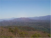
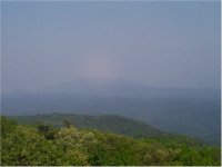
Visual Range: 100 miles vs. 20 miles
Source: Great Smoky Mountains National Park, Look Rock Air Quality Monitoring Station
 Businesses that depend on tourism are getting concerned about the long-term sustainability of the natural resources that attract tourists. The economic impacts could be devastating to a community like Front Royal. The tourists who come to Skyline Drive to see the trees turn color in October ("leaf lookers") might stay at home, rather than rent motel rooms and eat in Front Royal restaurants, if they can't see a special vista.
After all, people don't drive overnight to a movie theater in a distant town - they go see the same movie at a theater near home. There has to be something unique and "special" to justify the expense and the hassle of a trip...
You don't need a landscape architecture degree to recognize an attractive scenic vista, but sustaining what is "special" without blocking all land use changes requires some expertise. Professional experience is helpful when a government agency specifies in a permit how to mitigate the impact of new highways, electric powerlines, gas pipelines, and other human-induced alterations of the landscape.
Now, new transmission towers in scenic areas may be made from brown, rusty-looking steel rather than painted bright silver. In the national forests, the boundaries of timber sales are designed to mimic the natural edges between fields and forests rather than create sharp, straight lines separating mature forests from harvested lands.
To increase the diversity of color/form/line/texture, a timber sale can even improve the "look" of a mountainside. Before a timber sale, a forest might be composed of a series of trees, all the same height and monotonous shade of green.
A timber sale can result in a dramatic shift in color, form, line, and texture. However, a few years after the harvested area is replanted, the view might show patches of forest with a variety of patterns of trees at different stages of growth. Foresters nor create patches with natural-looking boundaries, comparable to those created by windstorms or forest fires, rather than straight geometric lines based on property boundaries.
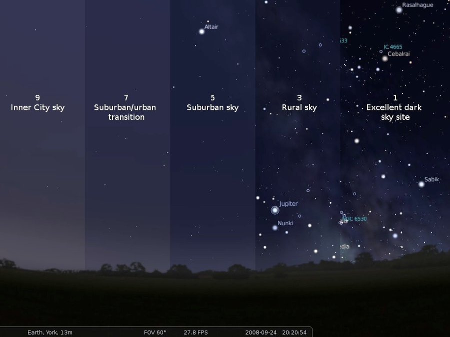
light pollution is measured on the Bortle scale, and in typical cities and nearby suburbs only the brightest stars are visible
Source: James Madison University, John C. Wells Planetarium, Light Pollution: The Overuse & Misuse of Artificial Light at Night