rivers of Virginia, plus Geographic Information System (GIS) layers showing state boundaries and capitals
Source: National Atlas
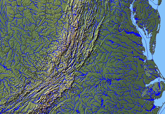
On small-scale maps (the ones that shows a large area, such as the entire state), you won't notice the little streams. The old USGS "National Atlas" (retired in September, 2014) could zoom to Virginia and display just the Streams and Waterbodies:
The "Shaded Relief Land and Ocean" box displayed this map:
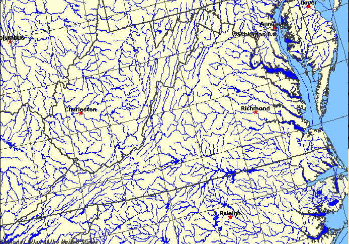
Even on a "small scale" statewide map you can find the four big rivers that drain the eastern part of Virginia, Northern Virginia, and the Shenandoah Valley - the Potomac, the Rappahannock, the York, and the James rivers. Get out your Atlas and Gazetteer, and find where those 4 rivers run into the Chesapeake Bay.
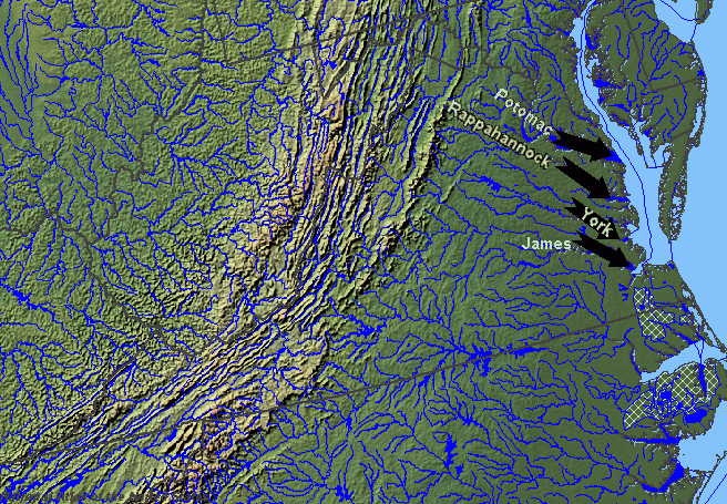
Almost all the rain that falls onto Virginia north of Interstate 64 drains into the Chesapeake Bay via the James, York, Rappahannock, and Potomac rivers. Note that the rivers do not flow eastward exclusively. One major tributary to the Potomac River, the Shenandoah River, flows predominately north on its journey to Harpers Ferry.
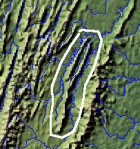
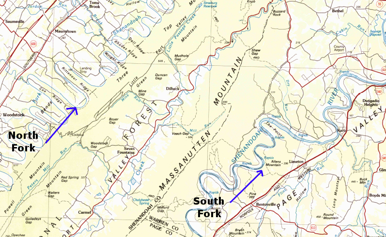
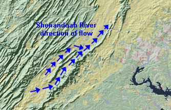 direction of flow for North Fork of Shenandoah River, South Fork of Shenandoah River, and main stem north of Front Royal (recognize Massanutten Mountain, separating the two forks?) Source: USGS Seamless Data Viewer |
There are two branches of the Shenandoah River. The North Fork of the Shenandoah River is located exclusively west of Massanutten Mountain. Rain that falls on the mountains near Harrisonburg flows through the North Fork to Front Royal. The South Fork of the Shenandoah River stretches all the way across the valley's southern end. Tributaries of the South Fork, such as Lewis Creek in downtown Staunton, carry rain that fell on the valley between Waynesboro/Staunton. (Use your DeLorme Atlas and Gazetteer to locate these cities...)
Rainwater falling near Waynesboro/Staunton drains down (always down, thanks to gravity...) into a stream that runs east of Massanutten and west of the Blue Ridge to Front Royal - and that stream is the South Fork of the Shenandoah River. At Front Royal, the North Fork of the Shenandoah River merges with the South Fork of the Shenandoah River to form the main stem of the Shenandoah River.
Where the streams merge is called the confluence. The main stem flows downhill to Harpers Ferry, where the Shenandoah River water merges into the Potomac River.
Humans determined whether a stream would be called the Shenandoah, the Potomac, or something else. In the early days of European exploration, when maps were scarce, it must have been very confusing to provide directions. Even today, many average Virginians screw up their directions when describing the Shenandoah River. As a person studying Virginia geography... you should do better than average.
The big four rivers in Virginia define the natural boundaries of the regions east of the Fall Line known as the Peninsula, Middle Peninsula, and Northern Neck. The Northern Neck is the land once owned by Lord Fairfax between the Potomac River and the Rappahannock River; the city of Fredericksburg is at the western edge of the Northern Neck peninsula.
The Peninsula is the land between the James River and the York River. Richmond is at the western edge of the Peninsula, and Newport News/Hampton/Poquoson are at the eastern edge. North of the Peninsula and south of the Northern Neck is the Middle Peninsula, bounded by the York River on the south and the Rappahannock River on the north.
The cutural regions are shown in on the map below. I did not label the Potomac, the Rappahannock, the York, and the James rivers - you should be able to do that now.
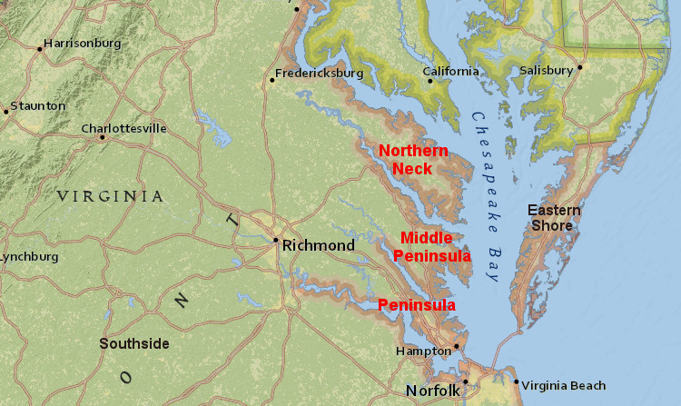
the Peninsula, Middle Peninsula, and Northern Neck are defined by four of Virginia's rivers
Source: ArcGIS Online
It's hard to visualize these areas from words on a web page. Go to your Atlas and flip through the pages. Get familiar with county boundaries, road locations, and rivers in eastern Virginia.
Natural boundaries separate counties, but there are also numerous straight lines shown on the maps that define portions of the county boundaries. Political boundaries do not always line up with natural features that are easy to spot on the ground, and surveyors are required to define the administrative and ownership boundaries on the ground.