Using the Geographic Names Information System (GNIS) to Find Elevation
One way to check your topography-reading skills: look up a place name near where you live on the Geographic Names Information Server (GNIS). Try it for Penderbrook, a subdivision north of Fair Oaks Mall (where I-66 and Route 50 meet, north of the Fairfax Campus).
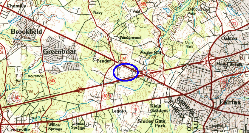
in 1986, the Pender area was undeveloped and Fair Oaks Mall (in blue circle) had not been built just south of it
Source: US Geological Survey (USGS),
Washington West 30X60 Grid (1986)
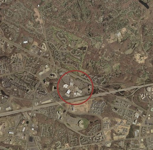
April 2002 aerial photo, showing Fair Oaks Mall and development of Penderbrook to the north
(mall location is circled on map)
Can you spot the Fairfax County Government Center to the south,
the structure shaped like the letter "C" between I-66 and US29?
If you know the area, you'll recognize that since this photo was taken in 2002,
Fairfax Town Center has been built in the cleared area on the photo
between I-66 and the Fairfax County Government Center.
(Source: Microsoft Research Maps )
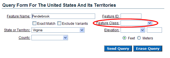
Go to the Geographic Names Information Server, and query for "Penderbrook" in the state of Virginia:
NOTE: If I had indicated in the Feature Class field that I was looking for just a "populated place," I would have seen just one "hit" showing the one populated place in Virginia with Penderbrook in the name. In this case, however, I left the Feature Class field empty - and discovered that two places in the GNIS database for Virginia include the word Penderbrook.
The elevation of Penderbrook is 443 feet above sea level, and the USGS provides elevation in meters as well:
Class 1: Where Does "Virginia" Begin and End?
Virginia Places