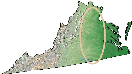
 see the lower elevation of the river valleys in the Piedmont? Look for the darker-green lines in the Piedmont physiographic province, between the Coastal Plain and the Blue Ridge. |
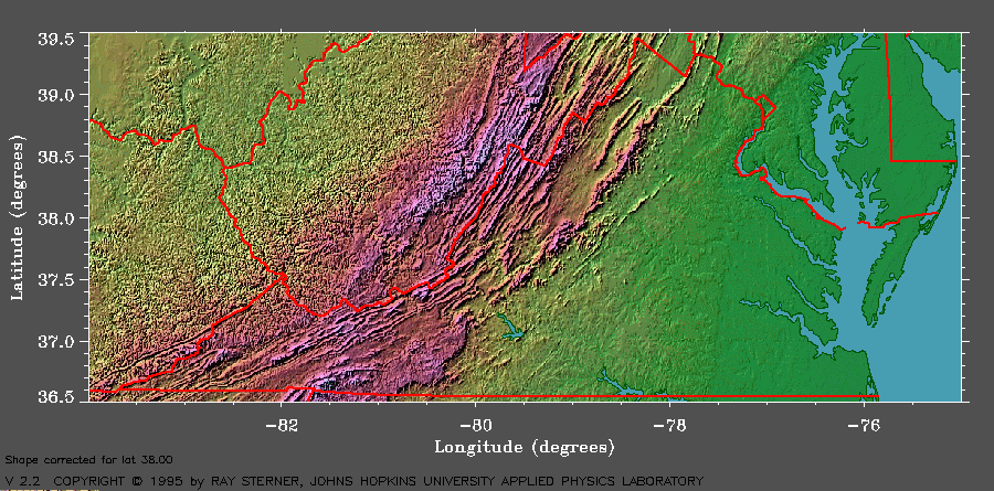
On highway and topographic maps, the location of the major rivers of Virginia is normally marked by blue lines. You've seen that already, and now you have seen on a bathymetric map that we can trace the historic route of the Susquehanna River through the Chesapeake Channel into the Atlantic Ocean.
On the small scale National Atlas maps that show elevation of the entire state of Virginia, you can also look for a darker green color reflecting the lower elevation of the rivers as they etch their way through bedrock and sediments on their downhill journey to sea level. You can find those lower-elevation river channels carved into the Piedmont physiographic province between the Blue Ridge and the Fall Line. The different colors on the map reflect the different elevations in Virginia, and there is a greater elevation difference between a river valley and nearby land in the Piedmont compared to the Coastal Plain:
see the lower elevation of the river valleys in the Piedmont? Look for the darker-green lines in the Piedmont physiographic province, between the Coastal Plain and the Blue Ridge. |
 Water runs downhill, of course. Rivers are constantly cutting into the earth, carving out a channel as the force of the water etches away at the bedrock. Spray water from a hose on you car, and you can see it wash the soap away.
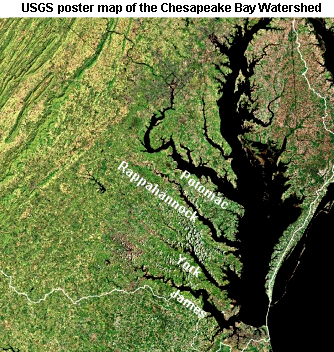
Once the rivers cross the Fall Line, leaving the metamorphosed bedrock of the Piedmont and reaching the Coastal Plain, the river channels widen substantially. A quick look at the map, and a little swimming from a boat, will show you that rivers crossing Virginia's Coastal Plain are deeper than in the Piedmont and wider at their mouth compared to their headwaters.
So apply your critical thinking skills and ask the question "Why are the river mouths - where the Potomac, Rappahannock, York, and James rivers flow into the Chesapeake Bay - wider than the river channels upstream of the Fall Line?"
River channels are deeper and wider in the Coastal Plain in part because, as the rivers flow downstream, they are joined by other streams and carry more water. The additional volume of water requires more space. The additional volume gives rivers more erosive power, more mechanical energy to scour a bigger channel to carry the extra water. (When you spray your garden hose at higher volume, you can push more dirt/leaves. If you scratch with more force into a bar of soap, your fingernail can make a deeper channel.)
Also, remember from last week that the exposed rock on the surface of the Coastal Plain is relatively soft, often unconsolidated sediments. In the Coastal Plain, the soft sediments make it easy for a river to dig a wide channel. Pretend that your fingernail is a river, and scratch both the shower stall (equivalent to the hard Piedmont rock) and a bar of soap (equivalent to the Coastal Plain sediments). In which surface did you make the biggest dent? Once the "big four" rivers reach the Coastal Plain, they carry more water and have more erosive power... and in the soft sediments, the rivers carved wide channels.
Finally, the mouths of the Potomac, Rappahannock, York, and James rivers have been "drowned." Sea level has risen as the Ice Age glaciers have melted, and the downstream portion of the rivers draining into the Atlantic Ocean have been flooded by the rising sea level. (Most of the Chesapeake Bay itself is the drowned river valley of the Susquehanna River.)
|
A "brain stretcher" from the If Things Were Really Different Universe
If the physics of water was very different and water could be compressed easily, and if the Coastal Plain of Virginia was hard volcanic rock like the Blue Ridge... |