Some unique natural features with associated populated places such as Natural Bridge (yes, there's a Natural Bridge post office as well as the rock feature) are listed in the Virginia Atlas & Gazetteer. However, most mountains and streams are not in the Virginia Atlas & Gazetteer index. A simple way to locate a place like Mount Rogers, the tallest peak in Virginia, is to use the USGS Geographic Names Information System (GNIS).
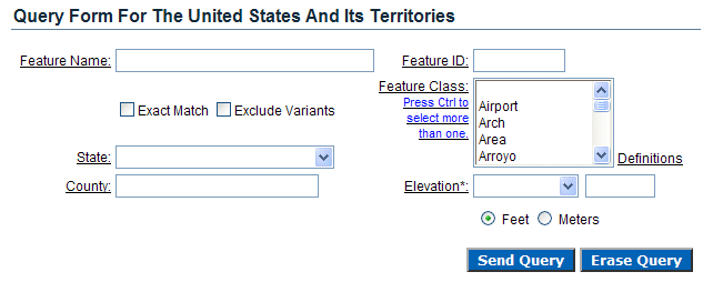
Go to the U.S. Board on Geographic Names and follow the link to "Domestic Names," then to "Search." You'll end up at Query Form For The United States And Its Territories.
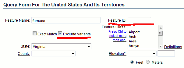
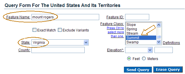
The Feature Name that we are seeking in this exercise is Mount Rogers - so type those two words into the field on the form. For State, click on the arrow at the right of the empty white box and scroll down to Virginia of course.
The tricky part is knowing the Feature Type. "Mountain" is not listed as a choice.
Click on "Feature Class" and follow all the links to get to Geographic Names Information System (GNIS) Feature Class Definitions, where you'll find a definition of the acceptable Feature Types that we can enter in that particular space on the GNIS form. You'll end up at Feature Class definitions. There are so few choices, we can actually scan them all pretty quickly and discover that the term "Summit" includes nearly all the terms for prominent elevations (except for three - pillars, ridges, and ranges are listed separately).
So return to the GNIS form and complete filling it out, click on the Send Query button, and you'll see that Virginia has one Mount Rogers summit:
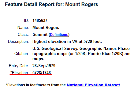
Click on the Feature Name, "Mount Rogers." That will take you to the Feature Detail Report page, which includes links to several online mapping systems on the right-hand side of the page:
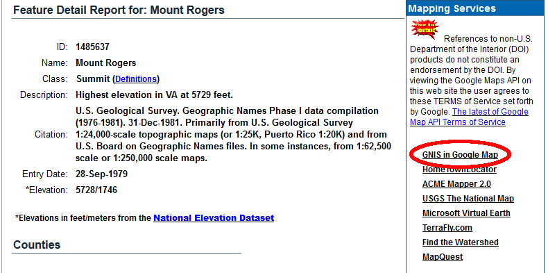
If you pay close attention to the GNIS details on the Feature Detail Report page for Mount Rogers, you might notice that the elevation of the summit is 5,728 feet (1,746 meters).
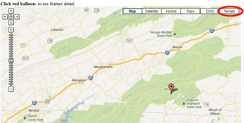
Now click on the link to "GNIS in Google Map." You'll see what may be a familiar type of map, showing "layers" of basic political boundaries, roads, place names, Federal lands (in green), and shading of hills to illustrate topography.
Experiment with that mapping tool as well; it's one you can use often in this class. Each user interface is different. We will experiment throughout the semester with many online mapping tools, so you can navigate multiple sites with ease and choose your own favorite(s). Odds are, you'll decide that no interface is perfect. Human interaction with maps requires understanding psychology as well as geography, and people from different cultures and backgrounds interact differently with maps. (Some map interfaces are based on business economics rather than customer preferences - for example, Apple's unpopular decision in 2012 to yank Google Maps off the iPad/iPhone and substitute their own maps.)
Click on "Terrain" to get a sense of the bumpy ridges and mountains in that
part of Virginia. (There's a 17-mile stretch of the Virginia Creeper bike
trail that is just straight downhill, no pedaling required...) See if you
can navigate east/north/west/south, and change the size of the map. Click on
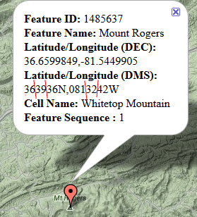
the red balloon, and you'll see displayed the coordinates for latitude (36 degrees
39 minutes 36 seconds north of the Equator) and longitude (81 degrees 32 minutes,
42 seconds west of the Prime Meridian that runs through Greenwich, England):
Now click on the "Topo" link, in the GNIS in Google Map for Mount Rogers. Zoom in, and you'll see the familiar brown lines. Topographic maps show contour lines of equal elevation. Walk along one of those lines, and you'll be on a level trail that will not climb higher or lower. I marked the 5,600 foot above sea level contour line on the map below in red, to show how a circular trail could be located just below the summit of Mount Rogers. Each contour line closer to the summit marks a rise of 40 feet in elevation (on this particular USGS map).
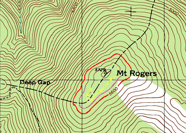
The dotted purplish line marks the elevation contour at 5,640 feet. The yellow line with arrows marks the contour at 5,680 feet. Hikers walking from the red line uphill, past the purple to the yellow line, would climb 80 feet in elevation on their way to the summit. The brown contour line just below the summit marks the locations on the mountain that are 5,720 feet above sea level.