Metro land use impacts, in 1975 Environmental Impact Statement
Source: Metro EIS
As late as 1965, Congress tried to restrict building of a passenger rail transit system to primarily within the boundaries of the District of Columbia. Only three of today's Blue Line stations, from Pentagon City to Rosslyn, would have been included in Virginia (see National Capital Transportation Agency, Rail Rapid Transit for the Nation's Capital, 1965). Arterial highways, with commuter parking lots at the rail stations, would have linked Fairfax County, Falls Church, Alexandria, and Arlington suburbs with the rail system. Previous studies had considered a wider network of rail stations, and at that time the W&OD railroad was still in place.
Northern Virginia gots its guarantee that the system would be regional when the Washington Metropolitan Area Transit Authority was created through an interstate compact between Maryland, Virginia, and DC in February, 1967. WMATA replaced the National Capital Transportation Agency. It was created to serve the regional Washington Metropolitan Area Transit Zone... and that extended to Vienna and Springfield/Franconia.
It was clear from the beginning that Metro would shape land use in Northern Virginia, by making it easier for people to live in the suburbs and commute to jobs in the core city. The system was designed with DC as the "hub," with Orange, Blue, and ultimately Yellow line "spokes" extending into Northern Virginia.
Read:
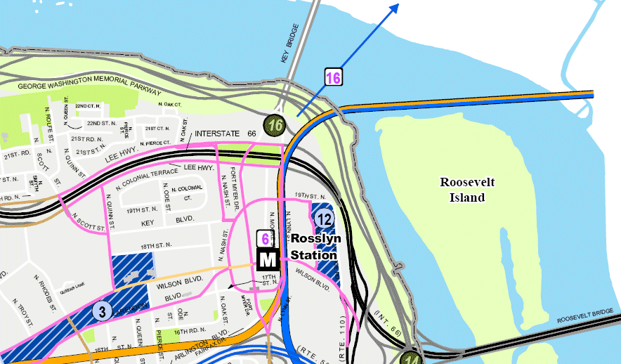
The decision to build the Orange Line underneath Fairfax Street in Arlington is often cited as the key to the revitalization of that area into the shining example of "smart growth" in the United States. Fairfax Street and the parallel Wilson Boulevard were low-density, low-value commercial and retail corridors in the early 1970's. A modern-day comparison might be Route 1 between I-495 and Fort Belvoir, or between Lorton and Quantico. Sudley Road between Manassas and I-66 also resembles "old Arlington."
The decision to route the Orange Line in Fairfax County along the median of I-66 is often cited as "missed opportunity" for Fairfax to stimulate an equivalent success. Instead of incentivizing redevelopment of low-density suburban neighborhoods and strip shopping centers into urban town centers with high-rises, Fairfax zoned land around its Metro stations to perpetuate that land use pattern. Look at Vienna Metro - see anything taller than a townhome?
Read: