
the US Coast Guard maintains the location of buoys that mark designated shipping channels
Source: Defense Visual Information Distribution Service, Coast Guard, Navy remove aground buoy from Chic's Beach, Va.
the US Coast Guard maintains the location of buoys that mark designated shipping channels
Source: Defense Visual Information Distribution Service, Coast Guard, Navy remove aground buoy from Chic's Beach, Va.
The US Coast Guard in the Department of Homeland Security marks shipping channels that offer safe access to wharves and docks. As mud and sand naturally flows into shipping channels, shoaling changes the bathymetry. Once hazards are identified, the Coast Guard removes channel markers that are no longer accurate. When sediments clog an undredged and no-longer-safe channel, the Coast Guard will remove the navigation markers and replace them with "Danger" buoys.
Federal funding for small dredging projects became tighter in 2010. Major harbors were prioritized, and the resources to maintain channels to small ports with primarily recreational traffic were reduced. The Coast Guard discovered that its safety operations to replace channel markers generated public controversy.
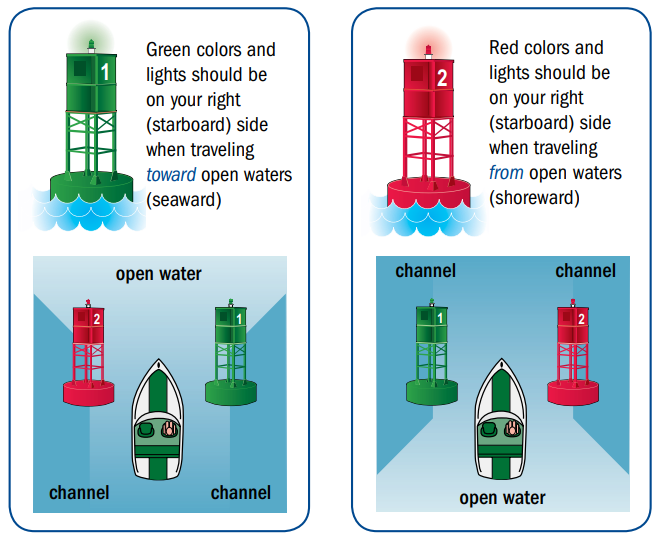
boaters rely upon channel markers to avoid running aground
Source: US Coast Guard, US Aids to Navigation System (p.9)
Marinas and shore-based operations became upset when channel markers were replaced with buoys warning that the channel depth was no longer consistent with navigation charts. The warnings can reduce business substantially, especially for commercial ships with insurance constraints.
Local/state governments and businesses can fund the installation of private navigation aids. The Federal government will include such markers on official navigation charts, but label them so it is clear they are not the Coast Guard markers. That agency will not be responsible for maintenance of private markers. Storms and shifting sediments can move or twist buoys, and collisions with boats can also trigger maintenance needs.
The Coast Guard did not install the typical red and green navigational aids in March 2018 on the four mile channel of Neabsco Creek, running through Prince William County, when boating season started in the spring. The channel's authorized depth was five feet, but the Coast Guard's smallest buoys required six feet of water. The channel had been dredged in 1998, but 20 years later the Coast Guard determined that it was only four feet deep.
The three marinas on Neabsco Creek had 600 boat slips, plus room to store another 400 boats on land. Customers called with plans to move their boats to another marina, somewhere on streams with channel markers.
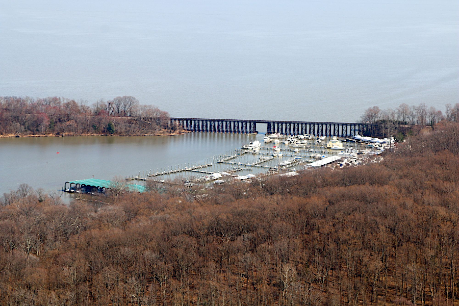
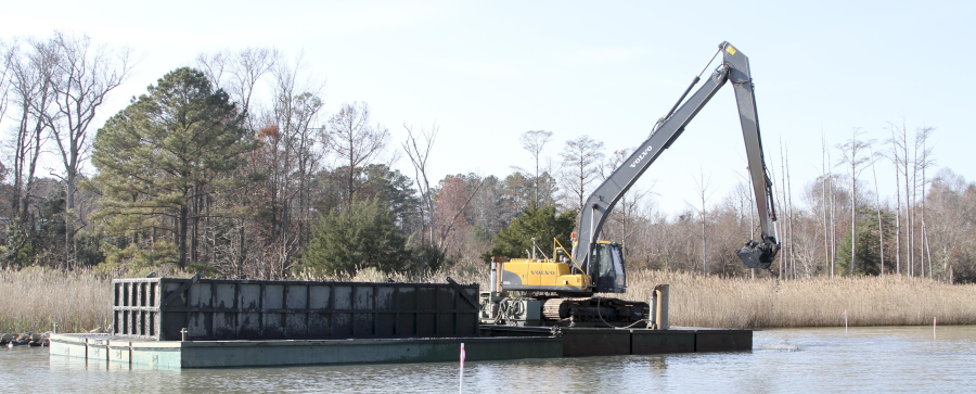
marinas west of CSX railroad bridge needed the Neabsco Creek channel dredged to maintain access in 2019
Source: Historic Prince William, Neabsco Marina - #134 (by David Cuff on March 29, 2019)
The Coast Guard prioritized safety over support for recreational boating:1
Since Federal funds were not available, the Prince William Board of County Supervisors, Virginia Port Authority, and local businesses committed over $1 million to fund a new dredging project. The Corps of Engineers issued the necessary permits using its Section 408 regulations, but provided no Federal funding. By the start of boating season in 2019, 20 tons of silt had been removed and carried by truck to the Prince William County Landfill, and Coast Guard channel markers identified a safe route for boats.2
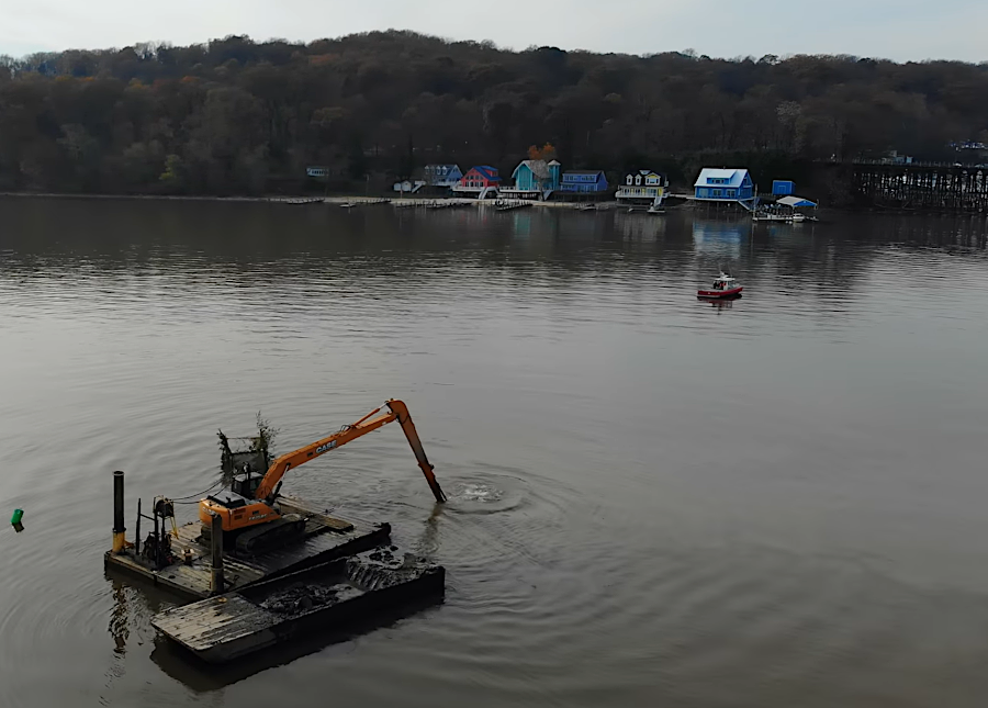
Prince William Board of County Supervisors provided most of the funding to dredge Neabsco Creek in 2018
Source: Norman Voss, Lake Services, Inc. at Neabsco Creek November 19th, 2018
The US Army Corps of Engineers is responsible for dredging designated Federal Navigation Channels to keep them clear of obstructions, but Congress must appropriate the funding for each project. The 2010 Federal policy shift to prioritize non-recreation harbors affected the maintenance dredging of the 32 Federal navigation dredging projects located on the Eastern Shore
The military has its own ships that can dredge channels, but in many cases the Corps of Engineers awards contracts to private sector companies to do the work. Under Section 10 of the Rivers and Harbors Act of 1899, Section 401/404/408 of the Clean Water Act of 1972, and the Marine Protection, Research, and Sanctuaries Act (MPRSA or Ocean Dumping Act), the Corps must approve of dredging and placing aids to navigation in waters of the United States to ensure that they will not cause an obstruction to navigation.
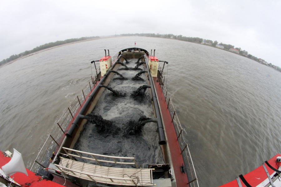
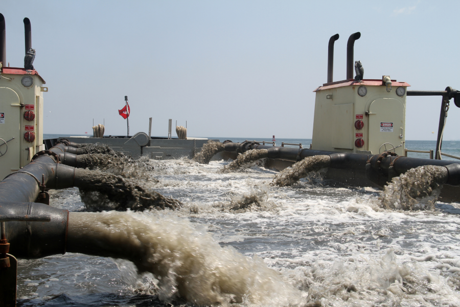
water is separated from mud/silt/sand brought up from the bottom, so the dredge ships can store the sediments and transport them for disposal
Source: US Army Corps of Engineers, Norfolk District Image Gallery
The Environmental Protection Agency and the Department of the Army define the geographic scope of federal jurisdiction under the Clean Water Act. Wetlands and Relatively Permanent Waters with flow which might affect navigation are within the scope. The scope of "Waters of the United States" has been contested in Federal courts, but the legal disputes primarily involve interpretation of inland waters not directly connected to perennial streams. The authority of the Federal government to require permits for projects affecting tidal channels along the Atlantic Ocean, rivers, and large reservoirs such as Smith Mountain Lake is rarely challenged.3
The Corps definition of "navigable waters" is:4
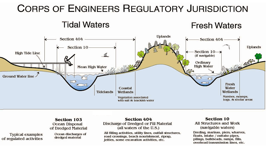
the US Army Corps of Engineers issues permits for projects which might impact navigation on the Waters of the United States
Source: US Army Corps of Engineers, Section 404 & Section 408 Integration
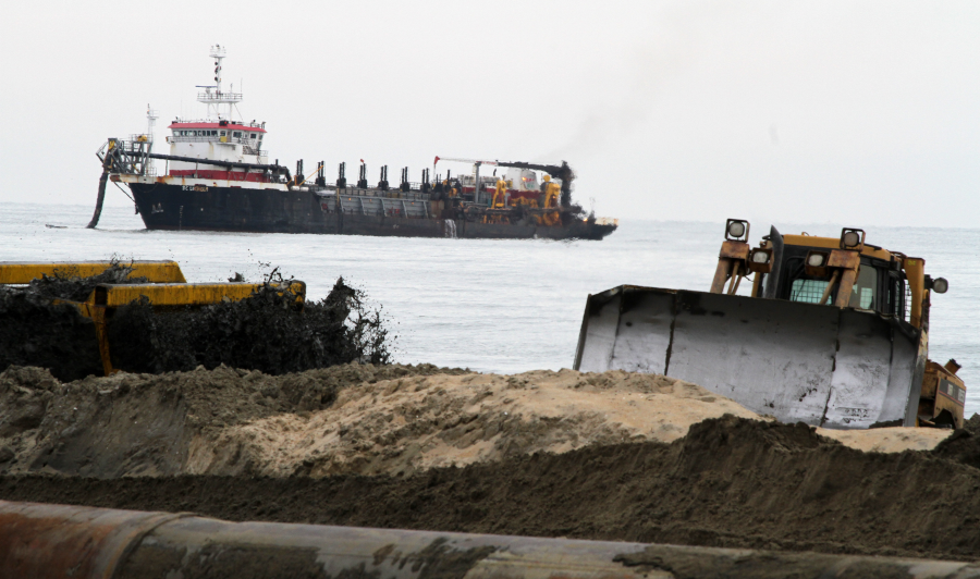
dredging contractors removed over 20,000 cubic yards of material from Tylers Beach, a small harbor in Isle of Wight County, in 2015
Source: US Army Corps of Engineers, Norfolk District Image Gallery
In Hampton Roads, both the Navy and the Army require dredging to maintain shipping channels. The largest dredge disposal site in Virginia is Craney Island, but other sites are used when the transportation costs to Craney Island are too high.
Ships dock at the US Army's Third Port facility at Fort Eustis after they travel up Skiffes Creek. River currents regularly wash sediments into the port's shipping channel, so the US Army Corps of Engineers maintains the depth of that channel at 20 feet by dredging. The material removed from the bottom of Skiffes Creek and the James River is known as "dredge spoils."
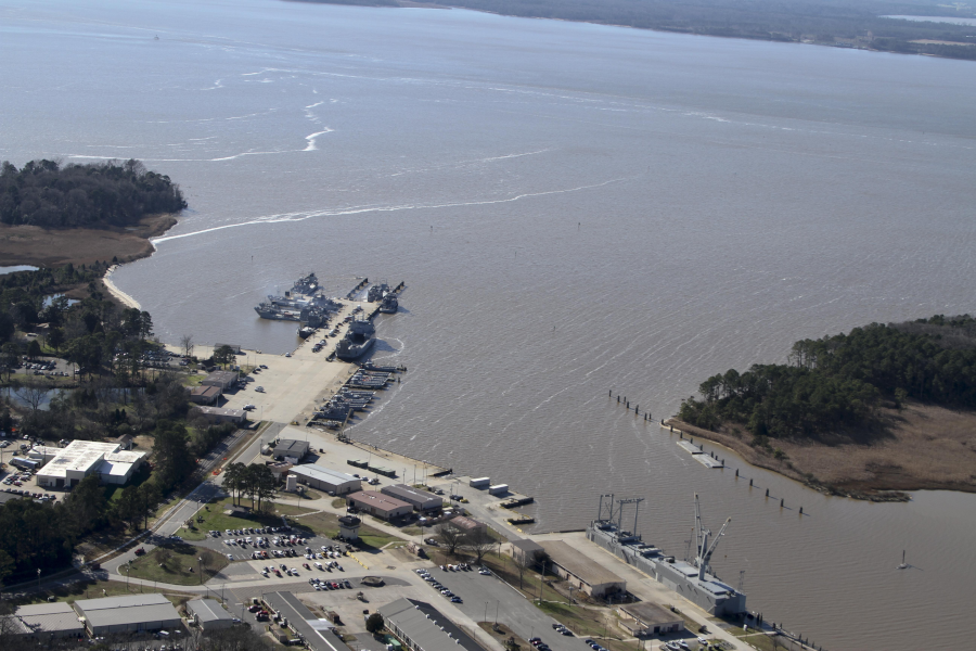
Skiffes Creek Federal Navigation Channel at Fort Eustis
Source: US Army Corps of Engineers, Norfolk District Image Gallery
Specific sites have been identified for disposal of dredge spoils so they will not migrate back into the shipping channel. If dumped at random into the James River or the Chesapeake Bay, currents could transport those sediments back into the channel and required dredging to remove them again. The Corps could haul the sediments from Skiffes Creek to the Atlantic Ocean and dump them in a designated disposal area on the Outer Continental Shelf, but transportation costs by barge for such a long distance would be excessive.
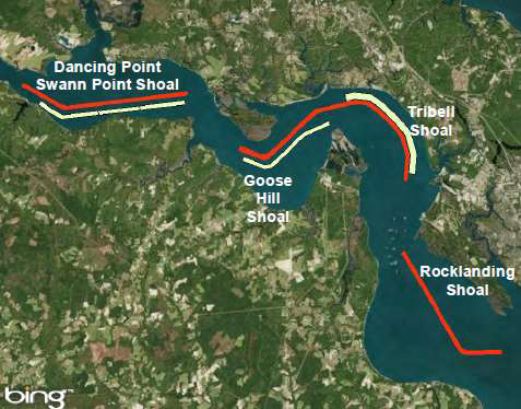
the Corps of Engineers determined that only 3% of the material dredged at Dancing Point-Swann Point migrates back into the channel
Source: US Army Corps of Engineers, James River Partnership - 2017 presentation (slide 49)
The cost-effective solution was to create a disposal facility on land. The Skiffes Creek spoils are deposited into the Fort Eustis Dredge Material Management Area, where the sediments are away from currents and will never clog the shipping channel again. The Fort Eustis Dredge Material Management Area was expanded in 2016 to accommodate 500,000 more yards. For an interim channel project in 2015, the cost to haul spoils from Skiffes Creek was $15 per cubic yard vs. $4.75 per cubic yard for pumping the spoils by pipeline to the Fort Eustis Dredge Material Management Area.5
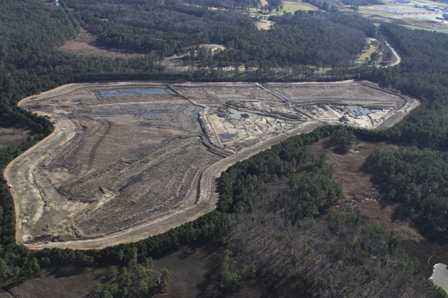
Fort Eustis Dredge Material Management Area handles material dug up from the Skiffes Creek Federal Navigation Channel
Source: US Army Corps of Engineers, Norfolk District Image Gallery
Starting in 2012, Virginia Beach disposed of dredge spoils from Lynhaven Inlet in the Whitehurst "borrow pit" near Oceana. Sand and gravel had been excavated from that pit for construction, so there was a hole into which dredged material could be deposited. In 2025, the pit was nearly full. The city planned to fill up another borrow pit nearby, which would be large enough for 8-10 years of dredging Lynhaven Inlet.
The borrow pit was already full of water, but served as a stormwater pond as well. Neighbors feared adding dredge spoils would increase flooding on adjacent properties, and contaminants in the spoils could create problems. Before the City Council voted in approving a conditional use permit, the Planning Commision unanimously rejected the application.6
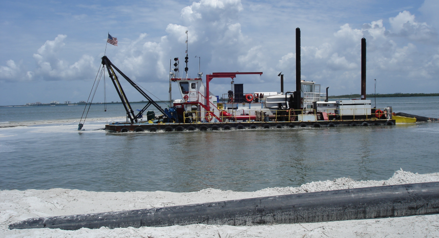
cutter-head dredge "Wilko" was used to maintenance dredge the Lynnhaven Inlet channel after Superstorm Sandy in 2012
Source: US Army Corps of Engineers, Norfolk District Image Gallery

after filling the Whitehurst borrow pit, Virginia Beach planned to move south slightly and use another borrow pit for Lynnhaven Inlet dredge spoils
Source: ESRI, ArcGIS Online
Recycling dredge spoils for beach replenishment projects, such as at Virginia Beach, is suitable only when the material has the right type of sand grains. If particles are too fine, waves will quickly wash the material off the beach. If there is too high a percentage of clay, beach users will not be satisfied.
Tangier Island residents sought for years to have dredge spoils added to their island, to keep it from disappearing due to erosion and sea level rise. Dredge spolis resulting from maintenance of the Baltimore shipping channel are being used to rebuild unpopulated Poplar Island. The General Assembly passed HB52 in 2026, prioritizing projects that reuse dredge spoils and directing that the Virginia Marine Resources Commission require the beneficial use of dredged material for permits it issues whenever feasible.7
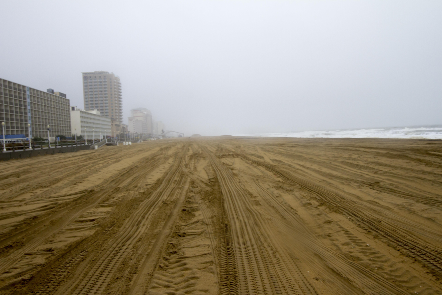
in 2013, the Corps widened the beach in the resort area of Virginia Beach
Source: US Army Corps of Engineers, Norfolk District Image Gallery
The largest dredging projects are for the shipping channels leading to port terminals in Hampton Roads. The $450 million "Wider, Deeper, Safer" project deepened and widened the Thimble Shoal Channel to 55 feet (59 feet in the Atlantic Ocean Channel) to permit two-way passage of ultra-large container vessels (ULCV).
A crane dredge working on the edge on the Thimble Shoal Channel scooped up 21-cubic-yards with each "bite" at dumped the spoils into a scow, which then hauled the waste material to an authorized ocean dumping site. When conditions were right for the large dredging project, the crane could complete one scoop-and-dump cycle every minute. The center of the channel was deepened with hopper dredges which pumped the soils from the ocean bottom into a scow.8
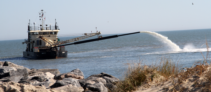
US Army Corps of Engineers dredge "Currituck," removing sediments from the Rudee Inlet channel
Source: US Army Corps of Engineers, Norfolk District Image Gallery
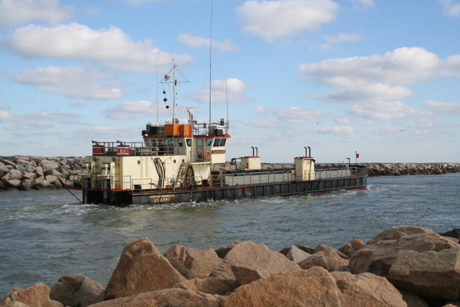
US Army Corps of Engineers dredge "Currituck," in the Rudee Inlet channel
Source: US Army Corps of Engineers, Norfolk District Image Gallery
spoils are transported by hopper dredges to a Virginia Beach pump-out landing station near 26th Street, then piped onshore
Source: US Army Corps of Engineers, Norfolk District Image Gallery
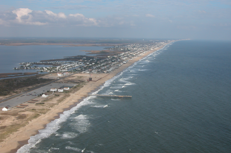
the beach at Sandbridge has been replenished
Source: US Army Corps of Engineers, Norfolk District Image Gallery
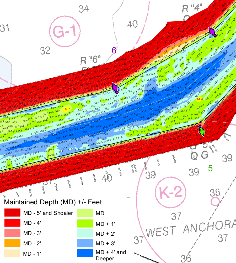
the 50' deep shipping channel to Newport News can be as much as 5' shallower on the edges, and deeper than 50' in the middle
Source: US Army Corps of Engineers, Channel to Newport News