
in the first half of the 1700's, colonial settlement advanced westward past the Fall Line and major port cities such as Fredericksburg developed on the Appomattox, James, Rappahannock, and Potomac rivers
Source: ESRI, ArcGIS Online
in the first half of the 1700's, colonial settlement advanced westward past the Fall Line and major port cities such as Fredericksburg developed on the Appomattox, James, Rappahannock, and Potomac rivers
Source: ESRI, ArcGIS Online
Virginia has been integrated into the international economy since Christopher Newport brought the Susan Constant, Godspeed, and Discovery from England to Jamestown in 1607. From the beginning, Virginia had port cities - but for the first century, it had very few.
The first colonial port was Jamestown, to which the Virginia Company sent re-supply expeditions. Once settlement expanded beyond the protection of the fort, wharves were built on the riverbank and warehouses constructed along River Road in New Town.
The company's leaders in Virginia sent workers to build a fort at Old Point Comfort, where ships first stopped to get fresh water and news. Much later, that site grew into the port city of Hampton. Upstream of that site, the Chesapeake and Ohio (C&O) Railroad built a coal exporting facility after the Civil War and Newport News developed.
In the first decade of colonization, the English who settled in Virginia realized that growing tobacco was the best way to gain wealth. Many of the farms carved out of the forests in Tidewater had their own loading spot on a navigable river, where ships from Europe stopped to load hogsheads of tobacco.
Colonists acquired land on Tidewater "necks" next to the Chesapeake Bay. Hauling tobacco and other crops from farms to the rivers required only a short trip over the dirt trails. As the colonial population grew and Native Americans were displaced, land was cleared further away from the river edges. Farms were created in the middle of the Peninsula, Middle Peninsula, and Northern Neck westward to the Fall Line, but no towns were developed .
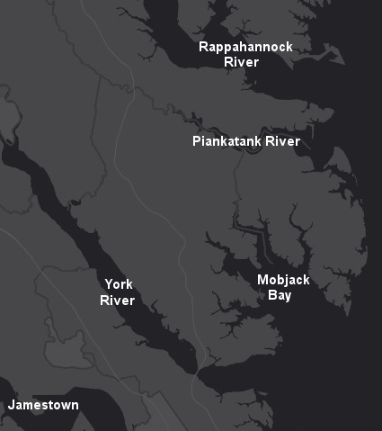
Chesapeake Bay "necks" (peninsulas of land surrounded by water) were settled before towns were established in the colony
Source: ESRI, ArcGIS Online
There was no advantage to clustering development. Throughout the 1600's the General Assembly had to pass special legislation mandating ships stop at Jamestown and subsidizing the construction of housing there, just to maintain that town in Virginia.
Gradually, some concentrations of people emerged along the Chesapeake Bay to support the fishing industry. Town such as Onancock in Accomack County developed as transfer places for fishermen to market their hauls to local customers, and then to Baltimore, Philadelphia, and New York.
The most dramatic development was Reedville in Northumberland County. It became the center for the menhaden fishery, and the wealth resulting that business can be viewed today in the grand Victorian homes in that town.
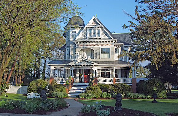
the historic Morris House in Reedville, with 4,864 square feet of living space, was listed for sale in 2016 with a price of $1,595,000
Source: Mary Burgess - RE/MAX Commonwealth
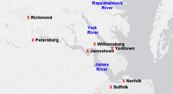
The first urban areas developed in Tidewater because they were good locations for ports to handle international trade. Yorktown, at the mouth of the York River, thrived until its devastation in 1781 during the American Revolution.
Norfolk grew into a port city almost a century after initial settlement of Virginia. Its excellent harbor on the Elizabeth River offered shelter from storms and pirates, but the region was exposed to attack by Spanish, Dutch, and French warships. The initial colonists in 1607 recognized the benefits of ships being able to safely stay in Hampton Roads, but moved upstream to get out of reach of potential European enemies.
The sandy soils in the Elizabeth River and Nansemond River watersheds produced poor tobacco, but the region did provide lumber, pork, and produce needed by the Sugar Islands in the Caribbean as well as coastal cities in North America. Settlers could make a profit shipping food and timber products from the protected harbors of Norfolk, which were the closest to the mouth of the Chesapeake Bay.
Norfolk also grew as the export/import center for northeastern North Carolina. Barrier islands on the northern part of Albemarle Sound blocked ships from easy access to the Atlantic Ocean, incentivizing port development in the Chesapeake Bay watershed. Norfolk, Portsmouth, and Suffolk handled much of the shipping to and from the Albemarle country. Petersburg also competed for the trade that came down the Roanoke River and was transported by road and later rail for shipping via the Chesapeake Bay.
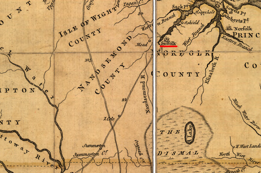
Suffolk grew on the Nansemond River, thanks in part to trade from North Carolina
Source: Library of Congress, A map of the most inhabited part of Virginia containing the whole province of Maryland with part of Pensilvania, New Jersey and North Carolina
Norfolk was destroyed by the American rebels at the very start of 1776, in part to prevent Lord Dunmore and the British from making it a base of support and in part because its Scottish and English merchants were not strong supporters of the American Revolution. It was soon rebuilt, and Portsmouth developed on the western side of the Elizabeth River. Norfolk was the main population rival to the state capital at Richmond until the 1950's, when its neighbors incorporated as independent cities and blocked Norfolk from expanding its boundaries through annexation.
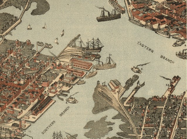
Norfolk and Portsmouth waterfronts on the Elizabeth River waterfront, about 1891
Source: Library of Congress - Bird's eye view of Norfolk, Portsmouth and Berkley, Norfolk Co., Va.
In the 1700's, cities on the Appomattox, James, Rappahannock, and Potomac rivers at the Fall Line developed as ports. Ships could not continue sailing upstream, so trading stations and warehouses were constructed at the rapids. Jamestown and Norfolk got started first, but the ancient geological boundary separating the Coastal Plain and the Piedmont defined the location of the Virginia's major port cities.
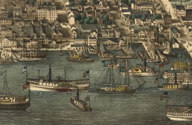
Alexandria waterfront, 1863
Source: Library of Congress - Birds eye view of Alexandria, Va.
Petersburg, Richmond, Fredericksburg, and Alexandria grew into urban centers because of their Fall Line locations. Those ports shipped tobacco and grain to the Caribbean and Europe, and then to Baltimore, Philadelphia, New York, Boston, and Charleston and other population centers that emerged on the East Coast.
From the beginning of colonization, Virginia relied upon trade. There were few subsistence farms on the Coastal Plain and Piedmont. Crops, especially tobacco, were grown in surplus beyond local demand and shipped to market. Hauling agricultural products to Virginia's port cities was a challenge before rail lines and turnpikes were constructed, but the headache was worth the cost. Once crops got to a port city, farmers had expanded the number of potential buyers and would receive higher prices.
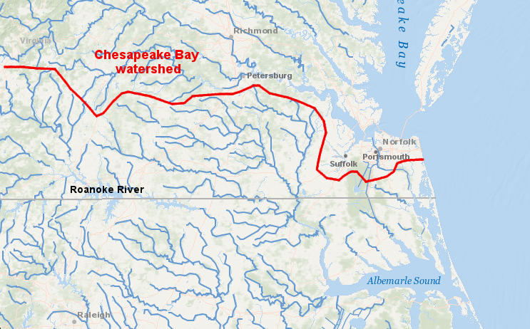
Virginia's first ports developed in the Chesapeake Bay watershed, and products from the Chowan River and Roanoke River watersheds were transported by boat and wagon to Norfolk, Suffolk, Portsmouth and Petersburg
Source: ESRI, ArcGIS Online
Some ports on the Fall Line failed to grow because they never developed a network of roads, canals, and railroads to connect with a "hinterland" to the west. The majority of marketable goods came from not from nearby neighbors, but from farmers on the Piedmont living as far west as the base of the Blue Ridge itself.
Dumfries was chartered on the very same day as Alexandria and supported by the same Scotch merchants, but no inland connections up Quantico Creek were funded. After the watershed of Quantico Creek was deforested by tobacco farming and charcoal production for the Neabsco Iron Works, sediment filled up the harbor and Dumfries withered as a port.
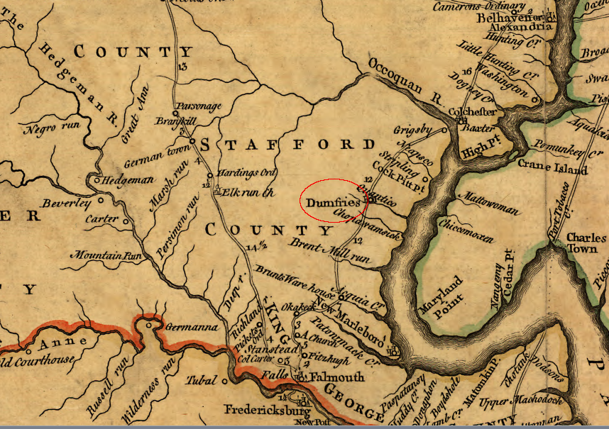
Alexandria built a transportation network into the Piedmont and even across the Blue Ridge via the Manassas Gap Railroad, but Dumfries failed to grow
Source: Library of Congress, A map of the most inhabited part of Virginia containing the whole province of Maryland with part of Pensilvania, New Jersey and North Carolina
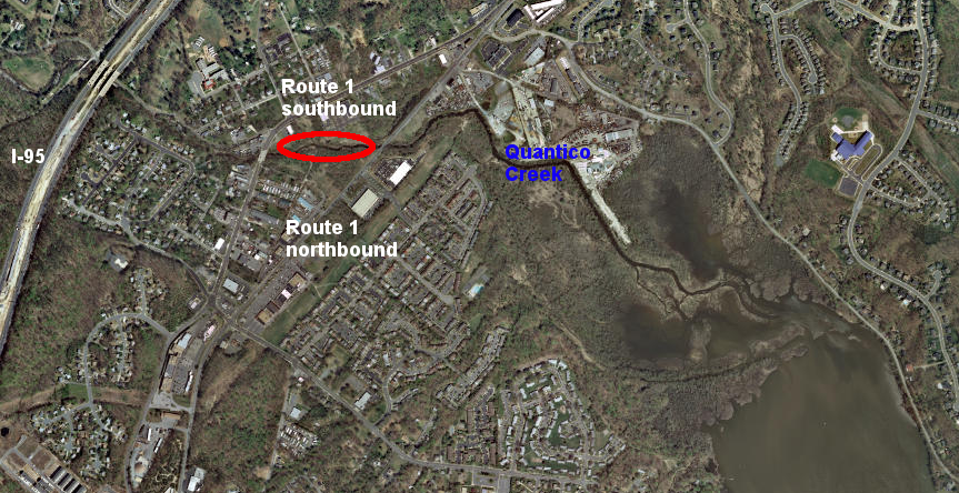
the location of the original harbor at Dumfries (red oval) is now between Route 1's northbound and southbound lanes
Source: ESRI, ArcGIS Online
Occoquan and Colchester were rival ports on either side of the Occoquan River in the 1700's. Colchester connected to the inland marker via Old Ox Road, a "rolling road" used for oxen to pull hogsheads packed with tobacco to the wharf.
According to local lore, Ox Road was constructed initially to ship copper ore back to England. Robert "King" Carter had found a promising deposit at what today is Frying Pan Park in Fairfax County. He planned to ship it north on a new road cut through the woods of what was then Stafford County to a new wharf on the Potomac River near Little Falls, and to export the ore from that site.
However, Carter's rival Thomas Lee patented all the suitable land along the shoreline first in 1729. Both men were well familiar with the patenting process, since each at different times had been land agent for Lord Fairfax. At the time, Robert Carter was serving in that role. Carter's solution was to move the ore south, and he had a road built between Frying Pan and the shoreline of the Occoquan River downstream from the town of Occoquan. Colchester developed as the new port there.1
Robert Carter's copper deposit quickly proved to be uneconomical to mine, but the number of hogsheads pulled to Colchester to export tobacco led to the name "Ox Road."
Occoquan was not any more successful as a port city that Colchester or Dumfries; shippers chose to focus on Alexandria. Occoquan ultimately survived because merchants there utilized the waterpower at the Fall Line to operate mills grinding grain and bellows for an iron forge. The success of Alexandria, with a better road an later rail connections to the interior, limited the growth of Occoquan, Colchester, and Dumfries as competing port cities on the Potomac River.
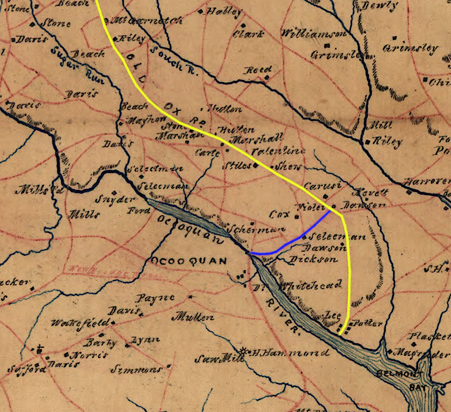
Occoquan built a road (blue) to intercept trade going to Colchester via the Old Ox Road (yellow)
Source: Library of Congress, A map of Fairfax County, and parts of Loudoun and Prince William Counties, Va., and the District of Columbia
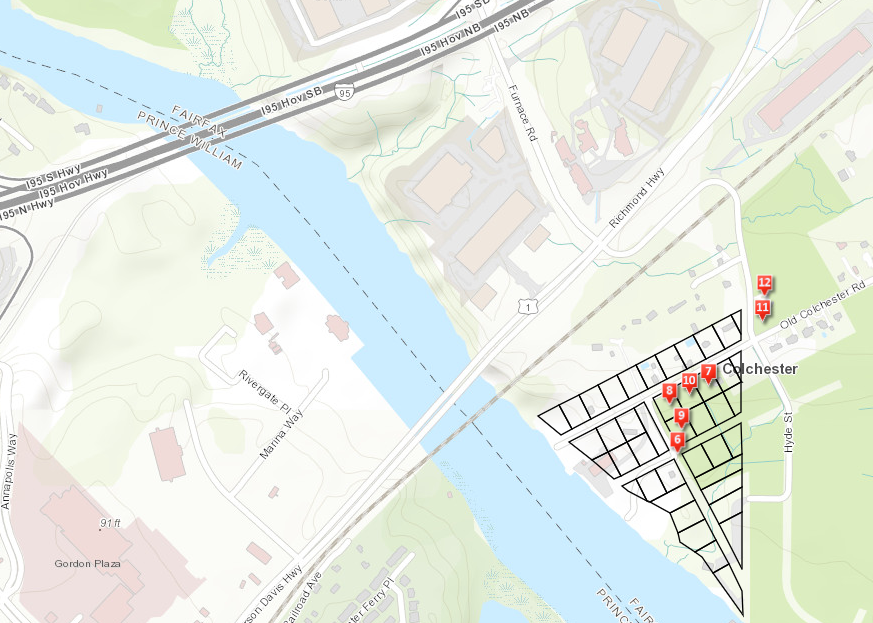
the Fairfax County Park Authority has conducted extensive archeological studies at Colchester
Source: Fairfax County, A Cultural History Tour of Old Colchester Park and Preserve
Richmond and Petersburg started in the 1730's, when William Byrd II chose to survey and sell land at the Fall Line of the Appomattox and James rivers. It took 125 years for enough colonists to move up the James River from the initial location at Jamestown and justify the creation of the two port cities. Richmond pushed the James River and Kanawha Canal west of the Blue Ridge, drawing trade to the Fall Line of the James River. Petersburg financed the South Side Railroad link to Lynchburg, competing for the same business.
Richmond could load shallow-draft ships at the base of Church Hill, where Shockoe Creek entered the James River. As ships grew larger, Richmond built a deepwater terminal further downstream, but city leaders recognized they needed even deeper water for larger ships.
To maintain its shipping trade, Richmond built a railroad to West Point at the junction of the Mattaponi and Pamunkey, the start of the York River. Petersburg did the same, and built a railroad to deeper water at City Point (now part of Hopewell).
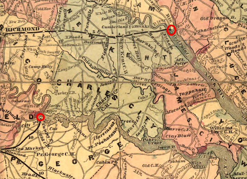
Petersburg built a railroad to City Point, and Richmond obtained access to a deeper-water harbor in 1861 by constructing a railroad to Delaware Town (renamed West Point) on the York River
Source: Library of Congress, Lloyd's official map of the state of Virginia from actual surveys by order of the Executive 1828 & 1859
No city exists in a government vacuum. State-supported transportation improvements were recognized from the beginning as tools for increasing population and wealth of one city, often at the expense of another.
Norfolk's growth demonstrates the impact of political geography as much as the physical geography of Virginia. Richmond and Petersburg tried to limit the shipping business on the Elizabeth River, and to block Portsmouth or Norfolk from benefitting from the inland trade of the Roanoke and James river watersheds. Petersburg business leaders in particular blocked rail connections between the Roanoke River and Norfolk, in order to divert trade north to the Appomattox River port.
Every early Virginia city was a port except one - Williamsburg.
Unique in the development of the state, Williamsburg was located on the watershed divide between College and Queens creeks on higher ground where the roads tended to dry out sooner after rains. The second capital was considered to be healthier than Jamestown, being away from the swamps and brackish drinking water.
Originally known as "Middle Plantation," it was located in the middle between the James and York rivers. There were efforts to build a canal to Williamsburg, but in contrast to Jamestown and Richmond no ship ever tied up at wharves of that capital city.
Williamsburg developed as a town, even though it was not a port, because it was the capital of the colony between 1699-1780
Source: ESRI, ArcGIS Online

Portsmouth waterfront in 1950
Source: David Rumsey Historical Map Collection, Portsmouth (Virginia) (Nirenstein's National Realty Map Co., 1950)
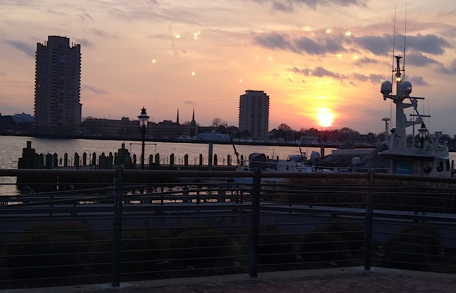
Portsmouth skyline, seen from Waterside on the Norfolk waterfront