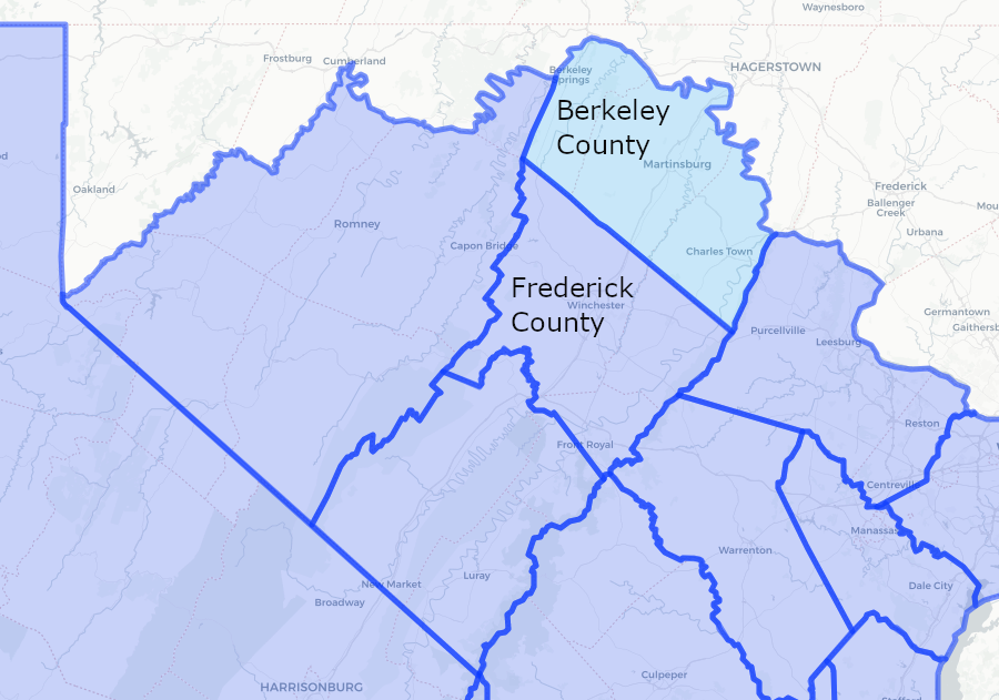
Berkeley County was carved out of Frederick County in 1772, and later Jefferson and Morgan counties were created from Berkeley County
Source: The Newberry Library, Atlas Of Historical County Boundaries - Virginia
Berkeley County was carved out of Frederick County in 1772, and later Jefferson and Morgan counties were created from Berkeley County
Source: The Newberry Library, Atlas Of Historical County Boundaries - Virginia
Virginia claimed the land northwest of the Ohio River and stretching to the Pacific Ocean under the Second Charter issued by James II in 1609:1
County governments were created when there were settlers in the area who wanted to document their ownership of land, and when the local population had grown sufficiently to justify the expense. Residents of a new county had to pay enough taxes to cover the costs of salaries for the justices, clerk, and sheriff.
The first time any land west of the Blue Ridge was incorporated into a county was in 1734/35, with the creation of Orange County. Its boundaries crossed the Blue Ridge, though everyone living on the western side had to cross the mountains to reach the courthouse located on the eastern side of the mountains.
In 1738, the General Assembly authorized the creation of Augusta and Frederick County. The Blue Ridge would serve as their eastern boundaries, and no limit was defined for their western boundaries. Enough settlers moved west of the Blue Ridge for courts to began to meet in Frederick County in 1743 and in Augusta County in 1745.
In 1772, more population growth justified splitting Federick County to create Berkeley County. It was subdivided in 1801 to create Jefferson County on the east. The remnant of Berkeley County was subdivided again in 1820 to create Morgan County on the west. The south border of all three was the "back line" surveyed for the Fairfax Grant in 1746.2
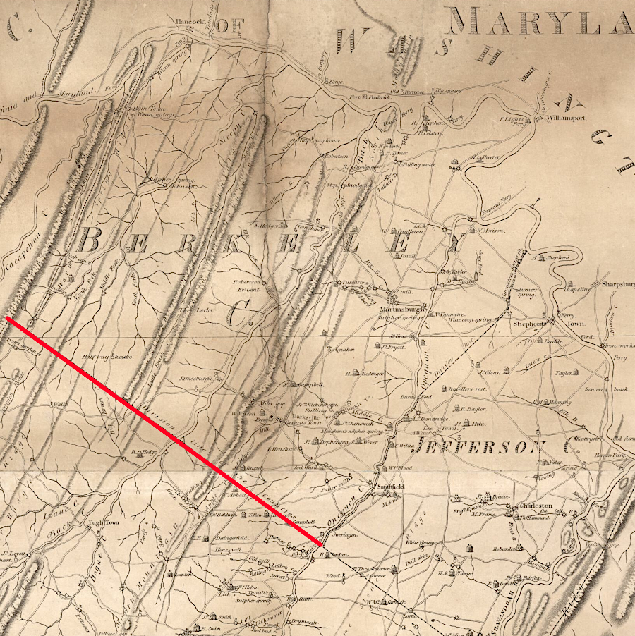
the southern boundary of Berkeley County was defined by the 1746 survey for the Fairfax Grant
Source: Library of Congress, Map of Frederick, Berkeley, & Jefferson counties in the state of Virginia (by Charles Varle, 1809)
In 1861, 13% of the population in Berkeley County was enslaved. To the east, 28% of the population in Jefferson County was enslaved, while to the west less than 3% of the people in Morgan County were held in slavery.3
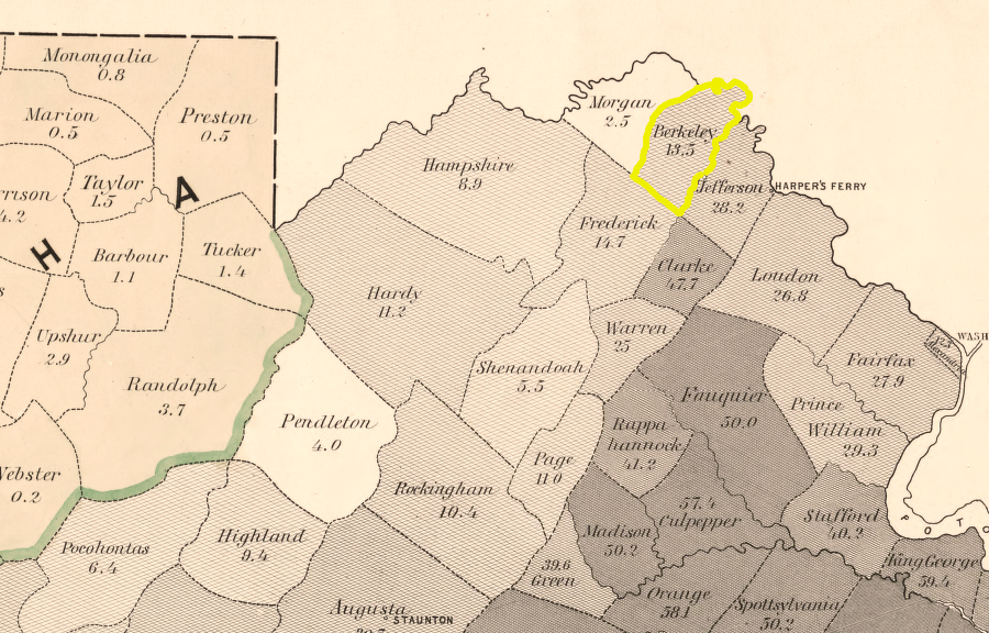
Berkeley County in 1860
Source: Library of Congress, Map of Virginia: showing the distribution of its slave population from the census of 1860 (Henry S. Graham, 1861)
When Virginia seceded from the Union, a Restored Government of Virginia assembled in Wheeling. On May 13, 1862, it approved the division of Virginia. That met the requirement in Article IV, Section 3 of the US Constitution that a state had to authorize creation of a new state out of an existing state. The same process had been used to authorize the creation of Kentucky in 1792.
The western counties of Virginia would be included within the new state, but the boundary on the eastern edge was not clear in 1862. The Restored Government of Virginia authorized residents of Berkeley, Jefferson, and Frederick counties to vote to authorize the new state constitution and join what would ultimately be called West Virginia. Berkeley Copunty residents voted in 1863 in favor of separating from Virginia and being included within the boundaries of West Virginia, by 645-7.
Results of an election held during a civil war are questionable. Confusion was increased by the election at the same time of Berkeley County representatives to go to Alexandria and serve in the General Assembly of the Restored Government of Virginia. Francis Pierpont. governor of the Restored State of Virginia, formally notified his counterpart in West Virginia that Berkeley County and Jefferson County had voted to join that state. The West Virginia legislature included Berkeley County on August 5, 1863.
However, Pierpont's government define State Senate districts in 1864 that still included Berkeley County. In December 1865, after the end of the Civil War, the Virginia General Assembly revoked its consent for Berkeley County and Jefferson County to join West Virginia. The US Congress went ahead on March 2, 1866 to authorize the two counties to be part of the new state. In 1870, the Supreme Court decided that the authorization by the Restored Government of Virginia in 1863 was valid, rejecting the legal effort of Virginia to reclaim Berkeley and Jefferson counties.4
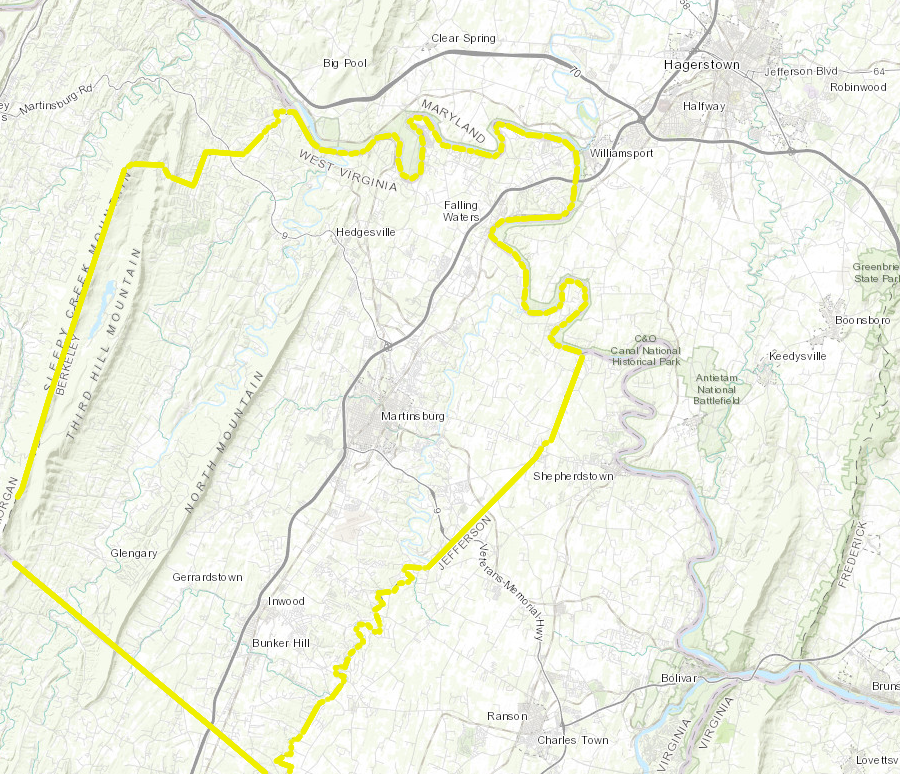
Berkeley County is in the Valley and Ridge physiographic province
Source: ESRI, ArcGIS Online