Dickenson County
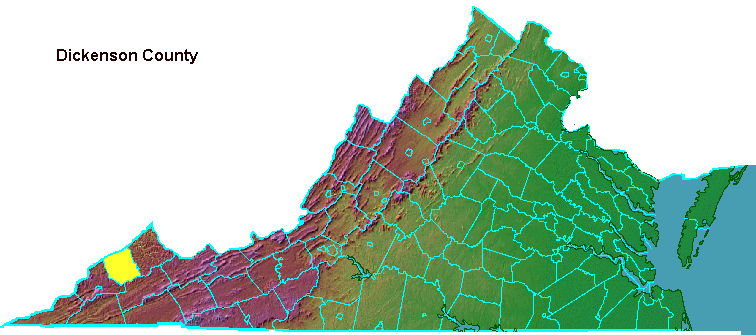
The last county to be created in Virginia was formed in 1880. It was named after William J. Dickenson, who was a "Readjuster" delegate to the General Assembly from Russell County in 1880.
The Readjusters were politicians who were just taking control of Virginia politics when Dickenson County was created. The party was named after their key political proposal to readjust the existing state debt (incurred mostly to subsidize highway, canal, and railroad construction prior to the Civil War), rather than pay it in full.
The Funders were in charge from 1870-1879. They wanted to pay off the state bonds in full in order to attract new northern/European investment during Reconstruction. However, this meant a high percentage of state taxes went to repay old debts from 1840-60 rather than to fund schools, new roads, etc. in the 1870's.
The Readjusters ended up repudiating a third of the existing state debt and stretching out the payments for the rest, rather than paying off bonds at 1000% of the promised rate. This let them promise more government services immediately to the current Virginia taxpayers, though lawsuits about the debt stretched into 1915.
For nearly a century after the Civil War, state politics would be dominated by factions of Democrats. However, the Republicans in the far southwest counties (the "Fighting Ninth" Congressional District) played a key role on some occasions.
According to the county's 2008 Comprehensive Plan:1
- Dickenson County lies in the Appalachian Plateau, along the crest of the Cumberland Mountains...
- The rough mountainous terrain, characteristic of the Appalachian Plateau, forced the early settlers to locate along the county's streambeds. The best farmland was to be found along the flat bottomlands, and the streams provided a good water supply. The first settlements in Dickenson County were Sandlick, Holly Creek (Clintwood) and Nora, all of which are located along the streams of the area...
- As the bottomlands of the county became occupied, more settlers began locating on the numerous ridges in the county. The settlers built homes on the broad ridge tops and began to farm the fertile land. Some of the ridge communities include Big Ridge, Omaha, Herald and Caney Ridge. This pattern is still evident today in Dickenson County. The valley floors and ridge tops are the only lands suitable for development. This fact brings to the forefront Dickenson County's developmental problems. The lowlands offer problems concerning susceptibility to flooding, and the ridge tops limit the availability of site development...
- In this mountainous region, flat land even a few acres in extent are rare, and valley slopes are very steep. The surface is deeply and maturely dissected by streams, with the water courses being only a few miles apart but separated by ridges that rise 500 to 1,000 feet above them. The valleys are deep, narrow and V-shaped, with little or no flat bottomlands.
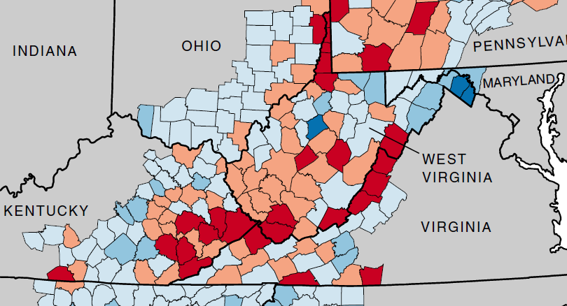
population levels in coal-dependent Appalachian Plateau counties of Buchanan and Dickenson are declining
Source: Appalachian Regional Commission, Population Change in Appalachia, 2000-2010
The 2008 Comprehensive Plan also noted that population and unemployment rates track world energy prices. When oil/gas prices climb, coal production in Dickenson County increases. However, as mines are mechanized, the number of miners hired in boom times does not match the employment levels of the past:2
- Upon completion of the Caroline, Clinchfield and Ohio Railroad, the coalmines and hardwood forests became accessible to the markets of the nation and the world. The population of the county nearly doubled between 1910 and 1920, as young men came with their families to live and work. The county continued to grow until the 1950's. By this time, most of the lumber companies had exhausted their timber, and the mines began to increase mechanization, thus requiring fewer workers. As the coal industry continued to decline during the 1960's, so did Dickenson County's population. Since the county's economy is so closely tied to the coal industry, it can be expected that it will rise and fall at a pace concurrent with the rises and declines in the coal industry...
- In the 1980's a "bust" period was again upon the area, as the boom of the 1970's quickly dwindled. The 1980's also saw a "second generation" of mechanization in the coal industry, increasing coal production but further reducing the manpower needs. Population declined once again and over the next decade employment reached double digits and the County's population was reflective of employment.
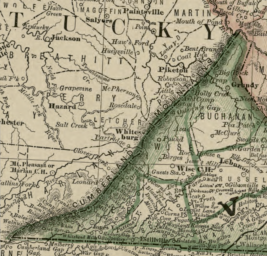
in 1879, there was no Dickenson County in Virginia
Source: Library of Congress, Rand, McNally & Co.'s Virginia and West Virginia (Rand, McNally and Company's business atlas, 1878-79)
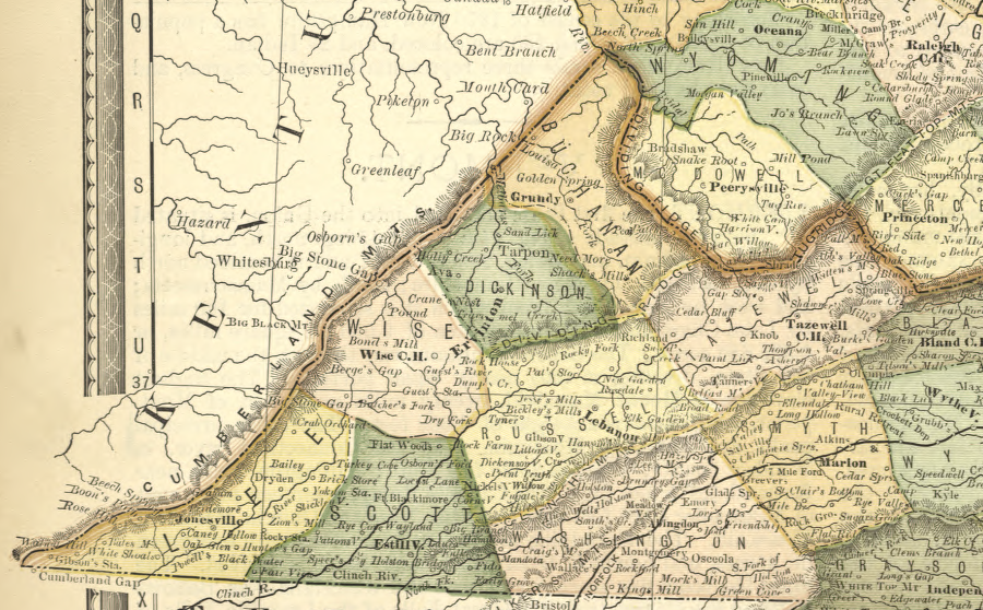
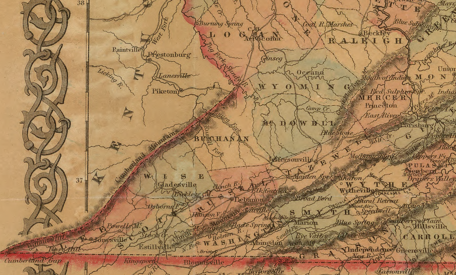
Dickenson County was on the map in 1882
Source: Library of Congress, Map of Virginia and West Virginia (H.H. Hardesty & Co., 1882)
Links
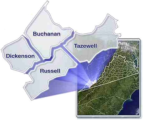
Dickenson partners with Buchanan, Russell, and Tazewell in the
Cumberland Plateau Planning District Commission (PDC)
Wise and Lee counties are in a separate PDC
Source: Cumberland Plateau Planning District Commission
References
1. "Comprehensive Plan 2008 - Dickenson County, Virginia," 2008, pp.8-10, http://www.dickensoncountyvirginia.org/compplan2008.pdf (last checked September 3, 2012)
2. "Comprehensive Plan 2008 - Dickenson County, Virginia," p.9-10
in 1855, there was no Dickenson County - and no separate state of West Virginia either
Source: Library of Congress, Colton's Virginia (by J. H. Colton, 1855)
Existing Virginia Counties
Virginia Counties
Virginia Places