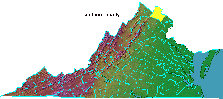
Loudoun County, within boundaries of the Fairfax Grant
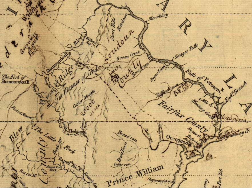
Source: Library of Congress, A survey of the northern neck of Virginia, being the lands belonging to the Rt. Honourable Thomas Lord Fairfax Baron Cameron, bounded by & within the Bay of Chesapoyocke and between the rivers Rappahannock and Potowmack: With the courses of the rivers Rappahannock and Potowmack, in Virginia, as surveyed according to order in the years 1736 & 1737
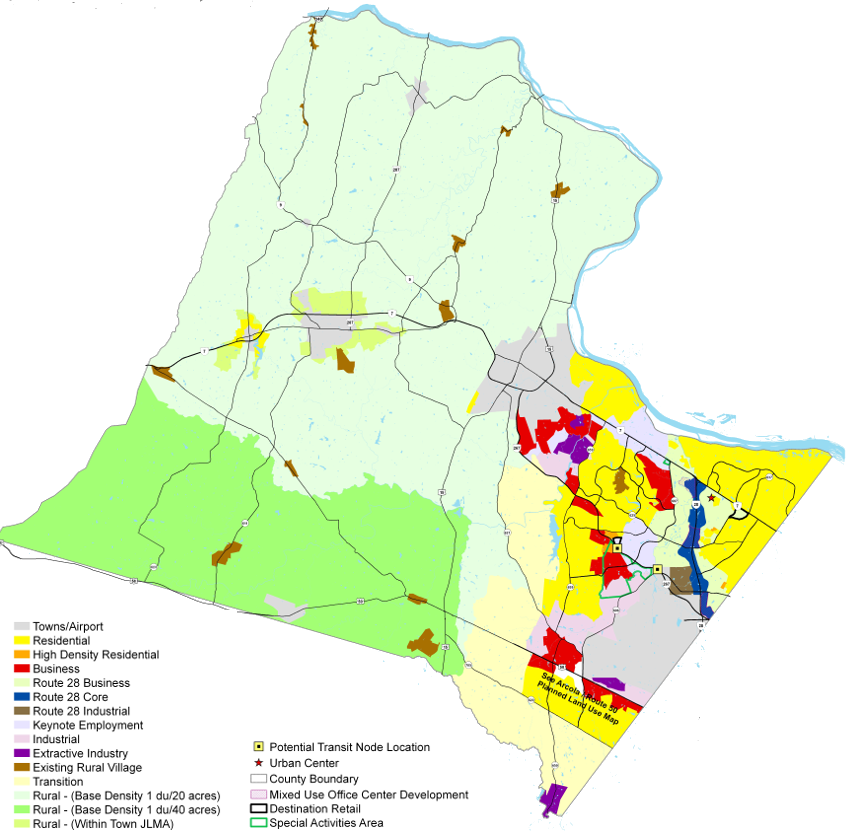
Loudoun County land use plans assume high-density development on the eastern side (near job centers in Tysons/DC), with a low-density rural area west of Route 15 in particular
Source: Loudoun County, Planned Land Use
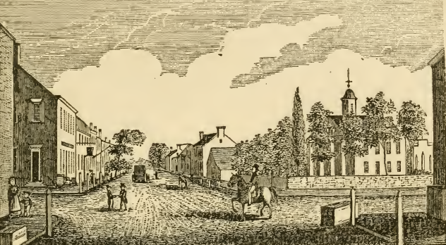
the county courthouse has been located in Leesburg since Loudoun County was formed in 1757
Source: Historical collections of Virginia, Central View in Leesburg (p.353)
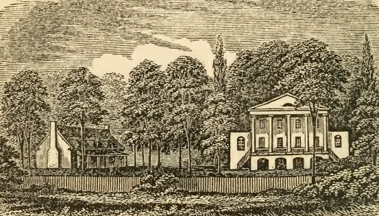
President Monroe's home at Oak Hill remains a private residence
Source: Historical collections of Virginia, Oak Hill, the Seat of President Monroe (p.356)
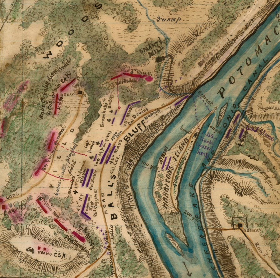
Union forces were defeated (and Col. Edward Baker died) at the Battle of Balls Bluff on October 21, 1861
Source: Library of Congress, Plan of the Battle of Ball's Bluff VA (by Robert Knox Sneden)

Loudoun County cartographer and historian Gene Scheel, signing map he produced showing places related to Native Americans in Loudoun County
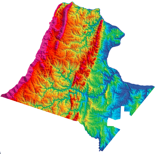
topography of Loudoun County (excluding Dulles airport...)
"The highest elevation is 1,920 ft above sea level on Blue Ridge at the southwestern part
of the county,and the lowest elevation is 180 ft above sea level
along the Potomac River at the easternmost part of the county." (page ii)
Source: US Geological Survey, Geologic Map of Loudoun County, Virginia (Geologic Investigations Series Map I-2553)

Loudoun County population increased faster than any other county at the start of the 21st Century
Source: U.S. Census Bureau, news release (April 28, 2004)
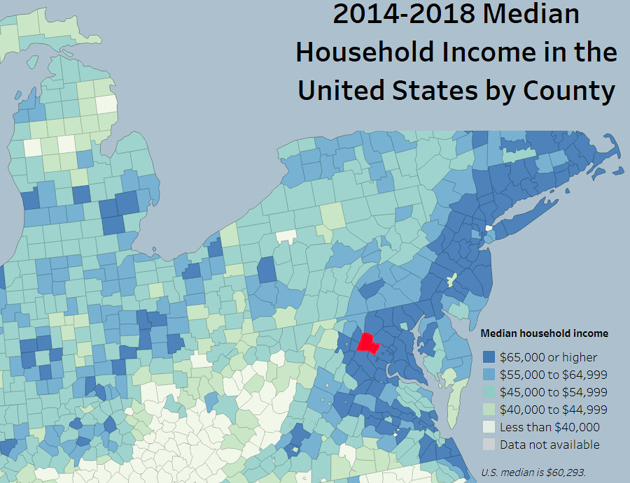
with a median household income exceeding $65,000/year, Loudoun is one of the wealthiest counties in the United States
Source: U.S. Census Bureau, 2014-2018 Median Household Income in the United States by County
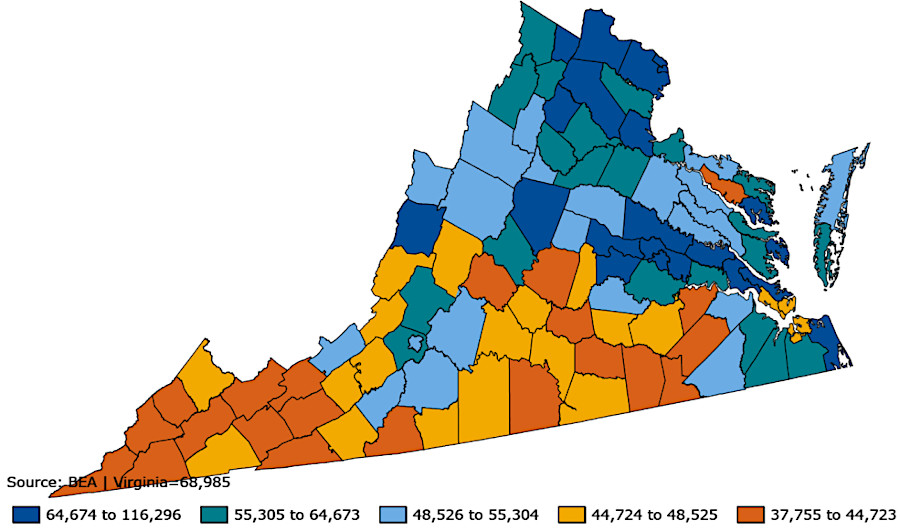
in 2022, per capital annual personal income in Loudoun County was $96,862
Source: Bureau of Economic Analysis, U.S. Department of Commerce, Regional Data - GDP and Personal Income Mapping