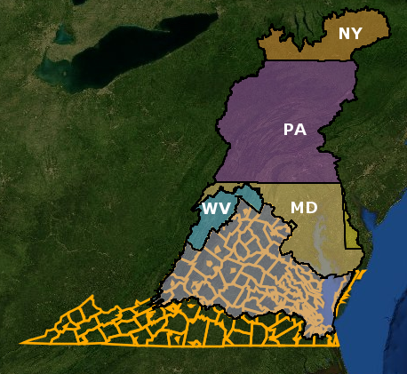
56% of Virginia is located within the Chesapeake Bay watershed, (and even Maryland has a portion of the state which does not drain to the bay)
Source: ESRI, ArcGIS Online
56% of Virginia is located within the Chesapeake Bay watershed, (and even Maryland has a portion of the state which does not drain to the bay)
Source: ESRI, ArcGIS Online
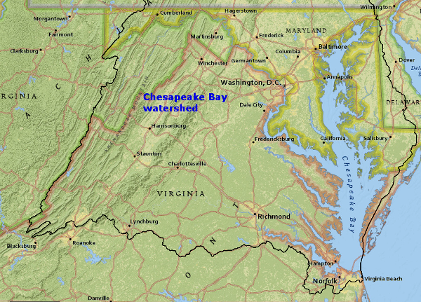
Not all of Virginia is in the Chesapeake Bay watershed. 44% of the land within the boundaries of the state drains to other areas, and 25% of Virginians live outside the bay's watershed.1
In Highland, Bath, and Alleghany counties, the Virginia-West Virginia line essentially defines the bay's watershed divide. Further south, the watershed boundary reaches almost to Mountain Lake in Giles County.
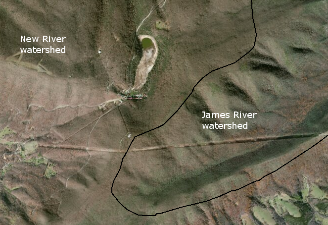
Mountain Lake is near the watershed divide between the Chesapeake Bay (James River watershed) and Gulf of Mexico (New River watershed)
Source: ESRI, ArcGIS Online (with Chesapeake Bay Watershed Boundary)
The towns of Blacksburg and Bedford, and the cities of Roanoke and Salem, are not within the Chesapeake Bay watershed; their sewage and stormwater runoff flows to Albemarle-Pamlico Sound. The towns of Appomattox and Pamplin City in Appomattox County, and the towns of Burkeville and Blackstone in Nottoway County, are located on the watershed divide. The towns of Crewe (Nottoway County), Surry (Surry County), and Windsor (Isle of Wight County) are just barely within the bay's watershed. The cities of Petersburg, Suffolk, Chesapeake, and Virginia Beach are split by the watershed boundary, so water running off only a portion of those jurisdictions will end up in the Chesapeake Bay.
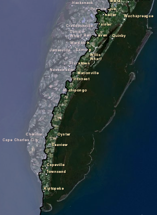
On the Eastern Shore "bayside" communities such as Cape Charles are 100% within the watershed, while "oceanside" communities such as Chincoteague are completely outside. The town of Belle Haven (Accomack County) is located just barely within the watershed. Most towns in the middle of the peninsula - Cheriton, Eastville, Exmore, Nassawadox (Nottoway County), plus Painter, Melfa, Onley, and Accomac (Accomack County) - are split in two by the divide.
eastern half of the Eastern Shore is not in the Chesapeake Bay watershed - but land near Mountain Lake in Giles County is...
Source: ESRI, ArcGIS Online
on the Eastern Shore, bayside communities are within the Chesapeake Bay watershed
Source: ESRI, ArcGIS Online
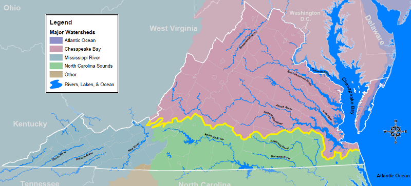
rivers south of the yellow line do not flow into the Chesapeake Bay
Source: Virginia Department of Game and Inland Fisheries, Virginia Watersheds
Drivers going south on Interstate 81 see a sign north of Roanoke announcing "Leaving the Chesapeake Bay watershed." Before the sign, drivers are in the James River watershed. Across the divide, south of the sign, drivers enter the Roanoke River watershed.
The Roanoke River itself flows through a water gap that it has cut through the Blue Ridge. Several dams slow the natural Roanoke River current to a standstill. The river goes into Smith Mountain Lake and then Leesville Lake, where some water is pumped back upstream to Smith Mountain Lake in order to flow through the hydroelectric turbines at Smith Mountain Dam and generate electricity one more time when demand peaks.

light blue color shows Roanoke River watershed in Virginia, carrying sediments from Blue Ridge/Piedmont down to Albemarle Sound and Outer Banks of North Carolina
Source: Virginia Department of Conservation and Recreation (DCR), River Basins in Virginia
After Leesville Lake, the water flows through a stretch known locally as the Staunton River. After the confluence with the Dan River, the Roanoke River enters Buggs Island/Kerr Reservoir, and then flows into Lake Gaston. The city of Virginia Beach built a pipeline that reaches a cove on the northern edge of Lake Gaston, where the cities of Chesapeake and Virginia Beach divert some water to the east to supplement their drinking water supply.
Thanks to the interbasin diversion, some raindrops that landed in the Roanoke River watershed end up reaching the Chesapeake Bay before entering the Atlantic Ocean. Most the water of the Roanoke River flows past the Virginia border into North Carolina and on to the Albemarle-Pamlico Sound and Roanoke Island, the home of the "Lost Colony" planted by the English in the 1580's.
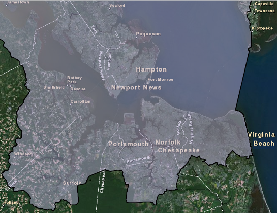
in southeastern Virginia, three cities are split by the Chesapeake Bay watershed divide
Source: ESRI, ArcGIS Online
sediment flowing down the Pigg River will never reach the Chesapeake Bay; it will flow down the Roanoke River to Albemarle Sound
Source: Virginia Geographic Information Network (VGIN), VBMP 2011 WGS Web Mercator (VGIN)