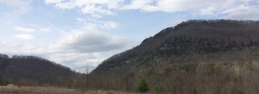
looking northwest towards Cumberland Gap, with Virginia on the right and Tennessee on the left
looking northwest towards Cumberland Gap, with Virginia on the right and Tennessee on the left
When Dr. Thomas Walker passed through what he called Cave Gap in 1750, he was following a path created by Native Americans over the previous 15,000 or so years. When Walker crossed through the gap, he walked on a game trail known as "Athiamiowee" by the Shawnee who lived to the north. The Cherokee also used the gap, following the trail north to attack the Shawnee. Walker and others initially called it the Warrior's Path.1
Walker was exploring the area for the Loyal Land Company. It had obtained an 800,000 acre grant of land, and he was searching for the best territory for locating that claim. Previous explorers had discovered the easiest way to cross the Alleghenies, and one living in the area (Samuel Stalnaker) helped Walker find the route to the gap. As he crossed it for the first time on April 13, 1750, Walker recorded why he named the pass "Cave Gap" and evidence he found of the previous visitors:2
The old path was developed into the Wilderness Road by land speculators. Judge Richard Henderson hired Daniel Boone to cut a path to the 20 million acres purchased by the Transylvania Company from the Cherokee in the Treaty of Sycamore Shoals and the Path Deed.
The Cherokee claim may have been specious and dissenters such as Dragging Canoe may have refused to concur in the sale, but Henderson gambled that the purchase would provide sufficient legal justification in the Virginia and North Carolina legislatures. Following the treaty signing, he hired Boone and 30 men to widen the traditional hunting path across the Allegheny Front. Boone himself first crossed through the gap in 1769, and led the first group of settlers through it in 1773.
In the 1770's and 1780's, Native Americans on the Ohio River were still a serious threat to settlers migrating west from Pennsylvania and the Potomac River. The Federal government had gained control of the Northwest Territory, but was slow to survey and sell parcels. In contrast, Virginia was able to issue legal land titles in the Kentucky Bluegrass region.
Between the Potomac River and Cumberland Gap, mountains blocked settlers trying to go west. Cumberland Gap offered the best route for settlers seeking land west of the Alleghenies and south of the Ohio River, which was less expensive that the Ohio River territory which was easily accessible from Pennsylvania. By 1792, 100,000 migrants had walked through the gap. In 1796, the Wilderness Road was improved enough for wagons to travel on it.3
a 1776 map shows how settlers headed west viewed the Alleghenies as a barrier
Source: Library of Congress, A general map of the middle British colonies, in America (by Thomas Pownall, 1776)
The gap's popularity as a migration route waned in the 1790's. General "Mad Anthony" Wayne won the Battle of Fallen Timbers in 1794, breaking the organized resistance of the confederation of Native Americans north of the Ohio River. They ceded land claims in the 1795 Treaty of Greenville, and the Federal Department of the Treasury made it routine to survey and sell parcels in the Northwest Territory. The Bluegrass Region of Kentucky was no longer the primary draw for western settlement.
Rather than follow the longer path of the Wilderness Road, settlers chose to migrate towards the Mississippi River via Wheeling Virginia and Zanesville, Ohio. The National Road evolved, and the Wilderness Road through Cumberland Gap became a minor transportation corridor.
The significance of the migration west was highlighted by the historian Frederick Jackson Turner in 1893. After the 1890 Census concluded the western frontier had been closed, he proposed the "frontier thesis" that the culture of pioneers displacing Native Americans and occupying their land was key to the evolution of democracy in the United States.
In Jackson's perspective, the Allegheny Front was the first frontier. The first steps of the march of progress towards the United States becoming a transcontinental nation were through Cumberland Gap. An observer there would witness the transition from "wilderness" to western democratic institutions:4
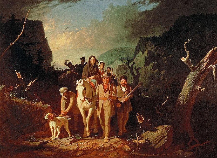
George Caleb Bingham romanticized the westward emigration through Cumberland Gap into Kentucky's Bluegrass Country
Source: Kemper Art Museum, Washington University in St. Louis, Daniel Boone Escorting Settlers Through the Cumberland Gap
Numerous songs refer to Cumberland Gap. A traditional Appalachian ballad, apparently written in the late 1800's, has been recorded by folksingers such as Woody Guthrie and Pete Seeger. A version in super-fast "skiffle" style was a #1 hit in England in 1957.
More recently, the popular song "Wagon Wheel" included a Cumberland Gap reference with a geographic mistake. The song gained more attention in 2019, when a version by Darius Rucker was used to introduce the Country Music historical documentary by Ken Burns. The lyrics included:5
Johnson City is 75 miles southeast of Cumberland Gap. The co-author of the song, Ketch Secor, started with an unfinished version by Bob Dylan and crafted the story of a hitchhiker going to North Carolina. Secor explained in 2011:6
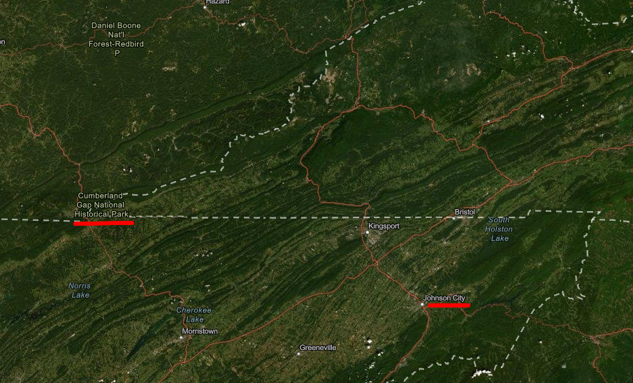
Johnson City is about 75 miles southeast from Cumberland Gap
Source: ESRI, ArcGIS Online
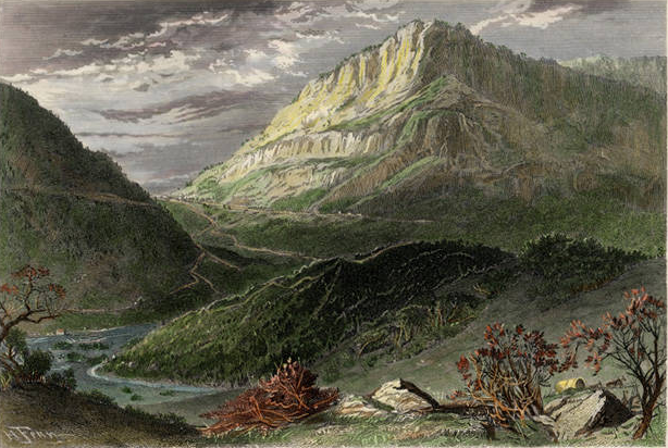
a romantic image of Cumberland Gap painted in the 1870's made the gateway to the west look far wider than in reality
Source: Lincoln Memorial University, Cumberland Gap (published by D. Appleton & Co., 1870's)
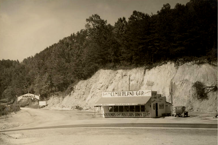
tourists paid to drive up the mountain road to the Pinnacle overlooking Cumberland Gap
Source: Lincoln Memorial University, Cumberland Gap tourist station and souvenir shop
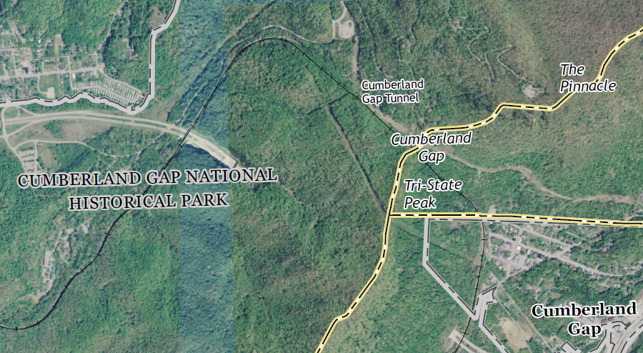
when Middlesboro was projected to grow into an iron-production center, a rail tunnel was constructed through Cumberland Gap
Source: US Geological Survey (USGS), 7.5-minute topographic map for Middlesboro South, KY-TN-VA (2016)
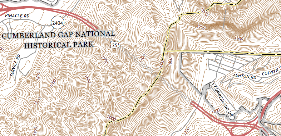
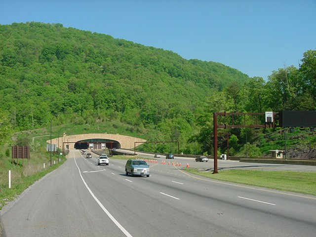
after construction of a tunnel for US 25 beneath Cumberland Gap, the modern road was removed to restore the site closer to its Eighteenth Century appearance
Source: US Geological Survey (USGS), 7.5-minute topographic map for Middlesboro South, KY-TN-VA (2016)
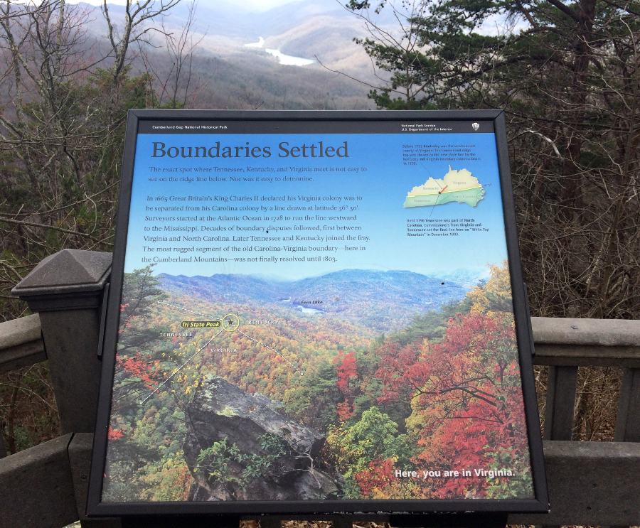
a National Park Service sign notes that the boundaries of Virginia, Tennessee, and Kentucky meet at Cumberland Gap
the southwest corner of Virginia is on Tri-State Peak at Cumberland Gap, as shown on a National Park Service sign at Pinnacle overlook
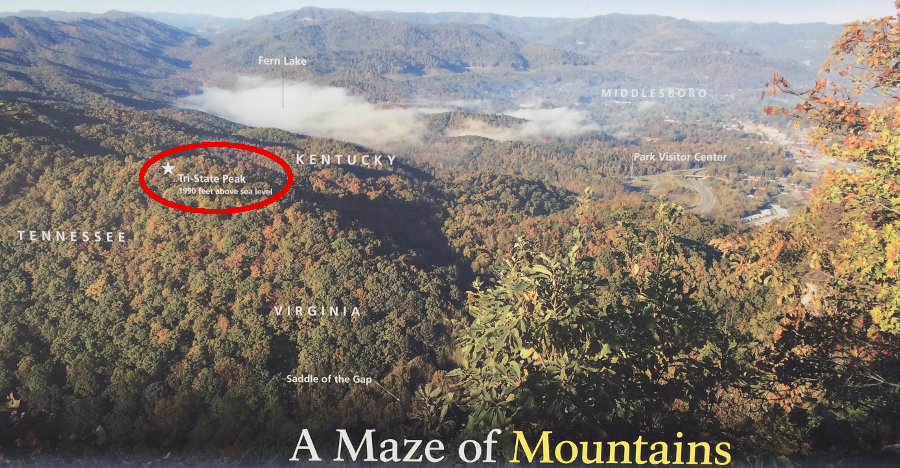
Tri-State Peak, looking southwest from Pinnacle overlook
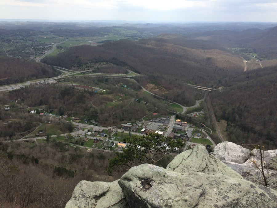
the town of Cumberland Gap, as seen from Pinnacle overlook, is located in Tennessee
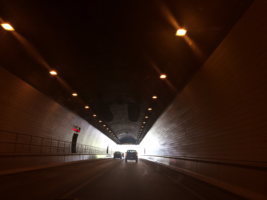
US 25 tunnel underneath Cumberland Gap
south (Tennessee) portal of the US25E tunnel underneath Cumberland Gap, looking towards Kentucky
Source: Cumberland Gap Tunnel, Restoring the Gap
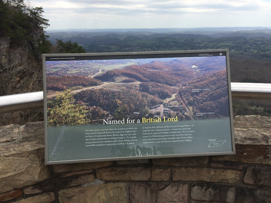
a sign at Pinnacle Gap overlook explains the origin of the name "Cumberland Gap"
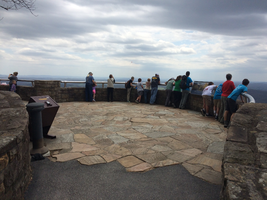
Pinnacle Gap overlook
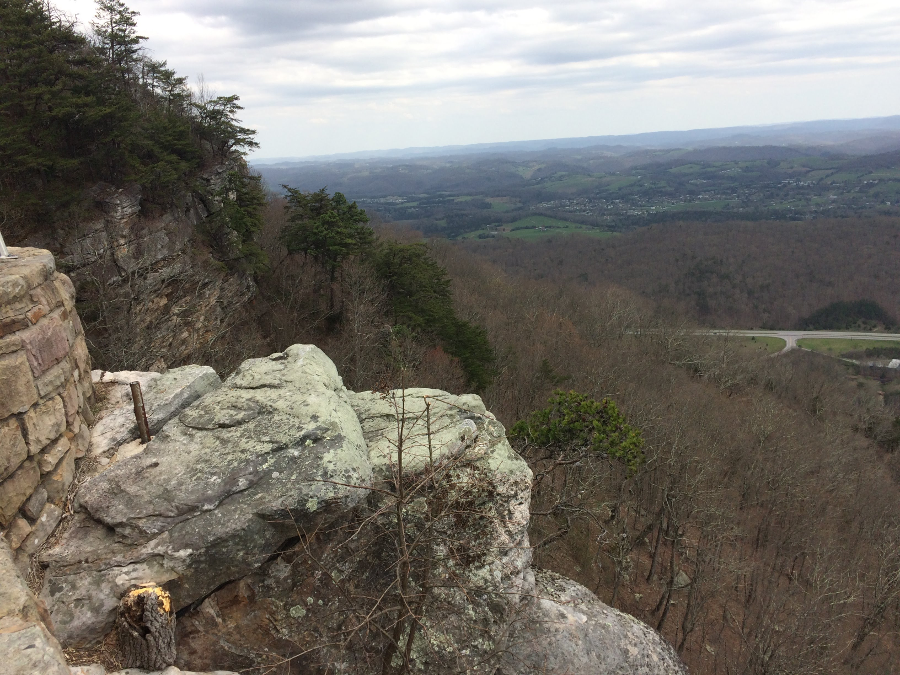
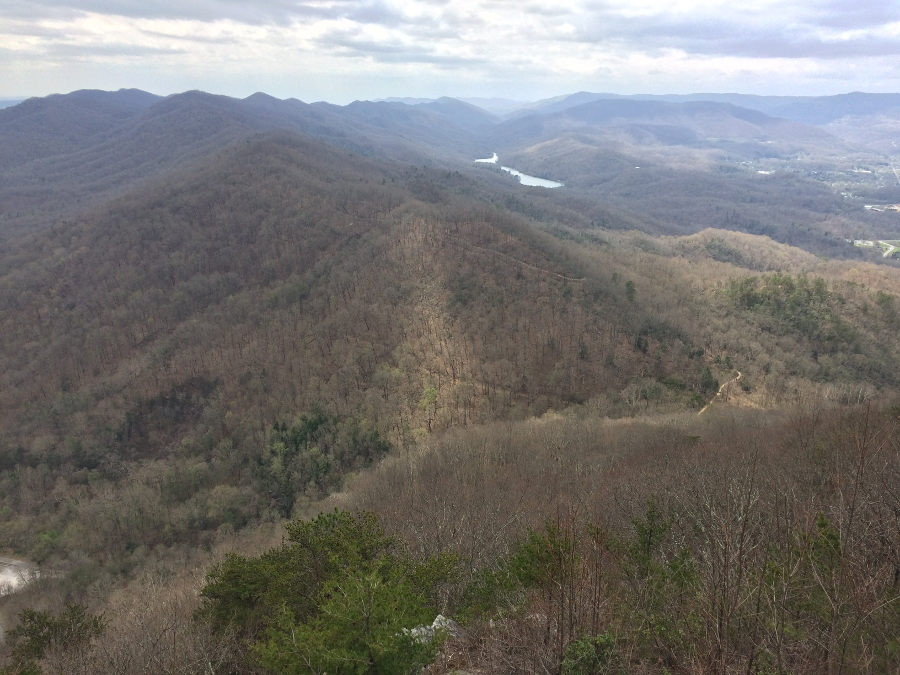
looking north at the edge of Cumberland Mountain and the Allegheny Front, from Pinnacle Gap overlook
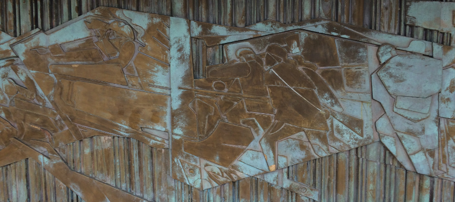
the artwork at Pinnacle Gap overlook emphasizes colonial settlement moving westward
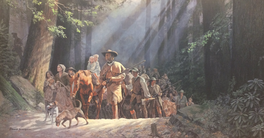
the visitor center at Cumberland Gap displays David Wright's "Gateway to the West: Daniel Boone Leading the Settlers Through the Cumberland Gap -1775"
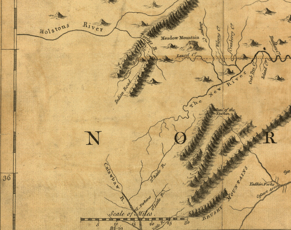
Southwestern Virginia, 1755
Source: Library of Congress, A map of the most inhabited part of Virginia , by Peter Frye and Thomas Jefferson (published 1755)
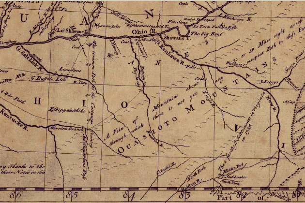
Southwestern Virginia, 1755
Source: Library of Congress, A general map of the middle British colonies, by Lewis Evans (published 1755)
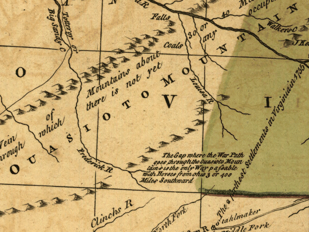
Southwestern Virginia, 1755
Source: Library of Congress, A general map of the middle British colonies, by Lewis Evans (revised 1765?)
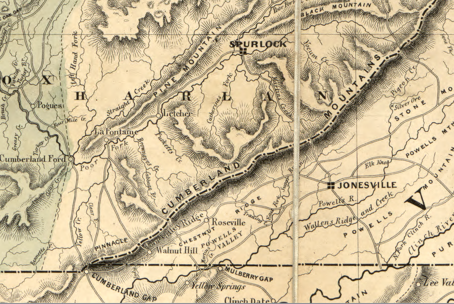
the Wilderness Road was built through gaps in Cumberland and Pine mountains
Source: Library of Congress, Lloyd's official map of the state of Kentucky (by James T. Lloyd, 1863)
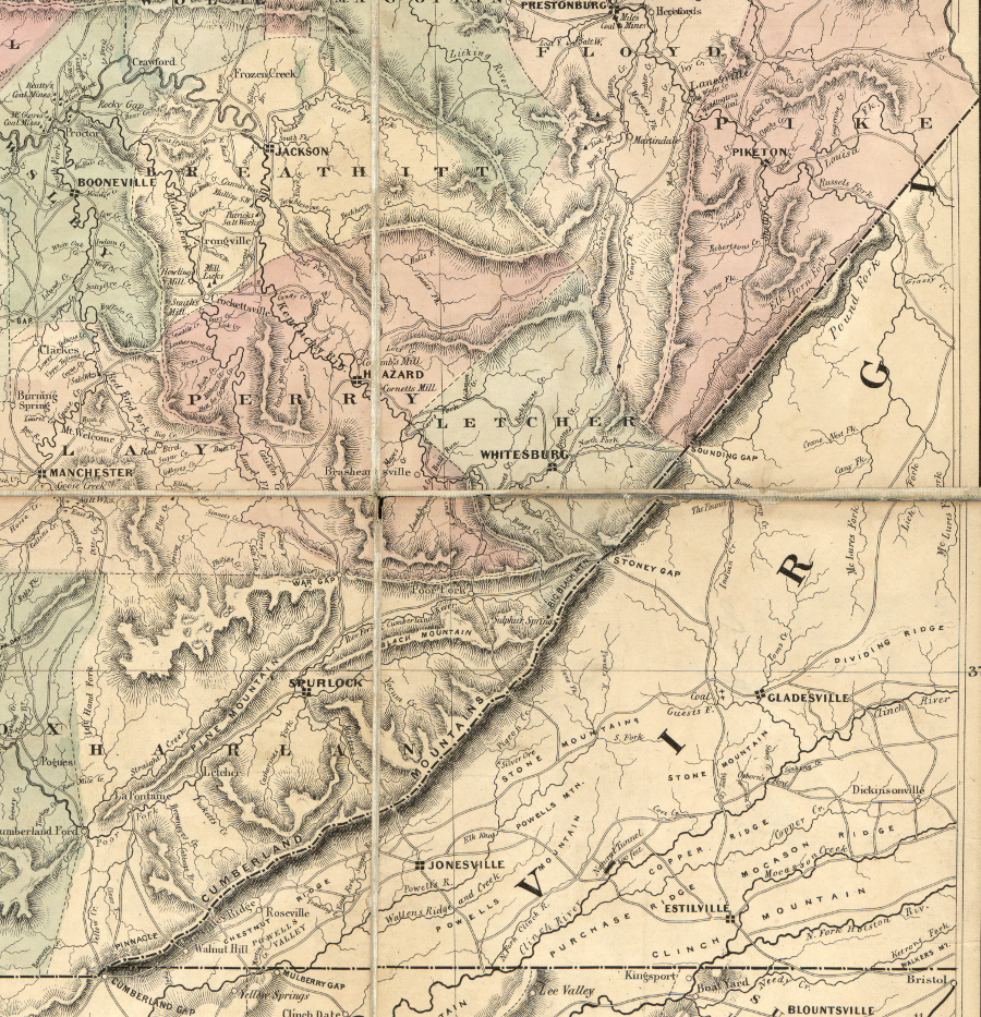
a century after Dr. Thomas Walker crossed through Cumberland Gap, there were a handful of other roads across Cumberland Mountain - including what is now US 23 at Pound (Sounding) Gap
Source: Library of Congress, Lloyd's official map of the state of Kentucky (by James T. Lloyd, 1863)
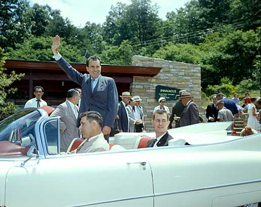
Vice-President Richard Nixon visited Cumberland Gap to dedicate a new visitor center in 1959
Source: National Park Service, NPS History Collection - Cumberland Gap National Historical Park
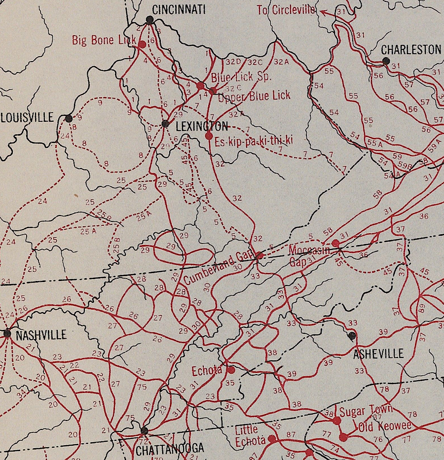
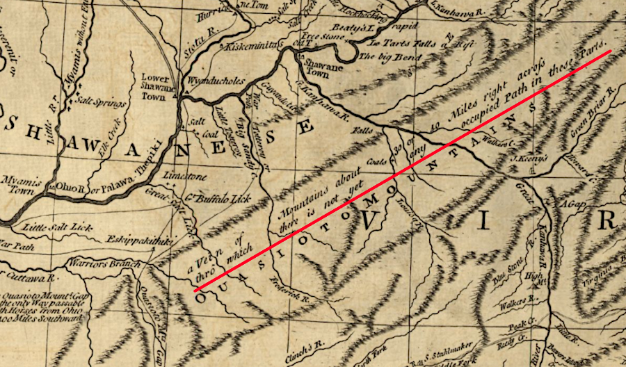
when Thomas Walker "discovered" Cumberland Gap, it had long been a node on a network of trails heavily used by Native Americans
Source: Yale University Library, Indian Trails of the Southeast (by William E. Myer, 1925)
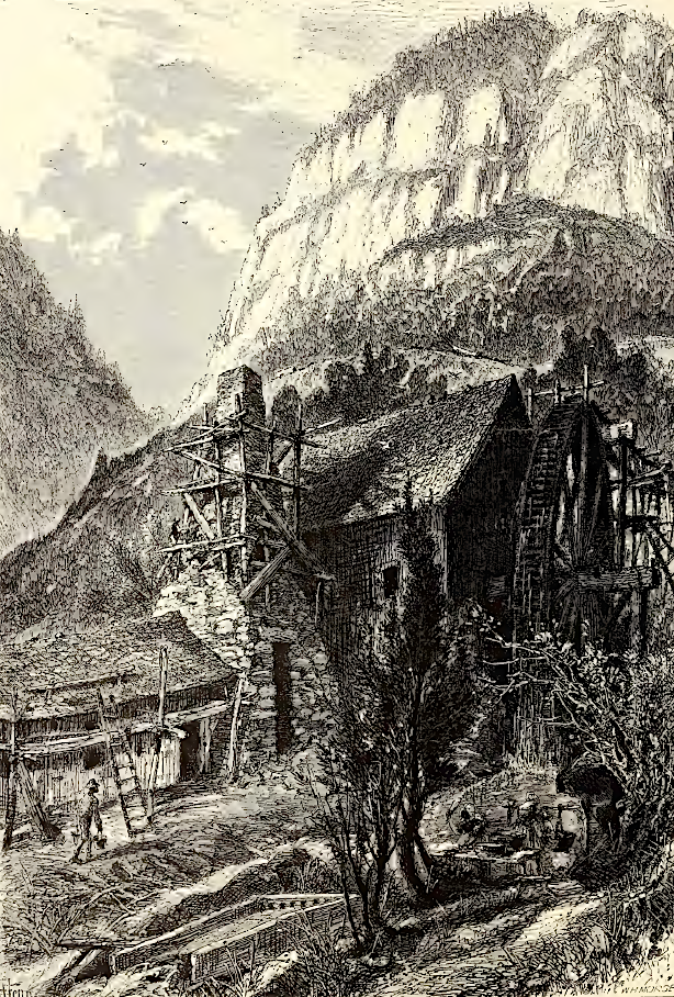
crossing Cumberland Gap required a steep climb uphill
Source: Picturesque America (by William Cullen Bryant, 1872)