The Role of the Blue Ridge
the Blue Ridge extends the length of Virginia, from the Potomac River past the James River all the way to the North Carolina border
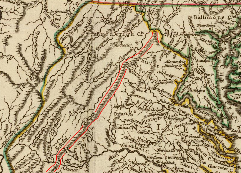
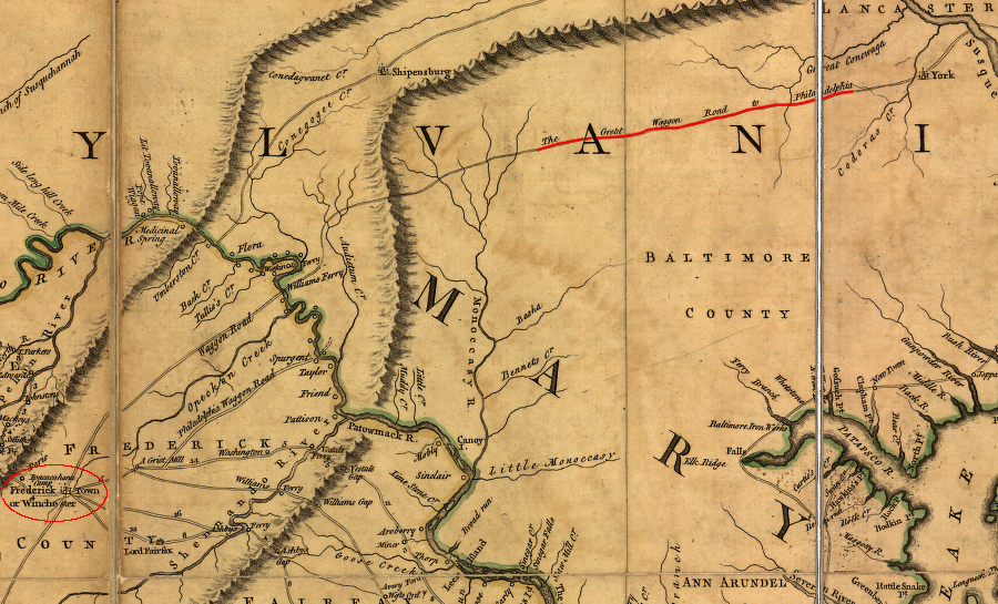
Source: David Rumsey Collection, Cours de l'Ohio, Nlle. Angleterre, Nlle. York, Pensylvanie, Virginie, Caroline (1755)
The mountains of the Blue Ridge are tiny hills compared to the Cascades or Rocky Mountains. Today, the topographic relief of just 1,000-3,000 feet makes it a challenge to see the Blue Ridge as a substantial barrier to transportation.
There are no fallen trees forcing detours off mountain trails, or stumps in a trail knocking wagon wheels askew from their axles. Paved roads provide gentle grades for modern cars powered by the equivalent of 150 horses or more. The climb across the mountain is no longer dreaded by people trying to cross the Blue Ridge. Instead, the steepest topography is appreciated for scenery and exercise; hikers climb Old Rag and other Blue Ridge mountains in a day just for fun.
Native Americans found it easy to walk along the eastern and western sides of the Blur Ridge. The mountains guided both hunting and war parties of different tribes, so they could identify their location when hunting deer or attacking a rival group.
In the early 1700's, when European settlement finally crossed the Blue Ridge, northern tribes were sending hunting parties into the Blue Ridge and Shenandoah Valley. These areas may have been depopulated earlier by disease. The Susquehannock established a hunting trail east of the Blue Ridge. The Iroquois created a path on the west side in the center of the Shenandoah Valley, used when they chose not to encounter Native American tribes in Virginia. Early European settlers converted these hunting paths into the Carolina Road/Route 15 in the Northern Piedmont, and Route 11 in the Shenandoah Valley.
Three hundred years ago, the Blue Ridge was a barrier blocking settlement from the Tidewater region. The ridge was first explored in the 1670's, and Governor Spotswood led the Knights of the Golden Horseshoe across the Blue Ridge in 1716. His efforts to spur development and build an iron works in the Rappahannock River area resulted in the German settlement at Germanna - far from the nearest gap across the Blue Ridge, because all trade from Germanna was expected to be downriver towards the east.
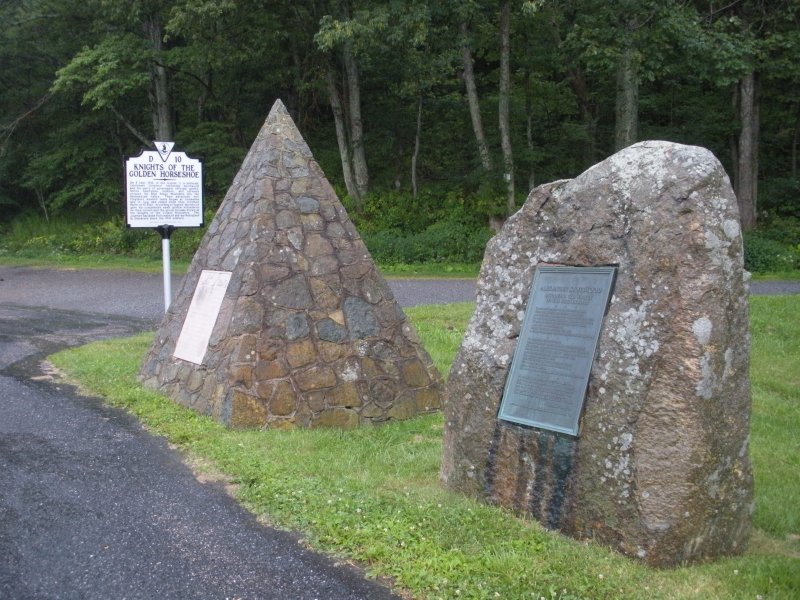
monuments to Spotswood's 1716 Knights of the Golden Horseshoe expedition, in Swift Run Gap where US33 crosses the Blue Ridge
It took another 50 years after John Lederer viewed the Shenandoah Valley before colonists started farming at the base of the Blue Ridge. Though the English migrated inland from Tidewater across the Fall Line, they were slow to occupy Virginia's Piedmont. Most of the settlements near the Blue Ridge started on the western side of the mountains. The mountains marked a cultural boundary between two European-settled regions of Virginia.
Catoctin Mountain marks the eastern edge of the Blue Ridge in Loudoun County
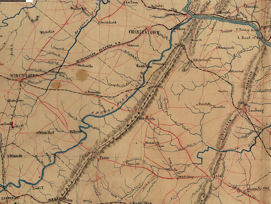
Source: Library of Congress, Part of map of portions of the milit'y dep'ts of Washington, Pennsylvania, Annapolis, and north eastern Virginia (1861)
In the 1730's-1750's, refugees from religious wars in Europe were able to enter the tolerant Quaker colony at Philadelphia, walk westward through the limestone valleys along modern-day US Route 30, and follow the Great Valley to enter Virginia from the north. That route avoided the climb up and over the mountains. Colonial settlers moved into Frederick and Augusta counties by walking up the Shenandoah Valley. ("Up the valley" is uphill, from the north to the south.)
bicyclists going through one of the gaps in the Blue Ridge still feel the uphill climb, just as the horses pulling wagons felt it in the 1700's
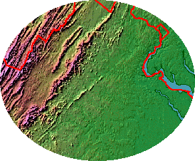
Source: Color Landform Atlas of the United States
Governor Spotswood and then Governor Gooch encouraged immigrants to move from the Philadelphia area to the Shenandoah Valley. They would serve as a buffer between the English in the Piedmont and the Native Americans to the west. New settlers allied with Williamsburg would also provide a trip wire, in case French troops moved from their forts along Lake Erie (and later on the Ohio River) into the Potomac River watershed.
Many Valley newspapers printed before the Civil War were in German, and land deeds were recorded in that language. There is even a deed in Swedish on the upper Potomac, reflecting the origin of one family.
The Blue Ridge shaped the economic links of the Shenandoah Valley settlers. The settlers were linked to the market economy from their first arrival; the idea that Virginia's frontier farmers were 100% self-sufficient is a myth. The Pennsylvania Dutch and Scotch-Irish farmers grew crops and raised livestock for sale, buying manufactured goods in return.
Because the Blue Ridge required hauling wagons uphill, it was difficult for Shenandoah Valley farmers to carry their products to market in Alexandria, Dumfries, or Fredericksburg. Good roads were essential to profitable farming, and the best road led through the center of the valley and across Pennsylvania to the Delaware River, so most trade went north on the Great Wagon Road to Philadelphia.
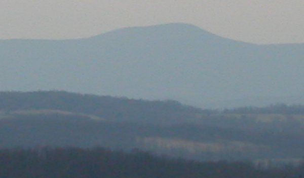
view of the Blue Ridge, looking west from Fauquier County, showing the blue haze that provided the basis for the name
Due to the mountains, there were relatively few economic links between the Shenandoah Valley and the plantation economy of Tidewater Virginia until rail lines were built in the 1840's. Baltimore finally managed to intercept much of the valley trade in the mid-1800's, after construction of the Baltimore and Ohio Railroad through Harpers Ferry.
The immigrants from Pennsylvania had a different set of social values than the Tidewater. Close experience with European rulers, who conscripted farmers to fight in what seemed to be an endless series of wars, had resulting in devastation of farms and families that drove people from Europe to Pennsylvania. If conscription for useless wars was wrong, the morality of holding a person in perpetual bondage was also wrong.
The immigrants who fled Europe and moved into Virginia west of the Blue Ridge brought their religious and personal dislike of slavery. Slaves were common in the Valley, but the percentage of slaveholders and the number of slaves each controlled were far less than in Tidewater or the Piedmont. West of the Blue Ridge, there were small farms growing wheat and corn, and raising cattle, pigs, and horses, They required far less labor than tobacco, so slavery was not essential to the economy of the valley.
west of the Blue Ridge, trade went to Philadelphia along the Great Wagon Road rather than east to the Tidewater ports on the Fall Line in Virginia
Source: Library of Congress, A map of the most inhabited part of Virginia containing the whole province of Maryland with part of Pensilvania, New Jersey and North Carolina. Drawn by Joshua Fry & Peter Jefferson in 1751
The initial Pennsylvania "Dutch" immigrants had different religious and cultural practices. Some brought their German Reformed religion (Church of the Brethren, Amish/Mennonite, and Dunker), while the Scotch-Irish brought their Scotch Reformed Protestantism (Presbyterian). The governors made accommodations to encourage settlement. When the governor appointed the first Anglican vestry in Augusta County, for example, he put Presbyterians on it.
The Anglican religion was the "established church" of the colony, and theoretically dissenters were tolerated but still required to pay parish taxes to the Anglican vestry. These taxes supported not only the social welfare functions of the parish (caring for widows and orphans, burying the indigent, etc.), and paid for building Anglican churches and funding the salaries of Anglican ministers.
In the Valley, however, the Anglican officials wisely compromised with the majority and avoided grandiose building projects. The expensive brick colonial churches, funded by local taxes to support Anglican services, were built east of the Blue Ridge.
The Blue Ridge was a physical barrier delaying settlement from the east, but it also served as a social boundary allowing Virginia's governors to support non-English social systems on the western frontier of the colony. When English settlers from Tidewater finally came through Ashby Gap and Snickers Gap and established their farms on the eastern side of Frederick County, the differences were so clear that a new county (Clarke) was carved out of Frederick.
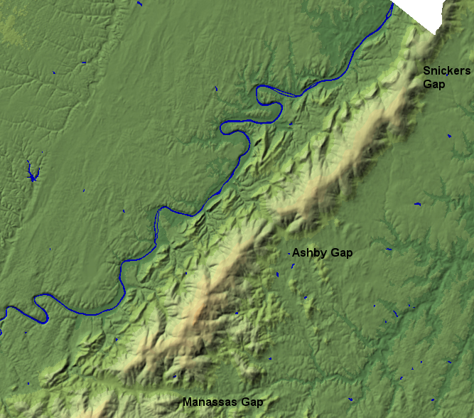
three gaps in the Blue Ridge determined the path of prehistoric trails, colonial roads, and modern highways
(I-66 through Manassas Gap, Route 50 through Ashby Gap, and Route 7 through Snickers Gap)
Source: USGS National Elevation Dataset, NED Shaded Relief - Virginia
Regions of Virginia
Virginia Places