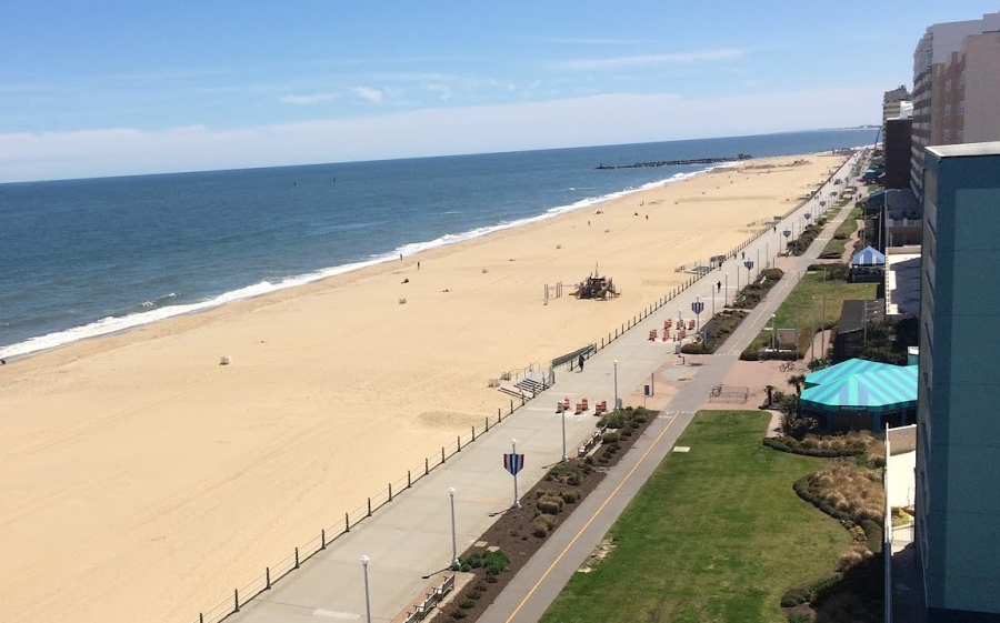
quartz grains that form Virginia Beach are remnants of the Appalachians
quartz grains that form Virginia Beach are remnants of the Appalachians
While you are at GMU, use the Geography of Virginia (GGS 380) class to discover the unique character of Virginia.
You see certain things in certain places: dark volcanic lava in Shenandoah National Park vs. orange/white river gravels on the trails of Prince William Forest Park. You'll see a threshing barn for wheat - but not a tobacco barn - at Mount Vernon.
Traffic is congested in Northern Virginia, Hampton Roads, and points in-between. The population is shrinking in southwestern Virginia counties; officials there would welcome the challenge of dealing with population growth and the traffic headaches associated with sprawl development.
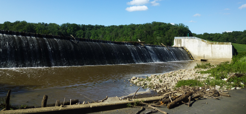
Springfield Dam was built in 1918 to create Lake Accotink as a water source for Camp A. A. Humphreys (now Fort Belvoir)
Virginia places are different, and for different reasons. On Sunday mornings, watch for horse-drawn buggies on the roads near Dayton in the Shenandoah Valley vs. golf carts on the roads at Colonial Beach. There are coal trains, and now passenger trains again, in Roanoke. Cotton is grown in southeastern Virginia, where roots can penetrate soils three feet deep. Apples are grown in the Shenandoah Valley and on hillsides of the Blue Ridge, where slopes are too steep and soils too thin for row crops.
Our climate has been warming for 18,000 years. Early English colonists thought they could grow oranges in Virginia; it is at the same latitude where oranges grow in Spain. However, if it gets warm enough to grow oranges in Virginia, there will be none at Jamestown. The 400th anniversary of the first permanent English settlement in North America was commemorated in 2007, but if sea level rise continues that site (plus Norfolk, Virginia Beach, Portsmouth, Gloucester, Chincoteague, the Pentagon, and many other places) will be underwater before the 600th anniversary.
Smart students and lifelong learners are curious, ask questions, and notice what is different in various places. If you visit another university in Virginia, note that most of the original academic buildings for schools east of the Blue Ridge (such as William and Mary or the University of Virginia) are made from red brick. West of the Blue Ridge, you will see white limestone structures. That is not just by chance; the buildings reflect different bedrock geology. The Hokie stones used to construct buildings at Virginia Tech and the gray limestone blocks at James Madison University may be over half a billion years old, while the bricks at George Mason University's newest structures may not have existed until last year.
Figure out why there are two separate-but-equal lakes at Twin Lakes State Park, and why the Third District was the first to elect an African-American member of the US House of Representatives in modern times. The population dynamics have been changing since the English arrived in 1607 and the first Africans in 1619, but the first Europeans who attempted to settle in Virginia spoke Spanish when they arrived in 1570. The surge of immigration is transforming places. One-third of the residents in Manassas told Census officials in 2014 that they were "Hispanic or Latino."1
So get savvy about Virginia's geology and topography. Learn why the Shenandoah River committed "stream piracy," and why the water that flows past Virginia Tech continues to New Orleans instead of to Virginia Beach. Get a clue about how the widening of the Panama Canal is increasing the number of trains that slow down traffic in Ashland, Farmville, and Manassas.
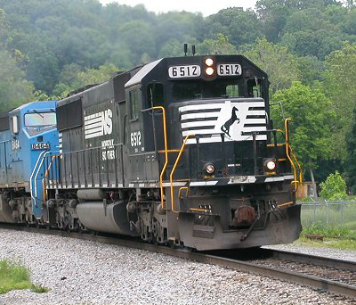
Norfolk Southern trains (shown here at Pembroke in Giles County) carry Appalachian coal to Pier 6 at Lambert's Point in Norfolk for export to steel mills
Why bother to learn geography? Former Governor Gerald Baliles tells a story of a business trip to a foreign country, where he arrived a day early. He toured the capital, enhancing his understanding of local culture and history before the courtesy call to meet the country's president. In their brief conversation, his local knowledge impressed the foreign leader, who then made some unexpected phone calls and made the business trip more successful.
You may not be leading trade missions or meeting presidents of foreign nations, but knowing about the places where you do business can improve your success as well. Knowing something about the place where you work can make you stand out as an employee, investor, or entrepreneur.
As Gov. Baliles put it:2
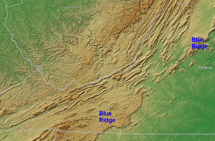
the Blue Ridge, a narrow mountain range in northern Virginia, is a broad plateau south of Roanoke
Source: NOAA National Geophysical Data Center, Bathymetry Data Viewer