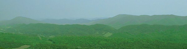
Blue Ridge near Roanoke
Blue Ridge near Roanoke
Can you find Massanutten Mountain? In which physiographic province is it located?
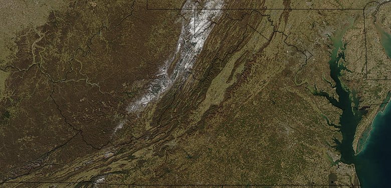
radar image of Virginia
Source: National Aeronautics and Space Administration (NASA), Visible Earth
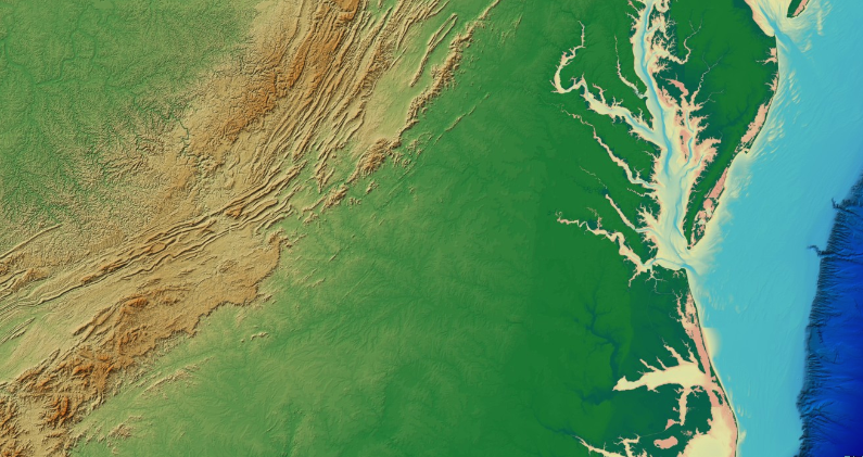
Look again at a shaded relief map of Virginia:

Source: National Oceanic and Atmospheric Administration (NOAA), National Centers for Environmental Information, GLOBE: Global Land One-kilometer Base Elevation
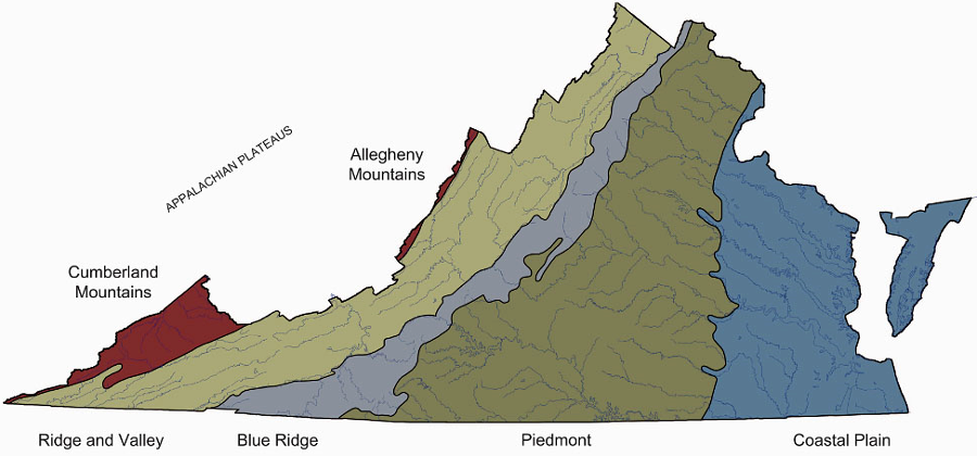
In your brain, decide where you would draw a line separating the 5 physiographic provinces: Coastal Plain, Piedmont, Blue Ridge, Valley and Ridge, and Appalachian Plateau. Remember which two provinces are separated by the Fall Line.
Using the image below and remembering what you learned last week, can you find the borders of Virginia and identify its portion of the Continental Shelf?
Can you identify the Virginia's portion of Eastern Shore on the map below, using just the location of the Chesapeake Bay?
find the southern border of Virginia using topography, with a map layer that does not show political boundaries
Source: NOAA National Geophysical Data Center, Bathymetry Viewer (with DEM Color Shaded Relief Imagery)
Groundwater management requires understanding the local geology. Water flows through rocks, and people in rural areas depend upon wells for their drinking water. Understanding the Hydrogemorphic Regions requires getting a grip on both bedrock geology and surface topography.
Coors located its East Coast brewery in the Shenandoah Valley because the limestone bedrock there is porous, and a well can suck up all the water needed for the beer.
In the Blue Ridge, water flows in a less-consistent pattern. The igneous rock is impervious, but water still flows underground through cracks in the bedrock. Neighbors living 100 yards apart may drill water wells at the same time, and one well can be bone dry while the other well could intersect a crack and provide 10 gallons/minute.
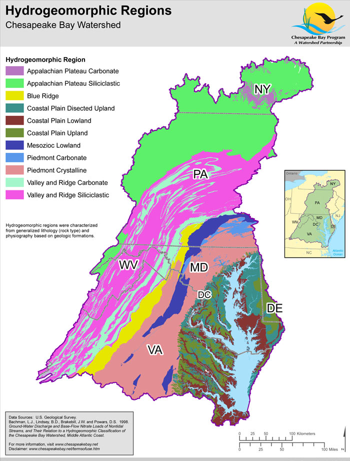
hydrogeomorphic regions are defined to manage water resources
(note that "Mesozoic Lowland" is another term for "Triassic Basin")
Source: Chesapeake Bay Program, Hydrogeomorphic Regions
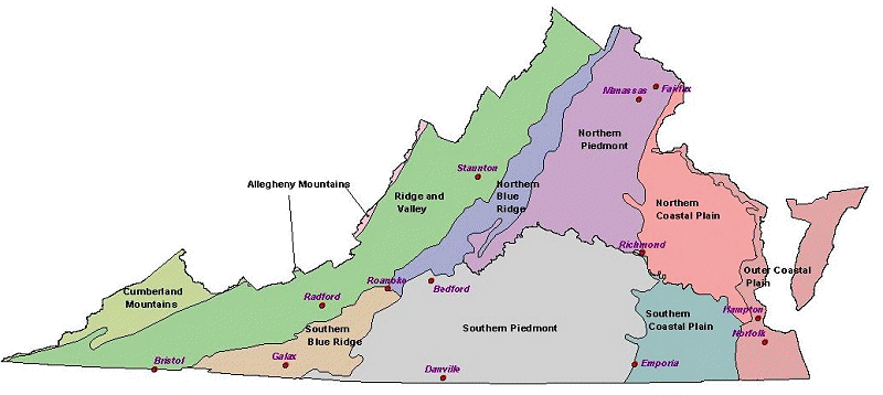
The Virginia Natural Heritage Program has several representations of the physiographic regions of Virginia, some with more-detailed boundaries:
Source: Virginia Natural Heritage Program, Overview of the Physiography and Vegetation of Virginia (Figure 2)
Source: Virginia Natural Heritage Program, The Natural Communities of Virginia
Classification of Ecological Community Groups
physiographic provinces as defined by a splitter, not a lumper
Source: Virginia Natural Heritage Program, Virginias Precious Heritage: A Report on the Status of Virginias
Natural Communities, Plants and Animals, and a Plan for Preserving Virginias Natural Heritage Resources (see Figure 7.1)
The Natural Heritage Program is identifying the rare biological communities in Virginia. Splitting the Piedmont physiographic region into north/south sections allows the analysis to be more granular, more localized in identifying what is common vs. what is rare and worth special protection.
Remember, the physiographic boundaries were not carved on stone tablets and handed to geographers. Scholars have made up the concept of physiographic provinces, and you (or government officials...) can modify maps to suit your particular purposes.
Great Falls, on the Potomac River, is in the Piedmont Province. Do you remember why the 40-foot high waterfall is located there, rather than near the I-66 bridge on the boundary of the Piedmont and Coastal Plain physiographic provinces?
By the end of this week, you should be able to draw the approximate boundaries of the Coastal Plain, Piedmont, Blue Ridge, Valley and Ridge, or Appalachian Plateau on any map of Virginia, and answer quiz questiona such as "In what physiographic province is Winchester located?"