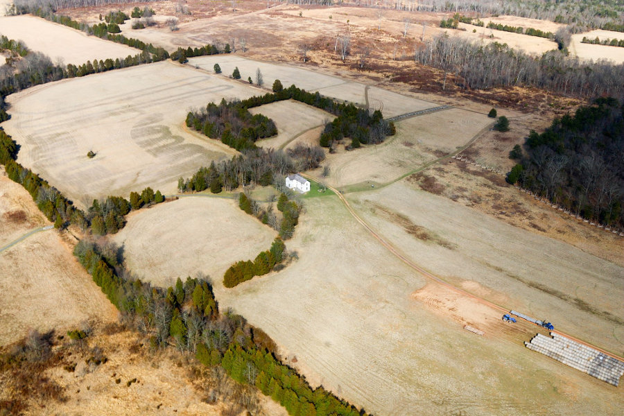
the National Park Service has ensured the Brawner Farm, part of Manassas National Battlefield Park, will never become a housing subdivision
Source: Historic Prince William, Brawner Farm Interpretive Center - #309
the National Park Service has ensured the Brawner Farm, part of Manassas National Battlefield Park, will never become a housing subdivision
Source: Historic Prince William, Brawner Farm Interpretive Center - #309
"Sprawl" is unplanned, uncoordinated growth that overwhelms the ability of a community to absorb it.
Most Virginia cities are so close to being "built out" that growth management is not a major challenge. In Manassas, for example, only one large parcel remains undeveloped - and it's been known for years that the Smitherwood tract would be developed for housing. Of course, redevelopment of urban sites can still create a political firestorm.
Alexandria has had intense debates over the future of the Potomac Yard of the old RF&P Railroad, including an endorsement by Governor Wilder of plans to build a football stadium for the Redskins there. If you watch football, you know that FedEx Field (formerly Jack Kent Cooke Stadium) is located in Landover, Maryland and not in Alexandria.
In the last 40 years, growth has inundated some counties that once had large rural areas of low density pasture, farmland, and woodlots. The definition of "Northern Virginia" has shifted to include Fairfax, Prince William, Loudoun, Stafford - and now Spotsylvania by some definitions. Fauquier has positioned itself to block sprawl, while other counties have debated the issue but done little to control growth.
Sprawl affects more than just the fast-growing communities. Virginia counties with only minimal population growth need to worry about excessive development, if such growth will degrade air or water quality or force a rise in the general tax rate. Cities with a declining population are also affected by suburban sprawl.
Virginia's cities could become the "hole in the doughnut," as population moves to an outer ring of counties away from the urban center. In some cases, urban and suburban activists may combine efforts to steer development back towards the urban core, where public facilities already exist. (The first cartoon in America was Join, or Die, illustrating Benjamin Franklin's call for the colonies to unite in 1754 against the threat of the French in the Ohio Valley. Ultimately, the Quakers had to quit politics in order for the Pennsylvania colony to raise a militia to defend the frontier.)
In theory at least, planning the timing of new homes can be synchronized with the development of new schools, roads, libraries, parks, etc. A Comprehensive Plan and zoning ordinance, plus judicious use of bonds to accelerate development and regulatory hurdles to delay it, could steer where retail shopping centers and even medical facilities are developed.
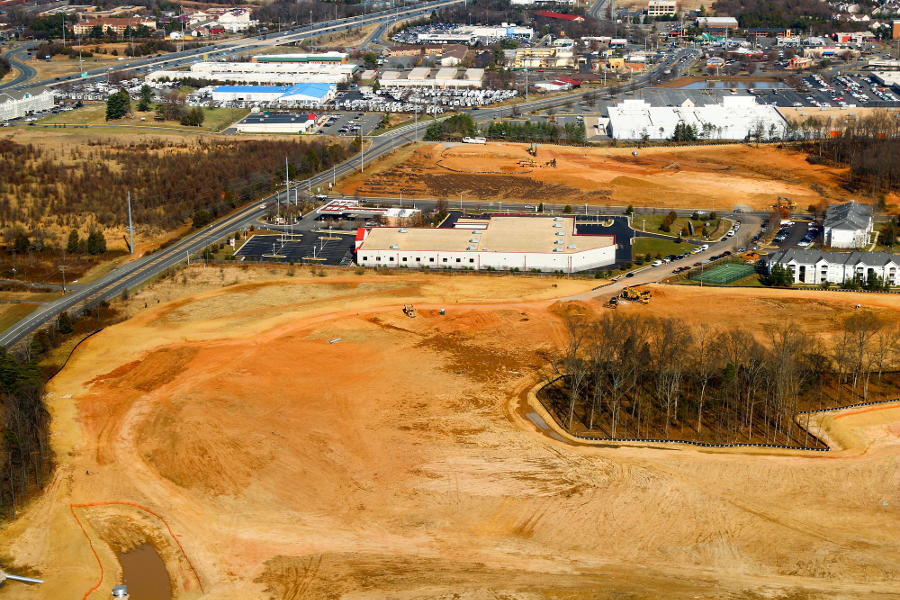
in 2015 Prince William County rezoned land near the I-66 and Business Route 234 intersection for residential rather than commercial/office use
Source: Historic Prince William, Balls Ford Rd. and The Salvation Army Family Store - #317
In practice, the counties have only coarse tools for controlling growth. Virginia has no requirement for payment for the county services that will be required, once the private land is developed. Under Virginia's "Dillon Rule," the counties are also prohibited from establish a local requirement for mandating development be matched with increased services.
Successful lawsuits over downzonings limit the ability of a county to reduce the development of parcels in urbanizing areas, once the acreage has been platted into separate lots.
If a 40-acre farm has been subdivided for two decades as a 40-home subdivision but kept in farm use anyway, the landowner pretty much has a right to develop 40 houses at his/her convenience. If the county rezones the area to a 10-acre minimum lot size, the development potential of the entire farm is not reduced to 4 houses. A rezoning is not retroactive, once the county has accepted the subdivision of a parcel.
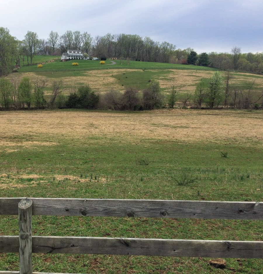
eastern Loudoun County has been developed with suburban housing, while western Loudoun County retains large lots with pastures for horses
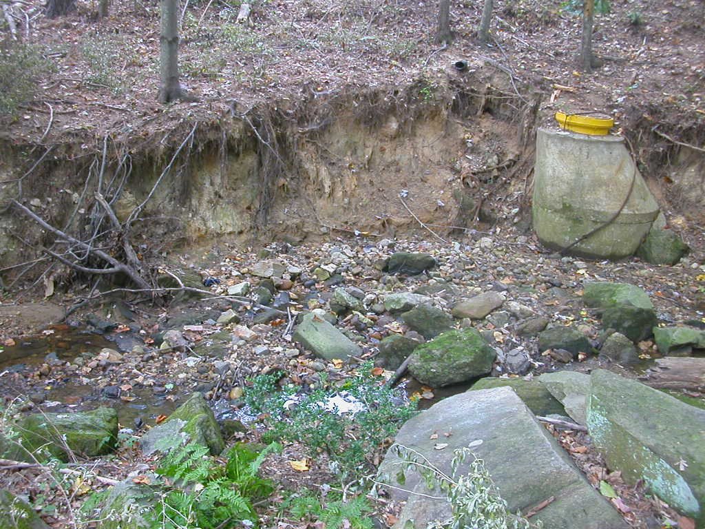
eroded stream after Lake Ridge subdivision was developed in Prince William County