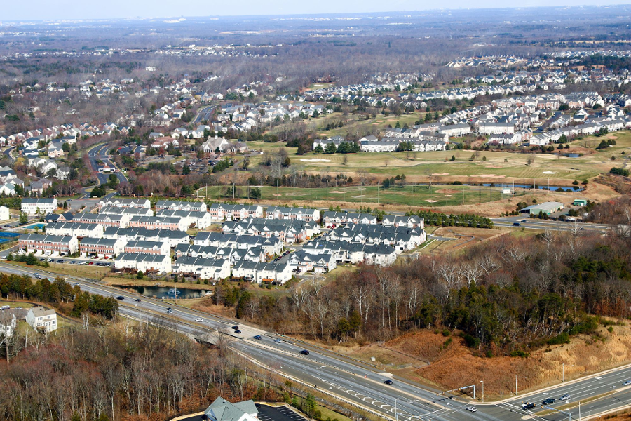
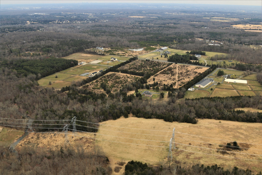
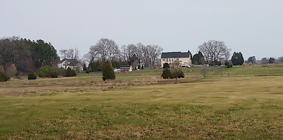
the urban growth boundary adopted in 1998 allowed development of new subdivisions on Route 15 north of Haymarket
Source: Historic Prince William, Rt 15 and Piedmont Development - #288
the urban growth boundary adopted in 1998 allowed development of new subdivisions on Route 15 north of Haymarket
Source: Historic Prince William, Rt 15 and Piedmont Development - #288
The Prince William County Comprehensive Plan defines the long-term objectives for development over the next two decades. Comprehensive Plans provide the "big picture" for the intended growth in a county, steering it to some areas and away from others. Site-specific sector plans elaborate on the generic guidance in the comprehensive plan.
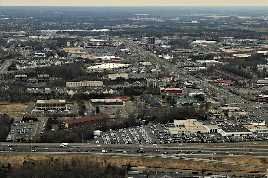
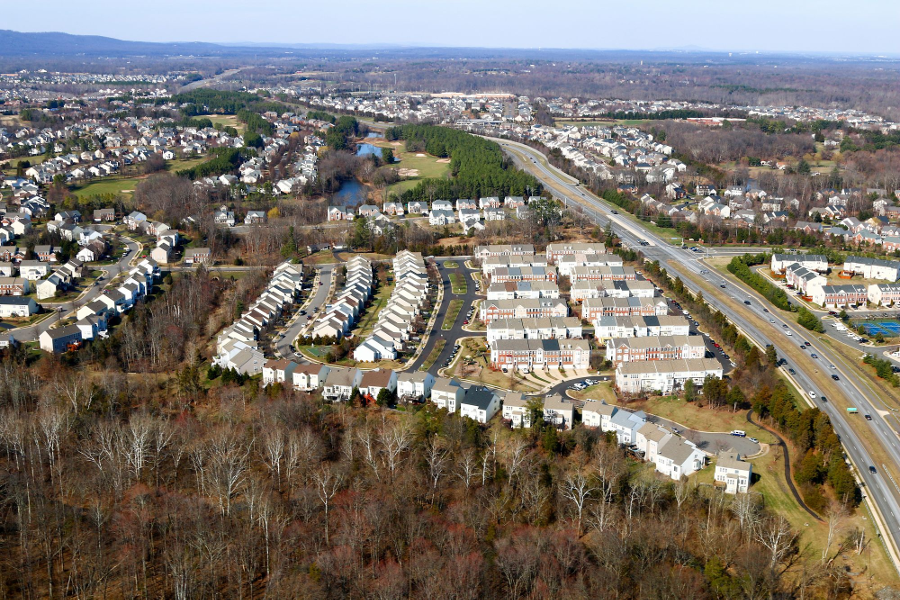
looking south past I-66 into Development Area along Route 234 towards Manassas
Source: Historic Prince William, Aerial Photo Survey 2019
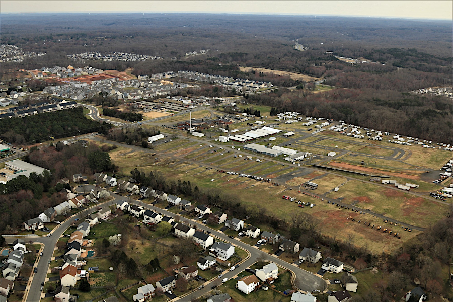
Prince William County fairgrounds
Source: Historic Prince William, Aerial Photo Survey 2019
However, developers know that the zoning and subdivision ordinances, and the design and construction standards, are the key to developing individual parcels. The ordinances describe what development is permitted by right and how to obtain special authorization (variances) for additional types of development. The Design and Construction Standards Manual (DCSM) defines what sort of sidewalks, parking lots, driveways, houses, etc. the county officials will approve automatically vs. where approval may require a judgment call.
In construction, time is money. Many projects are financed on borrowed money. Because the risks of a development being delayed or even going into bankruptcy are relatively high, construction loans often carry a high interest rate. The faster a project can be completed, the faster the loans can be repaid and the greater the profit to the developer. County officials are well aware of the power they wield, and the ability to force a developer to modify a proposal, simply by delaying a decision.
Numerous specialists in architectural and engineering businesses, construction companies, and law firms earn a living by navigating through the rules in order to maximize the profit from a parcel of land. Individual landowners, such as a farmer, rarely have the experience or expertise to prepare a "site development plan" that meets all the criteria for approval under the subdivision ordinance...
Prince William County has developed rapidly over the last 50 years. The trigger was completion in 1949 of the Shirley Highway connecting Woodbridge to the District of Columbia, bypassing Route 1. From the Occoquan River to Springfield, the new highway was just a two-lane road until another two lanes were completed on May 24, 1952.
The Shirley Highway (now I-95/I-395) initiated the housing boom on the eastern edge of the county. Prince William became a bedroom community, with relatively low housing costs within driving distance to jobs in the Pentagon and the District, Arlington, and Fairfax. Workers chose to buy houses in Marumsco Woods, Dale City, Lake Ridge, and other subdivisions and commute north.
After the 1989-91 recession, western Prince William also developed rapidly. As the Dulles Corridor filled up with office buildings, workers were more willing to live in Manassas, Gainesville and Haymarket. Housing in Prince William County was relatively cheap compared to Fairfax County, offsetting the costs and hassles of the commute.
In the last decade, the bucolic open space of farms west and south of Manassas has been replaced by subdivisions. When the first townhomes were built in Haymarket, the locals joked that no one would want to live there, and that Gossom's Hardware (the informal center of the community) would not have room for the increased business. Now, Haymarket is in the bullseye for development proposals - independent of the plans for the now-cancelled Disney America theme park.
In 1998, Prince William intensely debated its plans for growth. Rather than serve as a bedroom community, county leaders sought to increase commercial development and offer jobs locally, within the county. This would increase taxes from business, shifting some of the burden from the homeowners. At the time, Prince William had the highest property tax rate in Virginia. Politicians were forced to explain, over and over, that the rate was high but the assessments of property values were lower than in Fairfax, resulting in an overall lower tax on homeowners. Still, no elected - or even appointed - official likes to justify high taxes.
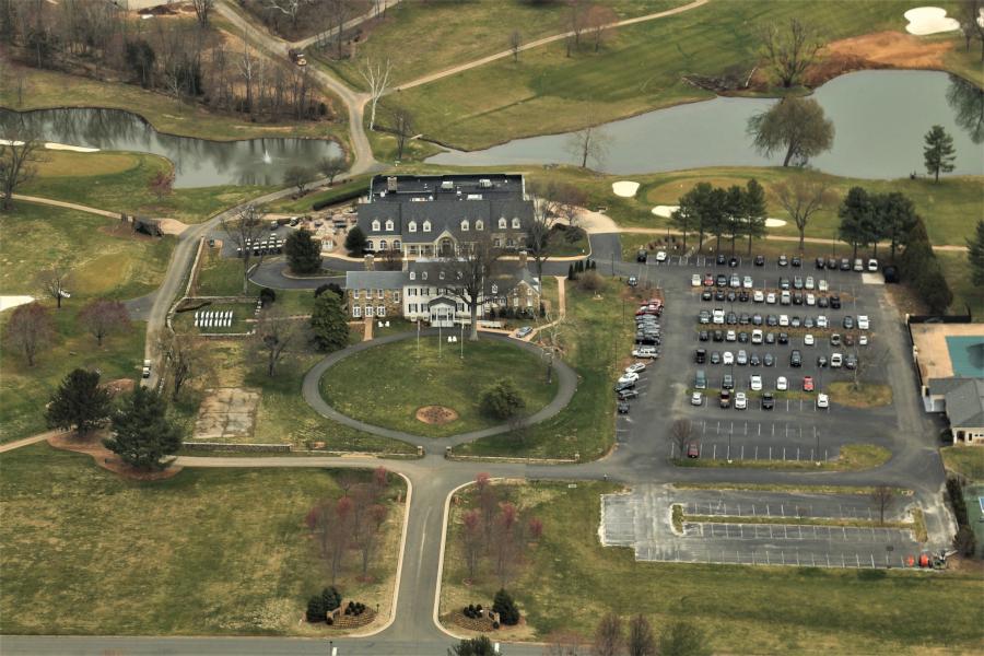
Evergreen Country Club in the Prince William Rural Area
Source: Historic Prince William, Aerial Photo Survey 2019
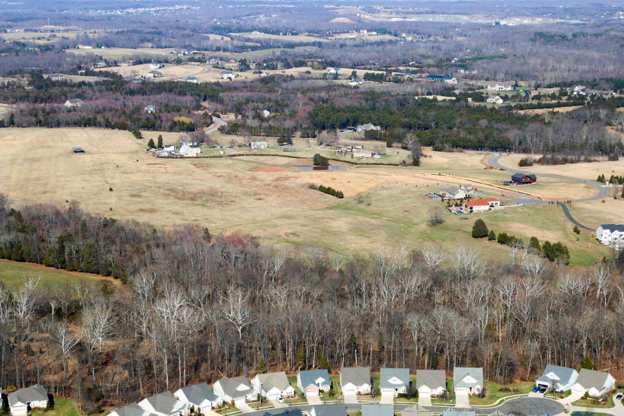
the Rural Area was intended to be subdivided into 10-acre lots or larger
Source: Historic Prince William, Aerial Photo Survey 2019
One strategic objective of the 1998 comprehensive plan was to discourage developers from building low-value housing (such as townhomes), and to increase the number of "executive homes." If the county could shift development to large houses on large lots, assessed at more than $250,000/parcel (in 1998), then the taxes from such parcels would more than compensate for the additional services required. New townhomes require the county to fund more services - schools, roads, police and fire stations, parks, libraries, etc. - than the new homes pay for in taxes, increasing the burden on existing residents.
The final version of the 1998 Comprehensive Plan defined a Rural Area along the southern and western edges of the county, in a curved patern that came to be known as the Rural Crescent. In that area, lot sizes for new subdivisions would be a minimum of 10 acres, where septic fields would likely be available. New sewer service would be extended into the Rural Area only to address public health or emergency conditions, or to service a public facility. Large-lot zoning encouraged developers to build executive homes, in contrast to low-cost (affordable) housing in dense developments. The rhetoric was clear - townhomes did not pay their own way, and were now discouraged.
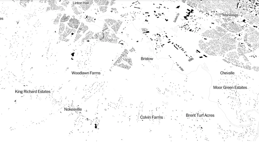
the different density of buildings in the Rural Area/Development Area is revealed in a map of all buildings, published by the New York Times in 2018
Source: New York Times, A Map Of Every Building In America
Parcels already subdivided into sizes less that 10 acres did not lose development rights; houses could still be built on those lots "by right" without a rezoning. Prince William County "downzoned" just a small area to avoid a lawsuit equivalent to what Fairfax County experienced in the late 1980's. Fairfax ended up settling with those landowners who could afford to sue, and allowed more-intense development of some parcels.
The 1998 plan was not a no-growth initiative; it allowed for extensive housing growth in the remaining urban and suburbanized areas of the county. The plan did steer such growth away from the still-undeveloped areas of Prince William, however. As described under the "Rural Area" section of the 1998 plan:
the area proposed for Disney America ended up being developed into housing subdivisions
Source: Historic Prince William, Rt. 15 and Westmarket Development - #290
Still, many landowners in the Rural Crescent, led by the supervisor for the Gainesville District in particular, objected to the plan. The Comprehensive Plan proposed restricting future development of, say, a 150-acre farm in the Rural Crescent to just 15 houses on 10-acre lots. In many Virginia subdivisions, houses are built on quarter-acre lots. At a density of 4 houses per acre, a 150-acre farm could be developed into a 600 house subdivision.
Think you could sell such a farm for a greater profit, if the development potential was for an additional 585 houses? Prince William County may lose money on every house that's less than $250,000 in value (in 1998 dollars)... but that farmer could lose a great deal of potential profit. The county decision to steer growth towards other sections of the county meant that western Prince William landowners would not be able to capitalize on high land values, while eastern Prince William landowners would benefit from increased demand. It may be legal, but is that fair?
The fairness issue continues to be debated. Is it fair for existing Prince William County taxpayers to absorb the burden of providing services to new residents, or is it fair that the Comprehensive Plan requires those that move into the county now to "pay their own way"? Is it fair that Prince William farmers who held onto their land, maintaining open space near Nokesville and Gainesville for all these years, should be blocked from obtaining the maximum value from that land just before their retirement?
the 1998 Comprehensive Plan adopted smart growth strategies, zoning for most new buildings and public infrastructure in the Development Area while establishing 10-acre lot sizes in the Rural Area
It is rare that, in any debate, all the costs and benefits for individuals and the general community in the county are presented with equal emotion. James Madison argued that the new Constitution drafted in 1787 was fair because it created a system of checks and balances that did nnot require everyone to be angels, and allowed for good government even where selfishness was the prime motivation for a voter.
In reality, every zoning decision is a economic windfall - or wipeout - for a developer. Balancing windfalls and wipeouts geographically so individuals are treated fairly may be impossible, unless one landowner has such a large parcel to develop that they could afford to forego development in one area in order to increase density in another. Irvine, California, has been developed recently under such a process, but in Prince William there is no way to compensate landowners in the western end with a "windfall" of increased density elsewhere. The county will permit cluster development in a Residential Planned Community, to concentrate housing in one section of a parcel and maximize acreage for open space elsewhere - but there is no program for transfer of development rights to other parcels in Prince William County.
The land use planning debate in Prince William continues to generate at least as much heat as light. Though the comprehensive plan defined a specific area for 10-acre zoning, subsequent exemptions and sector plans are increasing the density of different parcels within that Rural Crescent. "Smart growth" activists were dismayed during the summer of 2000 at the individual Board of County Supervisor decisions to increase density in the Braemar development on Linton Hall Road, to exempt Heritage Hunt from minimum payments (because the age-restricted community was not expected to create much demand on the school system), and to maintain separate sector plans for the Potomac waterfront.
The Nokesville Sector Plan deals with 560 acres (300 acres in 2 large parcels) in Nokesville, an unincorporated section of the county (described by the county as a "hamlet") bisected by Fitzwater Drive. Over half of the area in the sector plan is within the Rural Crescent. After several community meetings to draft a plan for development based on 10-acre lot sizes, there was a last-minute decision to more than triple the proposed density to 3-acre lot sizes.
By some accounts, this would create enough population density to stimulate commercial development in Nokesville. Others suggest that the density increase, if suitable for stimulating business, would be more appropriate if centralized just in Nokesville itself rather than spread out in a ring of 3-acre parcels surrounding the existing businesses.
The late decision to increase density alarmed the "smart growth" advocates and further polarized the political alignment in the county. The advocates for "smart growth" feared the Board of Supervisor was undercutting the Comprehensive Plan with site-specific exemptions. The Planning Office recommended against the increased density level, in order to comply with the approved Comprehensive Plan. After all, if an exemption is made for Nokesville, how could the county officials justify denial of requests from other landowners in the Rural Area?
wherever a growth boundary is defined by planning/zoning, landowners on the other side of the line will have less development potential
Source: Historic Prince William, Trapper Ridge Ct. - #304