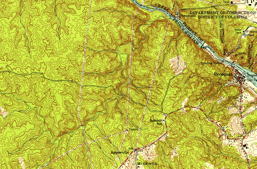
when the Shirley Highway was completed to the Occoquan River, what is now Lake Ridge in Prince William County was just forest
Source: US Geological Survey (USGS), Occoquan 1:24,000 scale topographic map (1951)
[NOTE: This site, just like Prince William County, is still under development...]
when the Shirley Highway was completed to the Occoquan River, what is now Lake Ridge in Prince William County was just forest
Source: US Geological Survey (USGS), Occoquan 1:24,000 scale topographic map (1951)
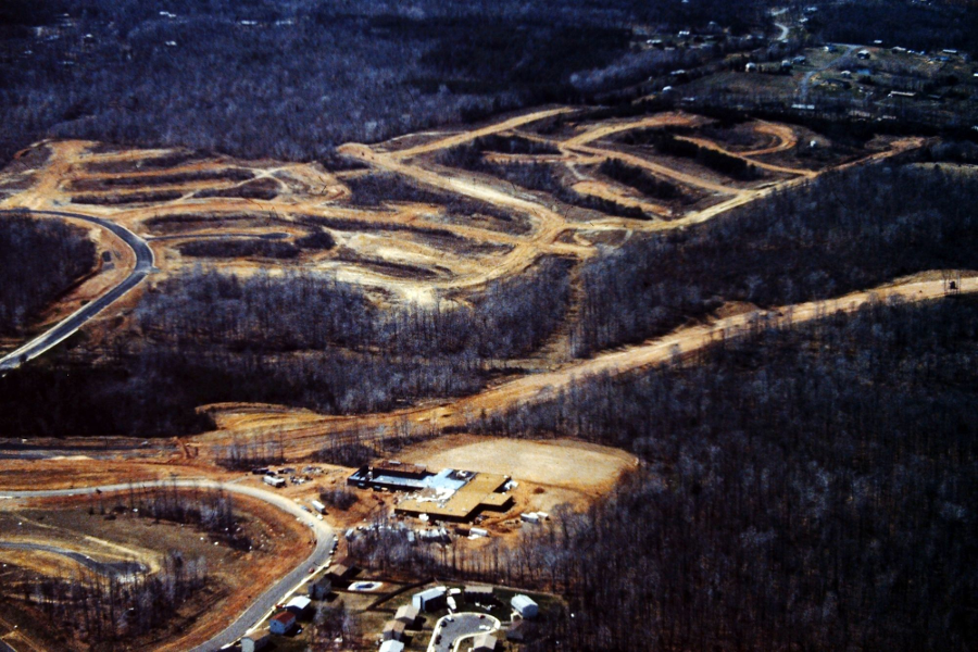
Dale City under construction in 1980, west of I-95
Source: Historic Prince William, Dale City Construction
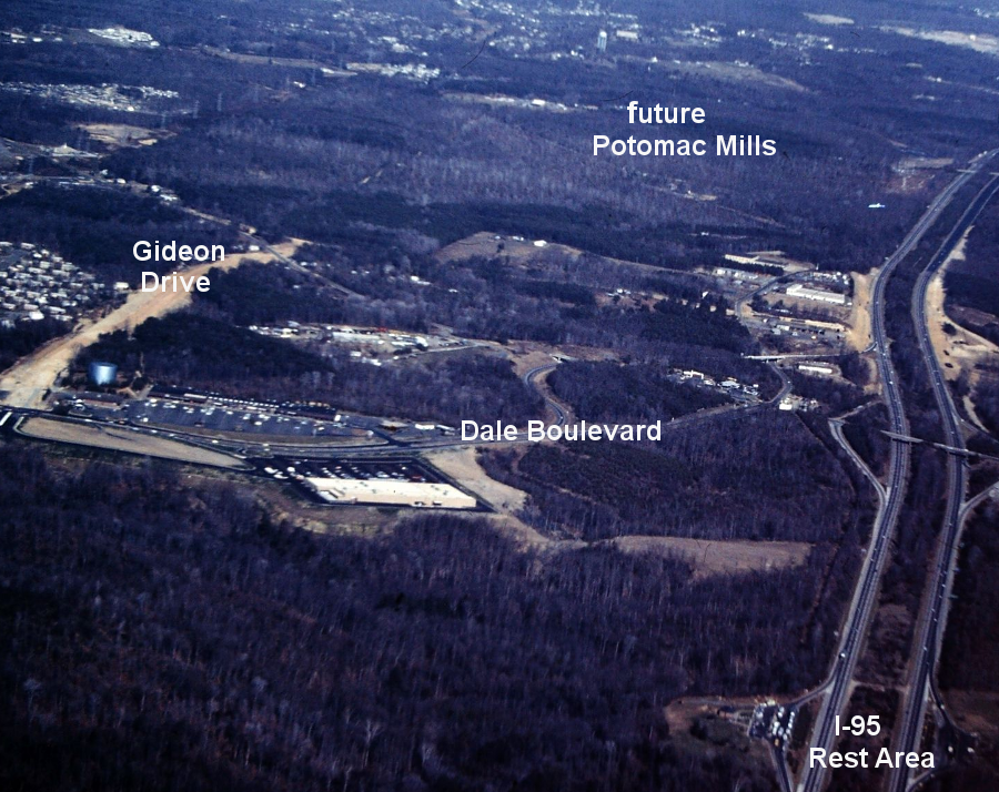
Gideon Drive under construction in 1980, at intersection with Dale Boulevard (Ashdale Plaza Shopping Center)
Source: Historic Prince William, Dale City Construction
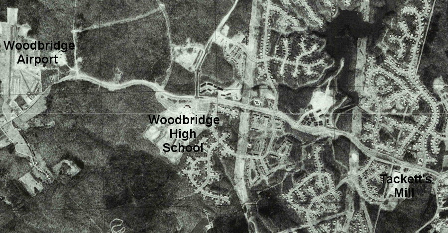
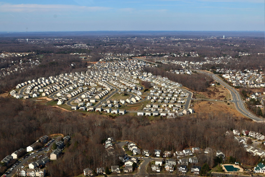
the planned community of Lake Ridge had not expanded west of Woodbridge High School in 1977
Source: National Map, US Geological Survey, Occoquan 1:24,000 scale orthophoto (1977)
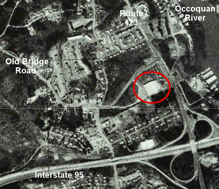
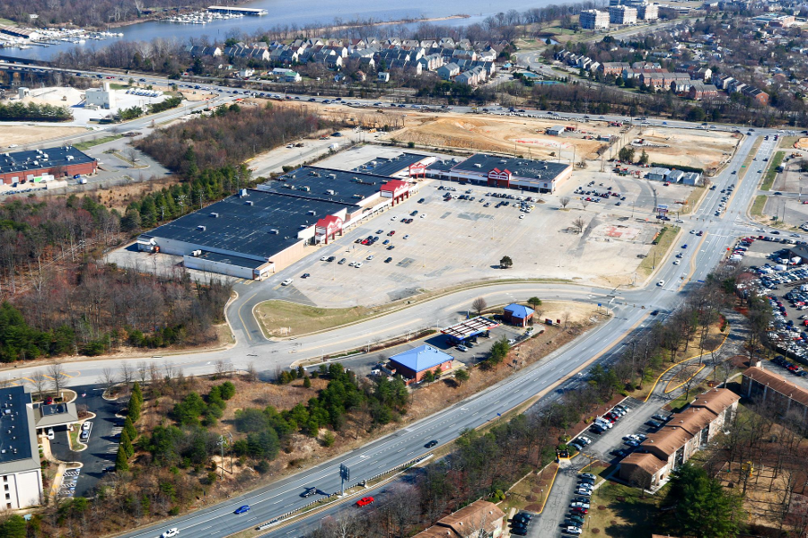
what was a Hechinger's hardware store in 1977 (red circle) is now a park-and-ride commuter lot
Source: National Map, US Geological Survey, Occoquan 1:24,000 scale orthophoto (1977)
site of Potomac Mills in 1977
Source: National Map, US Geological Survey, Occoquan 1:24,000 scale orthophoto (1977)
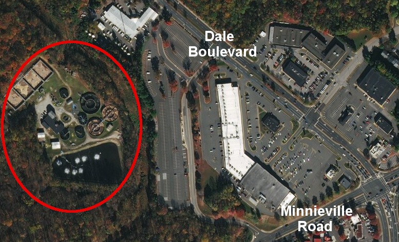
Dale Service Corporation's private sewage treatment plant on Neabsco Creek was built by the developer of Dale City
Source: ESRI, ArcGIS Online
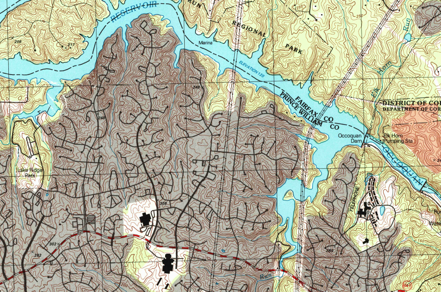
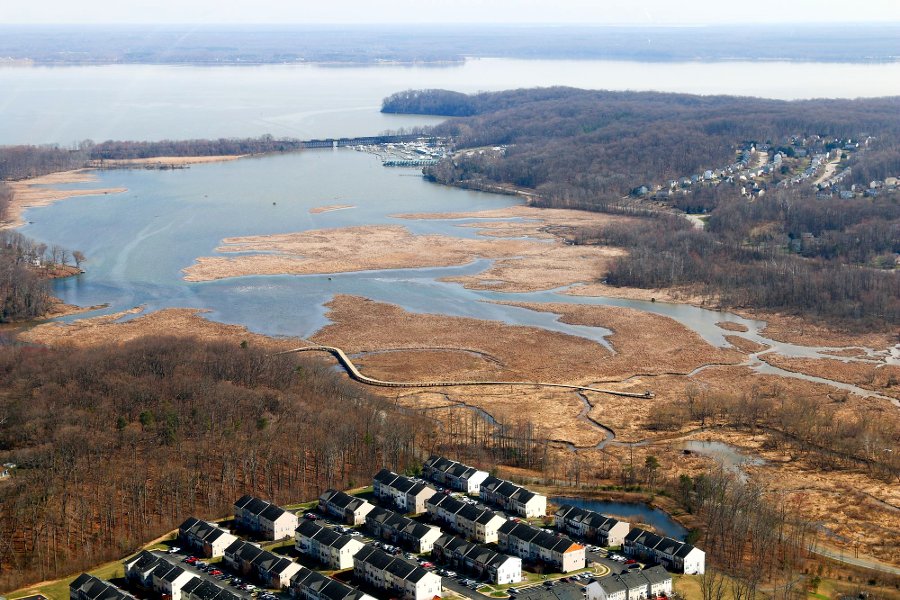
the Lake Ridge subdivision was built on the southern edge of the Occoquan Reservoir, starting in 1970
Source: US Geological Survey, Occoquan 1:24,000 scale topographic quadrangle map (1994)
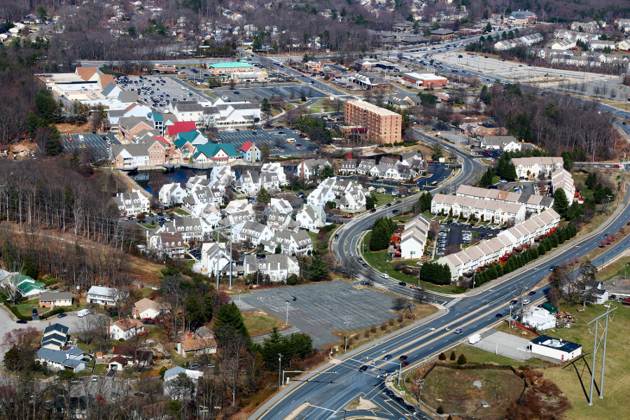
Tacketts Mill, looking north
Source: Historic Prince William, Tackett's Mill - #60
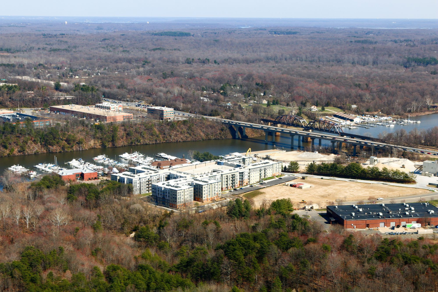
Rivergate Apartments and Occoquan Harbour Marina are the first evidence that North Woodbridge might emerge on the south bank of the Occoquan River
Source: Historic Prince William, Rivergate Apts. - #109
Gordon Plaza, a North Woodbridge revitalization opportunity
Source: Historic Prince William, Gordon Plaza on Rt. 123 at Rt. 1 - #110
mouth of Neabsco Creek, with new boardwalk under construction in 2018
Source: Historic Prince William, Neabsco Boardwalk, part of Rippon Lodge Park - #128
Prince William developed as a bedroom community because it offered low-cost housing with a relatively fast commute to high-paying jobs in the urban core
Source: Historic Prince William, Hope Hill Housing Development - #180
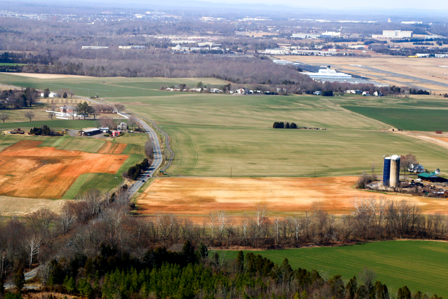
sod farm in Rural Area on Brentsville Road, south of Manassas Regional Airport
Source: Historic Prince William, Centerville Sod and Manassas Airport - #217
large farms in the Rural Area were carved up into 10-acre lots for houses
Source: Historic Prince William, Colvin Farm - #223
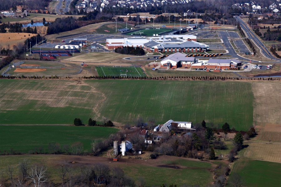
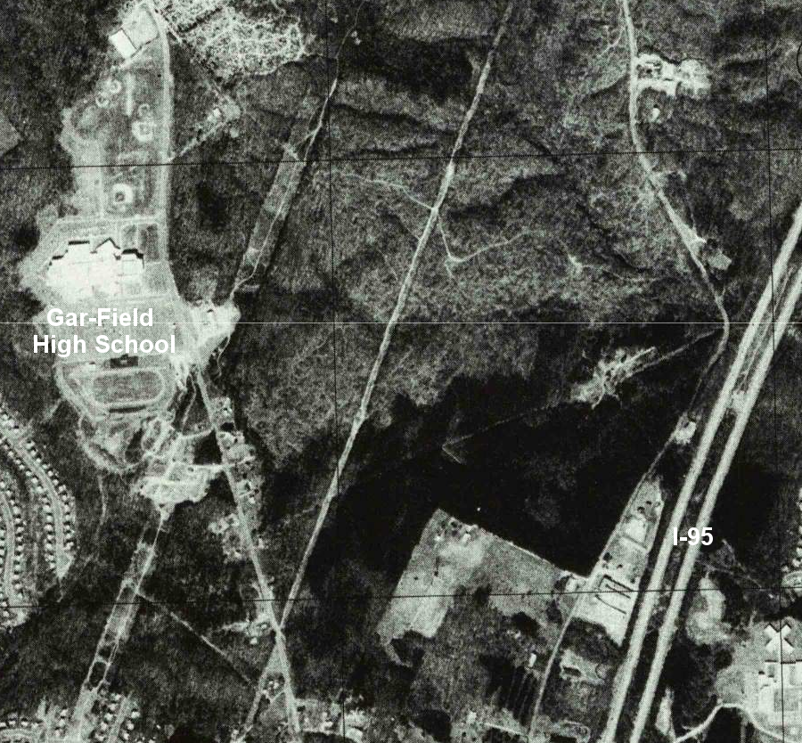
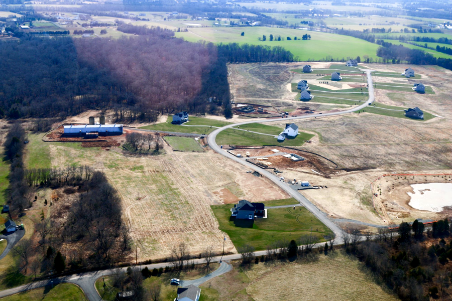
the Prince William School Board built Patriot High School in the Rural Area
Source: Historic Prince William, Wood Elem. and Patriot High School - #244
The Prince William County Planning Office has a brief description of the relationship between the county-wide Comprehensive Plan and site-specific Sector Plans:
The Comprehensive Plan is not a tight straightjacket that totally controls land use. The Comprehensive Plan is a flexible document - and it's revised every 5 years as well. It also allows for amendments to deal with proposals that are desired by a landowner but inconsistent with the Comprehensive Plan. The Board of Supervisors requires that proposed amendments must be requested by early January of each year, so landowners must plan ahead...
The county has identified over 20 possible sector plans that would elaborate on the 1998 Comprehensive Plan - but the planning process is complicated and time consuming, so the odds are that only a handful will be developed before the revision of the Comprehensive Plan scheduled for 2003. Not all of the proposed plans are guaranteed for approval, either.
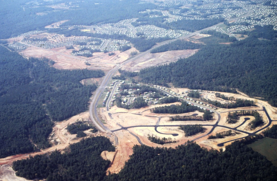
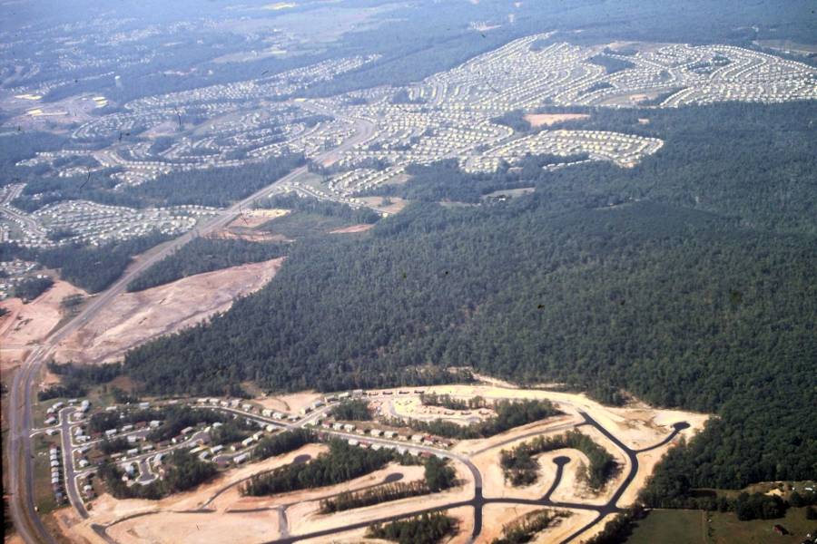
eastern Prince William, along I-95 corridor in 1984
Source: Library of Congress, Washington, D.C., and vicinity, 1:100 000-scale satellite image map (1984)
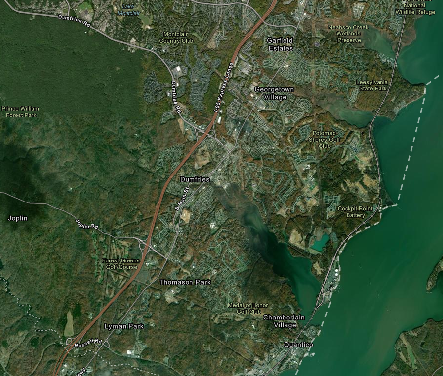
eastern Prince William, along I-95 corridor in 2020
Source: ESRI, ArcGIS Online (2020)