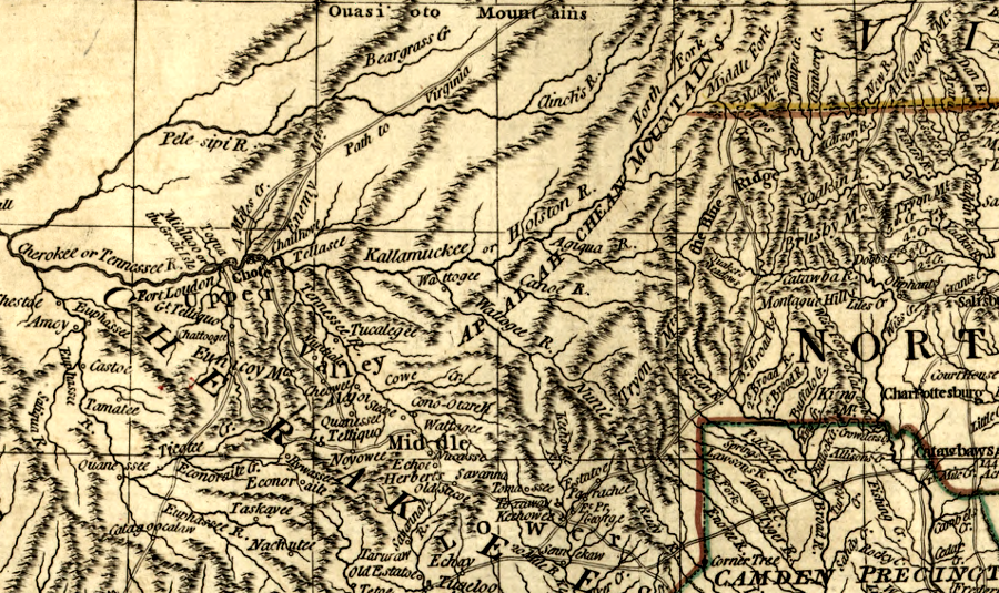
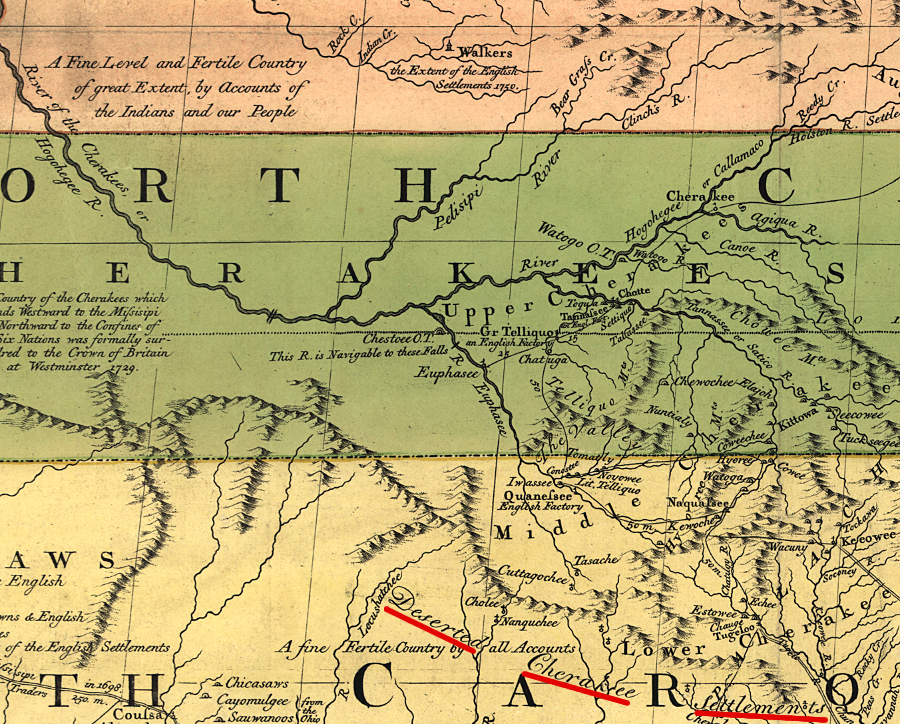
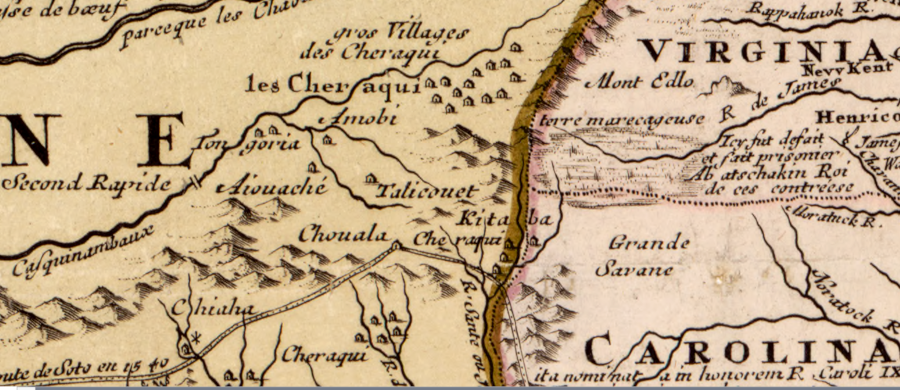
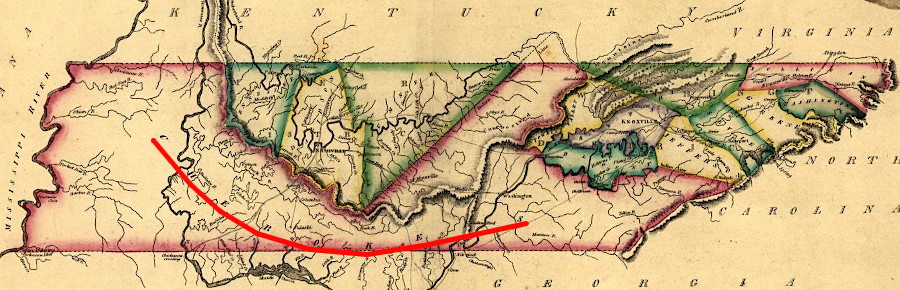
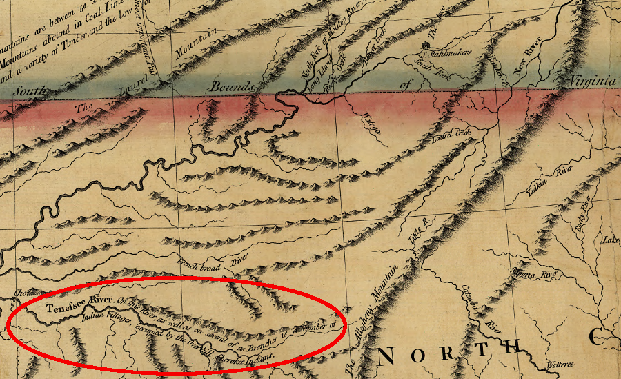
west of the Blue Ridge, the Cherokee occupied the headwaters of the Tennessee River
Source: Library of Congress, A general map of the southern British colonies in America (1776)
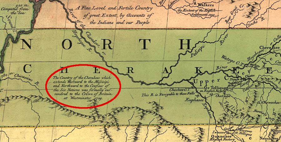
west of the Blue Ridge, the Cherokee occupied the headwaters of the Tennessee River
Source: Library of Congress, A general map of the southern British colonies in America (1776)
The Cherokee nation speaks an Iroquoian language. It is related to the languages spoken by the Nottoway, Meherrin, and Tuscarora in Tidewater south of the James River, the Susquehannock at the northern edge of the Chesapeake Bay, and the Mohawk, Onondaga, Oneida, Cayuga, Seneca in New York.
The original speakers may have migrated into the Southern Appalachians after the Moundbuilder culture in the Mississippi River faded in the 1300's and 1400's. Moundbuilding societies constructed mounds as gravesites for ceremonial burials, with houses on top for the elite.
The Cherokee continued to erect ceremonial houses on top of mounds that had been built earlier. Debris from those houses increased the height of the old mounds, but the Cherokee culture was not centered on the construction of *new* mounds. Moundbuilding in Virginia was concentrated west of the Blue Ridge, except near the headwaters of the Rivanna River. One mound built along the Rivanna River east of the Blue Ridge was excavated by Thomas Jefferson. Reports of Native Americans visiting the mounds
When the English arrived in Virginia, the Cherokee lived in the upper Tennessee River tributaries of what later became Virginia. In the Carolinas and Georgia, there were Cherokee towns along the Savannah, Chattahoochee, Hiwassee, Little Tennessee, and Tennessee rivers.
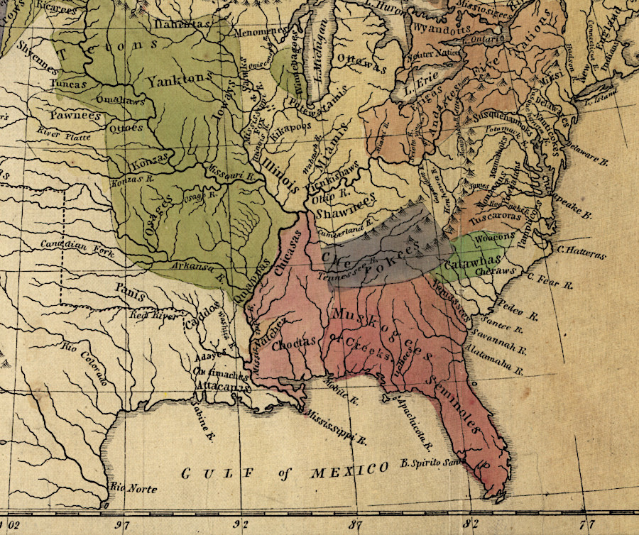
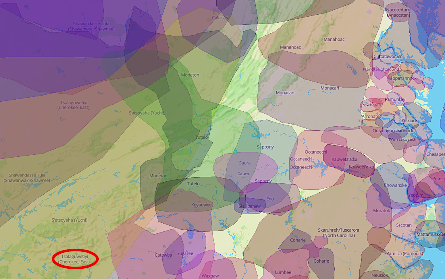
the Cherokee lived west of the Blue Ridge
Source: Library of Congress, Map of the Indian tribes of North America, about 1600 A.D. along the Atlantic, & about 1800 A.D. westwardly (by Albert Gallatin, 1836)
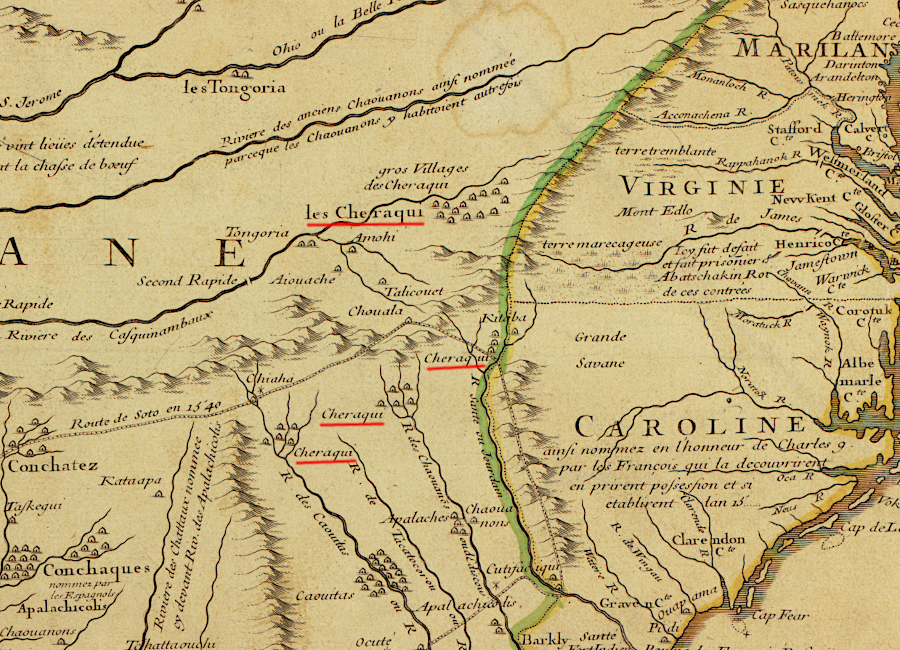
the French documented the location of Cherokee towns while mapping the Mississippi and Missouri rivers
Source: Library of Congress, Carte de la Louisiane et du cours du Mississippi (by Guillaume de L'Isle, 1718)
In later negotiations with colonial officials, the Cherokee claimed control over lands in Kentucky extending north to the Ohio River. They may have hunted through the bluegrass valleys in the Kentucky and Cumberland River watersheds, crossing through the mountains at Cumberland Gap long before English explorers "discovered" it, but the Cherokee had few if any towns west of the Allegheny Front.
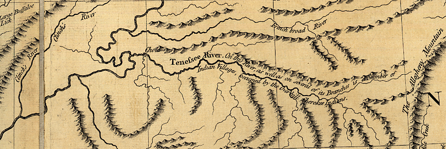
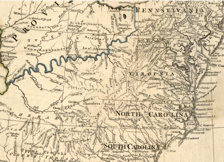
the Overhill Cherokee towns were concentrated along the Tennessee River
Source: Library of Congress, A new map of the western parts of Virginia, Pennsylvania, Maryland, and North Carolina (by Thomas Hutchins, 1778)
The disruption of the old culture and the development of new polities in the Southeastern US may have been affected by the 1540 expedition of Hernando de Soto through the Tennessee River watershed. The arrival of the unexpected Spaniards, with technology and beliefs far different from the Moundbuilders and the power to threaten the existing hierarchy of control, could have diminished the authority of religious leaders in particular. New diseases brought by de Soto and his herds of pigs may have helped to alter the alignments of different communities living along the mountain streams.
Because there were no Cherokee communities on the Atlantic Coast when Spanish colonists first began settling there in 1526, followed by French and English colonists, other Native American tribes discovered first that the colonists were willing to trade iron tools, guns, and textiles. In exchange, the Native Americans offered food, deer hides, and other Native Americans to be enslaved. The colonist-provided manufactured goods substantially improved the quality of life for people previously limited to stone/bone tools, and to production of clothing that required great amounts of time and effort.
Cherokee traded with English colonists through other groups of Native Americans in the 1600's
Source: Native Land Digital
The English, like the Spanish, were disappointed to learn there were no accumulated hoards of gold and silver to steal, but the traders found opportunities to acquire slaves and animal skins. The coastal tribes traded European goods with inland tribes for the desired furs, and the coastal tribes acquired slaves as well for trade. Initially, the Cherokee obtained trade goods though intermediary tribes and not through direct trade.
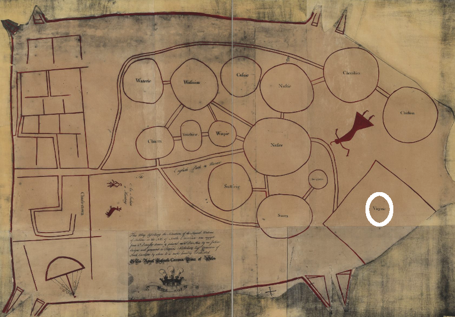
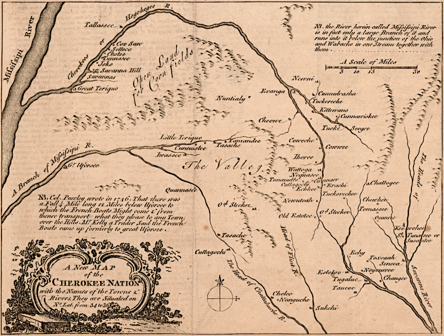
After traders based in Charles Town started direct trade with the Cherokee, they classified the Cherokee towns by location. The Lower Towns were in the Savannah River headwaters. The Middle, Valley, and Out towns were in the Blue Ridge along the Tuckasegee, Little Tennessee River, and Hiwasee rivers. The Overhill Towns were further down the Little Tennessee River.
Other Cherokee communities stretched north up the Tennessee and Holston Rivers into what is now Virginia. Towns were independent of each other; there was no paramount chief. Warriors regularly assembled from multiple towns to raid the Creek and Choctaw to the south, Chickasaw to the west, Sara to the east, and Shawnee and Iroquois to the north.
Several warrior paths developed as Shawnee and Iroquois returned to attack Cherokee towns. Siouan-speaking occupants of towns in the valleys west of the Blue Ridge, perhaps related to the Tutelo and Saponi, moved away to avoid the warring bands. The valleys were depopulated before the English, Scotch-Irish, and German immigrants arrived in the 1700's.
In 1673, Abraham Wood sent James Needham and Gabriel Arthur from Fort Henry and the first traders from Virginia reached the Overhill Town of Chota. Gabriel Arthur survived the trip and captivity, finally returning several years later with some Cherokee.
In 1690, Cornelius Dougherty came from Virginia and stayed with the Cherokee as a trader. Ultimately traders adopted the Occaneechi Path to link the English in Virginia with various Cherokee towns in the Tennessee River watershed. The Catawba map, marked on deerskins and provided to Gov. Francis Nicholson of South Carolina around 1721, suggests the Cherokee traded directly with Charles Town and with few intermediaries on the route to Virginia.1
the Cherokee found trading routes to Virginia, as well as to South Carolina
Source: Library of Congress, Map of the several nations of Indians to the Northwest of South Carolina (1776)
the Cherokee sold their claim to lands in Carolina near Charles Town to settle debts to British traders
Source: Library of Congress, A map of the British and French dominions in North America (by John Mitchell, 1755)
as the French and Indian War erupted, the British used treaties with the Cherokee to justify claims to the Ohio River and Mississippi River valleys
Source: Library of Congress, A map of the British and French dominions in North America (by John Mitchell, 1755)
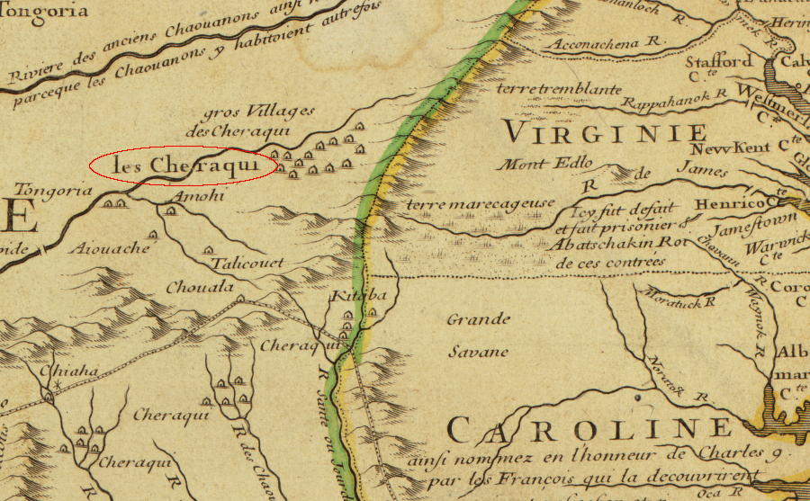
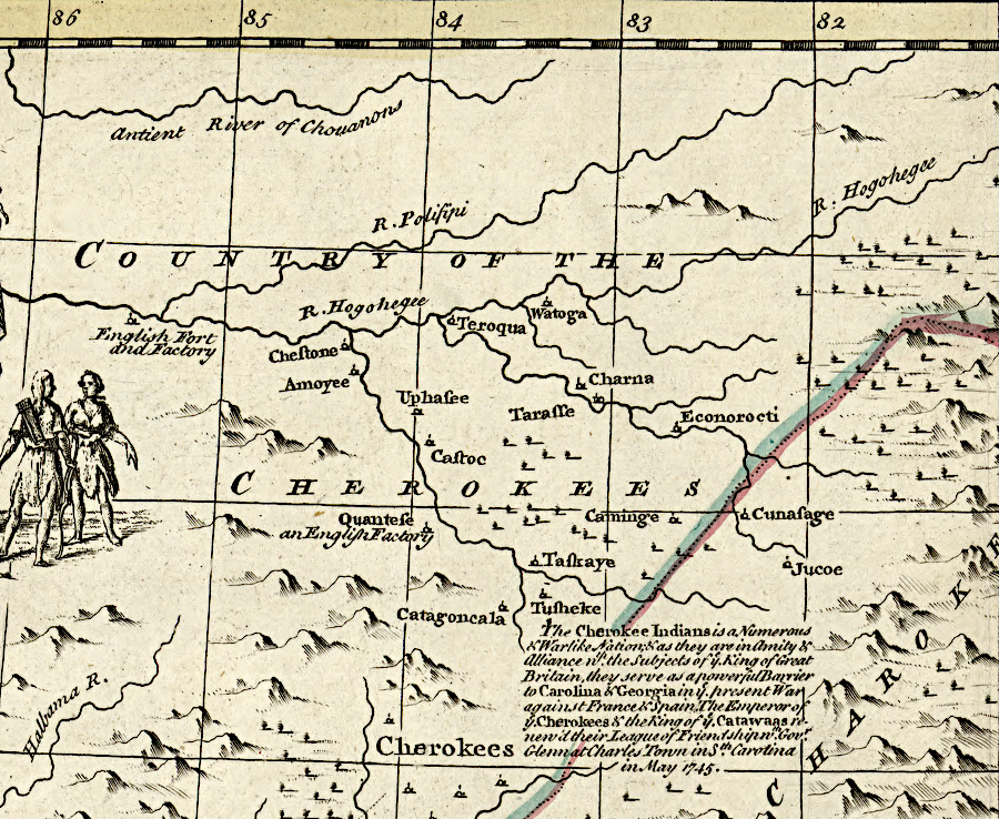
in 1716, a French cartographer placed Cherokee villages in southwestern Virginia
Source: Library of Congress, Novissima tabula regionis Lvdovicianae gallice dictae La Lovgsiane iam olim quidem sub Canadae et Floridae nomine in America Septentrionali (Guillaume de L'Isle, 1716)
the Cherokee occupied lands west of the Appalachians, so Virginia colonists did not settle in their territory and disrupt their society until a century after landing at Jamestown
Source: Library of Congress, The United States of North America, with the British & Spanish territories according to the treaty (William Faden, 1783)
the Cherokee homeland was in the Tennessee River valley, prior to removal of most members west across the Mississippi River in the 1830's
Source: Library of Congress, Carte de la Louisiane et du cours du Mississippi (1718)
though the geography of the lands west of the Appalachians was unclear in 1722, the first English map of the Mississippi River valley showed the location of the Cherokee
Source: John Carter Brown Library, A Map of Carolana and of the River Meschacebe (Daniel Coxe, 1722)
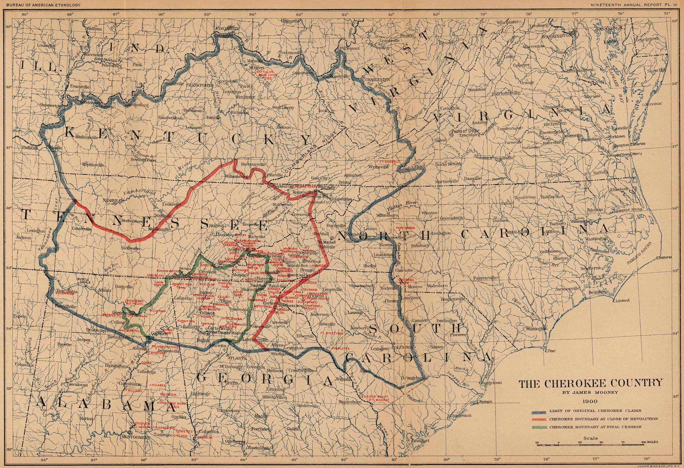
the Smithsonian Institution's "Nineteenth Annual Report of The Bureau of American Ethnology 1897-98" outlined the reduction of territory claimed by the Cherokee
Source: University of Texas, Perry Castaneda Library, Cherokee Country by James Mooney 1900
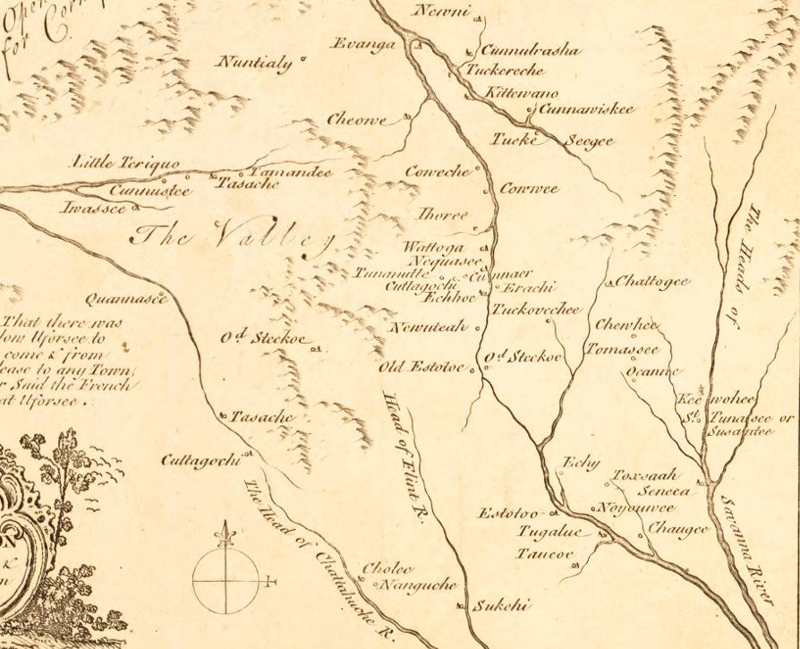
the Cherokee lived in Over Hill Towns west of the Blue Ridge, plus Middle Towns and Lower Towns east of the watershed divide
Source: North Carolina Maps, A new map of the Cherokee Nation with the names of the towns & rivers. They are situated on no. lat. from 34 to 36.
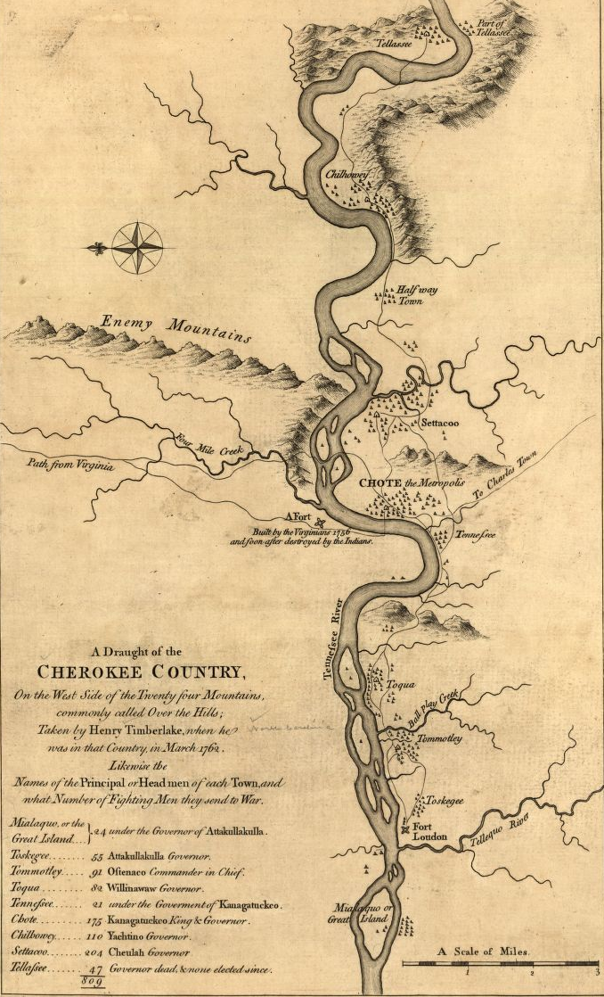
during the French and Indian War, Virginians built but did not occupy their own fort near Fort Loudoun (which was constructed by South Carolina)
Source: Library of Congress, Draught of the Cherokee Country (by Henry Timberlake, 1765)
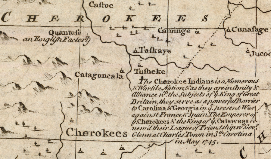
the English wanted the Cherokee to be allies
Source: David Rumsey Historical Map Collection, A new & accurate map of the provinces of North & South Carolina, Georgia &c. (Emanuel Bowen, 1747)
the Cherokee occupied the western edge of the Carolinas in 1820
Source: Library of Congress, Statistical atlas of the United States based on the results of the ninth census 1870 (image 65: "Population of the U.S. - 1790, 1800, 1810, 1820")
a map published in 1817 shows the Cherokee dominance of land in the new state of Tennessee
Source: Library of Congress, The state of Tennessee (by Samuel Lewis, 181__)
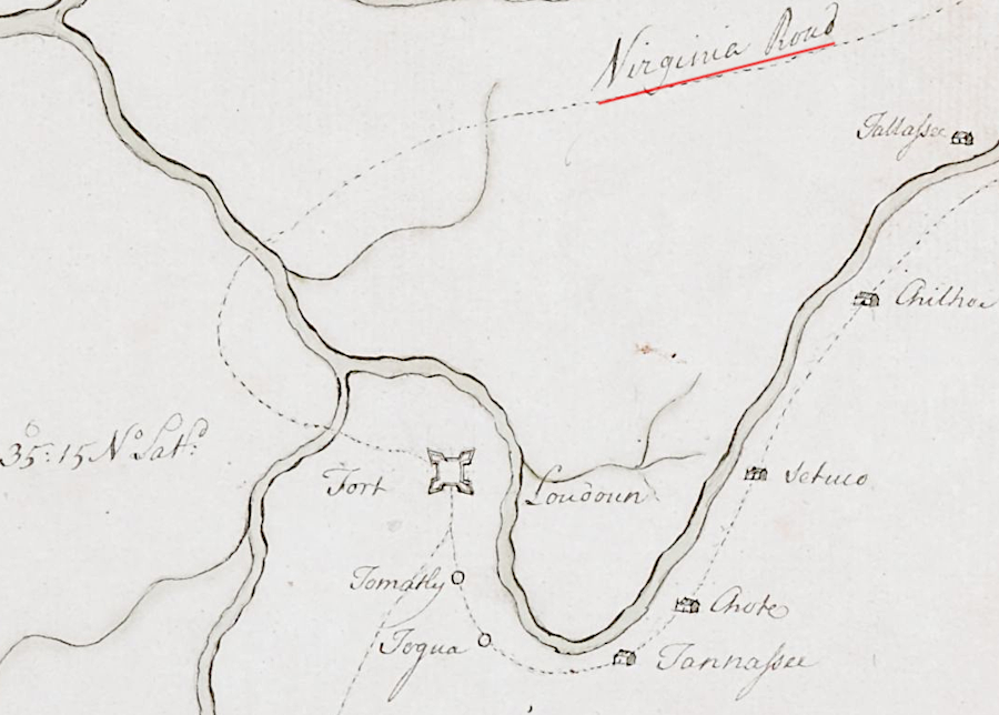
William Byrd III could have marched to Fort Loudoun via the Virginia road
Source: Norman B. Leventhal Map & Education Center, Sketch of the Cherokee Country and March of the Troops Under the Command of Luet. Col. Grant to the Middle & Back Settlements (John Stuart, 1760)
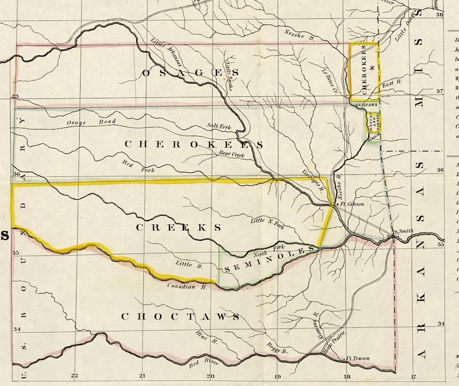
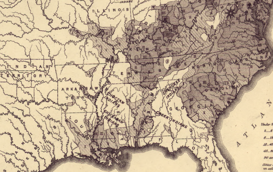
after passage of the Indian Removal Act in 1830, Federal officials planned to move an estimated 10,000 Cherokees west of the Mississippi
Source: Library of Congress, Map showing the lands assigned to emigrant Indians west of Arkansas and Missouri (1836)
Cherokee towns were located primarily in what is now South Carolina, North Carolina and Tennessee
Source: Library of Congress, A new map of the Cherokee Nation: with the names of the towns & rivers: they are situated on No. lat. from 34 to 36 (by Thomas Kitchin, 1770)
Source: Smithsonian MNAI, Native Knowledge 360° Online Series | Americans Part 3
Source: Liz Covart, 056 Daniel J. Tortora, The Anglo-Cherokee War, 1759-1761
the Cherokee on the Tennessee River traded with Virginians via the Occaneechi Path and then the Wilderness Road
Source: Library of Congress, A new map of the western parts of Virginia, Pennsylvania, Maryland, and North Carolina (Thomas Hutchins, 1778)

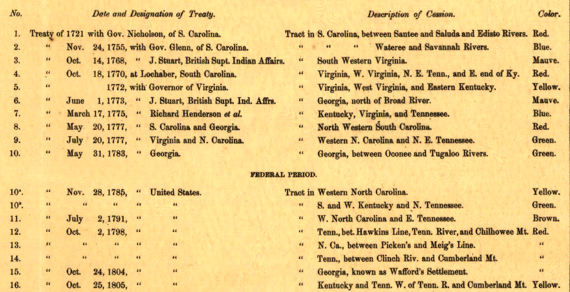
the Cherokee ceded land in multiple treaties with British and colonial officials, and then the United States
Source: Library of Congress, Map of the former territorial limits of the Cherokee "Nation of" Indians (by C. C. Royce, 1884)
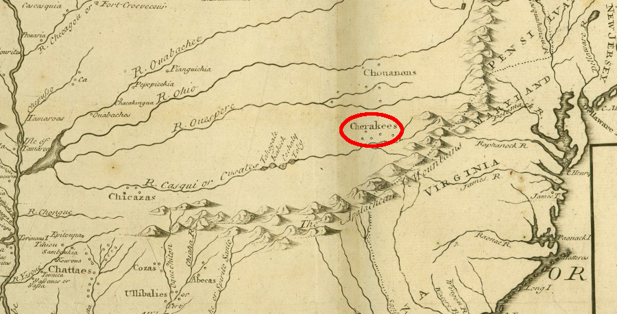
before the start of the French and Indian War, the Cherokee control of Virginia's southwestern frontier was well known
Source: Library of Congress, A new & accurate map of the provinces of North & South Carolina, Georgia &c. by Emanuel Bowen (1752)
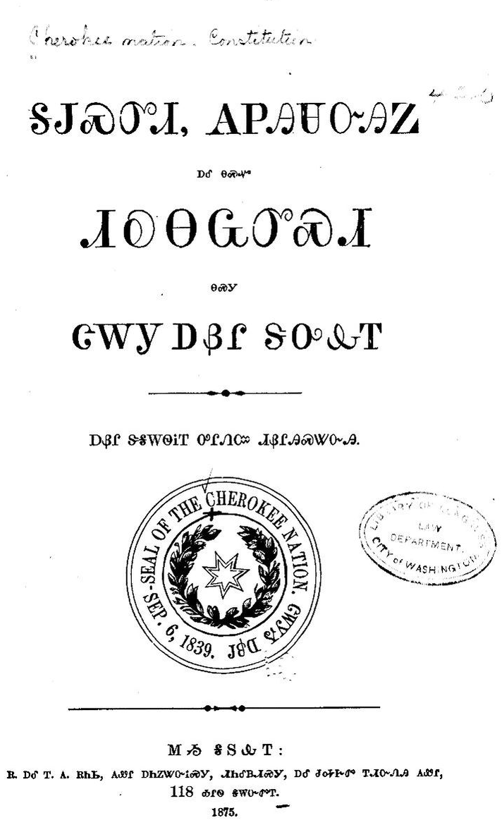
the Cherokee adopted legal and cultural practices of the United States, but were still forced off their lands
Source: Library of Congress, Constitution and laws of the Cherokee Nation (1875)
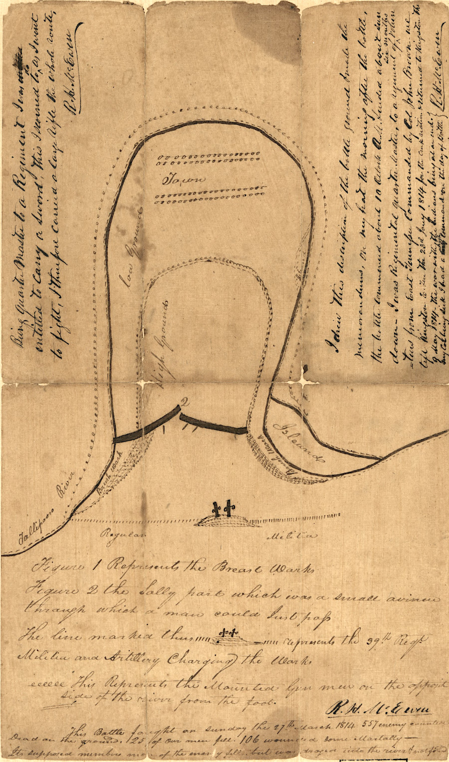
President Andrew Jackson forced the Cherokee out of their homeland despite their key assistance to help him win the Battle of Horseshoe Bend
Source: Library of Congress, Sketch map of the Battle of Horseshoe Bend of Tallapoosa River, 27th March 1814