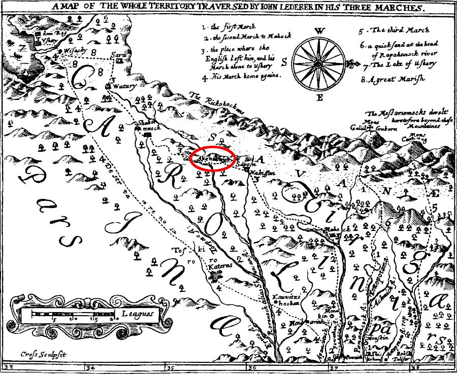
John Lederer explored into the Piedmont territory controlled by the Siouan-speaking groups, reaching the Akenatzy (Occaneechi) town on the Roanoke River
Source: University of North Carolina, The Discoveries Of John Lederer
John Lederer explored into the Piedmont territory controlled by the Siouan-speaking groups, reaching the Akenatzy (Occaneechi) town on the Roanoke River
Source: University of North Carolina, The Discoveries Of John Lederer
John Lederer claims he found the Saponi in 1670 living on the Roanoke River, in modern-day Charlotte County upstream of Clarksville. By that time the settlement may have included a mixture of Monacan, Saponi and Tutelo who migrated to the Occaneechi trading place after European colonists had disrupted Native American societies.1
Prior to the colonists beginning to occupy western Virginia, the Susquehannock, Delaware, Erie, and Siouan-speaking tribes were displaced by the Iroquois conquest of rivals during the "Beaver Wars" in the 1650's. Before being forced from their homelands in the Beaver Wars, the Tutelo may have been living along the Big Sandy River near Williamson, West Virginia. They apparently migrated to the Roanoke River near the modern city of Salem to get away from the Iroquois based on what is now New York.
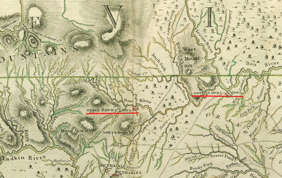
The Tutelo, also known as the Yesang, were a small group. They allied with the Saponis, also known as the Monasukapanough, living nearby. Together they were known as the Nahyssans. Their territory in the late 1600's included land on both sides of the Blue Ridge, stretching from modern-day Roanoke to Lynchburg and up to the Monacan territory near Charlottesvile.2
The Cherokee and Catawba raided north into territory controlled by the Iroquois, and they traveled south through Virginia's Piedmont to attack rivals south of the Roanoke River. Small towns of the Siouan-speaking tribes between the Blue Ridge and Fall Line were threatened from north and south, as well as Shawnee in the west and English colonists in the east.
Joining together at the Occaneechi town on the Roanoke River provided an opportunity to create a critical mass who could protect themselves. That location was on the trade route between Petersburg and the Catawba-controlled backcountry in the Carolina Piedmont. The Native Americans who settled at the Occaneechi town could also participate as "middlemen" in the English trade, maintaining connections to Native American groups further west which had better access to deerskins.3
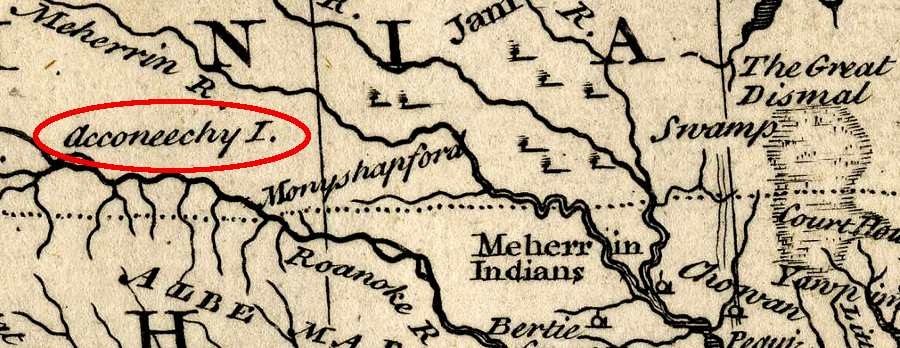
Occaneechee Island was a key trading location in the Piedmont for deerskins and furs from groups living as far west as the Tennnessee River
Source: North Carolina State Archives, A New and Accurate Map of the Province of North and South Carolina, Georgia, etc. (1747); University of North Carolina, A Compleat map of North-Carolina from an actual survey (by John Collet, 1770)
In 1671, Thomas Batts and Robert Fallam, exploring west to find access to furs for Abraham Wood's trading fort, met the Tutelo/Totero. He may have encountered them on the New River near modern Radford, or the town may have been at the site of the modern James I. Moyer Sports Complex in Salem.4
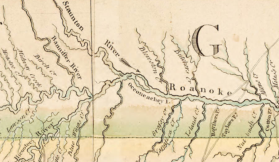
the Occaneechi Trading Path provided access for traders at Petersburg to the Native American towns on the Piedmont of North Carolina
Source: J. Carter Brown Library, "Early Maps of the American South," A compleat map of North-Carolina from an actual survey by Captn. Collet, Governor of Fort Johnston (by John Abraham Bayly, 1700)
William Byrd II recorded a visit with the Saponi on the Meherrin River in 1728. By that time, they had moved east from the Piedmont of Virginia and Carolina, merging previously-separate groups that shared the common Siouan language. In addition to the Tutelo and Saponi who had lived in the Roanoke River watershed, some apparently came from a one-time "Totero Town" in Albemarle County near Scottsville. Others may have been descendants of people displaced from Monacan towns on the James River upstream of the Fall Line.
Source:
Lignum Crucis Productions, Our People: The Sappony
Lignum Crucis Productions, Our People: Occaneechi Band of Saponi Nation
In 1750, when Thomas Walker explored through southwestern Virginia and passed through Cumberland Gap, those Native Americans had largely abandoned their towns west of the Blue Ridge. The area was a conflict zone and was visited too often by Catawba and Cherokee war parties moving north to attack the Iroquois and northern raiders moving south.
Relocation and consolidation provided greater capacity for the Siouan-speaking groups to defend against attacks from Iroquoian-speaking Cherokee from the west and the six Haudenosaunee tribes (now including the Tuscarora) from the north:5
William Mayo's 1728 map of the "dividing line" boundary between Virginia-Carolina showed the Occaneechi Trading Path downstream from the Ackoneechy Island
Source: University of North Carolina, "Early Maps of the American South," A Map of the boundary between Virginia and Carolina laid out by His Majesty's order and assent of the Lords Proprietors of Carolina in the year 1728 (by William May, 1728)
the Occaneechi, Saponi, and Tutelo had a network of trails for trading between the Piedmont and Blue Ridge
Source: Yale University Library, Indian Trails of the Southeast (by William E. Myer, 1925)
A group also settled on the Eno River, at modern-day Durham.
by the mid-1700's, there was an Occaneechi settlement on the Eno River south of the Virginia-North Carolina border
Source: Library of Congress, A new & accurate map of the provinces of North & South Carolina, Georgia &c. (by Emanuel Bowen, 1752)
Source: Alliance for Historic Hillsborough, The Occaneechi Band of the Saponi Nation: From the Revolutionary War to the 20th Century
Source: Alliance for Historic Hillsborough, The Occaneechi in Present Day
a 1671 map showed the main Occaneechi town on the Roanoke River
Source: North Carolina Maps, A new discription of Carolina by the order of the Lords Proprietors (John Ogilby, ~1671)
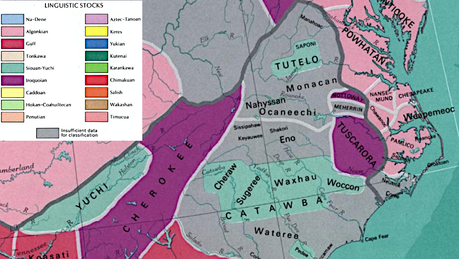
in 1970 the US Geological Survey concluded that the Tutelo and Saponi spoke a Siouan language, but the language of the Ocaneechi was unclear
Source: National Atlas of the United States of America, Indian tribes, Cultures & Languages (1970)
Source: The Center at Belvedere - Charlottesville, VA, MappingErasure: Acknowledging the Siouan Indians of the Piedmont
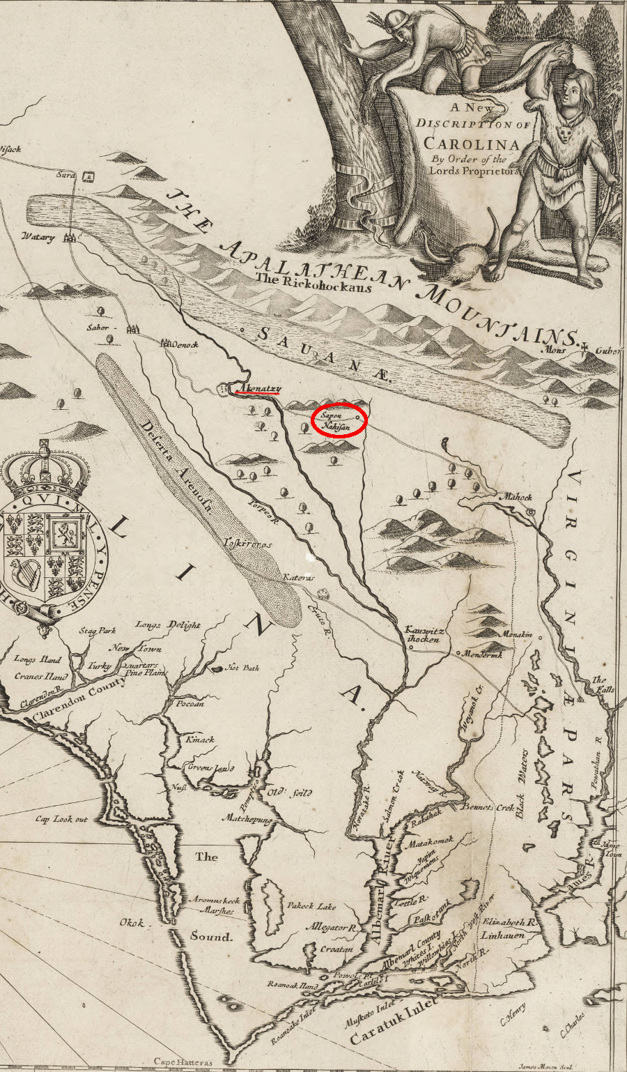
the Saponi lived in Sapona and Nahisan, as well as the Akenatzy (Occaneechi) town, when John Lederer explored south of the James River in 1669 and 1670
(on map, north is to the right)
Source: University of North Carolina at Chapel Hill Library, A new discription of Carolina by the order of the Lords Proprietors (by John Ogilby, c.1671)
islands in the Roanoke River near the old Occaneechi town were mapped by Confederate engineers in 1864
Source: Library of Congress, Map of Mecklenburg Co., VA (Confederate Engineer Bureau, 1864)