Transportation in the Early 1800's
nitially, the tobacco-exporting plantations along the Potomac River shipped hogsheads directly to Europe. Ships sailing westward from Europe to Virginia would bring some manufactured items for sale, especially luxury goods ordered by the gentry, and those items would be unloaded at the same plantation wharfs along the Potomac.
Thoughout the 1600's and 1700's, the General Assembly passed multiple laws to stimulate development of towns... but it was not until 1749 that Northern Virginia first started to develop an urban center away from a plantation. By the time William Fairfax, George Mason and George Washington became the rich-and-famous people of Northern Virginia, Alexandria was established and Dumfries was struggling. Apparently there was not enough business for two centers of commerce.
 When the Dumfries harbor silted up in the 1760's, it became very clear that Alexandria would be the commercial center for Northern Virginia. George Washington went out of his way to locate the District of Columbia boundaries so Alexandria could be included within the new Federal district, anticipating a boom in manufacturing and government activity. While Alexandria was part of DC between 1801-47, the city developed primarily as a trading center. Business leaders understood they needed to create a transportation system to extend their market influence - and recognized Georgetown, Baltimore, and Fredericksburg as the chief rivals.
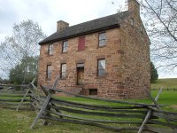
The city financed turnpikes to the west, including the Little River Turnpike (Route 236/Route 50 between Alexandria and Aldie) and the Alexandria-Warrenton Turnpike (Route 29 from Germantown to Warrenton). At locations where tolls were collected, such as the Stone House on Manassas Battlefield, long poles or "pikes" would be turned to permit passage after paying the toll.
The Little River Turnpike made a profit, but nearly all other transportation projects (including canals and railroads) were money-losing propositions. The state of Virginia saddled itself with massive debt by financing 40% or more of the projects, and post-Civil War politics revolved around paying or "re-funding" that debt. Even in the middle of the 20th Century, state leaders committee to a pay-as-you-go philosophy and minimized borrowing for transportation improvements.
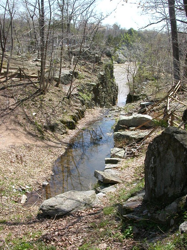 Potowmack Canal, at Great Falls
Read:
- The Transportation Network of Alexandria
- Alexandria Archeology: Discovering the Decades: 1800s
- The Patowmack Canal
- Alexandria Canal
The success of Alexandria meant that Georgetown, in the District of Columbia, got less business. Ocean-going ships that unloaded cargo for sale in Alexandria stimulated businesses in that city, and did not sail a few miles further upstream to trade with the Georgetown merchants. However, the business leaders of Georgetown understood their physical and cultural geography. They supported the Chesapeake and Ohio canal, on which construction started in 1825. That canal reached westward up the Potomac River, and stimulated farmers and manufacturer in the Potomac River watershed to ship products to Georgetown... not Alexandria.
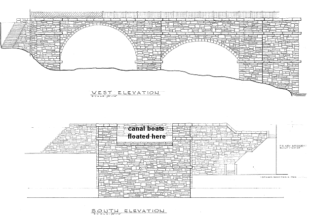
In response, Alexandria invested in an extension of that C&O canal, so canal boats could bypass Georgetown and travel all the way to a deepwater port. (Since 1805, a causeway crossed the Potomac River at what today we call Teddy Roosevelt Island, blocking shipping between Georgetown and Alexandria.) The Aquaduct Bridge over the Potomac River was constructed between 1833-43 so canal boats could float across the river to the Virginia side, then travel downstream - where the George Washington Memorial Parkway now runs - to Alexandria. The project was a high-risk venture for the city, and for some time it appeared the Federal Congress was not going to provide the expected funding.
Ruins of the canal locks in Alexandria are still preserved, located halfway between the Mirant Power Plant and the Torpedo Factory. A portion of one pillar of the Aqueduct Bridge is also visible for travellers on the George Washington Memorial Parkway, as they drive west past Rosslyn. (The superstructure was removed in 1933, and the rest of the piers were removed in 1962.)
Explore at the Library of Virginia:
- Board Of Public Works Introduction, describing maps of early transportation projects
- County And State Maps, looking in particular at 1827 map of Stafford County
Read
- Building the Commonwealth
- read all 4 pages of Board of Public Works introduction
Transportation in Northern Virginia
Geography of Northern Virginia
Virginia Places