Early Transportation in Northern Virginia

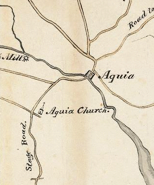
Wood-Boye nine-sheet map of Virginia, showing Stafford County (1827)
Source: Library of Virginia

Questions to Explore This Week

- how did the early colonists get around Northern Virginia?
- who paid for pre-Civil War transportation projects (and what are "lessons learned" that might apply to modern projects)?
- why do all roads, canals, and railroads in Northern Virginia seem to lead to Alexandria?
- how did transportation shape the development of Manassas?
- why did the Alexandria, Loudoun, and Hampshire railroad fail?

Stone Bridge over Bull Run, built originally for Alexandria-Warrenton Turnpike

1) Getting Around Northern Virginia in Pre-Colonial and Colonial Days
- The Manner of Making Their Boats
- Compare roads and political boundaries/cultural features in:
    - 1639 map
    - 1751 map (look familiar?)
    - 1770 map
- Fredericksburg's Beginning
- pages 3-10 ("The Colonial Period 1607-1776") of A Brief History of Roads in Virginia, 1607-1840
- pages ix-xiii ("Introduction" by Beth Mitchell for the Fairfax County History Commission) of Fairfax County Road Orders 1749-1800

view across Potomac River to Maryland, at Leesylvania State Park

2) Transportation in the Early 1800's
- The Transportation Network of Alexandria
- Alexandria Archeology: Discovering the Decades: 1800s
- The Patowmack Canal
- Alexandria Canal
- Board Of Public Works Introduction, describing maps of early transportation projects
- County And State Maps
- Building the Commonwealth
- Board of Public Works introduction

3) Read:
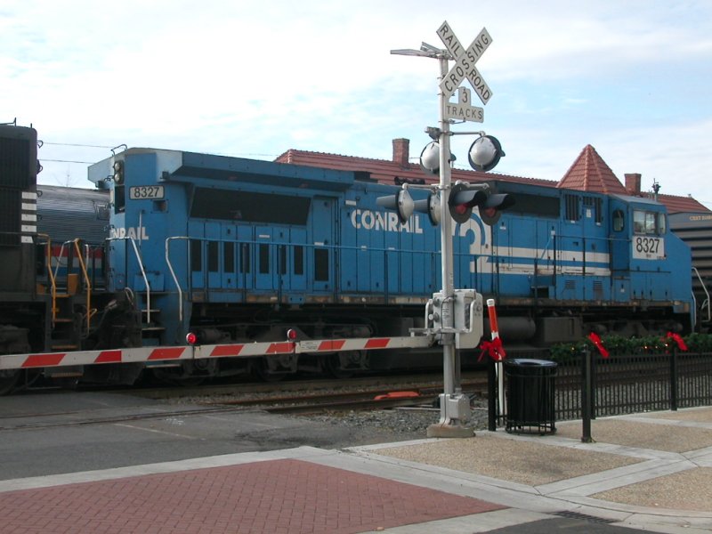
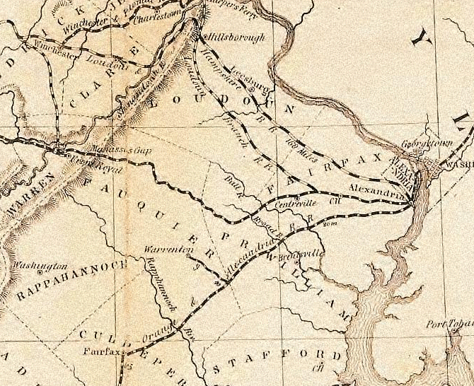
- Railroads of Virginia
- After First Manassas
- Manassas: A Railroad City
- The Orange & Alexandria Railroad
- Roads and Railroads in Braddock District (note planned location of Manassas Gap Railroad through City of Fairfax)
- Washington & Old Dominion Railroad: 1847 to 1968
- The Alexandria, Loudoun and Hampshire Railroad In The Civil War
- map of the Washington and Old Dominion Railroad
- About Herndon
- The W&OD Railroad is Heart of Herndon for 120 Years (the Great Falls Branch right-of-way sold to Arlington and Fairfax Counties is now Old Dominion Drive)

modern Centreville
modern Centreville

Conrail at Manassas Train station

train crossing Route 29 at Gainseville

gas pipeline at Route 29, just east of Bull Run Post Office Road

Amtrak at Quantico station

Jones Point lighthouse on Potomac River
(circle shows location of boundary stone marking southern tip of DC)
Read material relevant to a previous class: compare the costs for different jurisdictions in NOVA, using the Comparative Report of Local Government Revenues and Expenditures from the state's Auditor of Public Accounts

Tysons Land Use Task Force and the process of updating the Tysons Comprehensive Plan

Capital Engineers: The U.S. Army Corps of Engineers in the Development of Washington, D.C., 1790-2004 -->

1858 map of the rail roads of Northern Virginia
Map of the rail roads of Virginia, by Ludwig von Bucholtz (1858)
(Note plans for a Loudoun Branch Railroad, between Fairfax Courthouse and Centreville)
Source: Library of Virginia, Bureau of Public Works Entry #672

Super Northern Virginia region included portions of Shenandoah and Orange counties, according to one study by Virginia Department of Transportation
"Super Northern Virginia" region included portions of Shenandoah and Orange counties, according to one study by Virginia Department of Transportation
Source: Virginia Department of Transportation, Super NoVa Transit/Transportation Demand Management (TDM) Vision

Geography of Northern Virginia
Virginia Places