hikers can stay in shelters along the Appalachian Trail
Source: Appalachian Trail Conservancy, Interactive Map
hikers can stay in shelters along the Appalachian Trail
Source: Appalachian Trail Conservancy, Interactive Map
Virginia has 554 miles of the Appalachian Trail, more than any other state. The lowest point on the trail within the state is 265' high, and the highest is 5,500' high.1
The original route of the Appalachian trail in Virginia was about 50 miles east of the current route, following the Blue Ridge on the eastern edge of Carroll, Floyd, and Roanoke counties. In 1933, the Appalachian Trail Conference moved the route from the eastern edge of Roanoke County to the western edge. That brought the trail over Tinker Cliffs and McAfee Knob on Catawba Mountain. <
In 1952, the trail was shifted west of Blacksburg to run through Jefferson National Forest. That separated the walking trail from the Blue Ridge Parkway between the North Carolina border and Bedford County.2
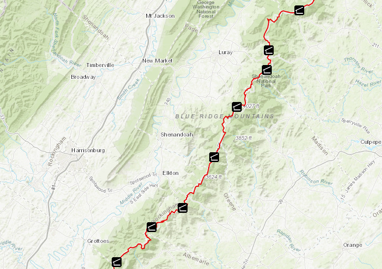
The trail still parallels Skyline Drive:3
Eight different groups maintain the Appalachian Trail in Virginia. The Potomac Appalachian Trail Club started in 1927, and today is responsible for 240 mile of the trail. The Roanoke Appalachian Trail Club started in 1932. It now maintains 16 shelters and 120 miles of the Appalachian Trail.
The other clubs which have evolved since the trail was first started are the Old Dominion Appalachian Trail Club, Tidewater Appalachian Trail Club, Natural Bridge Appalachian Trail Club, Outdoor Club at Virginia Tech, Piedmont Appalachian Trail Hikers, and the Mount Rogers Appalachian Trail Club.4
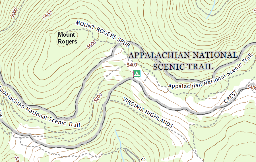
the Appalachian Trail skirts the summit of Mount Rogers, the highest point in Virginia
Source: US Geological Survey (USGS), Whitetop Mountain VA 1:24,000 topographic quadrangle (2019)
In Loudoun County, the Appalachian Trail crosses three major highways: Route 50 at Ashby Gap, Route 7 at Snickers Gap, and Route 9 at Keys Gap. The at-grade crossings are dangerous, and during the week traffic averages 27,000 cars/day. Pedestrian bridges to increase safety would require funding; a crossing over Route 7 is estimated to cost of $5-7 million.
During the peak hiking season, 500 hikers per day cross the four lanes of Route 7 where many vehicles are going 70-80 miles per hour. The Clarke County Administrator made clear in 2024 why a safer crossing is needed:5
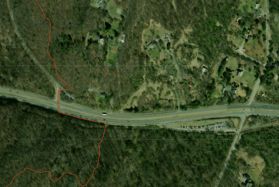
hikers on the Appalachian Trail must avoid cars going 70-80mph when crossing Route 7 at Snickers Gap (Clarke County)
Source: National Park Service, Appalachian National Scenic Trail (APPA) Interactive Webapp
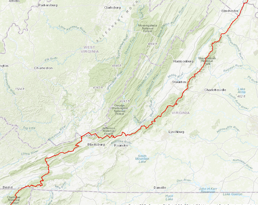
there are 554 miles of the Appalachian Trail in Virginia, more than in any other state
Source: National Park Service, Appalachian National Scenic Trail (APPA) Interactive Webapp