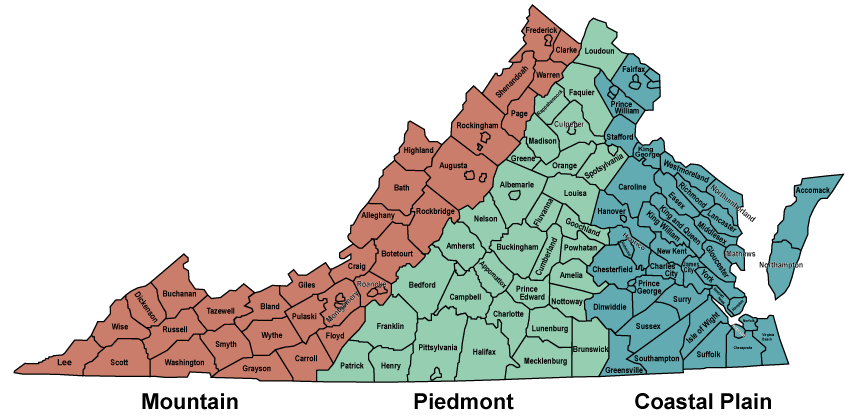
the Piedmont is west of the Coastal Plain
Source: Virginia Department of Conservation and Recreation, Natural Heritage
the Piedmont is west of the Coastal Plain
Source: Virginia Department of Conservation and Recreation, Natural Heritage
What makes the Piedmont a distinct region of Virginia?
Most Virginians living just east of the Blue Ridge would recognize the term. Piedmont originally referred to the equivalent area between the Alps and the Adriatic Sea in Northern Italy. There are other regions outside Virginia that are also "foothills," including the Arctic Foothills between the Brooks Range and the Arctic Ocean.
The name of the region (Piedmont="foot of mountain") provides a clue. Virginia's Piedmont ranges in elevation from 200 feet at the Fall Line to almost 1,000 feet at the base of the Blue Ridge. According to the Encyclopedia Brittanica, "piedmont" is a geologic term that means:1
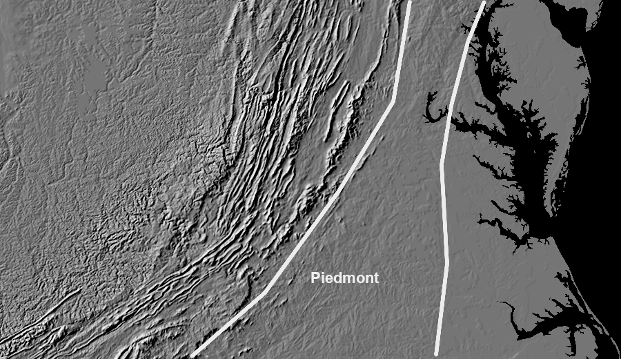
the Piedmont region lies between the Coastal Plain and the Blue Ridge
Source: US Geological Survey (USGS), Landforms of the Conterminous United States - A Digital Shaded-Relief Portrayal
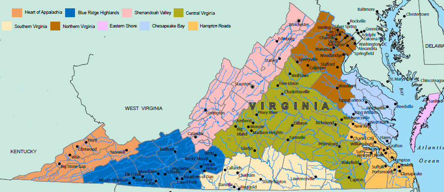
Going north-south, the Piedmont extends completely through Virginia east of the Blue Ridge. Culturally, the boundaries - or even the existence of the Piedmont as a distinct region - is less clear.
A "Northern Piedmont" cultural region could be identified as a triangle between Washington, DC, Richmond, and Charlottesville. Virginia's fastest-growing counties are the suburbs of those urban centers. Highways connecting those cities are one way to establish boundaries for the region - I-95 on the east, I-66 on the north, US Route 29 on the west, and I-64 on the south.
the 2007 Smithsonian Folkife Festival celebrated Virginia's cultural regions... and "Piedmont" was not one of them
Source: Smithsonian Institution, Roots of Virginia Culture
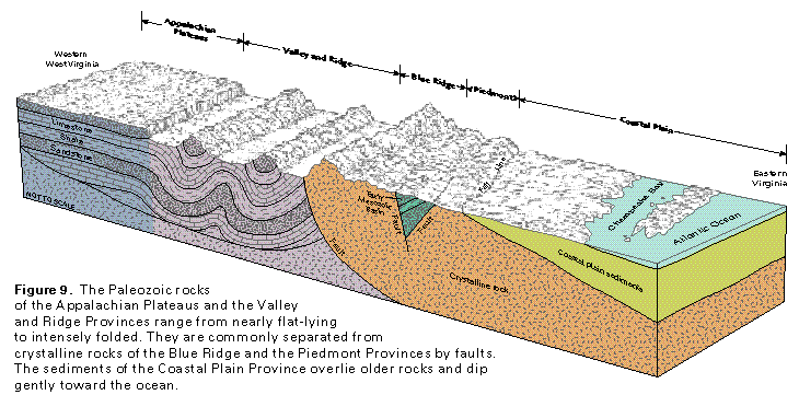
The eastern boundary of the Piedmont physiographic province is the Fall Line. The western boundary of the Piedmont is near the Blue Ridge mountains, but can be drawn in different locations. One could include within the Piedmont the gentle rise up to the base of the Blue Ridge, even though the bedrock geology changes around Route 29. West of Route 29 the bedrock is primarily basalt, unlike the metamorphic rocks to the east. However, the topography from Pantops Mountain at Charlottesville for almost 20 miles west past Crozet is very similar to the topography to the east.
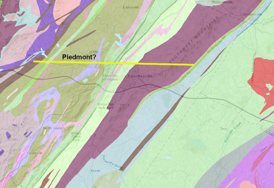
between the base of the Blue Ridge and Route 29, bedrock is associated with the Blue Ridge but topographic relief is similar to the Piedmont further east
Source: Virginia Department of Mines, Minerals and Energy
The Piedmont Environmental Council is active in the Blue Ridge counties from Loudoun south to Albemarle. The organization focuses on what it describes as the "Northern Piedmont." It does not have land officers active in Fairfax, Prince William or Stafford counties in northern Virgnia, or Fluvanna, Louisa, or Goochland counties further south. There is a land officer across the Blue Ridge in Clarke County, reflecting that jurisdiction's historical linkage to the east in contrast to Frederick County.
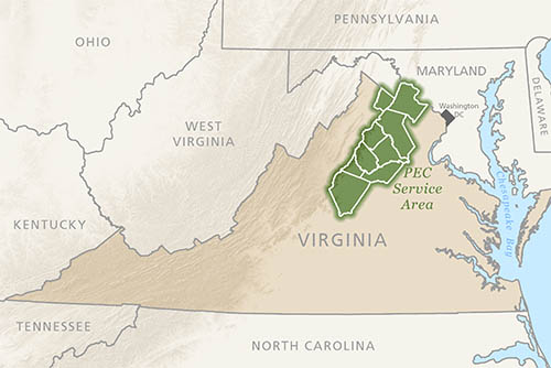
the Piedmont Environmental Council works north of Nelson County, with a focus on land conservation in the Blue Ridge and foothills to the east
Source: Piedmont Environmental Council, Our Region
The boundaries of the cultural region known as the Piedmont in Virginia do not coincide with the physical boundaries accepted by geologists and hydrologists. The volcanic lava of the Blue Ridge extends far enough to the east to lie underneath Warrenton and Charlottesville, but most Virginians would consider those communities to be in the Piedmont. Though Manassas, Fairfax City, and Falls Church are in the Piedmont physiographic province, those communities are most commonly considered to be part of Northern Virginia.
The Piedmont is composed, geologically, of a series of igneous and metamorphic rocks that were "smushed" onto the North American continent in a series of mountain-buildding collisions, primarily the Taconic and Alleghanian orogenies. Different terranes (chunks of rock) were added to the tectonic plate, expanding the size of what later was called Virginia. At the same time, the collisions compressed the bedrock which had accumulated earlier, piling up the limestone layers and reducing the width of "Virginia."
All the bedrock at the time of the orogenies was squeezed and baked; old geologic faults were reactivated and new ones were created. The August, 2011 earthquake occurred in the Choppawamsic Terrane, a former island arc of volcanoes that was compressed into North America when the Iapetus Ocean closed.
Groundwater within the Piedmont province moves through the faults and fractures in the bedrock. A drinking water well could produce just a few gallons per minute, or hundreds, depending upon whether it intercepted a fracture. In contrast, to the east in the Coastal Plain the groundwater moves through unconsolidated sediments.
South of the James River around Lynchburg, there are many businesses and government offices with "Piedmont" in their name. The foothills of the mountains south of the river are also described as being part of Southside Virginia (stretching south to Danville) or even "central" Virginia (stretching east to Richmond), cultural regions separate from "The Piedmont" north of the James River.
the Virginia Department of Health's "Piedmont Health District" is located south of the James River and east of Lynchburg
Source: Virginia Department of Health, Local Health Districts
The administrative boundaries of the Department of Environmental Quality regional offices are clearly not based on the physiographic boundaries of the Piedmont and Blue Ridge:
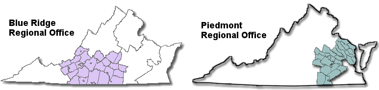
Piedmont/Blue Ridge regions of the Department of Environmental Quality
Source: Virginia Department of Environmental Quality (DEQ), Office Locations
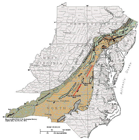
the Piedmont is east of the Blue Ridge
Source: US Geological Survey (USGS), Ground Water Atlas of the United States (Figure 60)