Carolina Road
Many of the early settlers moving to the cheap lands south of Virginia crossed to the east side of the Blue Ridge through the gap formed by the James River, or at Maggotty's Gap (between Roanoke and Boones Mill in Franklin County). They migrated into and through Southside Virginia, settling the lands east of the Blue Ridge prior to the American Revolution.
Some Scotch-Irish moved from the Shenandoah Valley to Southside, and then kept moving to more-distant frontiers as English settlement streched westward. For example, William Bean was in Augusta County in 1742, but four years later he was in Lunenburg... and in 1768, he may have been the first Englishman to settle in Tennessee.1
Morgan Bryan, a Pennsylvania Quaker, invested three months of his and his sons' labor to improve the trail over Maggotty Gap in 1748, before leading a group to found Bryan's Settlement on the Yadkin River. The Moravians used that same route on their trip from Pennsylvania to start what is now Winston-Salem, and in the late 1830's the Franklin Turnpike was constructed to connect Danville with Fincastle in Botetourt County. Daniel Boone's family followed that route to North Carolina, before he blazed the trail to Cumberland Gap and into Kentucky.2
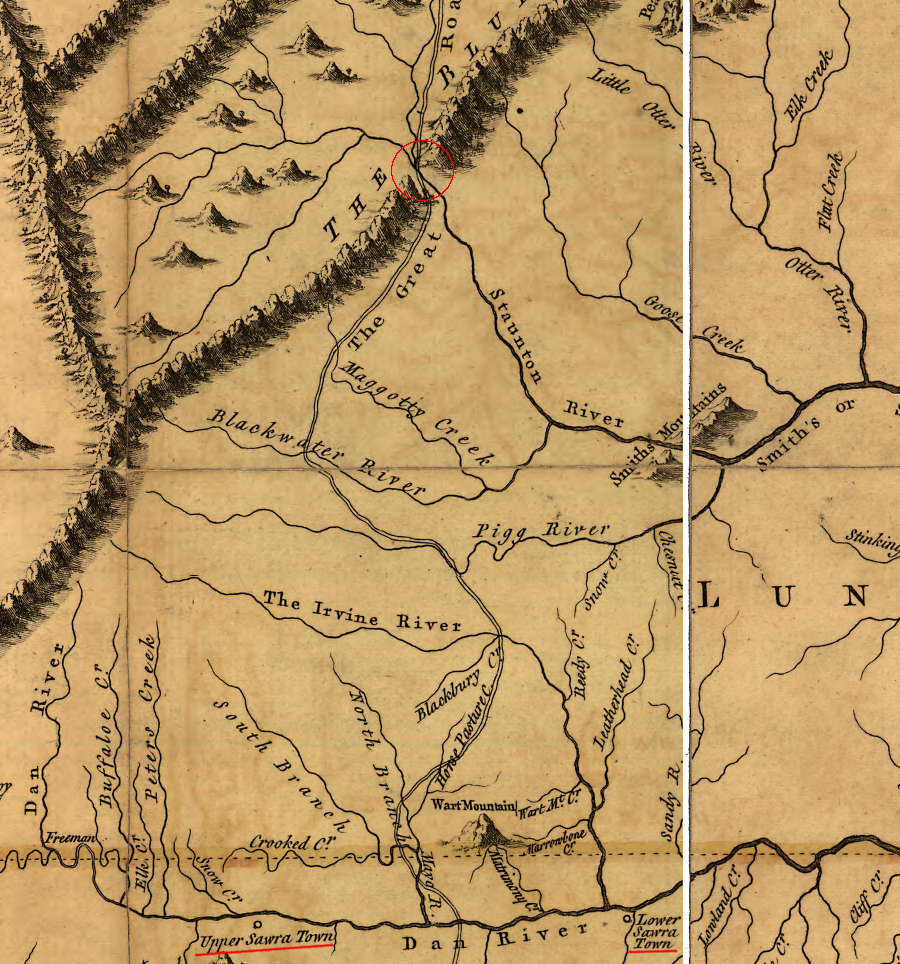
the path from the gap in the Blue Ridge cut by the Roanoke River to the Saura towns on the Dan River is now the route of US 220 from Roanoke to Martinsville
Source: Library of Congress, A map of the most inhabited part of Virginia containing the whole province of Maryland with part of Pensilvania, New Jersey and North Carolina (by Joshua Fry and Peter Jefferson, 1755)
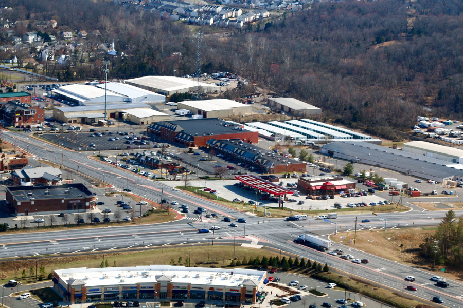
the modern equivalent of ordinaries/taverns at intersections of colonial roads is the gas station, such as the Sheetz in Haymarket (Prince William County)
Source: Historic Prince William, Sheetz at Rt. 15 and Rt. 55 - #287
Links
- The History of Loundoun County, Virginia
References
1. Thomas Perkins Abernethy, Three Virginia Frontiers, Peter Smith, Gloucester Massachusetts, 1962, p.52
2. Clement, Maud Carter, An Abbreviated History of Pittsylvania County, Virginia, c. 1952 www.victorianvilla.com/sims-mitchell/local/clement/mc/abb/05.htm (last checked April 7, 2002)
Paths, Trails, and Post Roads
Transportation: From Feet to Teleports
Virginia Places