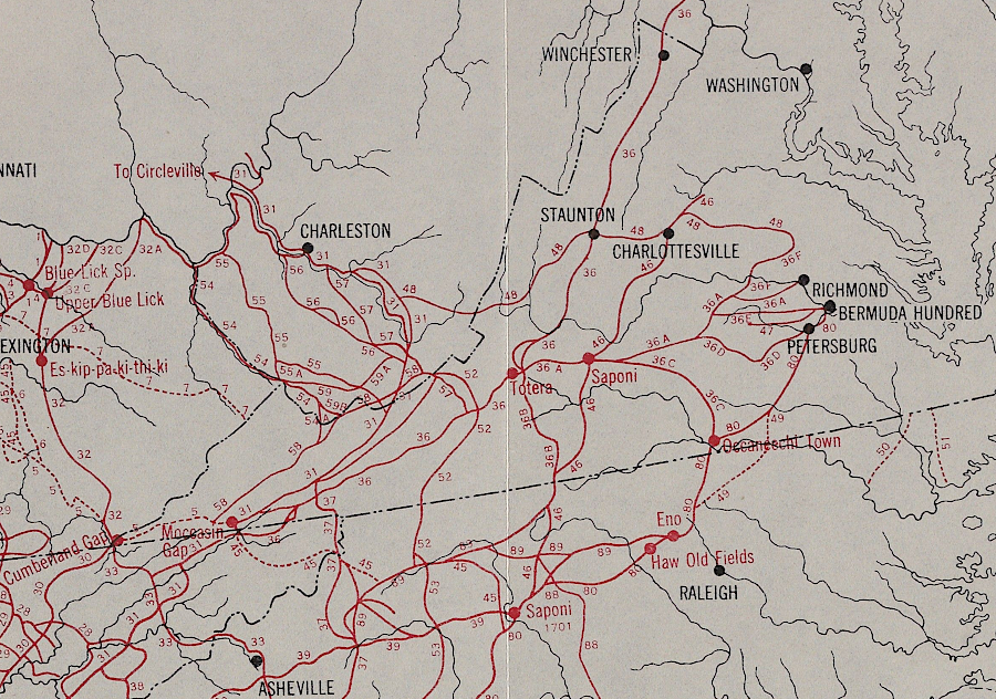
in the 1600's, the first European explorers discovered a network of pre-existing trails connecting Native American communities
Source: Yale University Library, Indian Trails of the Southeast (by William E. Myer, 1928)
in the 1600's, the first European explorers discovered a network of pre-existing trails connecting Native American communities
Source: Yale University Library, Indian Trails of the Southeast (by William E. Myer, 1928)
The first trails in Virginia were created by wildlife. At one point, dinosaurs established routes between places where they ate, drank, and slept. When the first Native Americans arrived, they followed paths created by migrating animals such as mammoth, mastodon, elk, bear, and bison. As he climate changed and the Eastern Deciduous Forest covered most of Virginia, deer became the primary creator of wildlife trails.
Native Americans engaged in long-distance trading for thousands of years before Europeans arrived. Prestige goods were traded between Virginia, the Great Lakes, and the Gulf of Mexico. Paths also provided connections between towns for local trade. People living along the Atlantic Ocean shoreline traded shells for desirable flint, chert, and other stone from the Piedmont and Blue Ridge. Since there were no horses in Virginia until the Spanish and then the English arrived, Native American traders had to carry their goods on their backs and walk from one town to another.
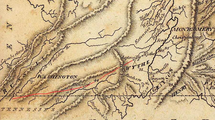
by the start of the 1800's, wagons could travel the Wilderness Road southwest of Austinville
Source: David Rumsey Map Collection, Virginia (by Samuel Lewis, 1804)
During the colonial era, the English established forts and designated them as the trading posts to exchange furs and hides for guns, ammunition, gunpowder, cloth, and other manufactured goods desired by the Native Americans. Fall Line forts became key nodes for the inland trading network. Some trading destinations evolved into towns; for example, Fort Henry on the Appomattox River led to the development of Petersburg.
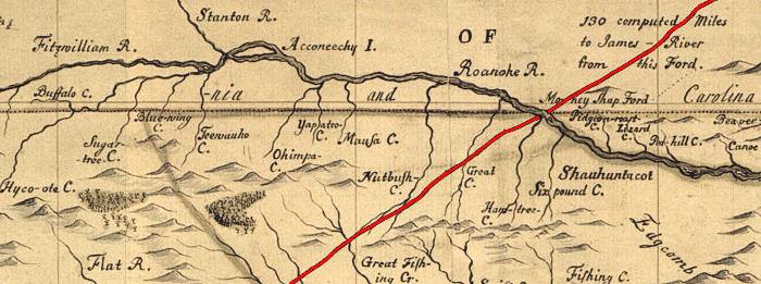
Occaneechee Trading Path, on a map produced by a North Carolina surveyor (who depicted the Fitzwilliam rather than the Dan river)
Source: NCPedia, Moseley manuscript map ("A New and Correct Map of the Province of North Carolina drawn from the Original of Colo. Mosely's")
The Europeans relied most heavily upon the rivers for long-distance travel for several decades. Transportation by water was traditional in England where, "because of heavily indented coastline, no location is more than 125 km from tidal waters."1
Initially, oxen rather than horses were used to pull carts.
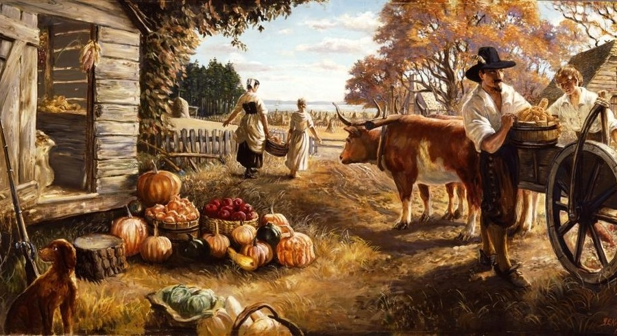
one ox-power carts were used for basic transportation in the initial colonial period
Source: National Park Service, An Autumn Harvest (Sidney King painting)
Once they explored inland, even when they did not have Native American guides assisting them, the Europeans followed the easiest routes: the existing trails. The driest trails between the Chesapeake shoreline and the Fall Line followed the watershed divides, the low ridges separating the Roanoke, James, Pamunkey, Mattaponi, Rappahannock, and Potomac rivers.
As settlement moved across the Fall Line, the plantation owners required better roads to transport grain to wharves for export to Europe. Road construction, except for bridges and ferries, was managed at the local level. County courts authorized local landowners to determine where public roads would go, and then required landowners to main the public roads that crossed their property. Most traffic was local, and the beneficiaries of the good roads were often the landowners required to maintain them.
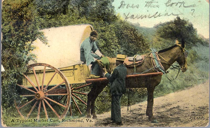
horse-drawn carts and dirt roads were a common sight around Richmond in 1911
Source: "Rarely Seen Richmond," Virginia Commonwealth University James Branch Cabell Library Special Collections and Archives, Typical Market Cart, Richmond, Va.
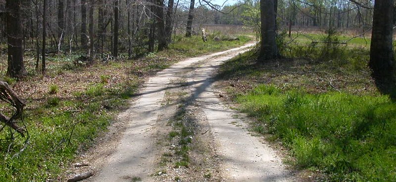
there are still unpaved dirt roads in Virginia (Surry County)
One farmer did not have a level road to transport his tobacco. Nicholas Taliaferro (pronounced "Toliver" in Virginia...) had to carry his crop to the Rappahannock River, and his address was Tottem-Down-Hill in Culpeper County.2
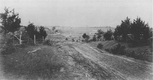
the road from Henry Hill to the Stone House on Manassas Battlefield
Source: National Park Service, "The Second Battle of Manassas," The Sudley-Manassas Road Looking North Toward The Warrenton Turnpike
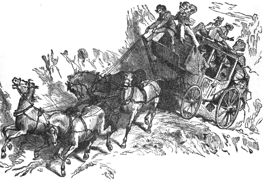
before there were car wrecks, there were wagon wrecks
Source: "The Chesapeake & Ohio Railway Directory, Containing an Illustrated History and Description of the Road," Pleasure (?) Travel in the Olden Time (p.298)
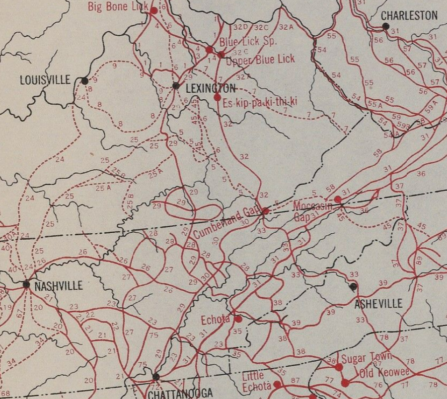
Native American trails used Cumberland Gap to link the Shawnee on the Ohio River to Cherokee on the Tennessee River
Source: Yale University, Indian trails of the Southeast (by William E. Myer, 1928)
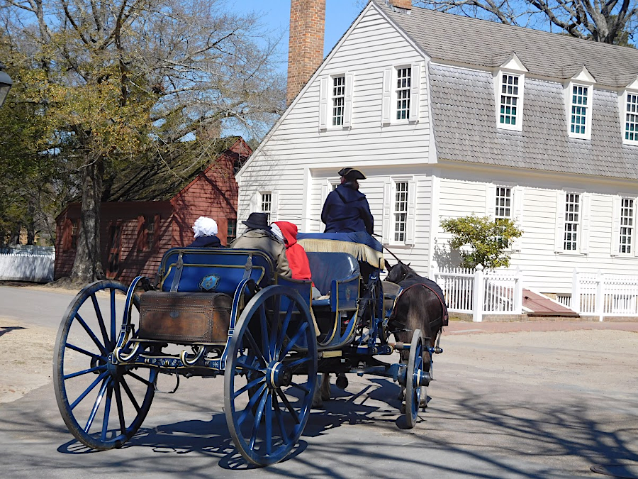
Colonial Williamsburg offers horse-drawn carriage rides for visitors seeking to experience the days before internal combustion engines
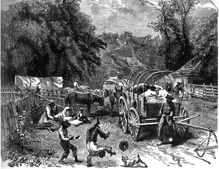
waggoneers on dirt roads were able to relax as well as work
Source: "The Chesapeake & Ohio Railway Directory, Containing an Illustrated History and Description of the Road," A Market Train of the Old Virginia Time (p.256)