the James River and Kanawha Canal competed against multiple railroads in Richmond
Source: Library of Congress, Map of the city of Richmond, Virginia (1864)
the James River and Kanawha Canal competed against multiple railroads in Richmond
Source: Library of Congress, Map of the city of Richmond, Virginia (1864)
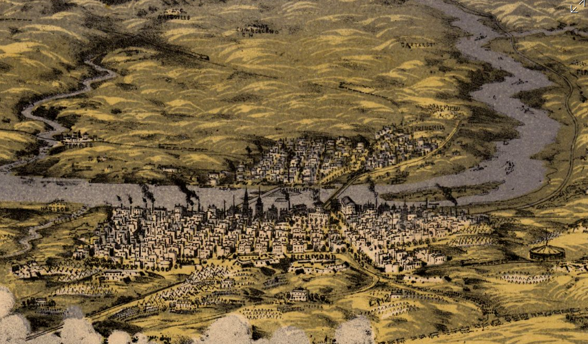
the James River & Kanawha Canal (on far right of graphic) allowed water transport downstream to the Fall Line, where goods were transferred to ocean-going ships at Richmond
Source: Library of Congress, Birds eye view of the seat of war around Richmond showing the battle of Chickahominy River, 29 June 1862
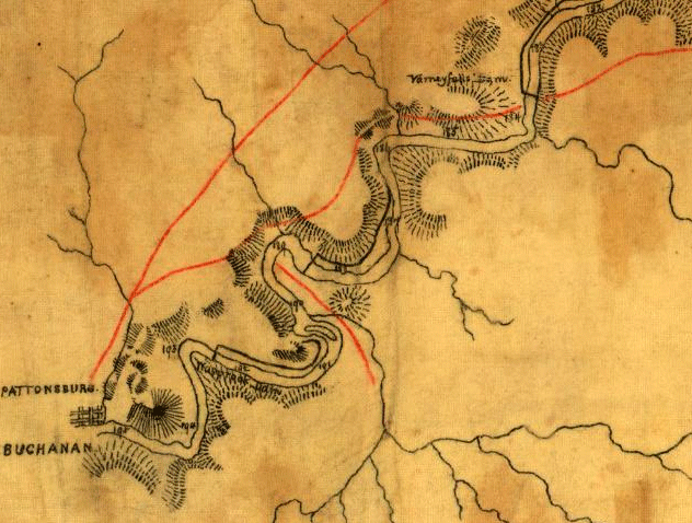
upstream end of the James River and Kanawha Canal at Buchanan, 1863
Source: Library of Congress, Map of the first & second division of the James River & Kanawha Canal
(Confederate States of America: Army, Dept. of Northern Virginia - Chief Engineer's Office, 1863)
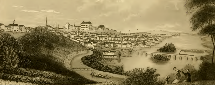
by the 1840's, the James River and Kanawha Canal made Richmond even more influential in the economics of the James River watershed
Source: Library of Congress, Richmond, from the hill above the waterworks (engraved by W.J. Bennett from a painting by G. Cooke, 1834)
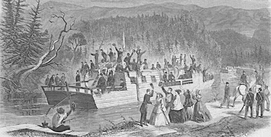
Confederate troops used the canal to go from Lynchburg to Buchanan in 1861
Source: Harpers Weekly, View on the James River Canal, Balcony Falls (September 28, 1861, p.616)
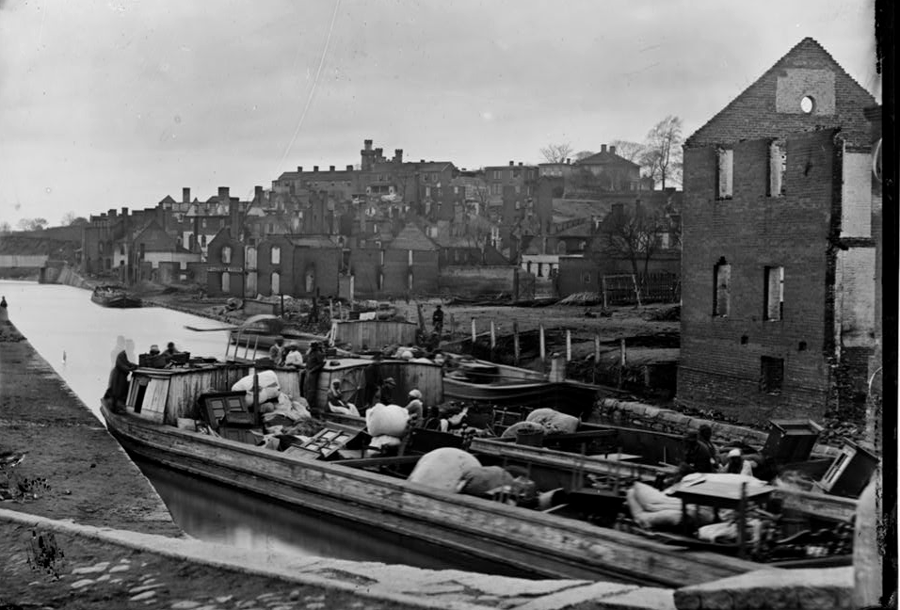
soon after the Evacuation Fire in April 1865, James River and Kanawha Canal boats were loaded and unloaded in Richmond, moving goods and people across the Fall Line
Source: Library of Congress, Richmond
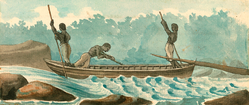
before completion of the James River and Kanawha Canal, slaves guided bateaux downstream with tobacco, flour, and other cargo to be sold in Richmond
Map Source: Library of Virginia, Three Slaves Steering a Bateau (by Benjamin Henry Latrobe, 1798)
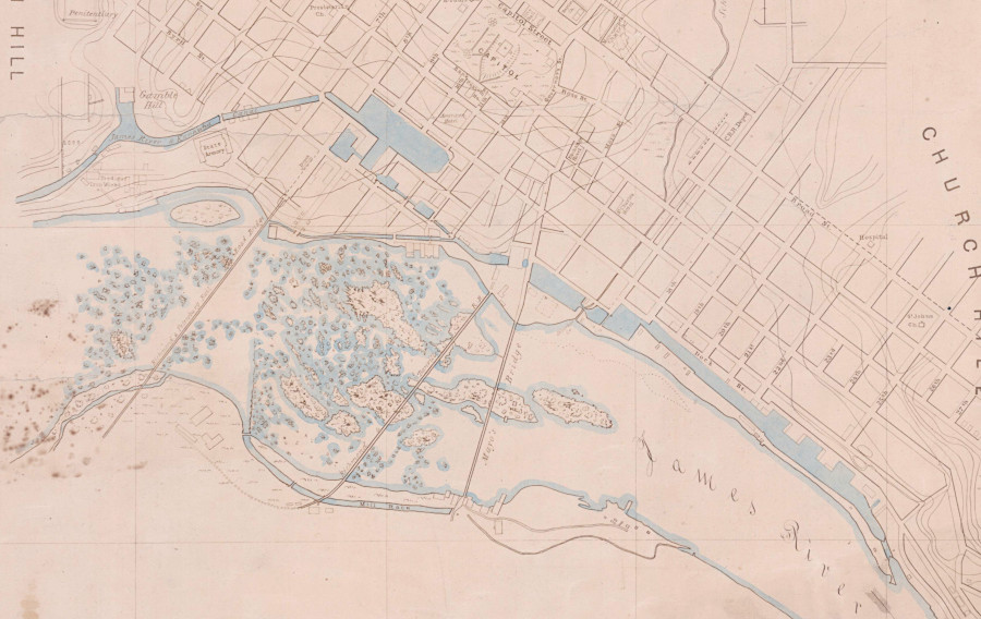
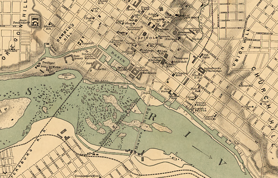
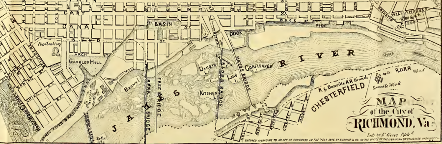
path of the James River and Kanawha Canal through Richmond before the Civil War
Source: National Archives, Map of City of Richmond, Virginia (1858)
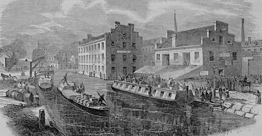
operations on the James River and Kanawha Canal restarted quickly after the Civil War
Source: Harper's Weekly, The James River and Kanawha canal, Richmond, Virginia (October 15, 1865)
the James River and Kanawha Canal linked the Shenandoah Valley to international shipping at Richmond
Source: Internet Archive, Sheriff's & Co. Richmond City Directory, 1876-77
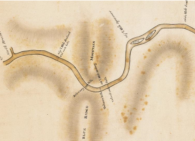
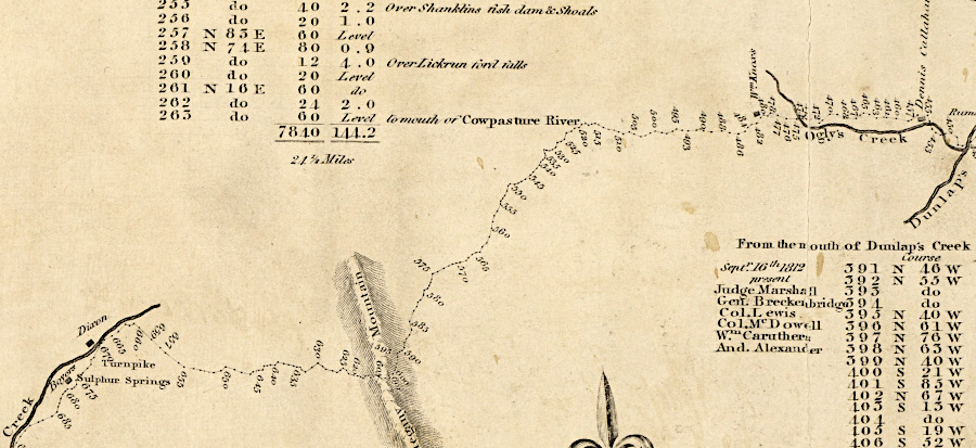
Balcony Falls, where James River passes through Blue Ridge
Source: Library of Virginia, Board of Public Works, A plan of James River from Lynchburg to the North Branch
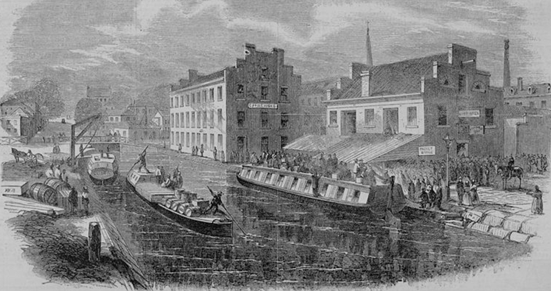
passenger and cargo boats on the James River and Kanawha Canal in Richmond
Source: Library of Congress, Harper's Weekly (October 1865)
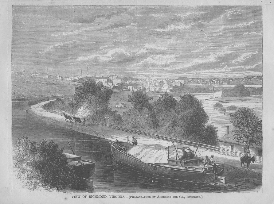
the James River and Kanawha Canal entered Richmond from the west, bringing business from the Piedmont and even west of the Blue Ridge to the Fall Line
Source: Harper's Weekly, View of Richmond, Virginia (May 14, 1870)
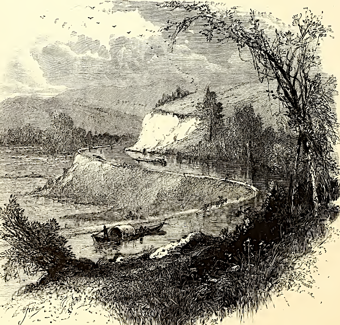
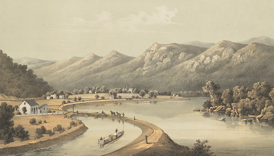
the James River and Kanawha Canal upstream of Richmond
Source: Picturesque America (1872)
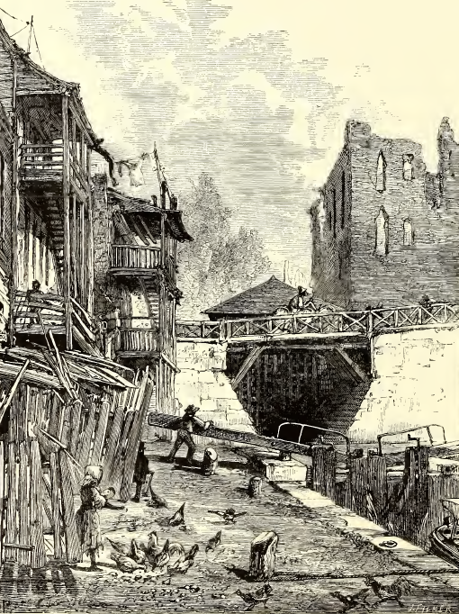
the James River and Kanawha Canal in Richmond
Source: Picturesque America (1872)
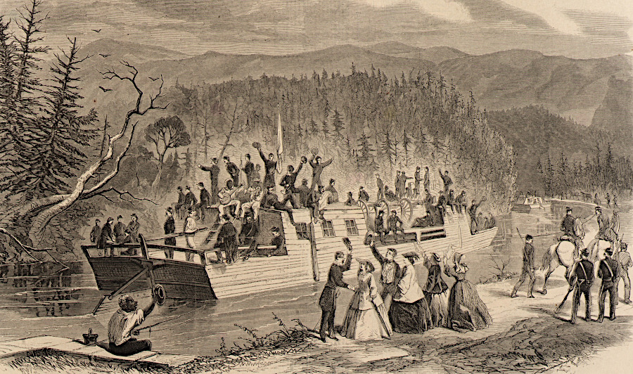
Confederate troops used the canal to travel west of Lynchburg in 1861
Source: Smithsonian Institution, View on the James River Canal, near Balcony Falls - Rebel Troops Going from Lynchburg to Buchanan, on Their Way to Western Virginia (Harper's Weekly, September 28, 1861)
the canal at the Maury River (current name)
Source: National Gallery of Art, James River Canal, Near the Mouth of the North River (1857)
a road was planned to connect the James River with the headwaters of the Kanawha River
Source: Library of Virginia, A survey of the headwaters of the James River and the Greenbrier, Jackson River and the Great Kenhawa or New River, and the high road between them (1814)
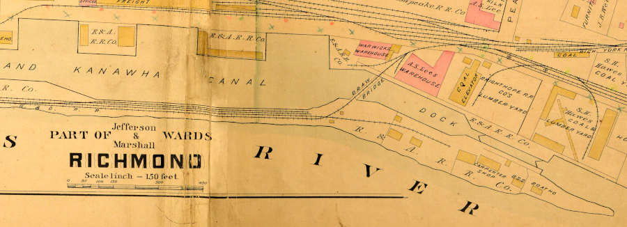
a dock downstream of the turning basin connected the canal to the James River near Rockett's Landing
Source: Baist Atlas of Richmond, VA, 08_Part of Jefferson & Marshall Wards Richmond (1889)
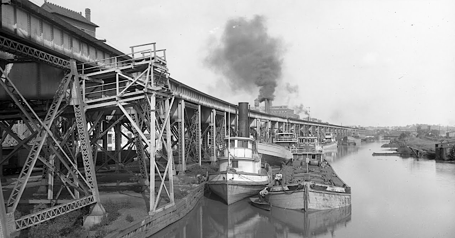
there were still boats on the canal in Richmond in the early 1900's
Source: Valentine Museum, Chesapeake & Ohio Train Trestle and James River and Kanawha Canal (on Google Arts and Culture)