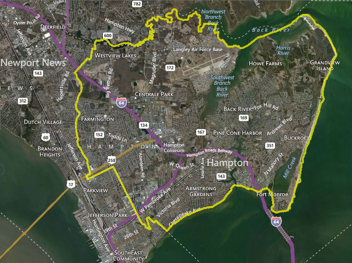
city boundaries - Hampton, Virginia
Source: City of Hampton, WebGIS Portal
city boundaries - Hampton, Virginia
Source: City of Hampton, WebGIS Portal
On April 30, 1607, English settlers stopped briefly at what they called the Strawberry Banks on the north bank near the mouth of the James River. Fresh strawberries were rich in Vitamin C, which the sailors and colonists welcomed after having no fresh vegetables during the long ocean voyage. The English also named their 1623 settlement at the mouth of the Piscataqua River (in modern New Hampshire) "Strawbery Banke," presumably for the same reason.
Several members of the local Kecoughtan tribe swam out to welcome the boats. Sailing ships were not unknown in Tidewater Virginia. Occasional visits by Spanish and previous English captains had provided opportunities for the Native Americans to acquire iron tools and prestige goods from sailors. The new arrivals were entertained in the town. Modern Hampton is built on the site of that town, which had 18 houses in 1607.
In 1607 the English did not occupy what King James II called in the colony's second charter "Point of Cape Comfort." The three ships sailed upstream, looking for a site less exposed to Spanish attack. They finally sailed back from Jamestown in 1609 to occupy the land where they envisioned strawberries growing. 1
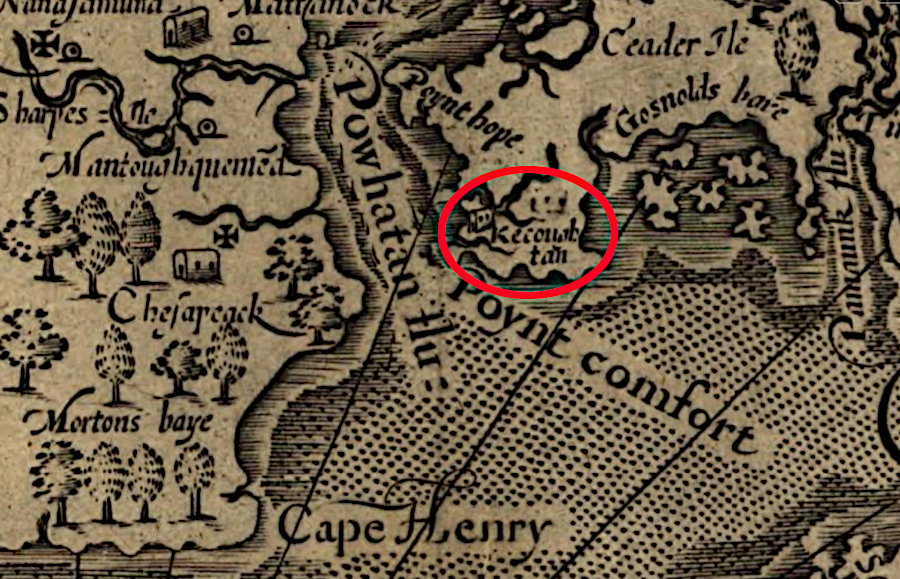
when the English arrrived in 1607, there was already a town at the site of Hampton
Source: Library of Congress, Virginia
Chief Powhatan had taken control of the Kecoughtan/Kikotan tribe a decade earlier. He installed his son Pochins as the weroance, incorporating the Kecoughtans into his paramount confederacy and extending his control over the territory of Tsenacomoco. What had been a population of around 1,000 was reduced to just 60 people by 1607.
The English displaced the Kecoughtans in 1610, killing nearly all of them, but the English were not the first to use military force to conquer the local residents. By 1616, 20 colonists had constructed houses and planted crops in fields previously cleared by the Kecoughtans. The town at Point Comfort was the first place where arriving ships would stop, including two vessels in 1619 which brought the first enslaved Africans to Virginia.
The town was known as Kicowtan until the first meeting of the General Assembly in 1619. The burgesses changed the name to Elizabeth City, honoring the daughter of King James I.2
The colonists built Fort Algernourne in 1609 near Point Comfort, likely on the Strawberry Banks. Moving some starving settlers away from Jamestown reduced the demand on the fort's food supplies, and may have reduced transmission of density-dependent disease. The fort also provided an early warning system of Spanish, Dutch, and pirate ships until being abandoned in 1667 after Charles II made peace with the Netherlands leader, William of Orange.
Sir Thomas Dale had Fort Charles and Fort Henry built near the mouth of the Hampton River in 1610.
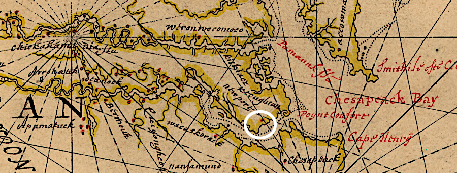
the forts at the mouth of the James River were isolated from Jamestown and the settlements upstream at Henricus
Source: Library of Congress, Map of Atlantic Coast of North America from the Chesapeake Bay to Florida (by Joan Vinckeboons, 1639?)
Elizabeth City was not attacked in the 1622 uprising, though settlers nearby on Mulberry Island were killed:3
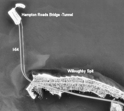
Fort George was built near the same site in 1727, and was washed away by a storm on October 19, 1749. A hurricane storm surge raised the level of Chesapeake Bay 15 feet, created Willoughby Spit at Norfolk, and washed away the fort's walls. The location of modern-day Hampton was buried under four feet of water. Today, I-64 has been reconfigured so it can be converted into a hurricane escape route. If necessary, all eastbound traffic can be stopped and those lanes used for westbound traffic inland to safety west of Williamsburg.4
The first gunshots fired between British and Virginia forces occurred at Hampton. On October 26–27, 1775, the British sought to regain a supply tender which had run aground during a storm and been seized by the colonists. After two days of fighting, the boat remained in the hands of the colonists. At least three of the British had been killed and several more wounded. The Virginia forces reported no casualties.5
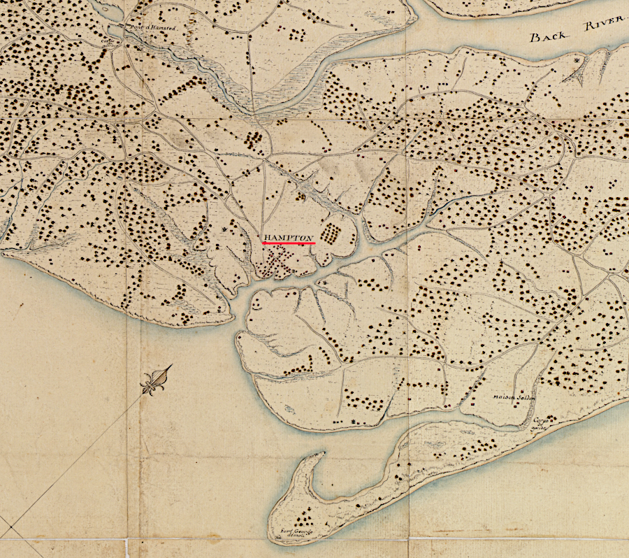
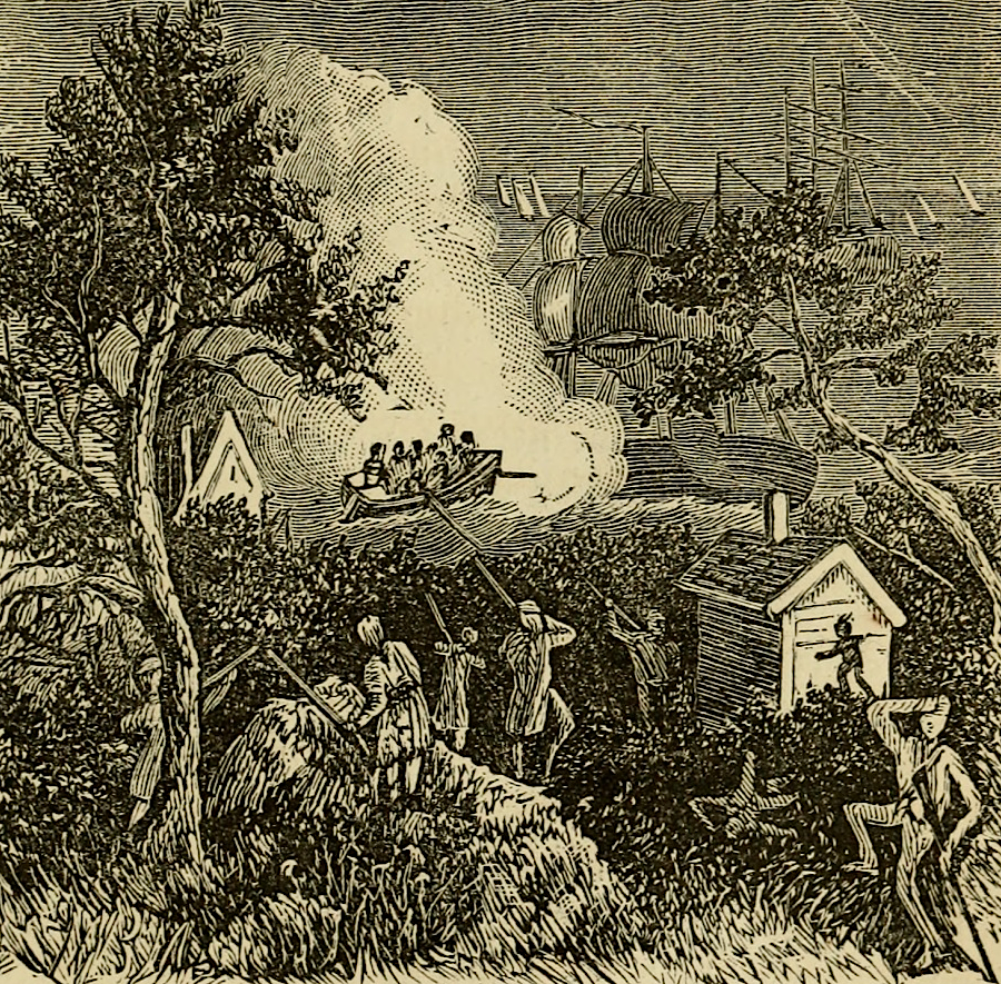
Hampton was the first place in Virginia attacked by the British in 1775
Source: Library of Congress, Carte des environs d'Hampton (1781); Mary Tucker Magill, History of Virginia, for the use of schools, 1873 (p.179)
Hampton was seized by British forces in the War of 1812, after the Americans on Craney Island successfully blocked the attempt to capture the Gosport Navy Yard on the Elizabeth River. The British behavior at Hampton generated American complaints about theft and rape.
The traditional American interpretation before the Civil War was that the British officers failed to exert appropriate discipline over poor-quality troops, and that the American slaves in Hampton were captured and forced to move to British-controlled islands rather than escaped to freedom:6
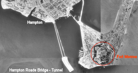
Following the War of 1812, the Federal government funded construction of seacoast fortifications. Fort Monroe was built at Point Comfort, on the eastern tip of the Peninsula. Enough rock was piled in top of a shoal in Hampton Roads to bring it above water, allowing construction of Fort Calhoun. That island fort was renamed Fort Wool in the Civil War.7
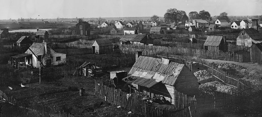
Hampton in 1864
Source: Library of Congress, Hampton, Va. View of the town
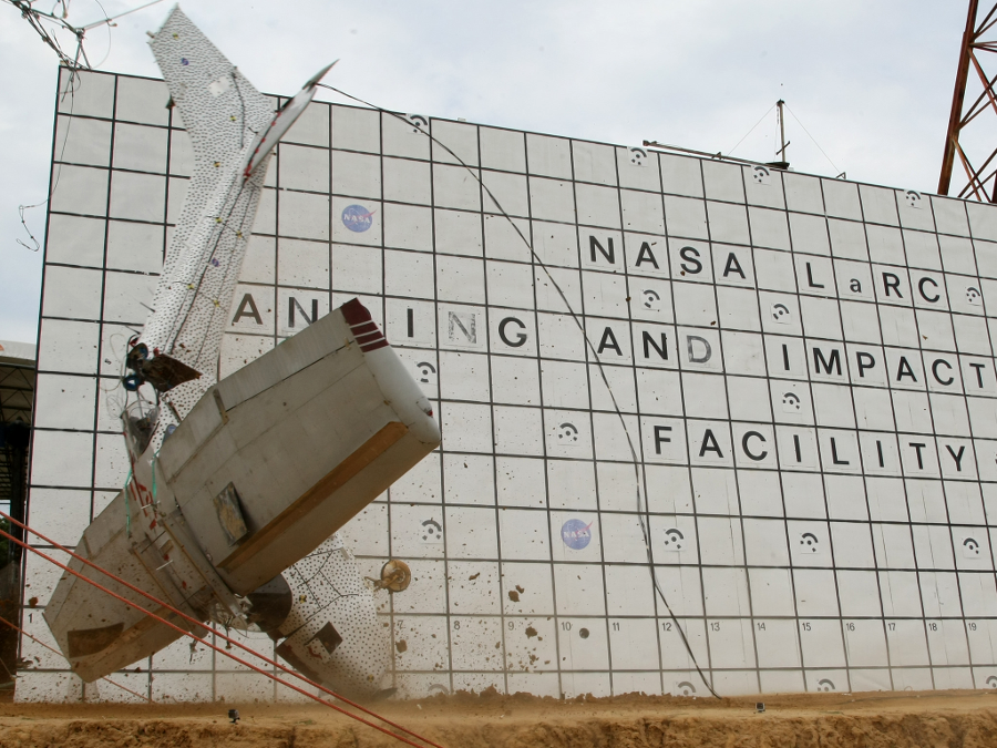
NASA conducts research on airplane technology and safety, including full-scale crash testing, at the Langley Research Center in Hampton
Source: National Aeronautics and Space Administration (NASA), Retired Aviator on Hand to Witness Drop Test of His Old Airplane
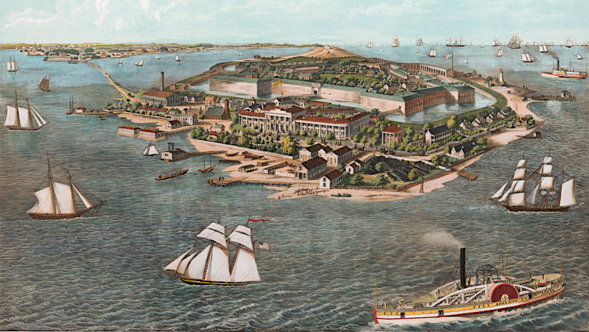
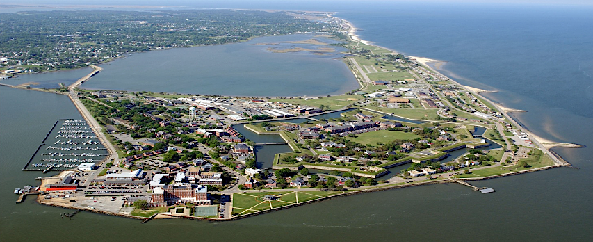
Fort Monroe is within the city limits of Hampton
Source: Library of Congress, Fortress Monroe, Old Point Comfort, and Hygeia Hotel, Va. (1853); US Army, Fort Monroe, VA Conveyance Progress Report
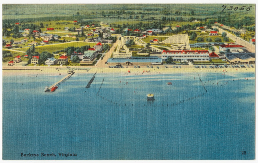
a 1930-1945 tourism postcard highlighted Buckroe Beach in Hampton
Source: Boston Public Library, Tichnor Brothers Postcard Collection, Buckroe Beach, Virginia

laying the cornerstone of the Soldier's Monument at Hampton, Virginia (October 8, 1867)
Source: Harper's Weekly (October 26, 1867, p.676)

in 1902, an electric rail line connected Hampton to Newport News
Source: Library of Congress, Map of Elizabeth City Co., Va. : from actual surveys by E.A. Semple, Wm. Ivy and C. Hubbard (1902)
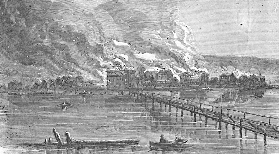
Confederate forces burned Hampton at the start of the Civil War
Source: Harper's Weekly (August 31, 1861, p.550)
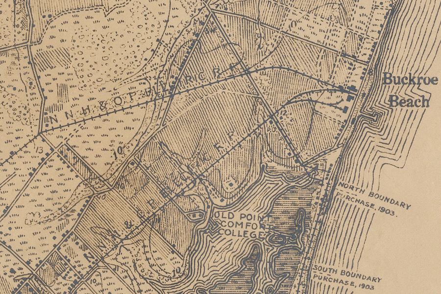
Buckroe Beach was a popular resort accessed by rail, before air conditioning became common
Source: US Geological Survey, Vicinity of Fort Monroe, peninsula between York and James Rivers, Virginia (1910-1911, Sheet 1)
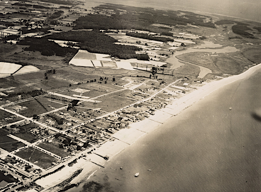
Buckroe Beach in 1920
Source: National Archives, Virginia - Blue Ridge Mountains through Cape Charles
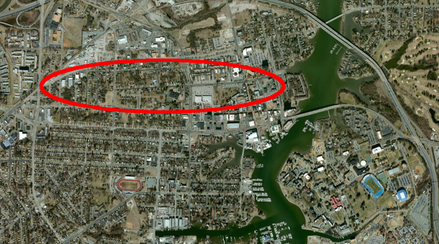
a major contraband camp was established in Hampton during the Civil War
Source: ESRI, ArcGIS Online
