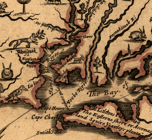
Norfolk's fine harbor was not the focal point of early colonial Virginia - John Farrer totally omitted the Elizabeth River (as shown in this 1667 version by his daughter)
Source: Library of Congress
Norfolk's fine harbor was not the focal point of early colonial Virginia - John Farrer totally omitted the Elizabeth River (as shown in this 1667 version by his daughter)
Source: Library of Congress
Before the English sailed into the Chesapeake Bay and named the Elizabeth River, there was a Native American settlement there. The Chesapeakes apparently were not subjugated or allied with Powhatan, though the reports by the leaders in the early days of Jamestown are contradictory.
In 1585, the Roanoke Colony settlers may have visited the Elizabeth River or Nansemond River watersheds. Those colonists then abandoned their attempt to settle permanently on the barrier islands, but leaders of the next effort planned to start anew on the south shore of the Chesapeake Bay.
Of course, that last batch of English colonists had their plans changed. In 1587 their ship captain dumped them back at Roanoke Island again, in order to have more time to attack Spanish ships. (Captains got a share of the profits in any Spanish shipping they could capture.)
There is speculation that the English in "lost colony" ended up, willingly or unwillingly, with Chesapeakes. Powhatan destroyed tribe around time arrived at Jamestown, and claimed to have remainder of Roanoke process, but no independent evidence residue - such as a collection iron tools weapons was even seen.
Powhatan may have "planted" his own town at the original homeland of the Chesapeakes after destroying them in 1607-08. There was plenty of protein in the brackish waters to support a large town there. Powhatan may have decided that he had to secure the fringes of Tsenacomoco (the area he controlled), while he coped with the intrusion of an alien people into the center of it.
Lots for the new town of Norfolk were surveyed in 1680-81. Among the early settlers were Henry Seawell, who lived there by 1629. Sewell's Point is named after him, though the letter "a" has been dropped. Thomas Lambert moved to the site now called Lamberts Point by 1635.1
William Byrd II visited Norfolk in 1728, on his way to survey the boundary between North Carolina and Virginia. The appointed commissioners for Virginia, plus surveyors and others hired to support the expedition, assembled at the Elizabeth River west of Norfolk.
Byrd reported that only the commissioners crossed the river to visit Norfolk, leaving the horses and most of the men behind "for fear of making a Famine in the Town." Norfolk was an active port, with enough visiting ships and sailors that Byrd's comment about available supplies probably reflected his over-the-top style more than reality.
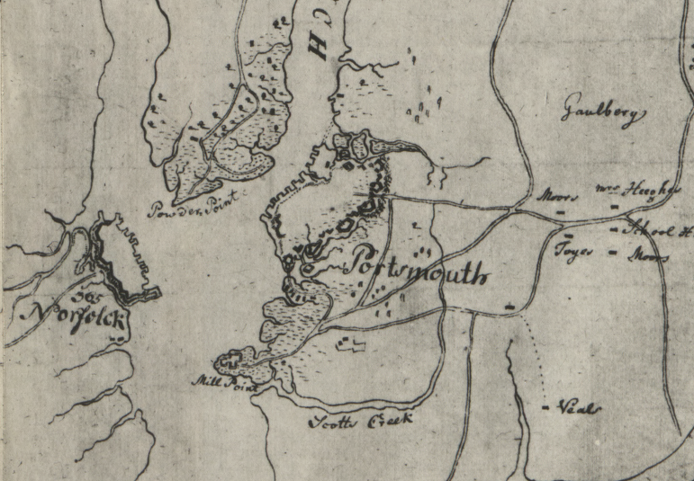
Portsmouth and Norfolk evolved on opposite sides of the Elizabeth River
Source: Library of Congress, Plan of Princess Ann and Norfolk counties (1780's)
He noted, perhaps more accurately, that the town was not dependent upon tobacco exports to England. Norfolk focused on trade with the Caribbean islands, and rum was a major import. Exports were local products, including food from hogs/cattle raised in Carolina and cedar shingles from the Dismal Swamp. Byrd, as a colonial official, was frustrated that no one bothered to purchase the timberland from the government in Williamsburg before cutting the trees:2
At the start of the American Revolution, Lord Dunmore sailed to Norfolk and loyalists took control of the town. Virginia "rebels" organized to block a reported plan of the loyalists to seize supplies from Suffolk. The two sides ended up confronting each other on opposite ends of the causeway at Great Bridge, with loyalists in control of the eastern edge and blocking any advance towards Norfolk.
The Americans may have arranged for a slave to "desert" and report that there were few armed opponents on the western edge of the causeway. For whatever reason, the British left the safety of their fortifications and attempted a head-on attack down the causeway. The Americans quickly killed or wounded the attackers. The British evacuated their position at Great Bridge, then moved out of Norfolk itself to safety on the ships in the harbor.
Unfortunately for the British, the ships were not safe. American riflemen hiding in buildings along the waterfront treated the ships as floating targets. In retaliation, on the night of January 1, 1776, British forces landed in Norfolk and set fire to the buildings that sheltered the sharpshooters.
The Americans may have facilitated the spread of the fire, ensuring that the town could not serve as a base for British troops or armed loyalists under Dunmore's command. There was some recognition on the American side that the destruction of Norfolk was partially due to American action, though 80 years after the event one historian gave credit to "patriotic" American property owners for choosing to destroy their own houses:3
The British report afterwards describe how the destruction started with the ships firing cannon to move the Americans away from the waterfront, allowing for the land assault to begin:4
The Virginia rebels burned the remaining houses at Norfolk a month later (there may have been 400 structures that survived the initial destruction), but Dunmore's fleet remained in the harbor. Patriots gradually forced loyalists out of Portsmouth and confiscated the shipyard, and the British finally sailed away to Gwynne's Island in May 1776. When British forces returned in 1780 to create a long-term base in Hampton Roads, they chose to occupy Portsmouth.5
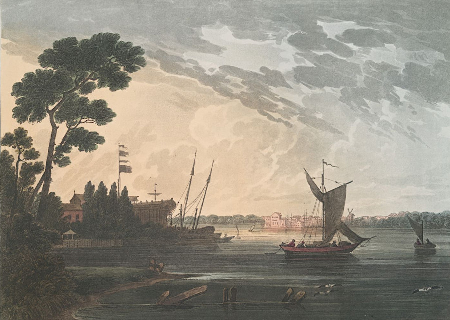
Gosport and Portsmouth were located across the Elizabeth River from Norfolk
Source: New York Public Library, Norfolk, from Gosport, Virginia (by Joshua Shaw, 1820)
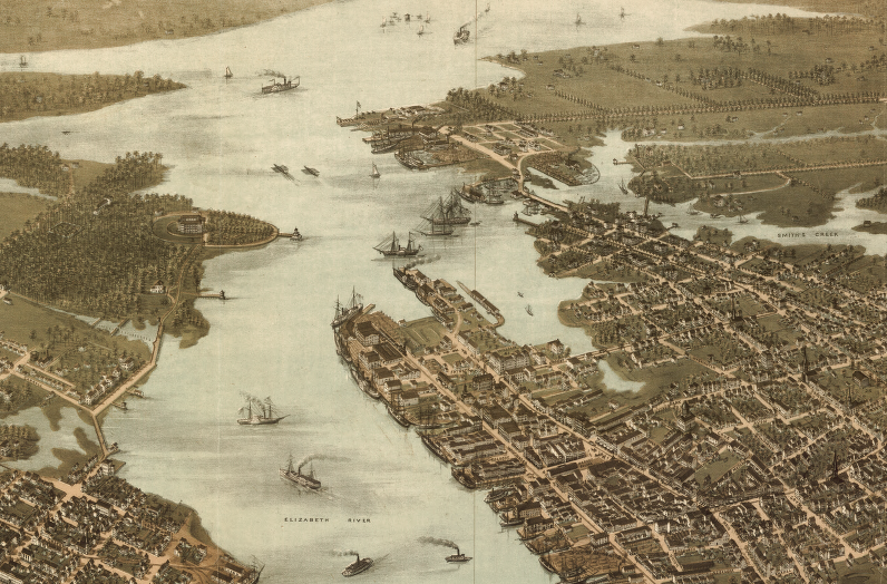
downtown Norfolk in 1873, when modern Boush Street near Town Point was still open water
(compare to modern vista on GoogleMaps)
Source: Library of Congress, Norfolk & Portsmouth, Virginia 1873
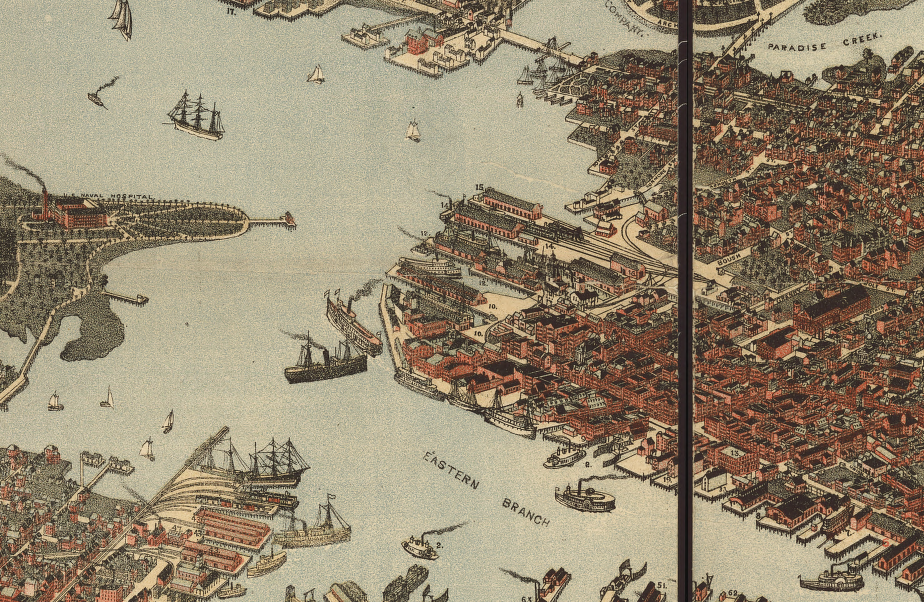
downtown Norfolk in 1891
(compare to modern vista on GoogleMaps)
Source: Library of Congress, Bird's eye view of Norfolk, Portsmouth and Berkley, Norfolk Co., Va
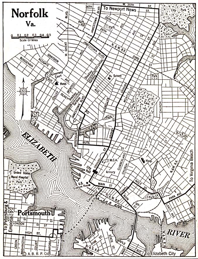
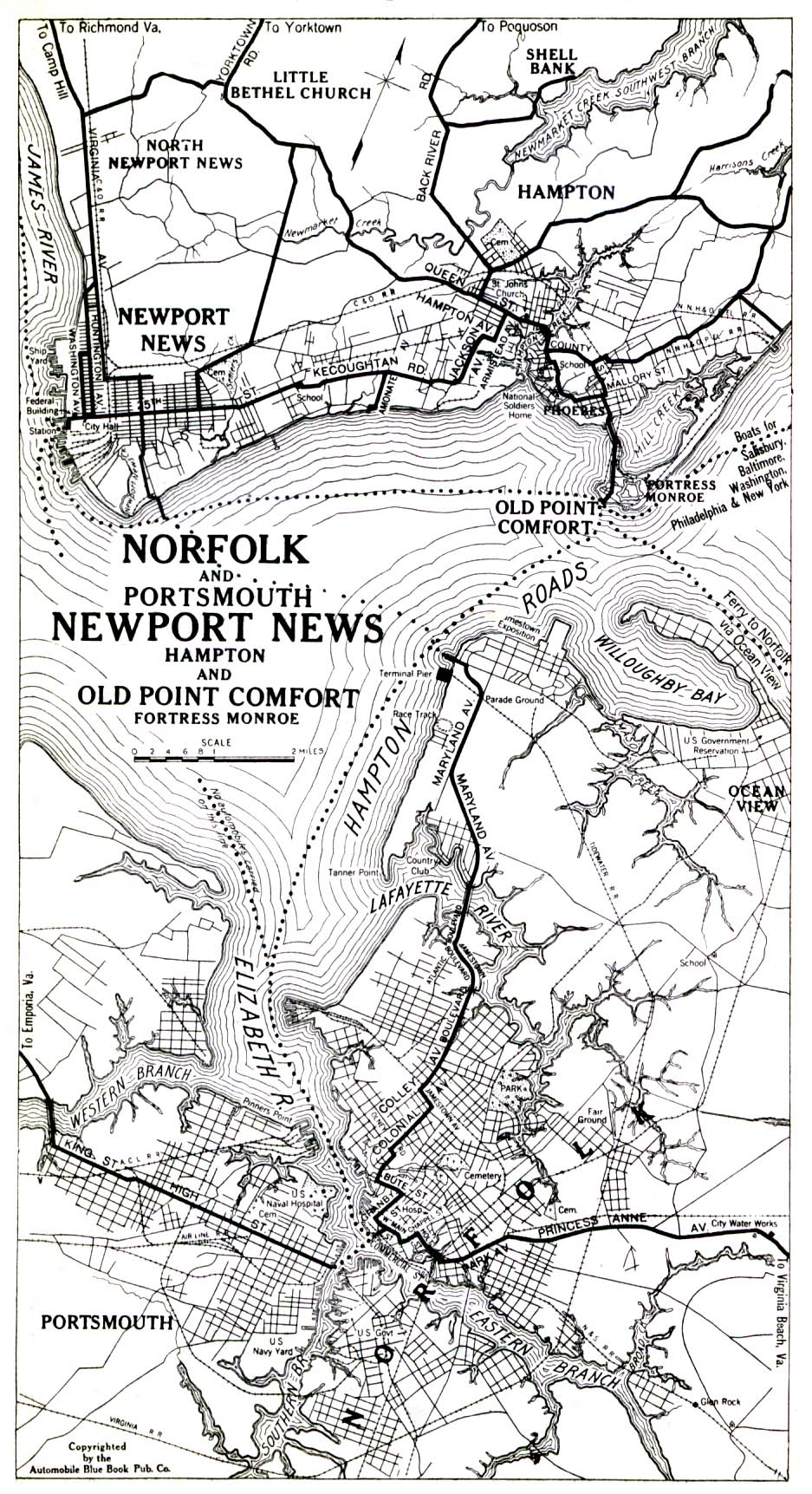
Norfolk is part of Hampton Roads. A century ago, it was the largest urban center in the region. After World War II, attempts by the city to annex more land from Princess Anne and Nansemond counties were blocked when those jurisdictions became independent cities. Since the 1950's, the primacy of Norfolk as the largest jurisdiction in the region has declined as the population of Virginia Beach, Chesapeake, and Suffolk have grown.
In 2017, Norfolk announced plans to expand its Scope arena, a competitive action as Virginia each was trying to arrange financing to build its own arena on the Oceanfront. Norfolk's mayor also floated a proposal to rebrand the city, emphasizing the "O" and "K" within the city's name. Negative responses, triggered in part because the mayor coordinated with no one before announcing his idea in a magazine interview, quickly sank that proposal.6

Mayor Kenny Alexander dropped his proposal for branding Norfolk almost immediately after he circulated it through an interview in Veer magazine
Source: Veer (December 17, 2017)
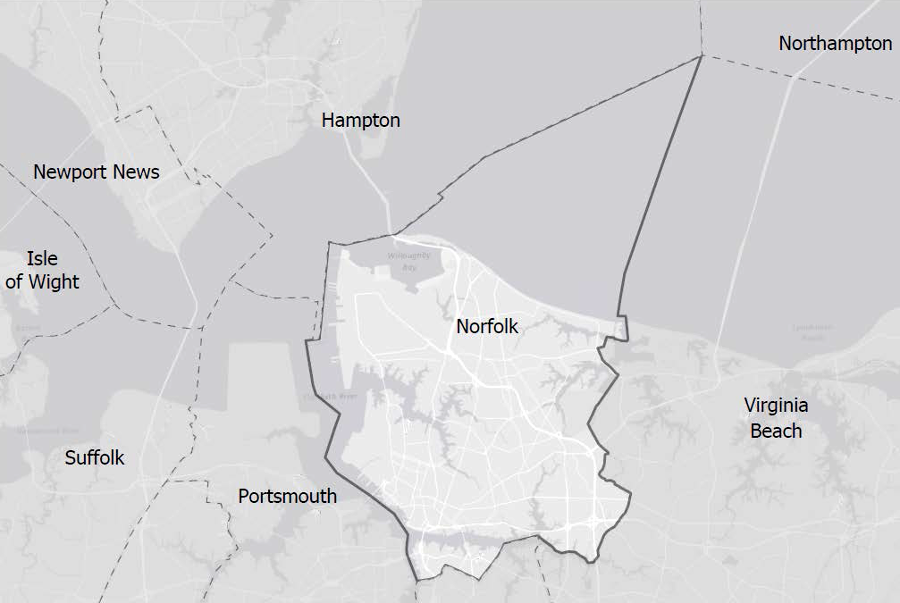
Norfolk's municipal boundaries extend beyond the shoreline into the Chesapeake Bay
Source: US Army Corps of Engineers, Draft Integrated City of Norfolk Coastal Storm Risk Management Feasibility Study / Environmental Impact Statement
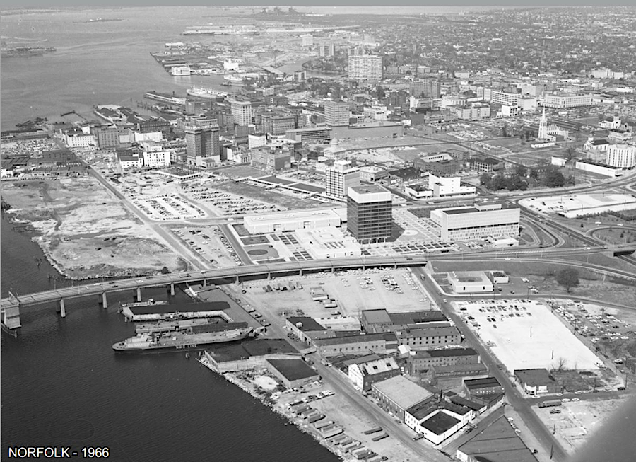
Norfolk waterfront on the Elizabeth River in 1966
Source: City of Norfolk, Photo Gallery
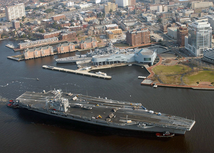
the battleship Wisconsin is permanently docked at the Nauticus science and technology center next to Town Point, but tourists in Norfolk often see operating warships in the harbor
Source: National Archives, An aerial view of the Norfolk Naval Shipyard located on the Elizabeth River. The nuclear-powered aircraft carrier USS GEORGE WASHGINGTON (CVN-73) is in the yard for a post-deployment overhaul. To the right of the GW is the decommissioned submarine tender HUNLEY (AS-31) and further to the right is the stripped down hull of the decommissioned guided missile cruiser VIRGINIA (CGN-38), 03/25/1995
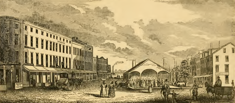
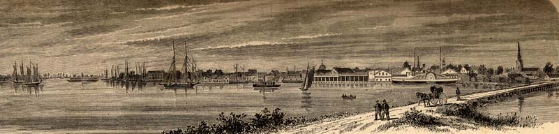
looking south past the market in Norfolk, across the harbor to the shoreline at Portsmouth in 1845
Source: Historical collections of Virginia, Market Square, Norfolk (p.393)
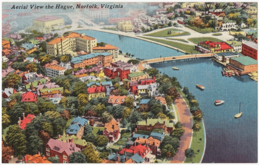
The Hague and Ghent neighborhoods are, like their namesakes, water-oriented neighborhoods
Source: Boston Public Library, Tichnor Brothers Postcard Collection, Aerial view the Hague, Norfolk, Virginia
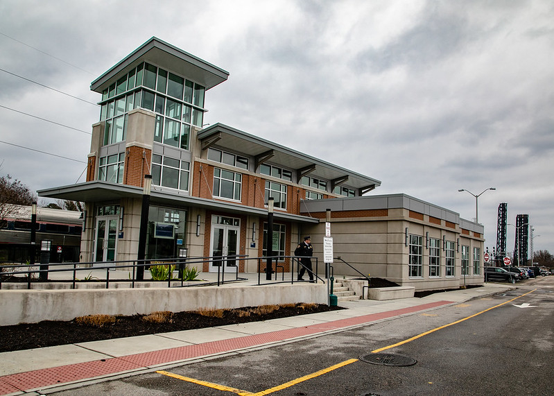
Norfolk's Amtrak station
Source: Virginia Department of Transportation, Second Train to Norfolk Celebration
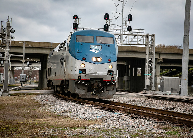
Amtrak arriving at Norfolk station
Source: Virginia Department of Transportation, Second Train to Norfolk Celebration
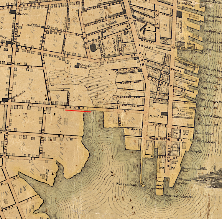
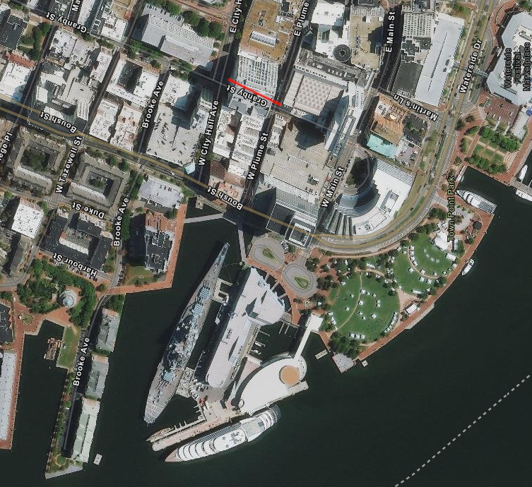
the stream that once reached past Granby Street in the mid-1800's have been filled in today
Source: Library of Congress, Map of the city of Norfolk and the town of Portsmouth (by Kelly James, 1851) and ESRI, ArcGIS Online
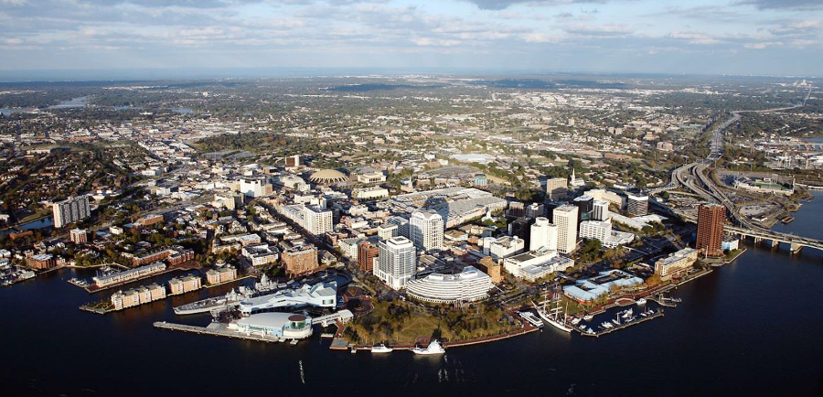
Norfolk's downtown lies along the Elizabeth River
Source: US Army Corps of Engineers, Draft Integrated City of Norfolk Coastal Storm Risk Management Feasibility Study / Environmental Impact Statement
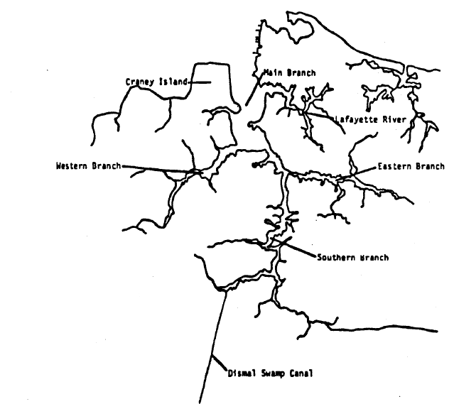
tributaries of the Elizabeth River
Source: Virginia State Water Control Board, Elizabeth River 205(j) Water Quality Plan (Figure 1)
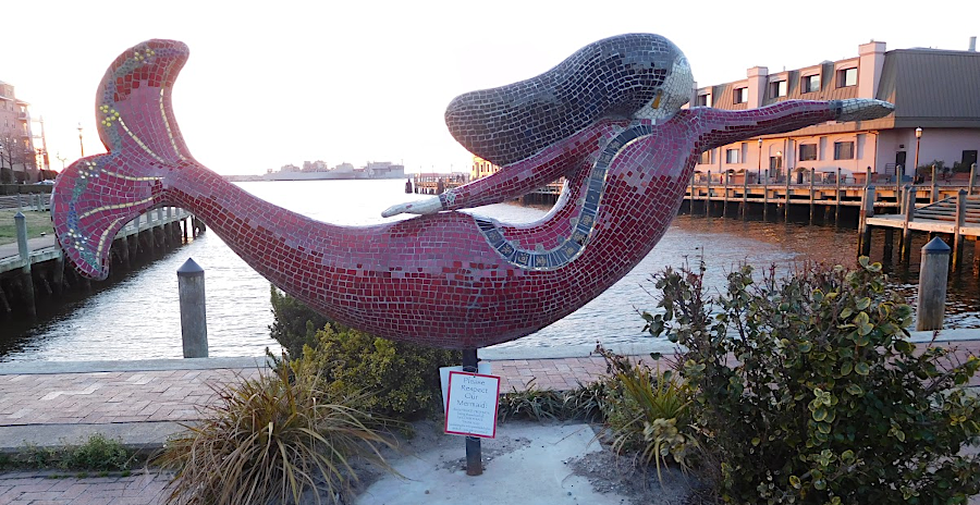
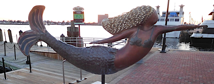
since the Mermaids on Parade event in 2002, Norfolk had adopted mermaids as the city's signature symbol
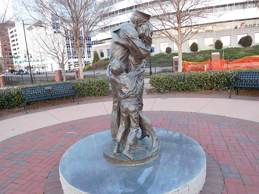
Norfolk honors its naval heritage with a statue of a sailor returning home
Norfolk grew because it was a port city
Source: University of North Carolina, The Great South; A Record of Journeys in Louisiana, Texas, the Indian Territory, Missouri, Arkansas, Mississippi, Alabama, Georgia, Florida, South Carolina, North Carolina, Kentucky, Tennessee, Virginia, West Virginia, and Maryland (1875)
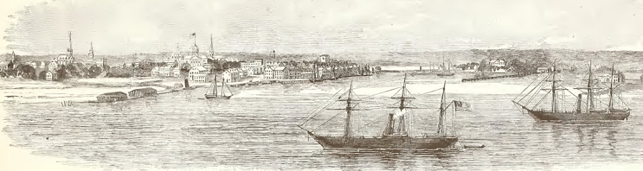
President Lincoln initiated the capture of Norfolk by the Union army during the Peninsula Campaign
Source: Frank Leslie's Illustrated History of the Civil War, Occupation of Norfolk VA By the Federal Troops - View of the City - Federal Vessels at Anchor (p.203)
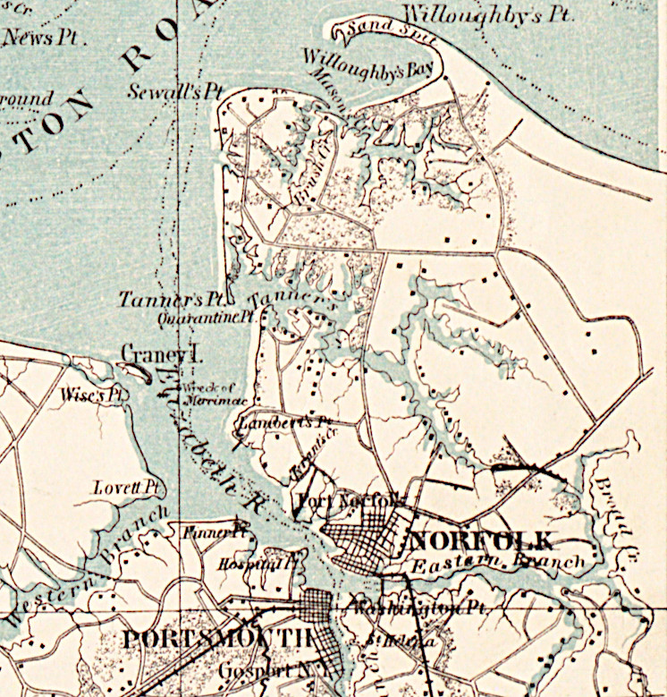
by the time of the Civil War, Norfolk still did not extend to Lammberts Point
Source: Norman B. Leventhal Map & Education Center Collection, Military map of south-eastern Virginia (c.1862)
Harrison Opera House in Ghent
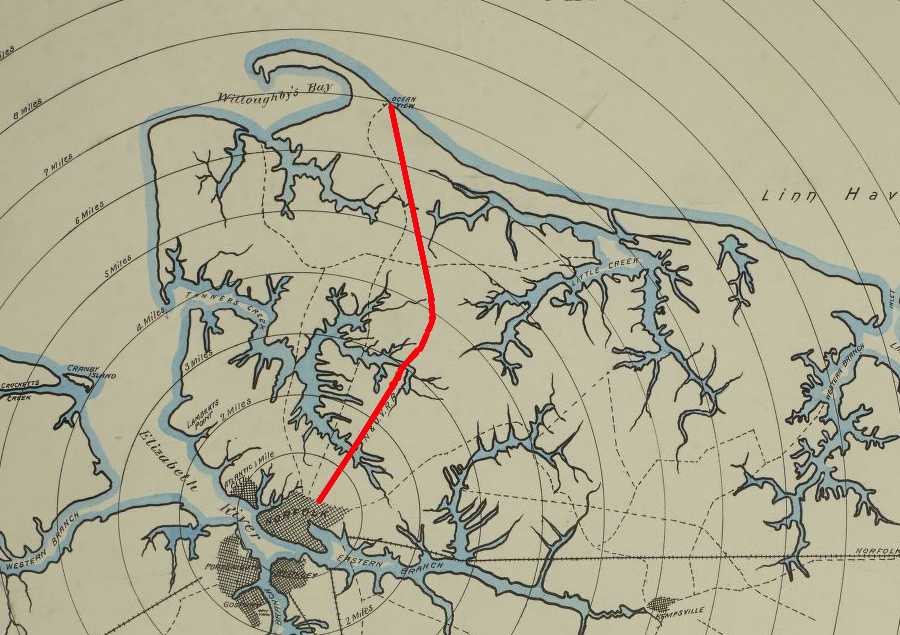
the Norfolk and Ocean View Railroad took tourists to the vacation destination of Ocean View on Willoughby Spit
Source: Library of Congress, Sanborn Fire Insurance Map from Norfolk, Independent Cities, Virginia (Sanborn Map Company, 1887)
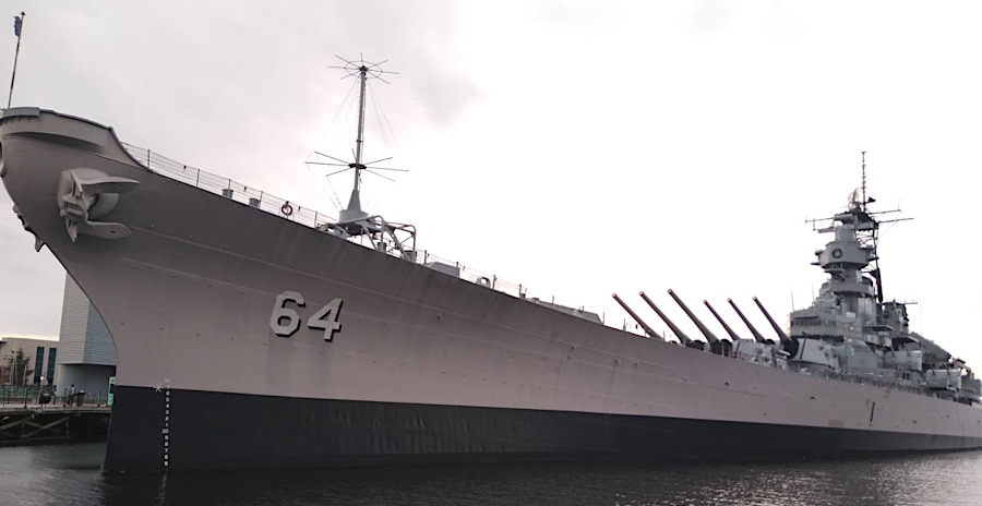
the USS Wisconsin is berthed now next to Nauticus at Town Point

the USS Wisconsin is a major tourist attraction on Norfolk's waterfront
Source: Watts, 2016 Norfolk Harborfest USS Wisconsin Battleship Navy ship
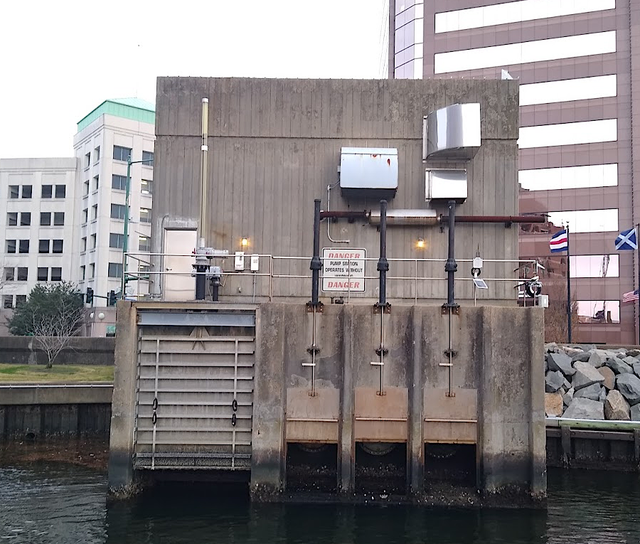
a pump station to manage floodwaters is on the Norfolk waterfront, next to the USS Wisconsin
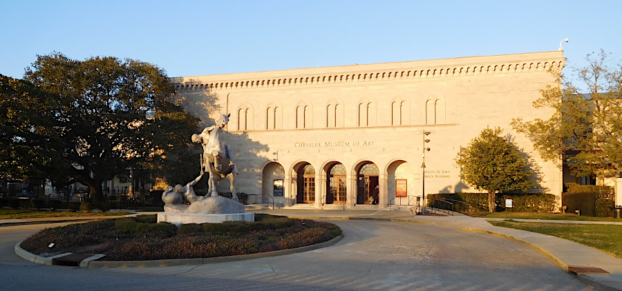
Chrysler Museum of Art in the Ghent neighborhood is at risk of flooding as sea level rises


the parade of tall ships on the Elizabeth River during Norfolk's Harborfest is a reminder of the days of sailing ships
Source: Watts, 2016 Harborfest Norfolk Va.; 2016 Norfolk Harborfest Virginia tall ship parade
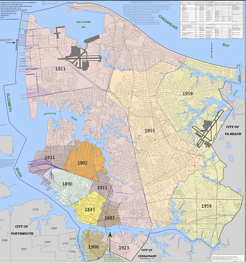
boundaries of Norfolk expanded through annexation between 1845-1959
Source: City of Norfolk, Map Gallery