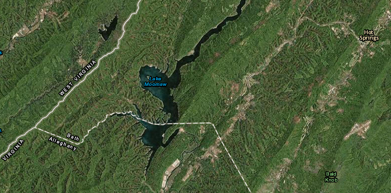
Gathright Dam blocked the free-flowing Jackson River and created Lake Moomaw in 1982
Source: ESRI, ArcGIS Online
Gathright Dam blocked the free-flowing Jackson River and created Lake Moomaw in 1982
Source: ESRI, ArcGIS Online
Lake Moomaw is a 12-mile stretch of the Jackson River, converted from a fast-flowing mountain stream into a slackwater lake when the US Army Corps of Engineers completed Gathright Dam in 1979.
Just downstream of Lake Moomaw, access to the Jackson River is limited by Kings Grant ownership claims of landowners. The Jackson River is navigable, so normally the state would own titles to the riverbed below the Mean Water Line and the Virginia Marine Resources Commission would be the responsible state agency for managing that land.
Some landowners adjacent to the Jackson River claim that the riverbed below Mean Low Water is their private property. Grants issued in colonial time, before the state of Virginia was created in 1776, may supercede the state's claim that the state owns the submerged lands underneath navigable rivers according to the Public Trust Doctrine.
In 1996, the Virginia Supreme Court decided in Kraft v. Burr that four riparian landowners could block the public from walking on the riverbank from .75 mile below the dam to Johnson Springs. The landowners could trace their chain of title back to colonial deeds isssued by King George II in 1750 and 1769, and the court ruled the grant included the submerged lands underneath the river as well as the property above the Mean Water Land. Other landowners cite a grant issued in 1743 by King Charles I, and public access to the Jackson River below Gathright Dam remains confusing.1
Before the private property/public access lawsuits, the Virginia Department of Game and Inland Fisheries had established a cold-water trout fishery on the Jackson River below the dam. That initiative was part of the mitigation for the environmental impacts of building the dam.
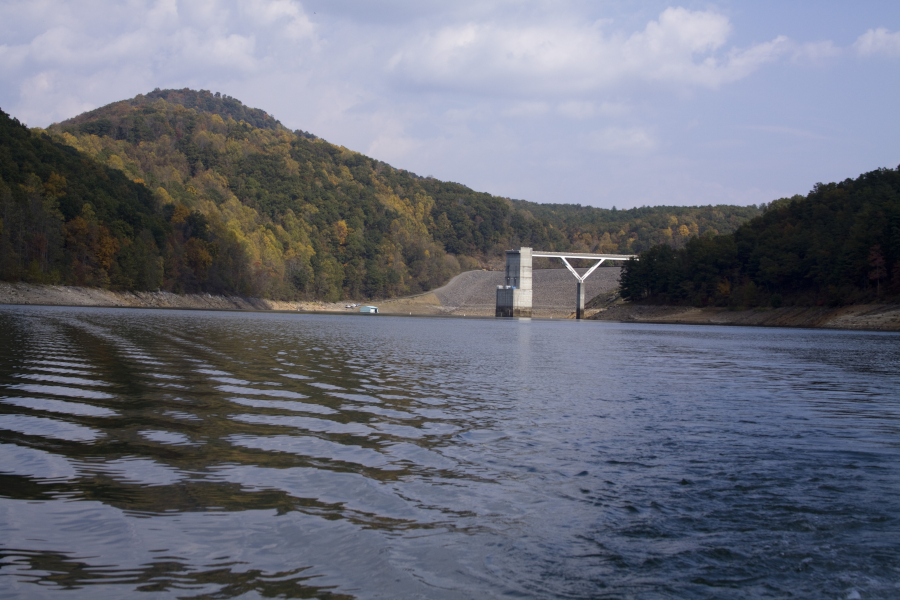
The river would normally provide limited habitat for trout, since low flows during the hot summer months would result in water temperatures too high for trout. Lake Moomaw averages 80 feet in depth, with a maximum depth of 150 feet at Gathright Dam, and the state and Federal agencies recognized that water drawn from the depths could provide a steady supply of cold water for trout downstream.2
After the lawsuits blocked public access, the Virginia Department of Game and Inland Fisheries stopped stocking trout.
Gathright Dam was constructed by the US Army Corps of Engineers
Source: US Army Corps of Engineers, Norfolk District Image Gallery
Gathright Dam
Source: US Army Corps of Engineers, Norfolk District Image Gallery
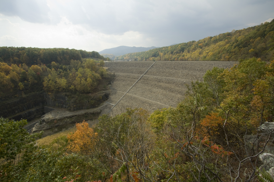
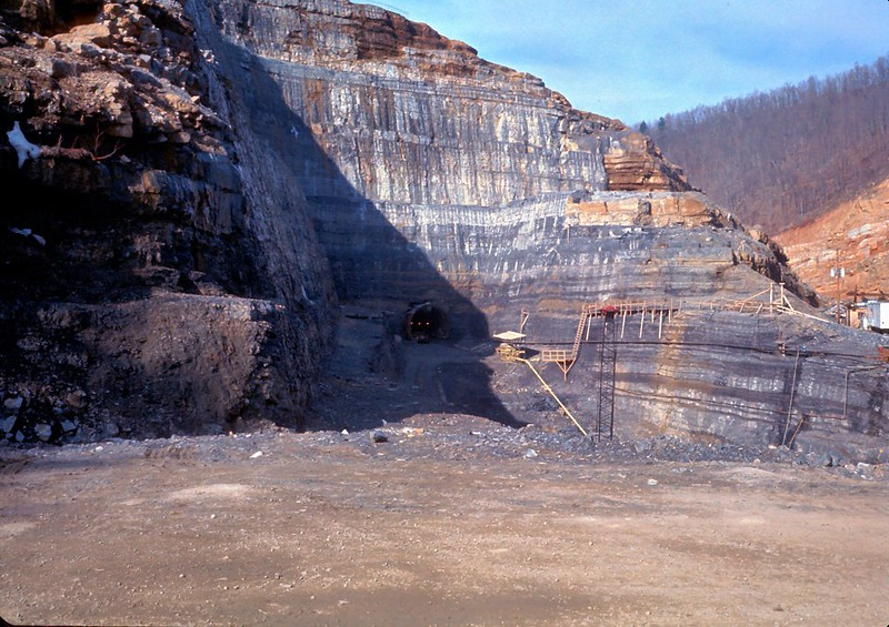
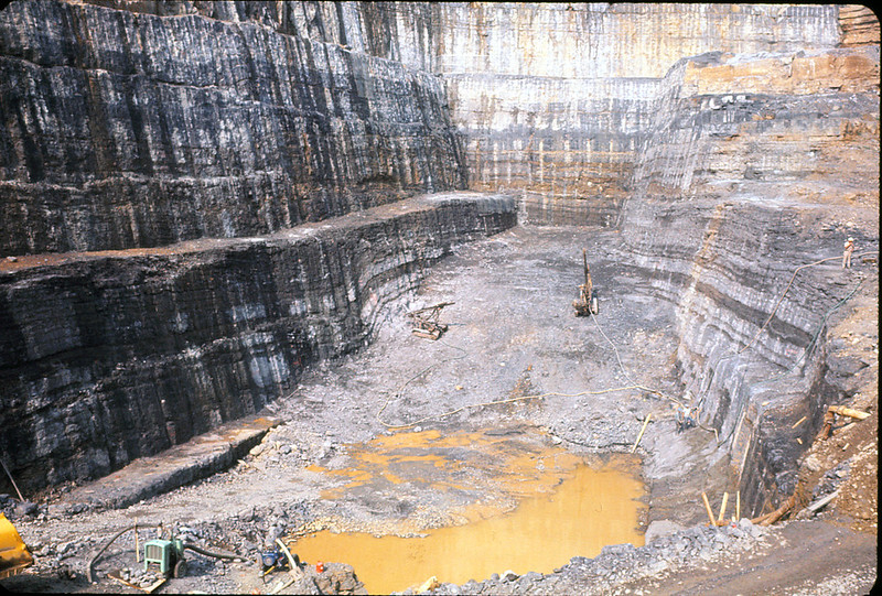
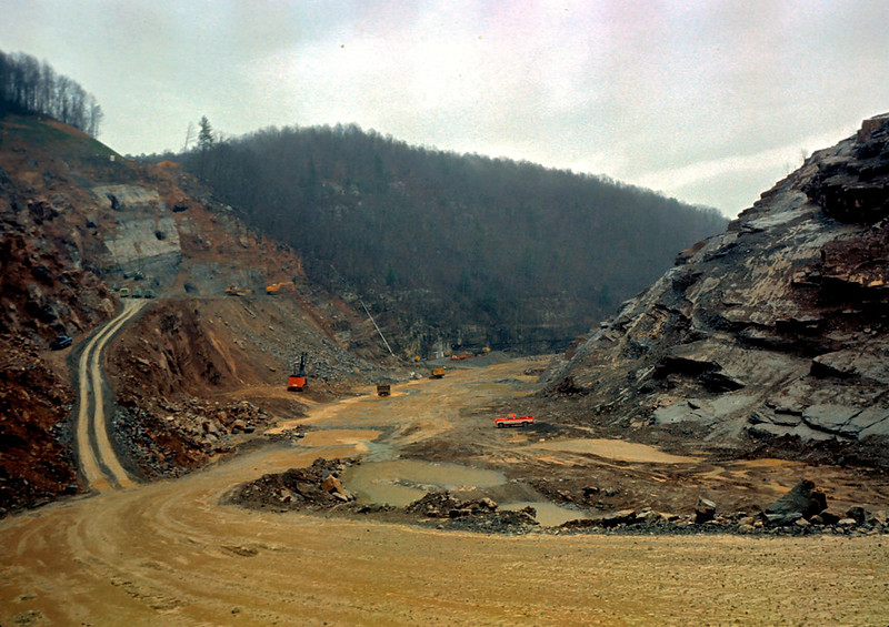
Gathright Dam, constructed between 1975-79, by the US Army Corps of Engineers
Source: US Army Corps of Engineers, Gathright Dam Construction - 1
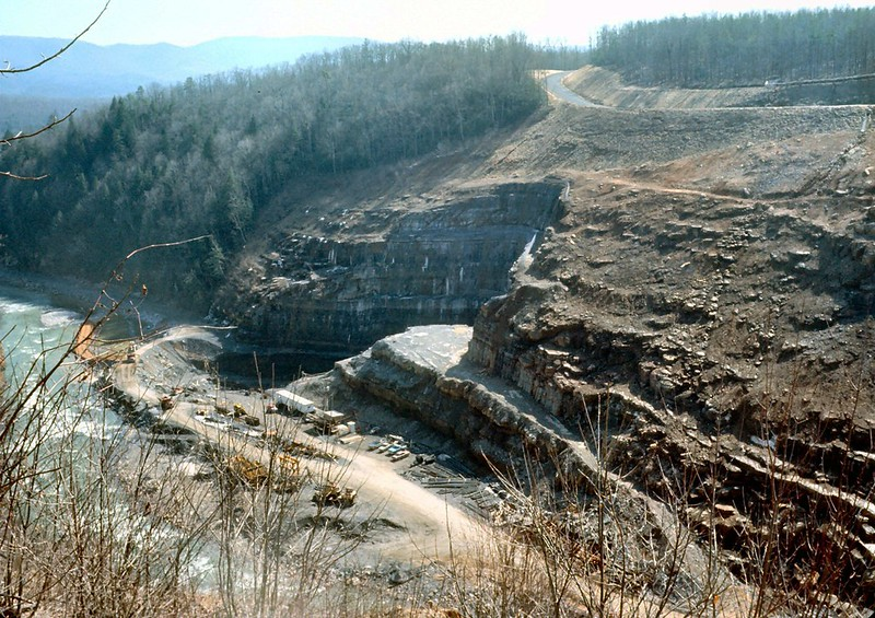
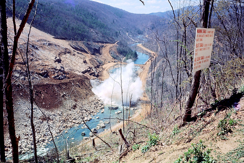
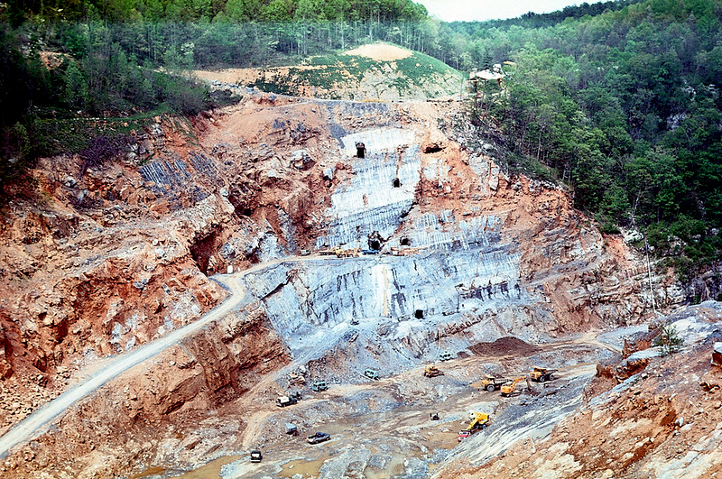
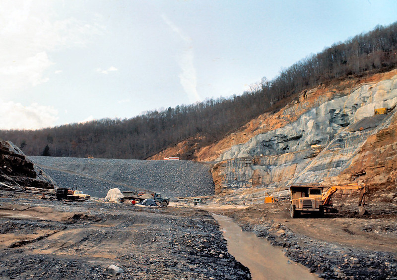
Gathright Dam, constructed between 1975-79, by the US Army Corps of Engineers
Source: US Army Corps of Engineers, Gathright Dam Construction - 2
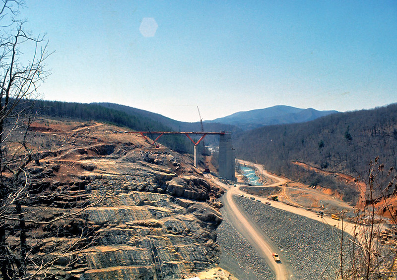
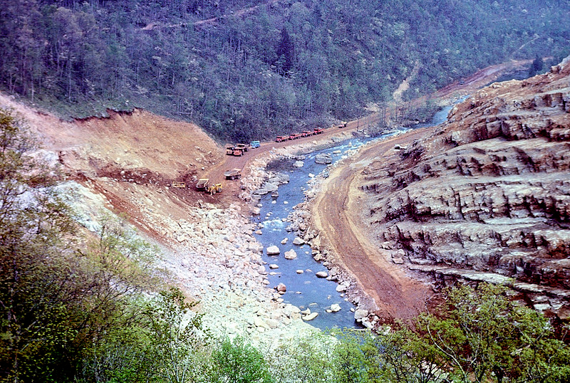
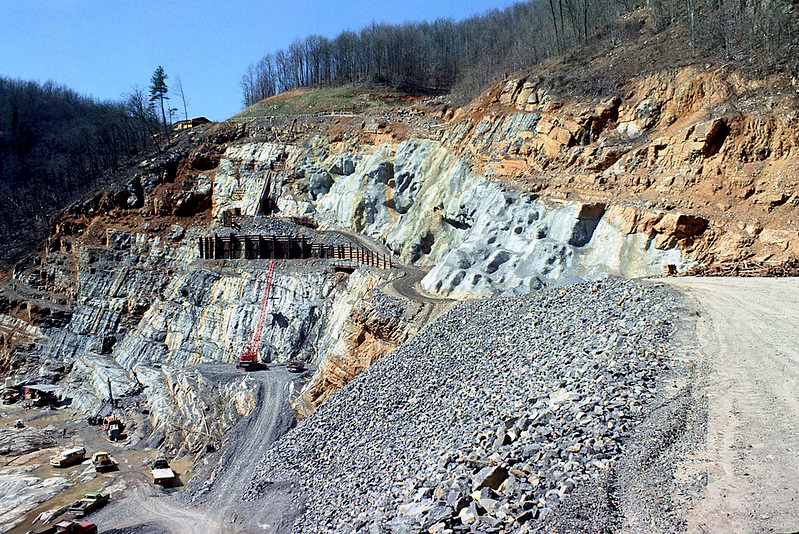
Gathright Dam, constructed between 1975-79, by the US Army Corps of Engineers
Source: US Army Corps of Engineers, Gathright Dam Construction - 3
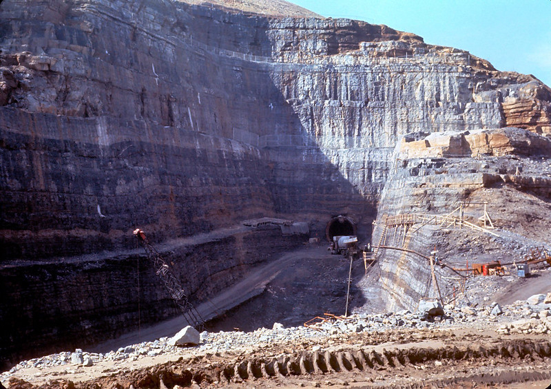
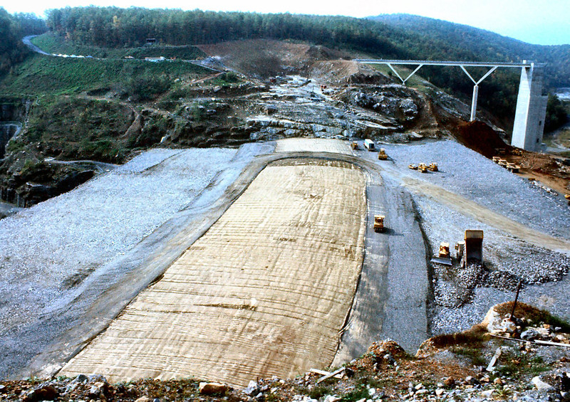
Gathright Dam, constructed between 1975-79, by the US Army Corps of Engineers
Source: US Army Corps of Engineers, Gathright Dam Construction - 4
Gathright Dam, constructed between 1975-79, by the US Army Corps of Engineers
Source: US Army Corps of Engineers, Gathright Dam Construction - 5
Gathright Dam, constructed between 1975-79, by the US Army Corps of Engineers
Source: US Army Corps of Engineers, Gathright Dam Construction - 6
Gathright Dam, constructed between 1975-79, by the US Army Corps of Engineers
Source: US Army Corps of Engineers, Gathright Dam Construction - 7
Gathright Dam, constructed between 1975-79, by the US Army Corps of Engineers
Source: US Army Corps of Engineers, Gathright Dam Construction - 8
Gathright Dam, constructed between 1975-79, by the US Army Corps of Engineers
Source: US Army Corps of Engineers, Gathright Dam Construction - 9
Gathright Dam, constructed between 1975-79, by the US Army Corps of Engineers
Source: US Army Corps of Engineers, Gathright Dam Construction - 10
Gathright Dam, constructed between 1975-79, by the US Army Corps of Engineers
Source: US Army Corps of Engineers, Gathright Dam Construction - 11
Gathright Dam, constructed between 1975-79, by the US Army Corps of Engineers
Source: US Army Corps of Engineers, Gathright Dam Construction - 12