the New River starts in North Carolina, flows through Virginia west of the Blue Ridge, then crosses into West Virginia
Source: US Geological Survey (USGS), Streamer
the New River starts in North Carolina, flows through Virginia west of the Blue Ridge, then crosses into West Virginia
Source: US Geological Survey (USGS), Streamer
The New River starts near Blowing Rock in North Carolina, then drops 900 feet in elevation as it crosses Virginia from the North Carolina border to West Virginia. At its confluence with the Gauley River, the New River ends and the Kanawha River starts. The changing of names for the rivers is an artifact of humans who settled the region starting in the 1700's. From a water droplet's perspective, the only change at the confluence is that more droplets are in the river channel.
Just downstream of the confluence of the New River and the Gauley River is Kanawha Falls. That 15' high drop is a barrier to both shipping and fish migration. Other rapids further upstream on the New River also limited its suitability for floating goods downstream to the Ohio and Mississippi rivers, and ultimately to New Orleans.
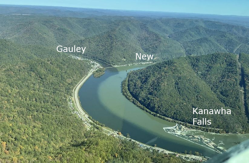
the downstream end of the New River is where it meets the Gauley River, just upstream of Kanawha Falls
Source: Dale Grady, Facebook post (October 26, 2024)

rapids made it difficult to ship agricultural products via the New River to New Orleans
Source: "The Chesapeake & Ohio Railway Directory, Containing an Illustrated History and Description of the Road," Running the Rapids of the New River (p.396)
The New River is often described as the "second oldest river" in the world after the Nile. That claim is based on the questionable assumption that the New River cuts completely through the Appalachian Mountains. The assumption is that an ancient river was powerful enough to erode its channel and retain its direction as the Appalachian Mountains were uplifted 250 million years ago, when the supercontinent Pangea formed.
The New River headwaters are high in the Appalachians - but not completely east of them. The New River has carved the New River Gorge as it cuts through the Allegheny Plateau, but the river does not cut through the Blue Ridge. The age of the river could range between 3 million-320 million years, based on five different ways to measure:1
eight other rivers have headwaters in the Appalachians and flow west, cutting though the ancient uplifted bedrock
Source: West Virginia Geological and Economic Survey
The oldest river in the world is often reported to be the Nile, but that river channel dates back only 30 million years based on the age of sediments in its delta. The Finke River in Australia could be 350-400 million years old, with the river flowing in its current channel for the last 100 million years. The Meuse in France could date back 320-340 million years as well.2
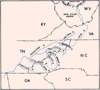
Many of the arguments used to describe the New River as "second oldest" could be applied easily to the French Broad River in North Carolina and the Susquehanna River in Pennsylvania. They also cut through Appalachian Mountain ridges, but the ages of those river channels are not the same as the age of the rocks in those ridges.
Erosion since the Appalachian/Allegheny Orogeny about 250 million years ago has removed thousands of feet of rock from the surface. Rivers have wandered in many directions across the landscape during the downcutting process, as water has encountered fault zones and bedrock of different resistance.
After the Appalachian/Allegheny Orogeny created the Ancient Appalachians, ancient rivers for which we have no names carried sediments from the mountains westward (in modern directions) far across the North American continent. Early erosion after the Appalachian/Allegheny Orogeny carried sediments far west of the modern Mississippi River. Rivers flowing from the central and southern Appalachians ended in the Ouachita deep-water trough, and some of the sediments deposited by those rivers survive as the Ouachita Mountains today.
Erosion has carried Ancestral Appalachian sediments as far as modern Arizona. Material deposited over 200 million years ago at what today is Petrified Forest National Park include detrital zircons dating back to the Grenville orogeny about 1.3 billion years ago. Those zircons were eroded from the Ancestral Appalachians and washed to the western edge of the continent. Detrital zircons in Arizona may have come from the northern end of the Ancestral Appalachians through a drainage system that started in Greenland when it was still attached to Laurentia.
Ancestral Appalachian zircons have been recycled back to the east since the formation of the Western Interior Seaway during the Cretaceous period. The direction of rivers changed with uplift of the Rocky Mountains, as the Farallon tectonic plate collided with the western edge of the North American plate. Zircons in ancient sediments from the Appalachians were uplifted and then eroded again, this time transported back to the east from the edge of the Rocky Mountains. The Missouri River today transports remnants of the Ancestral Appalachians, zircons in river sediments, eastward to the Mississippi River.
The modern Allegheny Plateau may be a rejuvenated landscape that was uplifted just in the last 23 million years, perhaps as the bottom of the North American Plate has broken off. Delamination of the tectonic plate would cause the bottom "root" segment to sink into the magma below. The top segment, no longer anchored by the weight of the bottom "root" segment, would rise upward.
The ridges through which the New River now runs may have been a flat peneplain into which the current channel was carved starting in the Miocene Epoch. Until that uplift ancient ancestors of the New River could have flowed in different directions before cutting into those ridges as they were initially exposed, prior to getting locked into the current channel. Until a reliable technique emerges for dating river channels worldwide, all claims that the New River is the world's second oldest are speculative.3
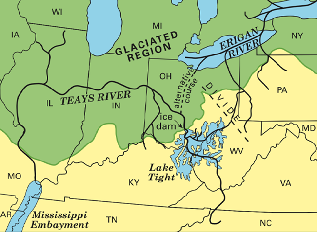
One known predecessor of the New River is the Teays River. Until an ice sheet pushed south about two million years ago, the Teays River flowed from the Blue Ridge in modern North Carolina in the current channel of the New River to Ohio. It reached Chillicothe, flowed westward across Indiana and Illinois, and intercepted the Mississippi River somewhere north of modern St. Louis. Sea level was higher two million years ago, and an embayment of the Gulf of Mexico occupied the valley of the Mississippi River up to St. Louis then.
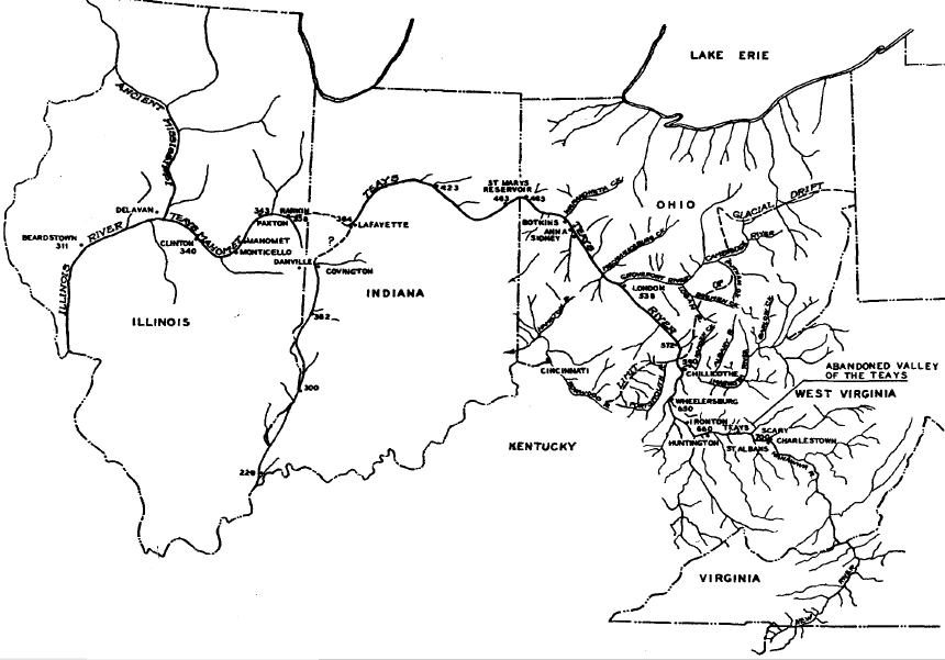
the route of the Teays River was identified in 1946
Source: Ohio Journal of Science, The Teays River (Karl Ver Steeg, Volume 46 Number 6, November, 1946)
During the last glaciation, a thick ice sheet covered the northern part of the Teays River. Lake Tight developed as a lobe of ice blocked the river channel and water backed up. Lake Tight reached almost the size of modern Lake Erie before rising high enough to cut a new route near Manchester, Ohio. The new route drained westward into the Mississippi River. The Teays River was truncated and water droplets that had started in North Carolina were redirected into a new channel (the proto-Ohio River) south of the ice sheet. Lake Tight disappeared, but left sediments behind marking its temporary existence.
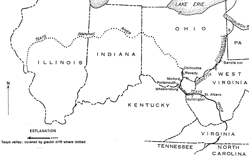
before the Illinoian Glaciation, the Teays River flowed west through what became northern Indiana and Illinois
Source: Ohio Department of Natural Resources, The Ice Age in Ohio
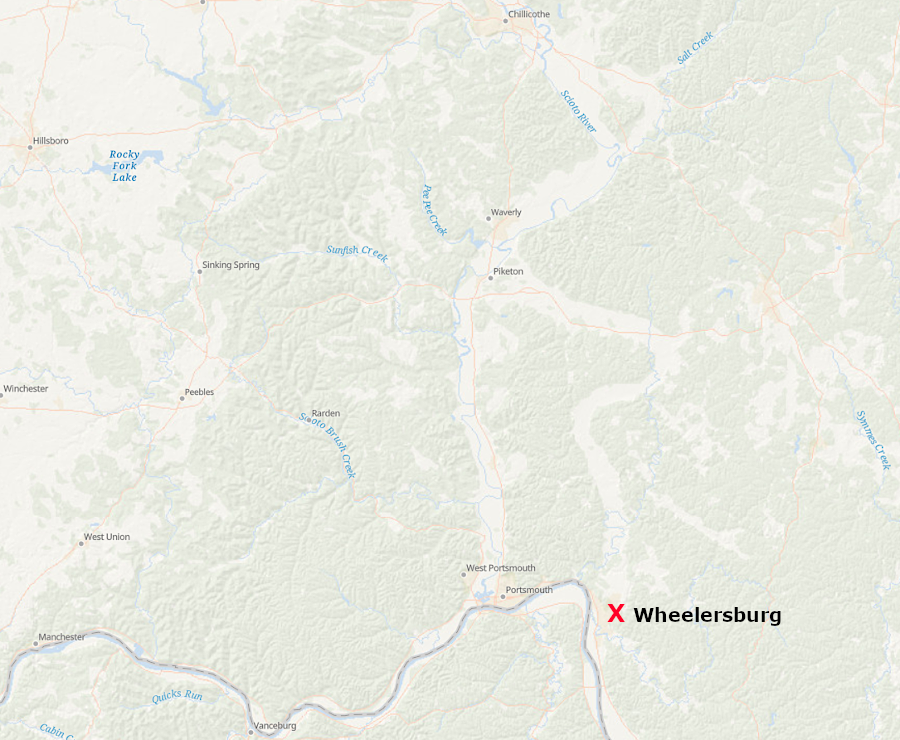
Through several stages of glacial ice advance and retreat, runoff from the southern edge of ice sheets eventually carved the channel of the modern Ohio River. That modern channel formed about 800,000 years ago as Lake Tight drained. The proto-Ohio River redirected water westward from the old Teays River channel at Wheelersburg and Sciotodale, Ohio. A portion of the modern Scioto River flows south now, on top of glacial till that fills the ancient channel of the Teays River that had previously flowed north.
two million years ago the Teays River flowed north to modern Chillicothe, Ohio
Source: ESRI, ArcGIS Online
The ice sheets carved out the Great Lakes and scraped off bedrock as they expanded to the south. Where the ice melted, sediments were deposited. They filled the Teays River valley with glacial silt two million years ago.
Another possibility is that the Teays River once flowed north into the St. Lawrence River, rather than westward to the Mississippi River. The Teays River may have flowed north rather than west and connected with the upper reaches of the ancestral Ohio River. Those reaches flowed north through the ancestral Erigan River channel (now occupied by Lake Erie) into the St. Lawrence River.
Cycles of erosion and deposition by different ice sheets over the last two million years makes it difficult to date the age of the Teas River channel north of the modern Ohio River. The oldest sediments which were deposited in the original bed of the Teays River have been recycled by later erosion.4
We know that the channel of the Ohio River is young, and the channel of the Teas River to the north is now buried in recent sediments brought by the ice sheet. However, upstream from Point Pleasant, West Virginia, the Teays River was not filled with silt. That channel is now occupied by the Kanawha River and its tributaries such as the New River and the Gauley River, and is not "new." The origin of the river channel from Point Pleasant upstream to Blowing Rock, North Carolina may date as far back as the Miocene Epoch 23 million years ago.
The current New River channel could have been created over 23 million years if erosion by the New River occurred consistently at the same rate as uplift of the Appalachian Plateau. The pre-existing curves of the river as it flowed across the flat peneplain could have been etched slowly into the bedrock, gradually forming the New River Gorge.
The channel of the New River may be even older, dating back as much as 200 million years to the Appalachian/Allegheny Orogeny. Assuming the channel is 200 million years old requires making an extraordinary assumption: an early erosion channel which developed after the formation of Pangea never changed its path, even as the river eroded down through perhaps 45,000 feet of bedrock that washed away to fill the Mississippi Valley on the west and create the Coastal Plan on the east.
An extraordinary claim that the New River channel that we see today originated in the Appalachian/Allegheny Orogeny requires extraordinary evidence. All we know for sure is that many river channels evolved over the last 200 million years. As the mountains were washed to the sea, numerous river channels were created. pirated, and destroyed by erosion.5
beyond the Ohio River, the old Teays River channel is largely buried under glacial silt
Source: US Geological Survey (USGS), Geological and Geophysical Study of the Preglacial Teays Valley in
West-Central Ohio (Geological Survey Water-Supply Paper 1460-E, Figure 16)
There is much speculation but no clear evidence explaining the origin of the name for the New River.
In 1641, Walter Austin, Rice Hoe, Joseph Johnson and Walter Chiles asked for the General Assembly to authorize an expedition "to undertake the discovery of a new river of lands bearing west southerly from Appomattox River." They evidently intended to enhance the opportunity to trade more directly with Native Americans who could provide deerskins and other furs.
They may have left the Fall Line on the Appomattox River and found a stream flowing west which they called Mondongachate. In 1643 the General Assembly granted the four men a monopoly until 1656 on profits from whatever they discovered.
The 1644 uprising led by Opechancanough, confusion regarding Virginia's governance after Governor Berkeley was displaced from his leadership position in 1652 during the English Civil War, or other considerations evidently prevented further travels across the continental divide into the Mississippi River drainage basin.
The first Europeans to document the existence of the New River were fur traders Thomas Batts (Batte) and Robert Fallam (Hallom) in 1671. The New River flowed west rather than towards the Atlantic Ocean; they had crossed the Eastern Continental Divide.
In the journal entry by Fallam (Hallom) for September 9, he called it the Supany (Saponi) River. Other settlers named it "Woods River" after Abraham Wood, who had sent Thomas Batts (Batte) and Robert Fallam (Hallom) to explore westward from Fort Henry (now Petersburg).
John Peter Salling saw the river in 1742, when he started on a journey through the Mississippi River watershed as part of an expedition initiated by Governor Gooch to explore the western lands claimed by the French. After visiting Natural Bridge, Salling recorded the Native American name for the river at that time - along with some incorrect distances of his float downstream:6
by 1755, it was clear that the Wood or New River stretched from south of the Virginia-North Carolina to the Ohio River
Source: Library of Congress, A map of the British and French dominions in North America (John Mitchell, 1755)
Reports that Batts and Fallam did not initially recognize the river and wrote "new river" on their map could be as much entertainment as fact. Equally suspect are reports that the waterway was named after a man with the last name of New, or that William Byrd III assigned the named in 1764 because it was not on the map produced by Peter Jefferson and Joshua Fry.7
in 1755, the river flowing from North Carolina through Virginia to the Ohio River was labeled the Conhaway (later spelled Kanawha)
Source: Library of Congress, A map of the British and French settlements in North America
in 1785, "Wood River" was still used to describe what is known today as the New River
Source: Library of Congress, The United States of North America, with the British & Spanish territories according to the treaty of 1784
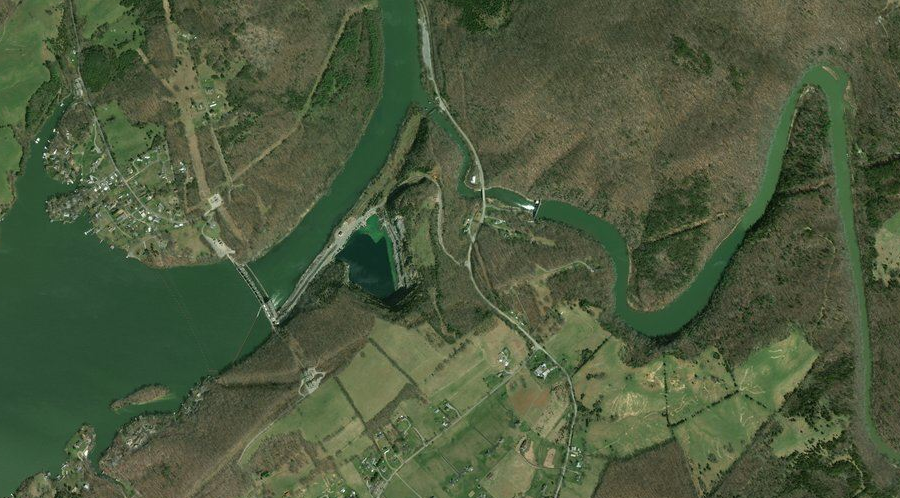
The steady flow of the New River and topographic relief offered mechanical energy to power the textile mills that moved from Massachusetts and other northeastern states to the southern states, taking advantage of cheap labor in the region after the Civil War. Col. Fields J. McMillian built a mill on Wilson Creek in 1884, spurring development of the town known as Mouth of Wilson. In 1901, Colonel Francis Fries built a 39' high dam across the New River to provide mechanical energy to the Washington Mills, which converted cotton into cloth until closing in 1989.8
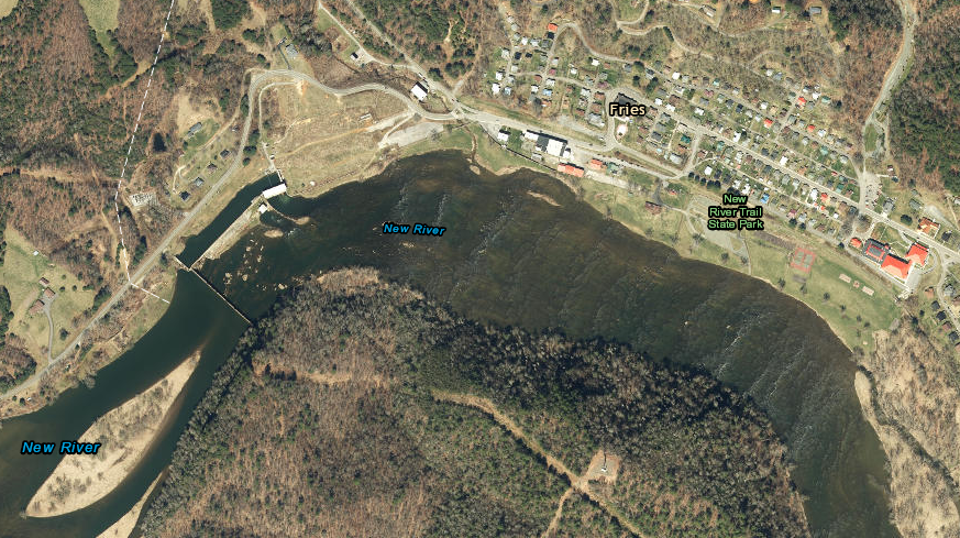
the Town of Fries (pronounced "freeze") was started in 1901 when Col. Fries built a 39' high dam across the New River to power the Washington Mills
Source: ESRI, ArcGIS Online
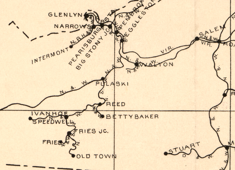
the Norfolk and Western Railroad built a line up the New River from Pulaski to service mines and mills, and much of that roadbed is now New River Trail State Park
Source: Library of Congress, Railway mail map of Virginia (by Earl P. Hopkins, 1910)
In 1912, the Appalachian Power Company built two hydropower dams at Byllesby and Buck in Carroll County to produce electricity for local factories, mines, homes, and the coal fields around Bluefield, WV. The natural island at Buck Dam was used to channel the river flow into a 1,000-foot long concrete spillway. Demand was sufficiently high to justify constructing over 400 miles of transmission lines. Appalachian Power still uses Byllesby Dam to generate up to 21.6MW of hydropower, while Buck can generate 8.5MW.9
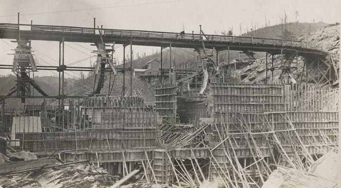
50' high Byllesby Dam under construction
Source: Library of Virginia, Byllesby Dam Photograph Collection
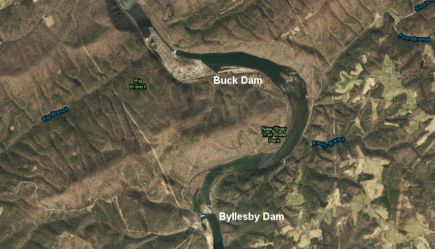
Appalachian Power Company built two hydropower dams across the New River in Carroll County in 1912, creating the Fowler's Ferry reservoir between Byllesby Dam and Buck Dam downstream
Source: ESRI, ArcGIS Online
The claim that the New River is the "second oldest" in the world was highlighted when the Appalachian Power Co. proposed to build a pumped-storage project on the New River near Mouth of Wilson in Grayson County. The Blue Ridge Project would have generated 1,800 MW of electricity at times of peak demand, supplementing the electricity generated at "baseload" plants during times of low demand.
Appalachian Power planned to construct two reservoirs, using the same pumped storage technology as on the Roanoke River when it created Smith Mountain/Leesville lakes. Water from the lower reservoir (three times the size of Claytor Lake) would have been pumped back upstream to a new reservoir 30% larger than Smith Mountain Lake.
The water level in the lower lake would have changed by up to 40 feet as water flowed in or was pumped back upstream. The plan was for the upper reservoir water level to fluctuate by up to 12 feet, a limit imposed by the Federal Power Commission in its Federal permit to preserve recreational uses.
Eight reversible turbines generating 200MW each were planned for the upper dam. Two conventional turbines capable of generating 100MW each were planned for the lower dam, where water would be released to flow down the New River to the Byllesby and Buck dams and ultimately West Virginia.
The two Blue Ridge Project dams would have been in Virginia, and Virginia jurisdictions would have received substantial tax revenue from the new infrastructure. About 70 miles of the free-flowing New River would have been converted into two lakes. Roughly 10% of the land in Grayson County would be flooded, but many of the people to be displaced lived upstream in North Carolina.
North Carolina officials opposed the project, while Virginia's officials supported it. The Federal Power Commission issued a permit to dam the New River in 1969, but the passage of the National Environmental Policy Act in 1970 slowed down the planning. By 1976, North Carolina's governor was a key official in President Gerald Ford's campaign. Ford was challenged for the Republican nomination by Ronald Reagan, and both candidates ended up supporting designation of the New River as a "Wild and Scenic River." Such a designation would block the dams and end plans for the Blue Ridge project.
The US Congress, over the opposition of Virginia's two US Senators, added the New River to the Wild and Scenic Rivers system. When President Ford signed the bill on September 11, 1976, he noted the conflict between development and preservation, saying that the people of the area clearly wanted to keep the New River "like it is."10

the New River Conservancy still celebrates President Ford's comment when he added the New River to the Wild and Scenic Rivers system
Source: New River Conservancy, Get the gifts that give back!
just upstream of I-81, dams block the natural flow on the New River (left) and its Little River tributary (right)
Source: Virginia Department of Transportation, Bridges and Culverts
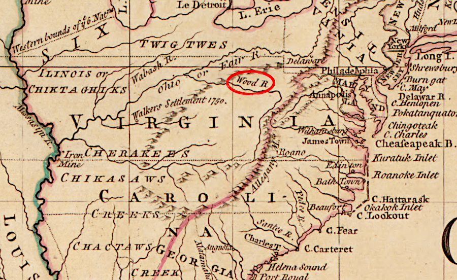
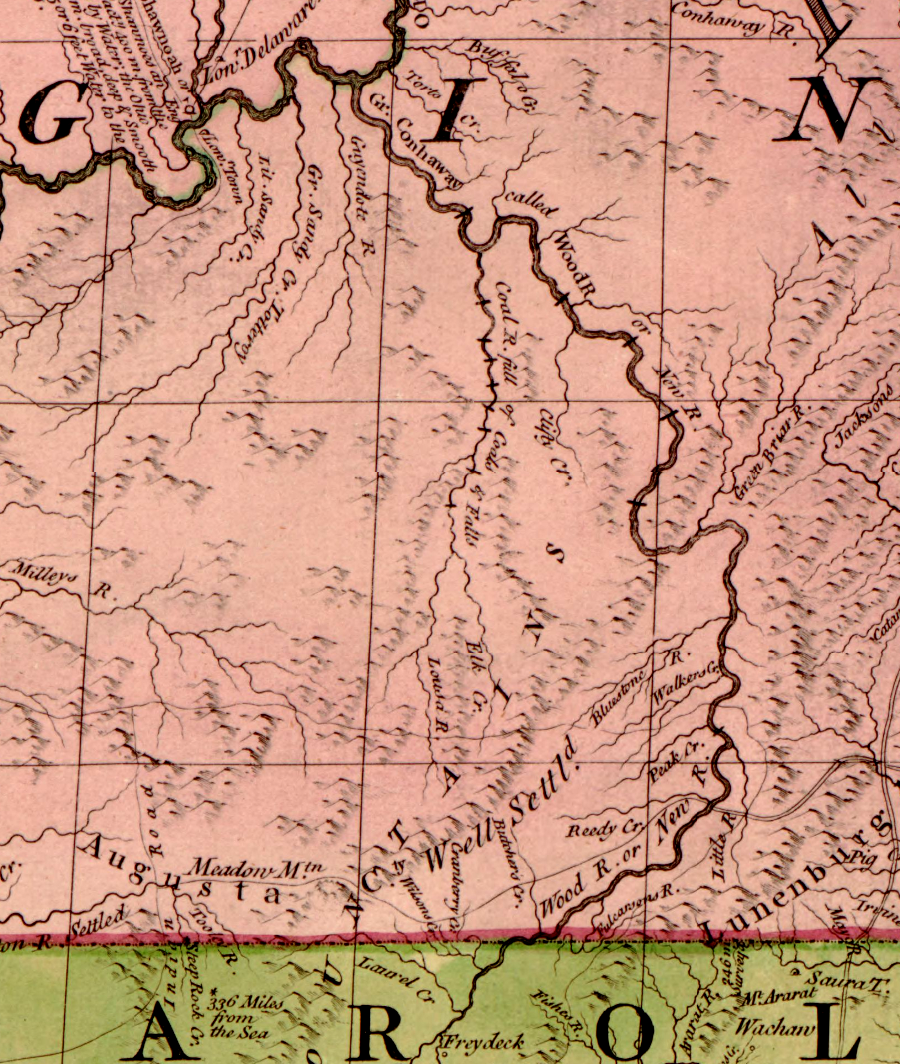
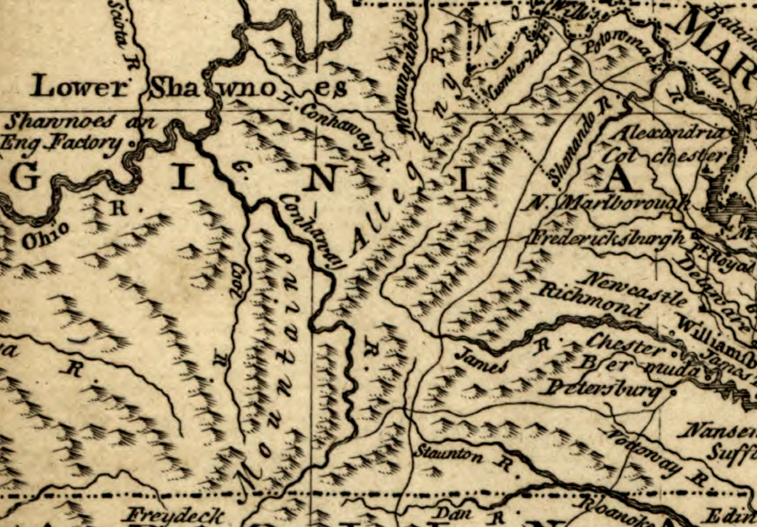
the New River was named originally after Abraham Wood, who sent explorers from his fur-trading facility on the Appomattox River (Fort Henry) across the Blue Ridge
Source: Library of Congress, A general topography of North America and the West Indies (by Thomas Jefferys, 1768)
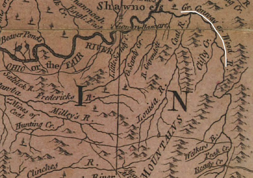
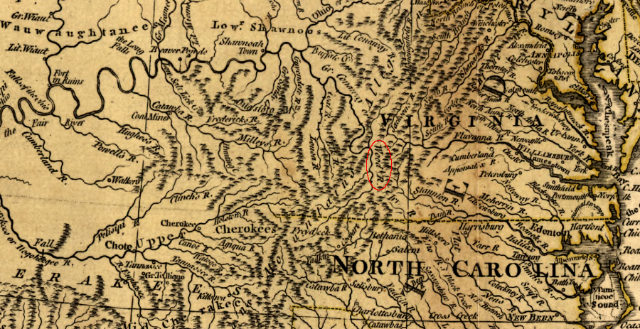
in 1763, Emanuel Bowen mapped the Wood River flowing north, where it was also known as the Great Conway (Kanawha) River
Source: Library of Congress, An accurate map of North America. Describing and distinguishing the British, Spanish and French dominions on this great continent; according to the definitive treaty concluded at Paris 10th Feby. 1763
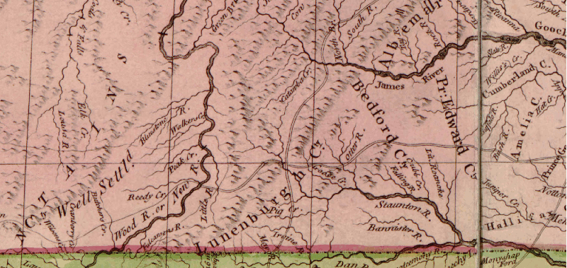
Wood/New River, at the time Mary Draper Ingles was captured in 1755 (note: Little River, near modern-day Radford, is placed upstream of Peak Creek)
Source: Library of Congress, A map of the British and French dominions in North America, with the roads, distances, limits, and extent of the settlements
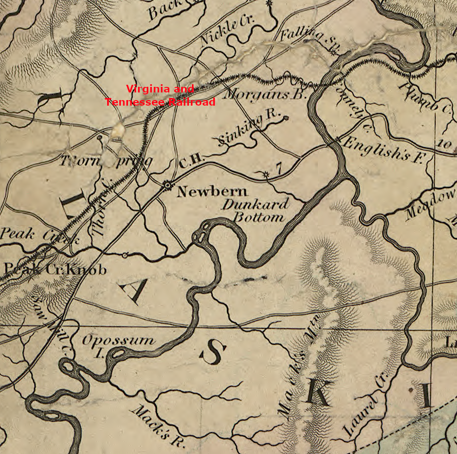
the New River in 1859, upstream of the Virginia and Tennessee Railroad
Source: Library of Congress, A map of the state of Virginia
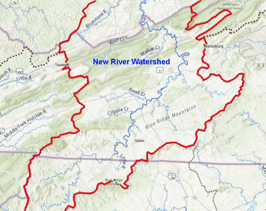
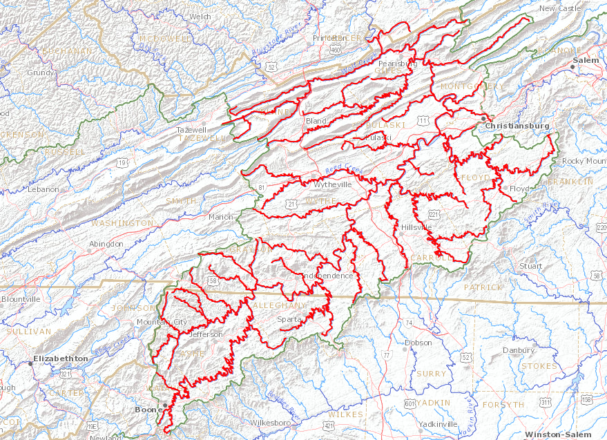
boundaries of the New River watershed in Virginia
Source: ESRI, ArcGIS Online