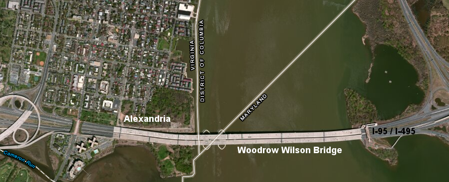
the southern boundary of the District of Columbia is at Jones Point, and today the Woodrow Wilson Bridge is divided between three jurisdictions
Source: ESRI, ArcGIS Online
the southern boundary of the District of Columbia is at Jones Point, and today the Woodrow Wilson Bridge is divided between three jurisdictions
Source: ESRI, ArcGIS Online
In 1632, Charles I issued a charter to the Calverts. When he gave them the new colony of Maryland, the king defined Virginia's new northern boundary as the southern shoreline (not the middle) of the Potomac River. The charter granted all of the Potomac River to Maryland, from the northern side to the "further Bank of the said River" on the Virginia side.
Creation of the District of Columbia in 1801 altered the Virginia-Maryland boundary Thomas Jefferson, Alexander Hamilton and James Madison had negotiated a deal in 1790 to put the Federal capital in Philadelphia for a decade, then relocate it to a new site on the Potomac River.
In the 1790 Residence Act, Congress gave President Washington authority to choose the specific location for a 100-square mile Federal district upstream of the Anacostia River. Maryland and Virginia passed legislation that permitted the Federal government to select up to 10 square miles of each state for the new District of Columbia.1
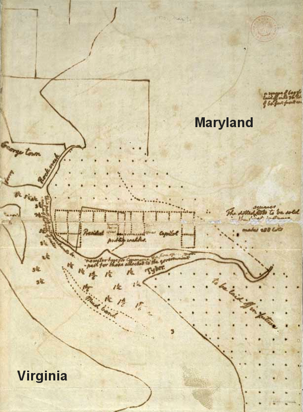
Thomas Jefferson sketched the plan for the new capitol on the Potomac River
Source: Library of Congress, Residence Act (drawing by Thomas Jefferson)
Washington ignored the requirement to locate all of the capital upstream of the Anacostia River. Instead, he chose to locate the southern tip of the new District of Columbia at Jones Point.
That decision included Alexandria within the district, even though the town was downstream of the mouth of the Anacostia River. Congress quickly amended the Residence Act on March 3, 1791 to ratify George Washington's decision.
President Washington shaped the boundaries of the District so Virginia would contribute one-third of the land and Maryland would contribute the other two-thirds of the land. Both Maryland's port town of Georgetown and Virginia's port town of Alexandria were included in the new District.
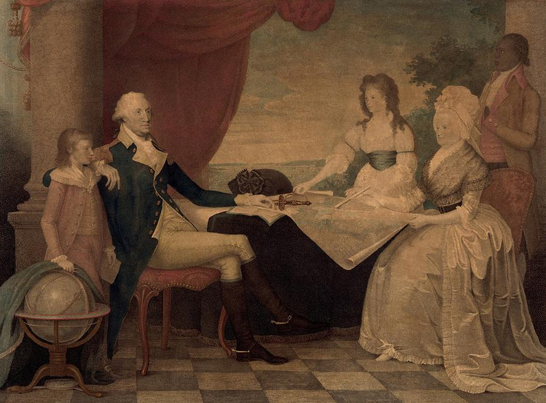
George Washington, portrayed with his hand on a map, chose the site for the District of Columbia
Source: Library of Congress, George Washington and his family by George Edward Perine
To define the exact boundaries of the 100-square mile district, Andrew Ellicott and his hired assistants (including Benjamin Banneker) surveyed four straight lines. Each was 10 miles long, running straight to right-angle intersections with other boundary lines.
the boundary between Virginia-DC, surveyed by Andrew Ellicott after the 1790 Residence Act, cut straight lines across the Potomac River and across topographic features
(note that north is to the upper left of the map, as indicated by the rosette)
Source: Library of Congress, Territory of Columbia
The 10-mile long lines met at 90° angles to create a square. The survey lines defining the southeast and southwestern edges of the district cut straight across the Potomac River.
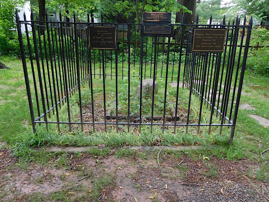
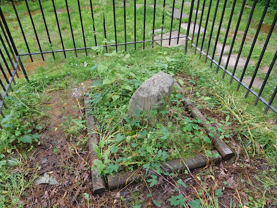
the west boundary stone in Falls Church
On a map oriented north-south, the new Federal district resembled a diamond. At the southern tip at Jones Point, lines went 45° to the northeast and 45° to the northwest. The surveyors erected stone markers one mile apart to document the boundary lines, with 14 stones used to mark the Virginia-District boundary. Over 230 years later, 36 of the 40 original boundary stones remain. (In addition, in 1932-33 the Garden Club of America placed ceremonial stone markers at key entrance points to the District of Columbia. One of the four placed in Virginia still remains, near Key Bridge in Arlington.)2
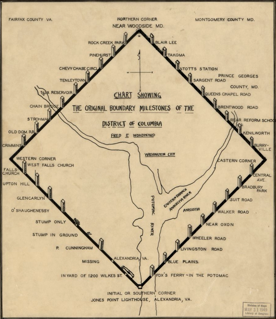
most boundary milestones of the District of Columbia could still be found in 1906
Source: Library of Congress, Chart showing the original boundary milestones of the District of Columbia (Fred E. Woodward, c.1906)
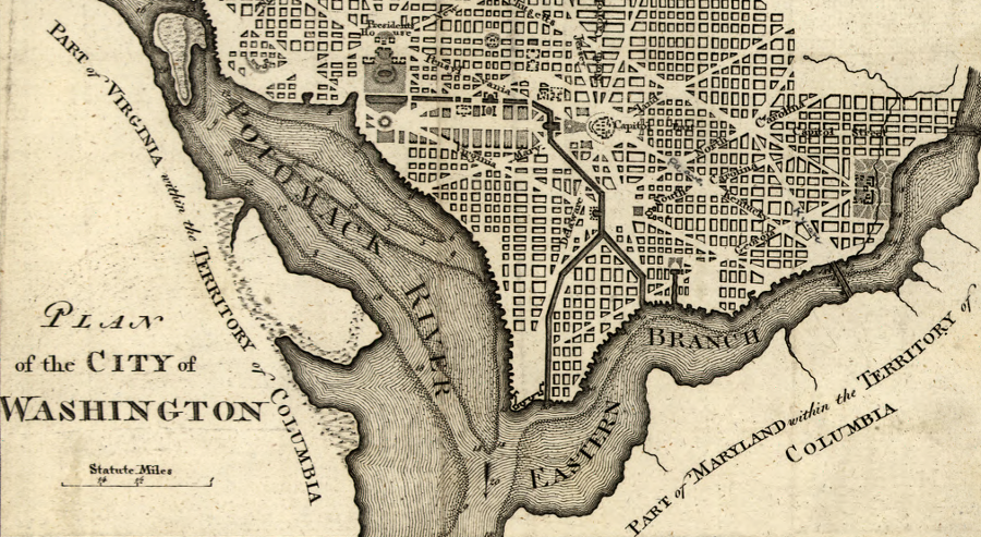
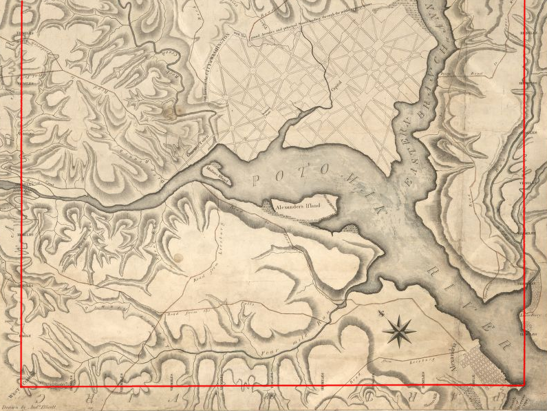
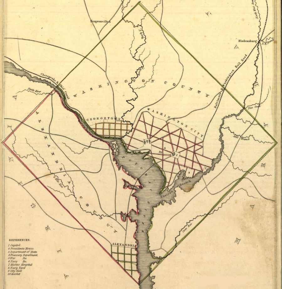
the portion of Virginia ceded to the District of Columbia was carved out of Fairfax County
Source: Library of Congress, Plan of the city of Washington (1800)
Maryland transferred jurisdiction over its portion of the new District of Columbia to the Federal government on December 19, 1791. In addition to the land, Maryland transferred all of the Potomac River inside the surveyed square. All of the Potomac River outside the District's surveyed boundary continued to be owned by Maryland. Virginia owned none of the Potomac River after 1632, so Virginia never transferred any part of the Potomac River to the District.
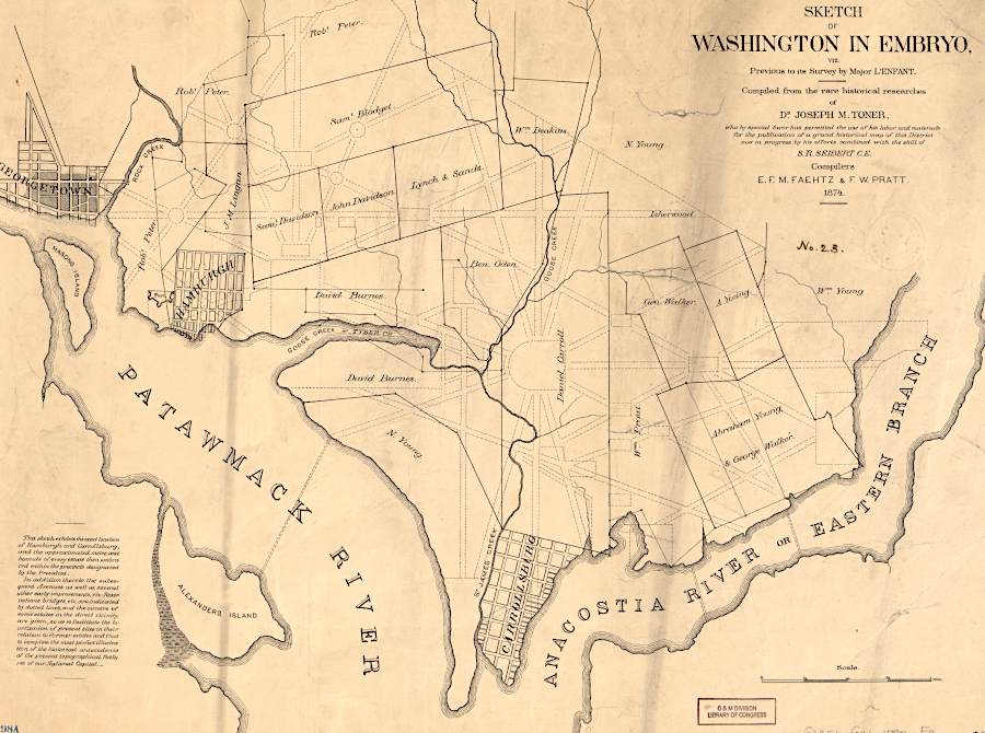
in addition to Alexandria, the new District of Columbia included three communities on the north side of the Potomac River in 1792
Source: Library of Congress, Sketch of Washington in embryo: viz., previous to its survey by Major L'Enfant (1874)
For a decade after the survey, Virginia transferred nothing to the District. That portion of the district Virginia committed to transfer, about one-third of the total, remained under Virginia jurisdiction. From the Federal government's perspective, it controlled land and water to the "further Bank of the said River" between 1791-1801, but did not control the land which Virginia planned to cede.
Ceding a slice of Maryland to the Federal government resulted in the first Virginia-District of Columbia boundary. It was on the southern edge of the Potomac River, stretching north from Jones Point towards Little Falls for roughly 13 miles.
The Virginia General Assembly agreed to cede its portion in 1789, but did not actually transfer the land until after the Federal government moved from Philadelphia to the District of Columbia. Virginia's legislators wanted the Federal government to establish some form of local government before ending Virginia's jurisdiction, to ensure that the territory would never be lawless. Even as late as 1801, the General Assembly passed laws that applied to the Virginia portion of the not-yet-established District.3
Later in 1801, the Virginia General Assembly formally transferred jurisdiction of a slice of Fairfax County to the Federal government. That slice of Virginia transferred into the District, including the town of Alexandria, was given the name "Alexandria County."
The Virginia cession in 1801 altered the Virginia-District of Columbia boundary that had been created in 1791. Instead of running along the edge of the Potomac River, two straight lines surveyed by Ellicott now separated Fairfax County, Virginia, from the new Alexandria County, District of Columbia.
the Virginia portion of the District of Columbia was Alexandria County
Source: Library of Congress, District of Columbia (by Thomas Gamaliel Bradford, 1835)
That Virginia-District of Columbia boundary lasted intact for 46 years. In 1846, the Federal government "retroceded" the Virginia portion of the District of Columbia. Jurisdiction of Alexandria County, including the town of Alexandria, was returned to Virginia.
That shift became effective in 1847, once the Virginia General Assembly concurred with the decision by the US Congress and assumed jurisdiction. Almost 25 years after retrocession, Georgetown, Washington City, and Washington County were unified into one government in the District of Columbia Organic Act of 1871.4
With retrocession, Alexandria County became a new county in Virginia. The land ceded from Fairfax County in 1801 was not incorporated back into Fairfax County in 1847. As a result, Fairfax County was no longer the Virginia jurisdiction located adjacent to the District of Columbia.
In 1847, the new Virginia-District of Columbia boundary became the approximately 13-mile stretch along the "further Bank" of the river again. The straight lines separating the two jurisdictions, based on Ellicott's survey, were replaced with a new boundary - the irregular shoreline of the south bank of the Potomac River.
Changes in Virginia jurisdictional boundaries altered the names on the Virginia side of its boundary with the District of Columbia, but not the location. After 1870, legislation based on the new state constitution defined Alexandria (incorporated in 1852 as a city) as an independent jurisdiction from Alexandria County. That created the City of Alexandria-DC boundary and reduced the length of the County of Alexandria-DC boundary.
The City of Alexandria expanded by annexation in 1915, incorporating land that was formerly within Alexandria County. As a result, the City of Alexandria-DC boundary became longer and the County of Alexandria-DC boundary became shorter. In 1920, Alexandria County was renamed Arlington County, but the location of the county's boundary with the District of Columbia remained unchanged.
A final annexation by the City of Alexandria in 1929 incorporated a portion of Arlington County, extending the city's boundary to Four Mile Run. That annexation, together with the independence of cities and counties in Virginia, reduced the length of the Arlington-DC boundary and increased the length of the Alexandria-DC boundary.5
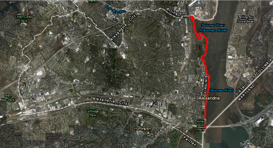
the City of Alexandria - District of Columbia border, from Jones Point to Four Mile Run, since 1929
Source: ESRI, ArcGIS Online
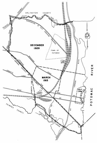
Alexandria annexed portions of Alexandria County in 1915 and Arlington County in 1929
Source: A History of the Boundaries of Arlington County, Virginia (Map IV)
Exactly where was the "shoreline" remained unclear until 1922. Virginia and Maryland had agreed in an 1877 arbitration, the Black-Jenkins Award, that the low-water mark would define the boundary between those two states. The 1877 arbitrators decided that Virginia had acquired prescriptive rights to the land between the high-water mark and the low-water mark, and Maryland accepted the low-water mark as part of the deal.
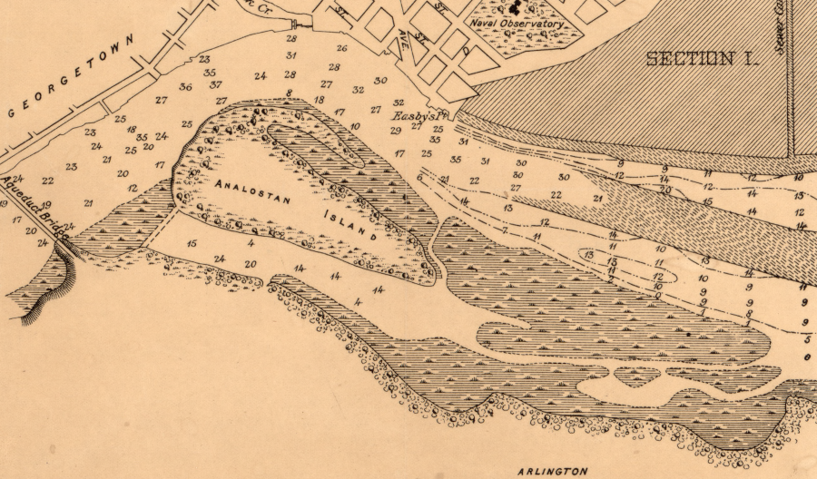
marshland developed upstream of the causeway to Analostan Island, and downstream on the southern bank
Source: Library of Congress, Potomac River at Washington, D.C., map showing progress of work: June 30, 1890
In 1921 in Marine Railway & Coal Co. v. US, the US Supreme Court stated "that the title of the United States embraces the whole river bed." In 1922 the Court of Appeals (District of Columbia Circuit) ruled in Herald v. United States that the Virginia-Maryland deal did not apply to the District of Columbia. The court ruled that the Virginia-District of Columbia boundary was the high-water mark on the Virginia shoreline. Virginia had prescriptive rights against Maryland, but not against the District of Columbia.
In 1931, the US Supreme Court adopted the same reasoning. It ruled in Smoot Sand & Gravel Corporation v. Washington Airport, Inc. that the high-water mark was the boundary. The boundary line between the District of Columbia and Virginia, at the time of Maryland's cession in 1791, was not affected by the 1877 Black-Jenkins Award in 1877 between Maryland and Virginia.6
The court decisions did not define the actual location of the high-water mark, and modifications to the shoreline complicated identifying what was Virginia vs. District of Columbia. Washington Airport was expanded by dumping fill on Potomac River mudflats in 1929. National Airport was created in 1941 by dredging the Potomac River and dumping fill on mudflats at Gravelly Point, downstream from Alexander Island. Based on the 1931 Smoot Sand & Gravel Corporation v. Washington Airport, Inc. decision, whatever new land was created below the high-water mark by the deposition of dredge spoils was part of the District of Columbia... but due to modification, the specific location of the 1632 shoreline was not obvious even by the 1800's.
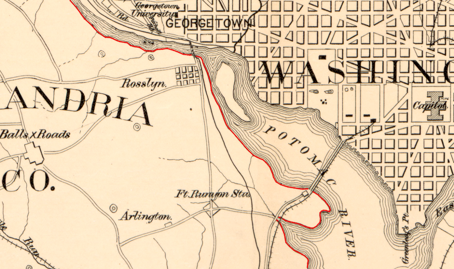
the boundary between Virginia-District of Columbia became the high-water mark on the Virginia shoreline after retrocession in 1847
Source: Library of Congress, Map of Washington D.C. and vicinity (1860)
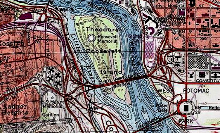
the land known as Analostan, Mason's, or Theodore Roosevelt Island became part of Maryland in 1632 and part of the District of Columbia in 1791
Source: ESRI, ArcGIS Online
At Alexandria, new land were created on the Alexandria waterfront by filling in the shoreline. The location of the "further Bank," referenced in the 1632 charter and in existence in 1801, was literally buried.
The edge of the Potomac River in 1791, when Maryland ceded its territory, was one or two blocks inland from the shoreline in 1847. In 1749, John Carlyle had purchased lot 41 for 30 pistoles (32 pounds, 5 shillings), and it was on a bluff overlooking the shoreline. He purchased Lot 42 for only 16 pistoles (17 pounds, 4 shillings), reflecting its reduced access to the waterfront. Lots 46 and 47 purchased by separate buyers, and lots 51 and 52 purchased by Lawrence Washington, showed a similar discrepancy in price.7
Today the Carlyle House is two blocks inland from the Potomac River.
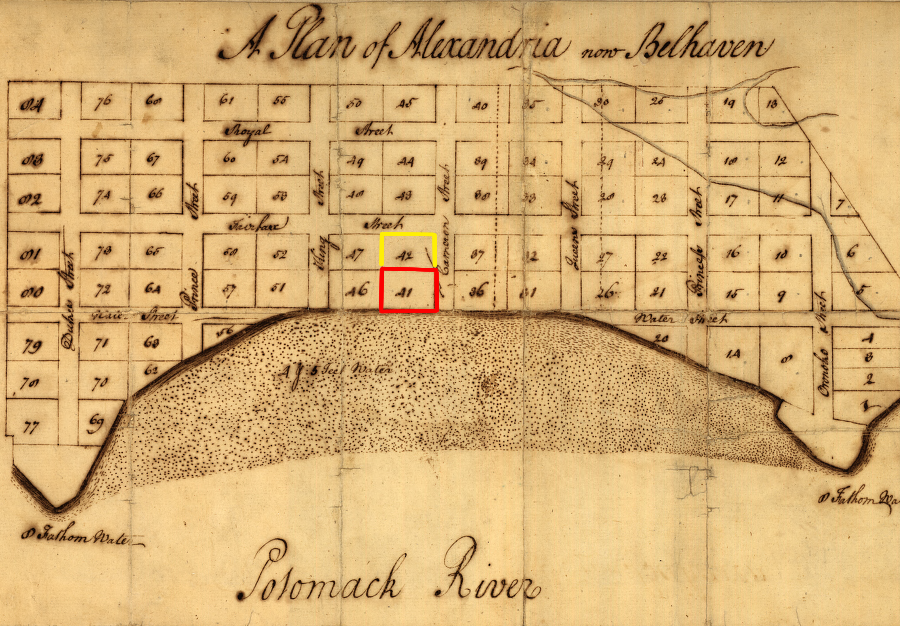
John Carlyle purchased Lot 41 in 1749, when it was a waterfront parcel on the edge of the Potomac River - and inland lot 42 for just 20% of the cost
Source: Library of Congress, A plan of Alexandria, now Belhaven (by George Washington, 1749)
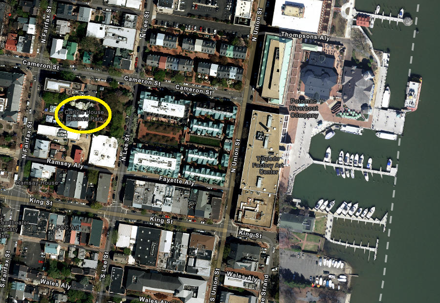
today the Carlyle House is two blocks inland from the Potomac River shoreline
Source: ESRI, ArcGIS Online
The changed shoreline forced courts and the US Congress to define the location of the District of Columbia-Virginia border at Alexandria. The edge of the Potomac River was legally moved to its present location, adding two blocks of artificially-created land to Virginia.
Key court decisions were Marine Railway & Coal Co. v. US by the US Supreme Court in 1921, Herald v. United States by the Court of Appeals (District of Columbia Circuit) in 1922, and Smoot Sand & Gravel Corp. v. Washington Airport, Inc. by the US Supreme Court in 1931.
The court rulings established that the high-water mark on the southern bank of the Potomac River marked the Virginia-District of Columbia boundary downstream into Alexandria.
However, within the boundaries of Alexandria, from Second Street downstream to Jones Point, Congress decided that the boundary would be defined by the "pierhead" line. In 1939, the US Army Corps of Engineers surveyed a line marking how far the structures on the waterfront of downtown Alexandria extended into the river channel. Their greatest extent marked the pierhead line.
In 1945, Congress declared that the pierhead line upstream to Second Street, and the high-water line as of 1945 upstream to the edge of the District of Columbia, defined the legal boundary between Virginia and the District of Columbia. The US Coast and Geodetic Survey surveyed that boundary in 1947.8
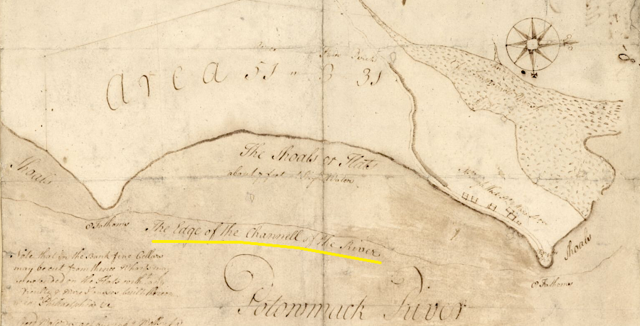
the 1749 shipping channel of the Potomac River was separated from the shoreline by a zone of shallow water which was later filled in with earth
Source: Library of Congress, Plat of the land where on stands the town of Alexandria (by George Washington, 1749)
the boundary stones marking the District-Virginia and District-Maryland boundaries reveal the diamond pattern established by George Washington's decision to locate the southern tip at Jones Point
Source: ESRI, ArcGIS Online (with DC Boundary Stones layer)
Boundary Channel at Pentagon, with red line showing border between DC and Arlington County
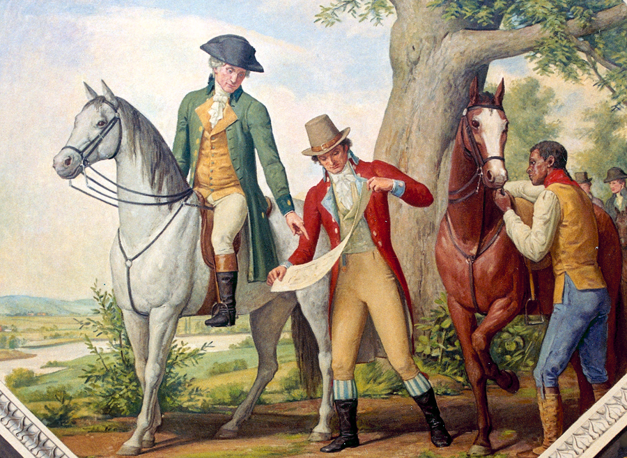
George Washington (on horse) chose the site of the new national capital, Pierre Charles L'Enfant (showing sketch to Washington) prepared the initial city plan, and many unnamed slaves and free black laborers (such as the unidentified man holding the horse) built the structures such as the US Capitol
Source: Architect of the Capitol, Capitol Site Selection, 1791