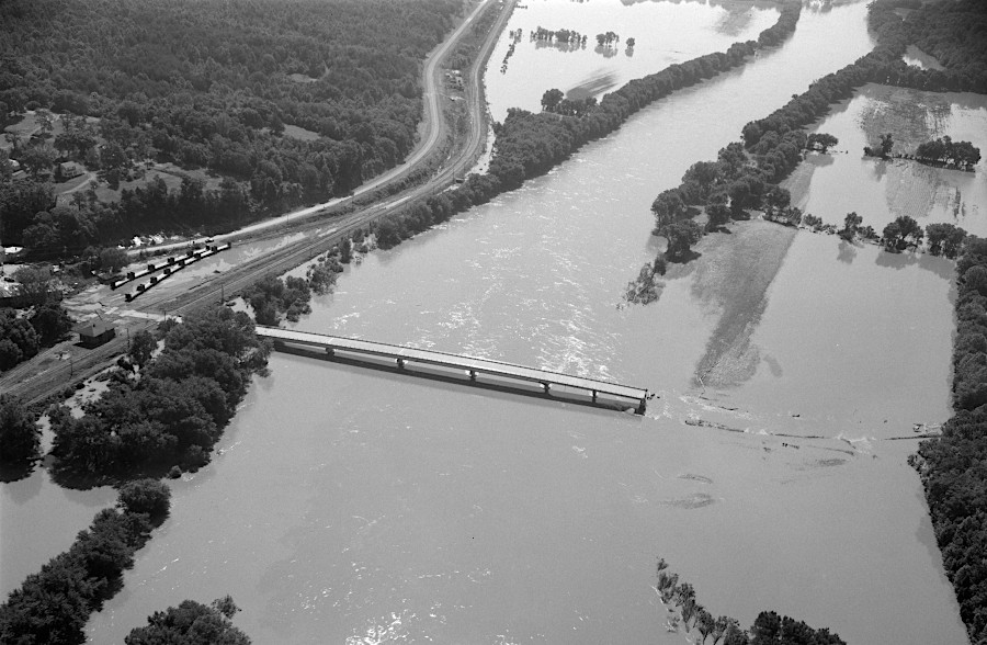
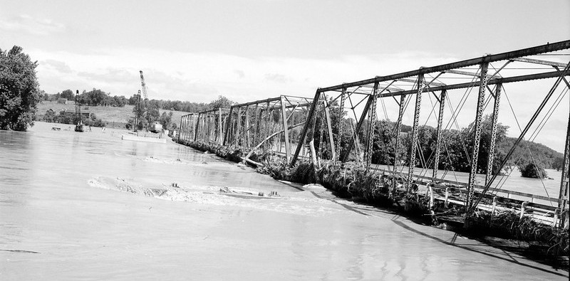
Route 690 at Columbia was closed when the James River Bridge was washed out
Source: Library of Virginia, Bridge Destruction at Columbia and Surveying the Damages
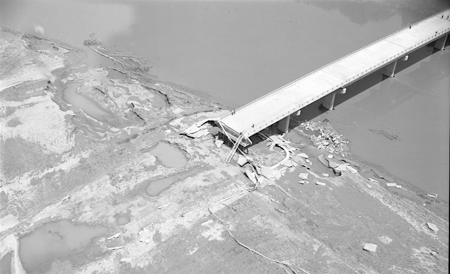
Route 690 at Columbia was closed when the James River Bridge was washed out
Source: Library of Virginia, Bridge Destruction at Columbia and Surveying the Damages
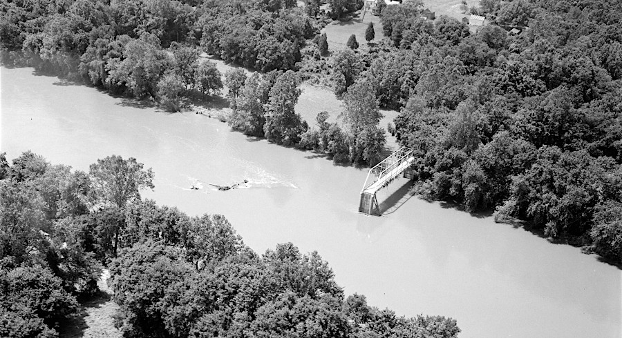
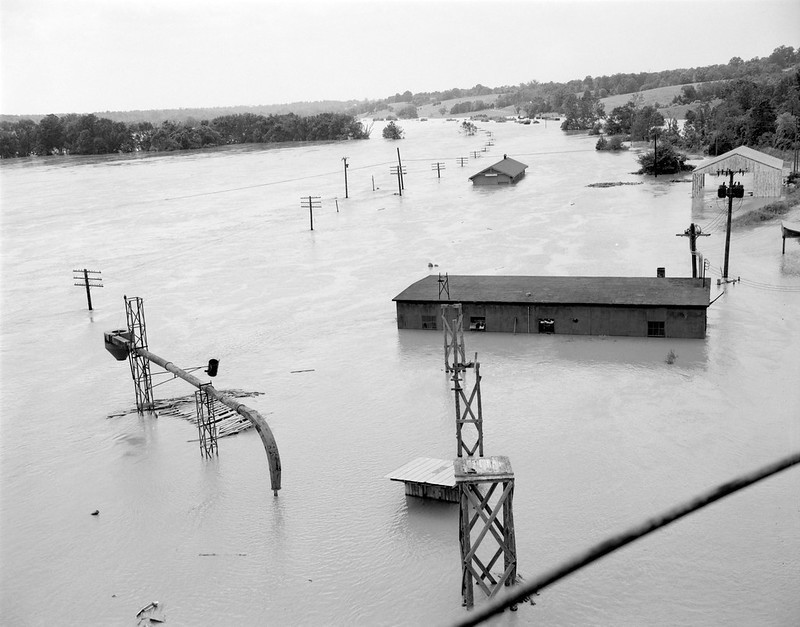
the Route 603 bridge at Columbia also was washed out
Source: Library of Virginia, Bridge Destruction Near Columbia
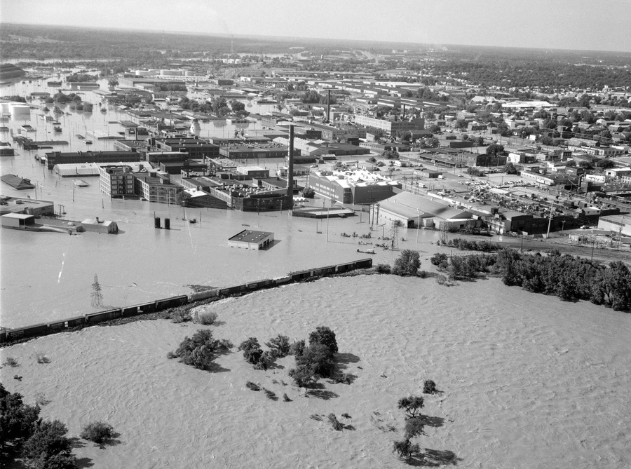
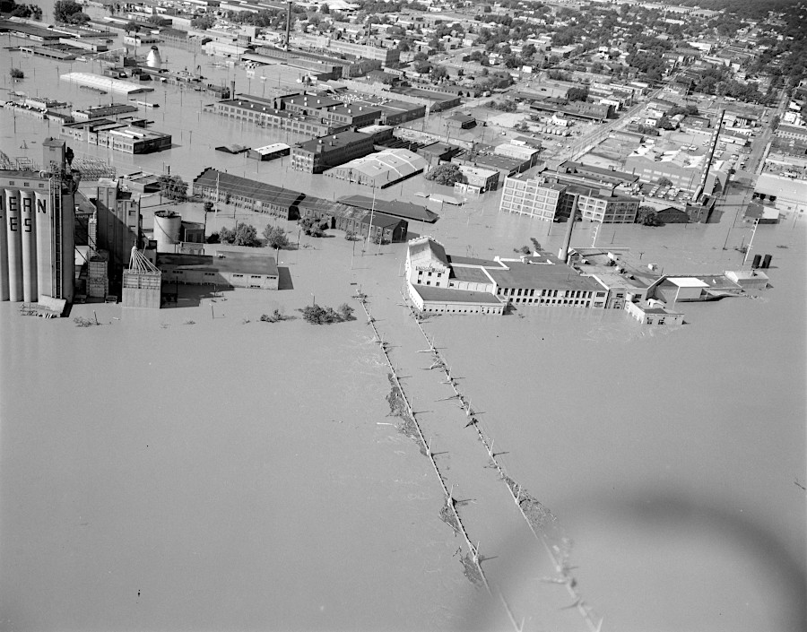
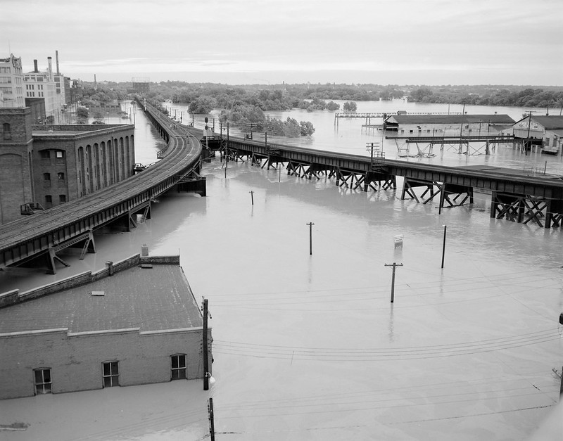
after Hurricane Agnes, the James River flooded southern Richmond opposite Belle Isle
Source: Library of Virginia, Richmond After the Flood
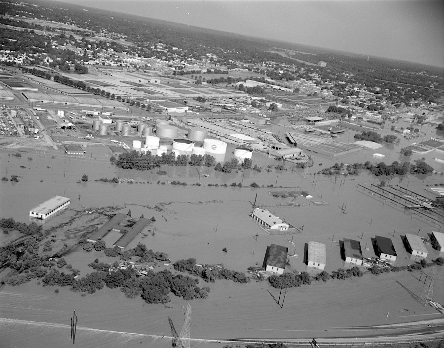
flooding south of the James River in Richmond
Source: Library of Virginia, Aerial view of Southside
looking towards the southern side of the James River at the 24th Street Bridge
Source: Library of Virginia, 14th Street Bridge Under Water
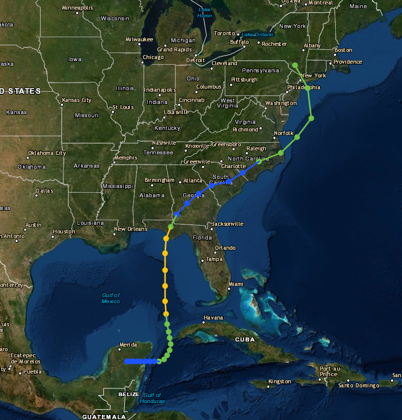
path of Hurricane Agnes in 1972
Source: National Oceanic and Atmospheric Administration (NOAA), Historical Hurricane Tracks
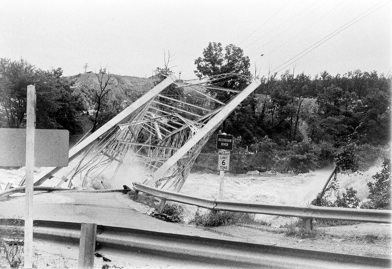
the Route 123 bridge across the Occoquan River was destroyed by the flooding from remnants of Hurricane Agnes
Source: Library of Virginia, Raging Occoquan River
the Route 45 bridge across the James River was completely underwater after Hurricane Agnes
Source: Library of Virginia, Flood Damage in Cartersville
flood debris on Route 56 bridge over James River near Wingina
Source: Library of Virginia, Flood Waters in Wingina
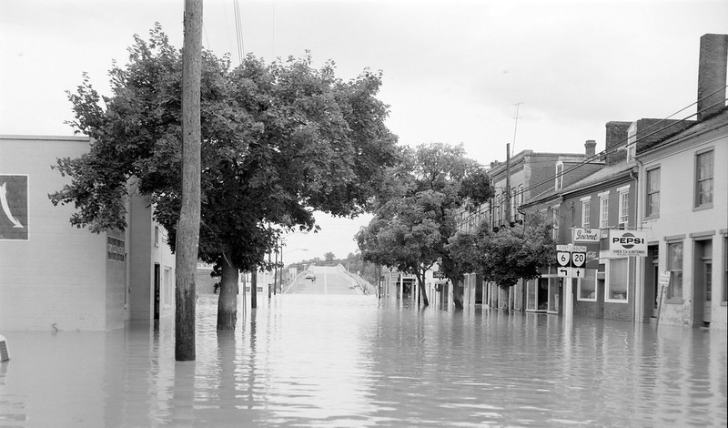
two days after Hurricane Agnes, near the intersection of Route 20 and Route 6 in Scottsvile looking towards the bridge over the James River
Source: Library of Virginia, Valley Street in Scottsville
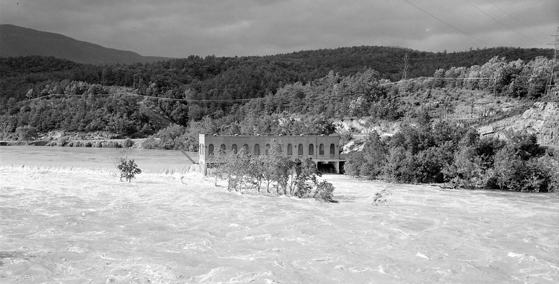
Cutshaw Dam on the James River near Snowden
Source: Library of Virginia, Flood Damage on Rt. 501
view in Richmond from the I-95 bridge
Source: Library of Virginia, James River Flooding
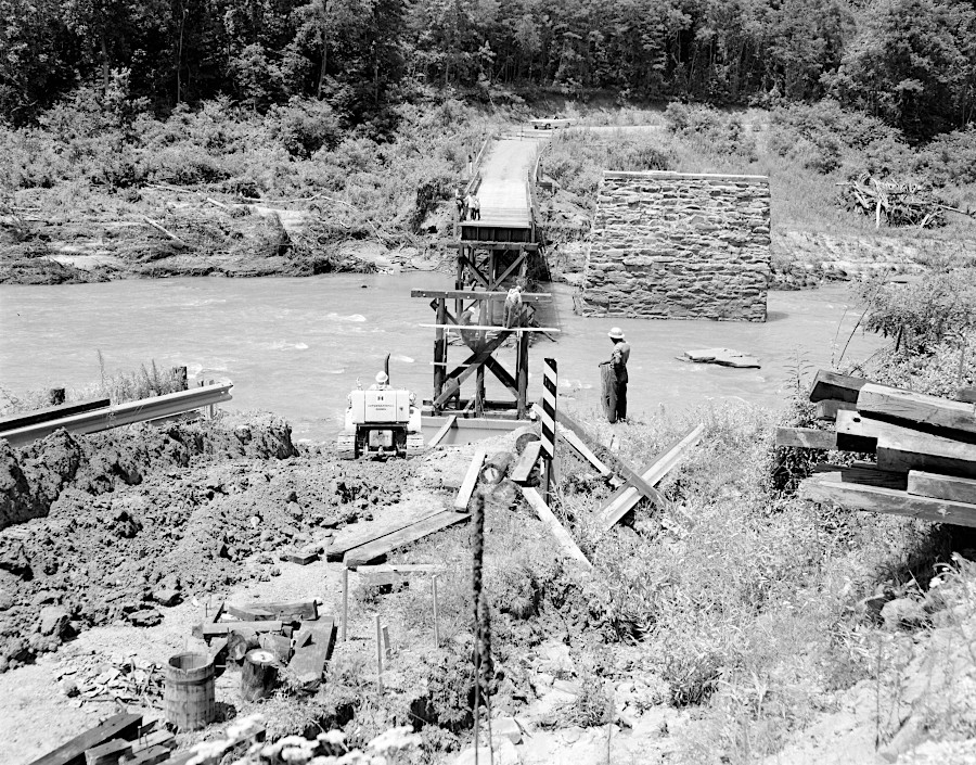
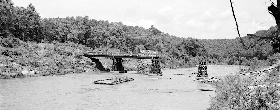
Route 654 bridge over the Tye River, Norwood in Nelson County, was washed out
Source: Library of Virginia, Rt. 654 Bridge in Pieces and Reconstruction of the Rt. 654 Bridge