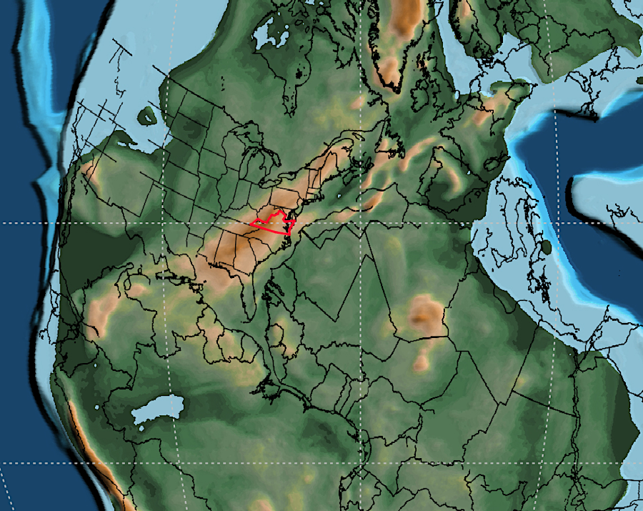
The Mountains of Virginia
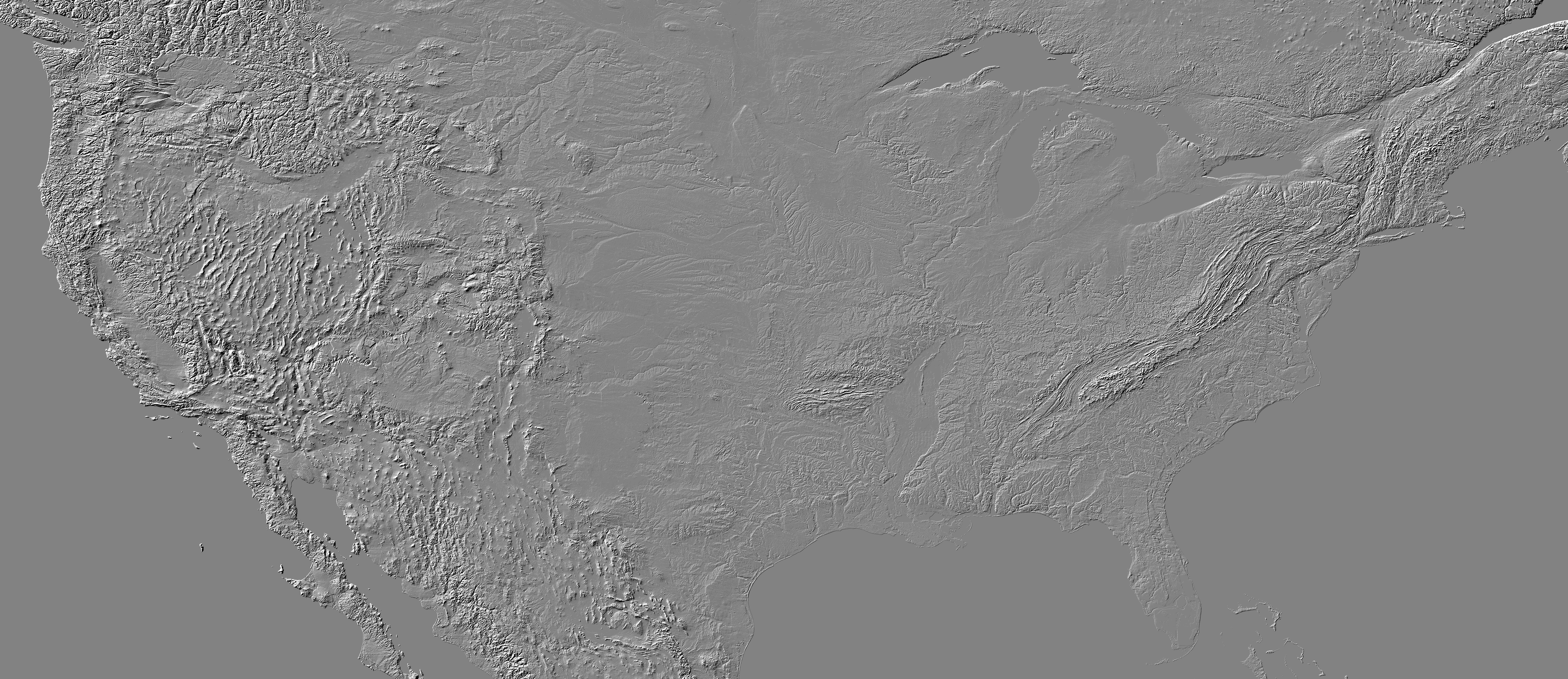
the collision of the African tectonic plate with the North American tectonic plate to create Pangea wrinkled the eastern edge of the North American continent and created the pattern of bedrock that has formed Virginia's mountains
Source: National Oceanic and Atmospheric Administration, GLOBE: A Gallery of High Resolution Images
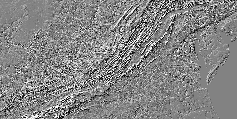
the mountains of Virginia
Source: US Geological Survey (USGS), NED Shaded Relief - Virginia
The only way to take a mountain hike on Virginia's Coastal Plain is to walk on a flat sandy beaches, and claim the sand grains are remnants of the Appalachians. A French artist painted a scene at Mount Vernon with a mountain in the background. That artist is not known to have visited Virginia. He used the image in someone else's engraving as his source, and probably misinterpreted clouds in it as mountains.1
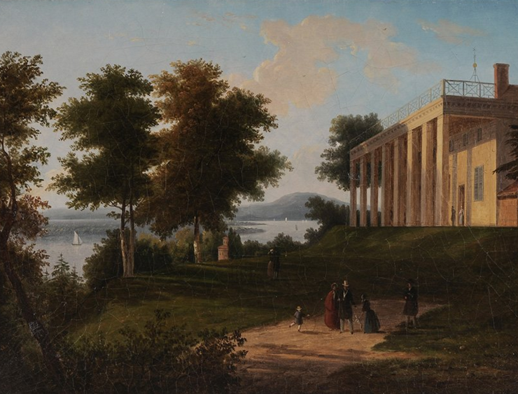
in 1848 a French artist who had never been to Mount Vernon included mountains in the background, after misinterpreting clouds in the engraving used as the basis for his painting
Source: LiveAuctioneers, View of Mount Vernon (by Victor de Grailly, 1848)
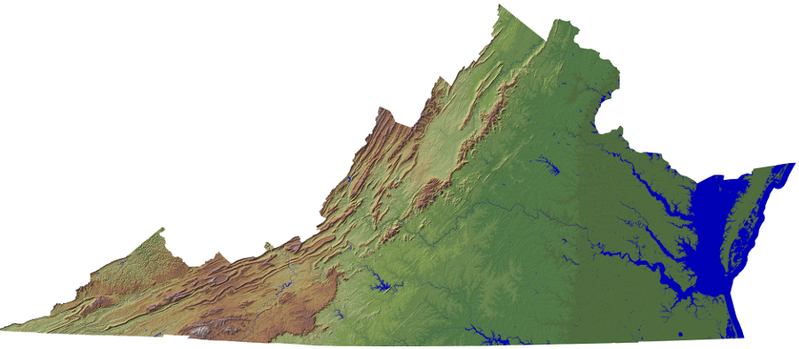
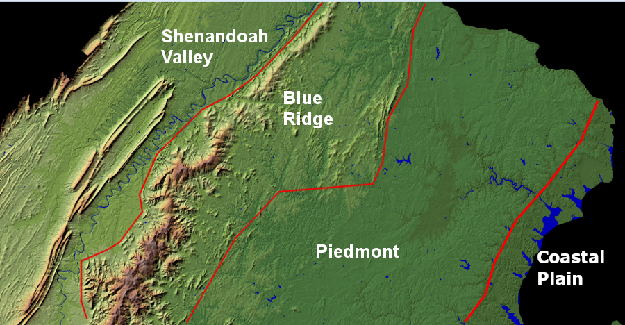
The mountains in the state start at the Blue Ridge, though there are a few ridges on the Piedmont. There are numerous stone-topped mountains to the west of the Blue Ridge, including Massanutten Mountain dividing the Shenandoah Valley.
Plateaus are created when a large block of land is lifted up to the same height. Virginia's mountains may have started that way by tectonic collisions, but erosion has carved out valleys and isolated peaks that we now call a "mountain."
Streams etched out channels with intervening ridges in the Coastal Plain and Piedmont, but topographic relief east of the Blue Ridge is rarely more than 100 feet. In the Blue Ridge and the Valley and Ridge physiographic provinces, ridges and peaks can often be more than 1,000 feet higher than the surrounding land.
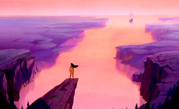
the Disney movie Pocahontas used artistic license to conclude with the main character on a high mountain ridge watching John Smith sail into the sunset, because the low ridges in the Coastal Plain of Virginia do not offer such a dramatic vista
Source: AwardsWatch, Best Disney Renaissance Film (1989-99)
The Blue Ridge shaped the settlement pattern of Virginia;. The Shenandoah Valley was separated from the Piedmont and Tidewater by those mountains, limiting interest on the part of early colonists to occupy the region despite its rich bottomlands suitable for farming. It was easier to float tobacco, wheat, hides, lumber, and other agricultural products on the east side of the Blue Ridge, down the Piedmont rivers to ports on the Chesapeake Bay. Settlers who crossed to the west side of the Blue Ridge had to transport corn, wheat, and other goods to market through mountain passes, except for those farmers who could use the Shenandoah River as a water highway.
Colonial officials in the first half of the 1700's consciously sought to increase settlement west of the Blue Ridge for geopolitical reasons. Governors Spotswood and Gooch feared the French would occupy the Ohio River Valley before the English. With Native American allies, the French might cross the mountains and attack English settlements on the western edge of the Piedmont.
To prevent such a scenario, Pennsylvania Dutch and Scotch-Irish immigrants were encouraged to move south from Pennsylvania and to settle in the valleys of the Shenandoah, James, and Roanoke rivers. The Blue Ridge provided a physical barrier separating the plantations and farms in the Piedmont from the French. New immigrants, even though they were non-Anglican and even non-English, supplemented the physical barrier of the mountains and created a human barrier to block the French.2
colonial governors did not think the physical barrier of the Blue Ridge would block French encroachment from the Ohio River
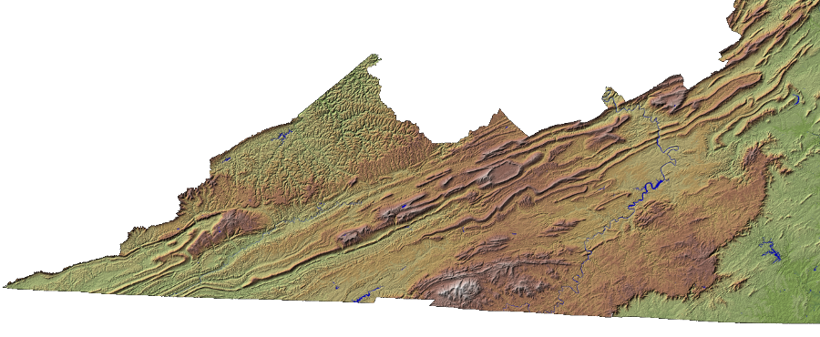
Source: US Geological Survey (USGS), NED Shaded Relief - Virginia
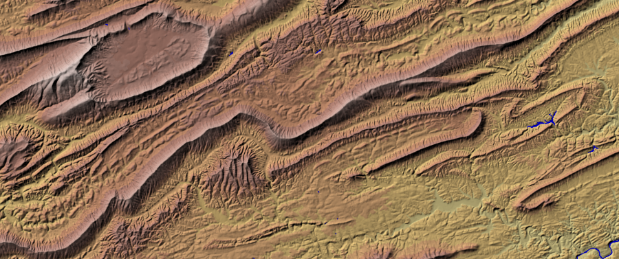
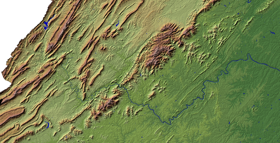
Those mountains are the eroded remnants of the land uplifted and folded by tectonic forces, plus a few topographic bumps (such as Mole Hill west of Harrisonburg) that were formed directly by volcanic activity. The primary tectonic event shaping the current mountains in Virginia was the collision between Africa and North America in the Paleozoic Era. The land surface was folded and cracked. Large chunks, including the Blue Ridge and Pine Mountain on the Kentucky border, were shoved westward on top of younger rocks during the formation of Pangea.
The Alleghenian orogeny was 300 million years ago. It thrust up the Ancestral Appalachians, with peaks as high as the Alps or perhaps even the Himalayas. Since then, several miles of rock have eroded away. Bedrock exposed on the surface of Virginia today, from the Blue Ridge west, was deeply buried until million years of erosion washed away what was on top.
the distinctive egg-shaped topography of Burke's Garden was created by tectonic uplift from the collision of the North American and African plates, creating an anticline that was exposed and carved by 200 million years of erosion
Source: US Geological Survey (USGS), NED Shaded Relief - Virginia
The spot with the highest elevation in Virginia is a remnant of ancient volcanic eruptions. Mount Rogers on the border of Smyth and Grayson County, Virginia's tallest mountain, reaches 5,729 feet (1,746 meters) above sea level today. The second-highest point in the state, the summit of Whitetop Mountain, is 5,520 feet high. In contrast, the high point in Washington, DC is only 409 feet above sea level. The Washington Monument is 555 feet tall, so the aluminum pyramid at the top of the monument is above the city's highest natural point at Reno Hill.3
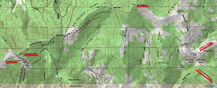
the highest five peaks in Virginia are within seven miles of each other
Source: ESRI, ArcGIS Online
Virginia's mountains stand taller than the surrounding landscape due to differential erosion. The hard volcanic material at Mount Rogers and along the Blue Ridge, and the hard quartzite capping other ridges to the west, is eroding - but the mountains and ridges as high points because they are eroding at a pace slower than the surrounding land. Valleys have been etched out faster by wind, ice and especially flowing water, creating topographic relief that humans have labeled as mountains and ridges.
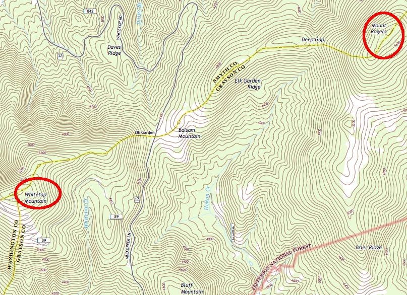
the high peaks of Mount Rogers and Whitetop Mountain are part of the volcanic Blue Ridge
Source: US Geological Survey (USGS), Whitetop 7.5x7.5 topographic quadrangle (2013)
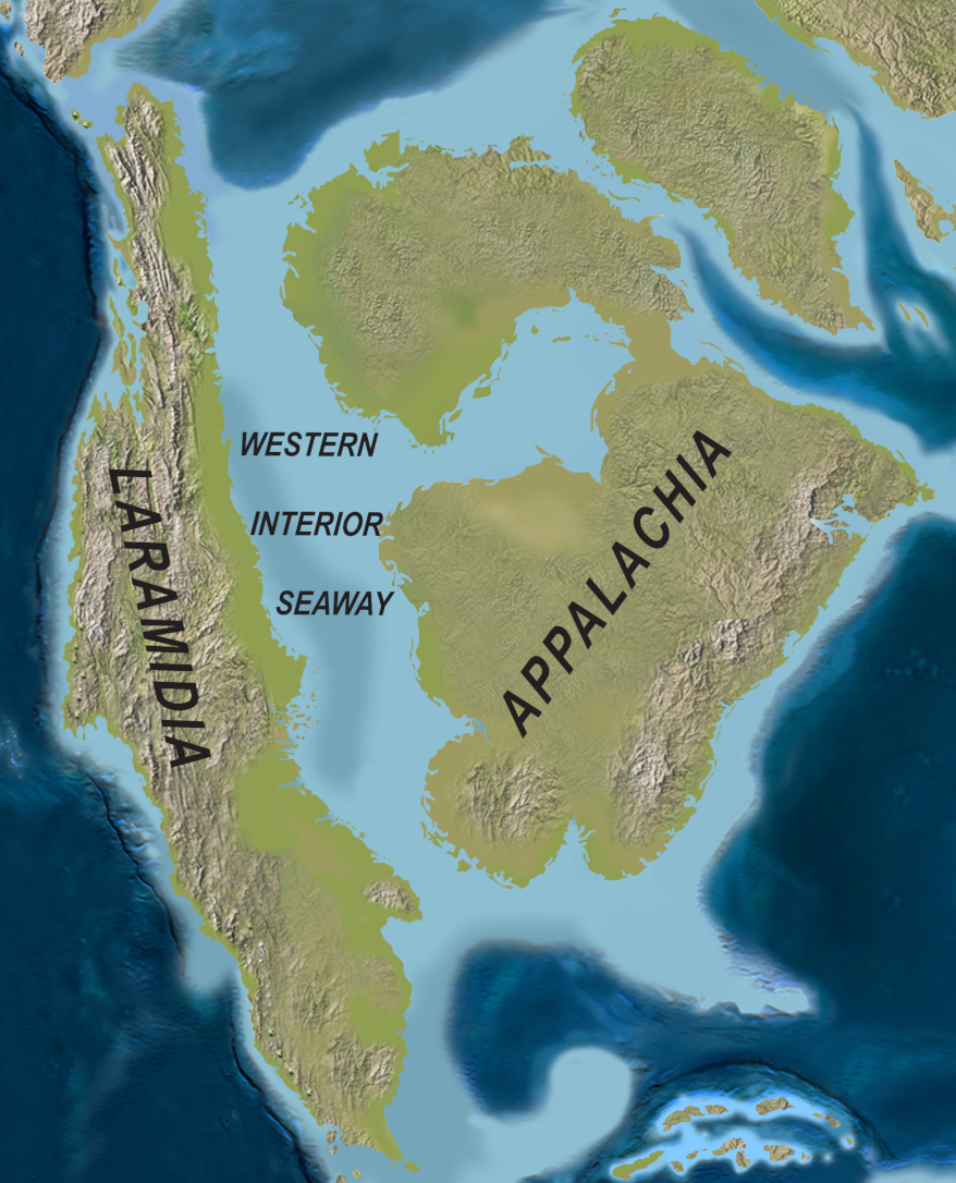
Much of what was once part of that pile of volcanic rock has washed down streams whose channels have disappeared, replaced by more-recent rivers such as the Roanoke, James, and the New rivers. The paths of the eroding rivers have evolved as tectonic plates have moved, the Ancestral Appalachian mountains have eroded, the Ancestral Rocky Mountains have been uplifted, and ice sheets how scoured the landscape. When Virginia was in the center of Pangea, rivers washed sediments downstream to the nearest coastline - which was in what today is Arizona.
sediments from the Ancestral Appalachians eroded downstream to the edge of Pangea in what today is Arizona (modern Virginia outlined in red)
Source: Wikipedia, Pangea (original source: The Cretaceous World: Plate Tectonics, Paleogeography, and Paleoclimate)
About 200 million years ago, after Pangea split up, the Atlantic Ocean formed. The Blue Ridge Escarpment has retreated from the edge of the North American continent as east-flowing rivers have etched their channels to the Atlantic Ocean.
Rivers flowing off the Ancestral Appalachians, going in what today is a western direction, carried sediments to the Western Interior Seaway about 100 million years ago. Later the Teays River (predecessor to the New River) took material north to the St. Lawrence River. Since an ice sheet blocked the flow of the Teays in the last Ice Age, the New River has been part of the Ohio/Mississippi River watershed. Sand grains which wash downstream today from Southwest Virginia end up in the Gulf of Mexico.4
the Western Interior Seaway interrupted delivery of sediments to the western edge of Pangea
Source: Wikipedia, Western Interior Seaway (original source: New Horned Dinosaurs from Utah Provide Evidence for Intracontinental Dinosaur Endemism)
The direction of flow has changed whenever streams (such as the Shenandoah River) have excavated their channel faster than other streams and pirated their headwaters. Others, such as the Teays, have dug entrenched meanders as fast as land has been uplifted. The eroded particles have settled ultimately in the Atlantic Ocean and the Gulf of Mexico, water bodies that were formed after the breakup of Pangea.
the James River crosses the Valley and Ridge physiographic province and cuts through the Blue Ridge at Balcony Falls, before flowing eastward across the Piedmont to deposit its sediment in the Chesapeake Bay
Source: US Geological Survey (USGS), NED Shaded Relief - Virginia
Is 5,729 feet tall enough to be a mountain? There are no official scientific criteria for distinguishing a "mountain" vs. a "hill" - or a "bluff," "mound," or "knob." In the United States, it is common that elevated spots that are less than 800 feet higher than nearby land will be called a hill. Elevated spots that are higher are often labeled as a mountain, with the tops labeled as individual peaks.
Biogeographers have different ways to distinguish "mountains," reflecting their interest in measuring the reasons for different forms of life to exist in different places. Overall elevation is a factor in what-lives-where because temperature and atmospheric pressure change with height, but mountains are different from plateaus because single points are higher than others.
Local custom determines place names, and the Board of Geographic Names has no formal standards that require Federal officials to override common names created by local residents.
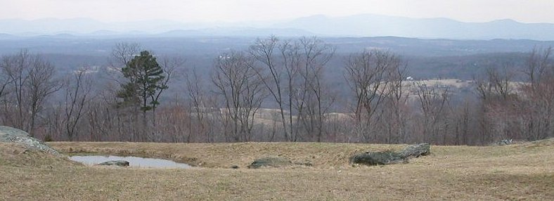
Looking towards the Blue Ridge on the western boundary of Fauquier County
The US Geological Survey has nearly 200 terms for mountain, hill, etc. Until the 1970's, that agency often classified a place as a "mountain" if there was 1,000 feet of local topographic relief (difference in elevation between nearby locations). Today, the US Geological Survey uses one classification, "summit," among the 43 classifications of landscape features in the Geographic Names Information System (GNIS). Over 70,000 places are identified as a summit, defined as:5
- Prominent elevation rising above the surrounding level of the Earth's surface; does not include pillars, ridges, or ranges (ahu, berg, bald, butte, cerro, colina, cone, cumbre, dome, head, hill, horn, knob, knoll, mauna, mesa, mesita, mound, mount, mountain, peak, puu, rock, sugarloaf, table, volcano)
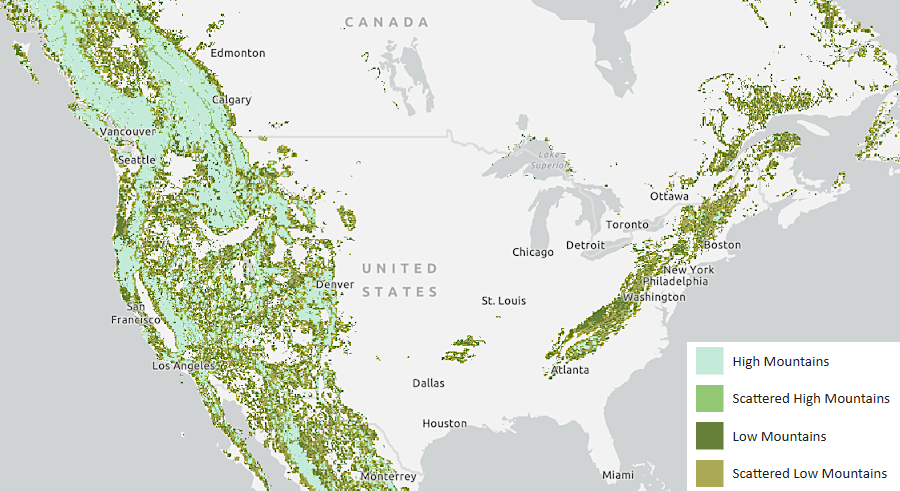
mountainous terrain (however defined) is concentrated on the eastern and western edges of North America
Source: US Geological Survey (USGS), Global Mountain Explorer
Paul Larson at Southern Utah University has emphasized one classification criterion:6
- ...the difference between a mountain and a hill is in vegetation changes. If it is high enough for vertical zonation to occur it is a mountain, but if the same vegetation type covers the entire height of the feature, it is a hill.
For many years, Thomas Jefferson and other Virginians thought the highest spot in the colony/state of Virginia was the Peaks of Otter, in part because Flat Top (3,994 feet high) and Sharp Top (3,862 feet high) stood out as distinct peaks compared to the adjacent ridges. Jefferson estimated their elevation in his 1785 Notes on Virginia:7
- The mountains of the Blue Ridge, and of these the Peaks of Otter, are thought to be of a greater height, measured from their base, than any others in our country, and perhaps in North America, From data, which may found a tolerable conjecture, we suppose the highest peak to be about 4000 feet perpendicular...
He measured the height of the Peaks of Otter in 1815, and told a surveyor three years later:8
- I found the height of the sharp peak above the bed of the river 2946 1/2 feet, that of the flat peak 3103 1/2 f.
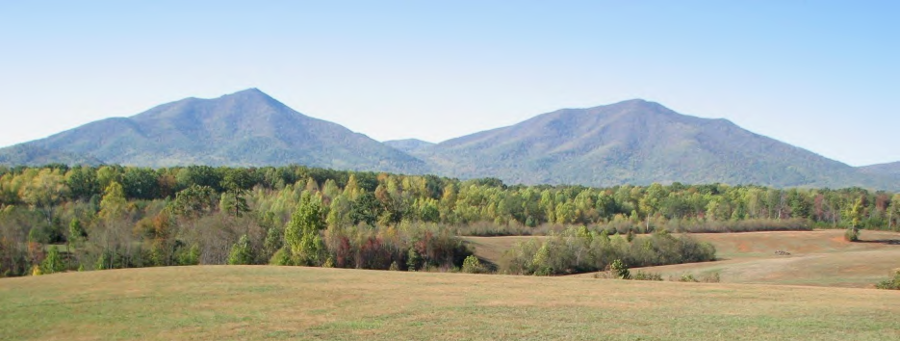
the Peaks of Otter, looking towards the west from Bedford County
Source: Peaks of Otter Soil & Water Conservation District, Big Otter River TMDL Implementation Plan
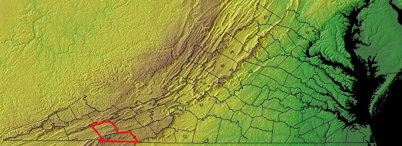
Today, we know that Smith and Grayson counties are the "roof" of Virginia. The five highest peaks in Virginia are within seven miles of each other. The summits of Mount Rogers, Whitetop Mountain and Buzzard Rock are in Smyth County. The other two summits, Wilburn Ridge on Pine Mountain and Haw Orchard Mountain, are in Grayson County. Grayson County has the highest mean elevation in the state, at 2,984 feet.9
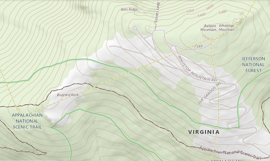
Whitetop Mountain and Buzzard Rock, like Mount Rogers, are in Smyth County
Source: US Geological Survey (USGS), Geographic Names Information System
To a casual visitor, Whitetop Mountain in Grayson County appears to be taller than Mount Rogers. Whitetop stands slightly apart from other places, and the treeless "bald" appearance also makes it more eye-catching than nearby Mount Rogers. However, if the red spruces covering Mount Rogers and blocking the view from the top continue to die off, then there's a chance that the highest point in Virginia will be easier to recognize.
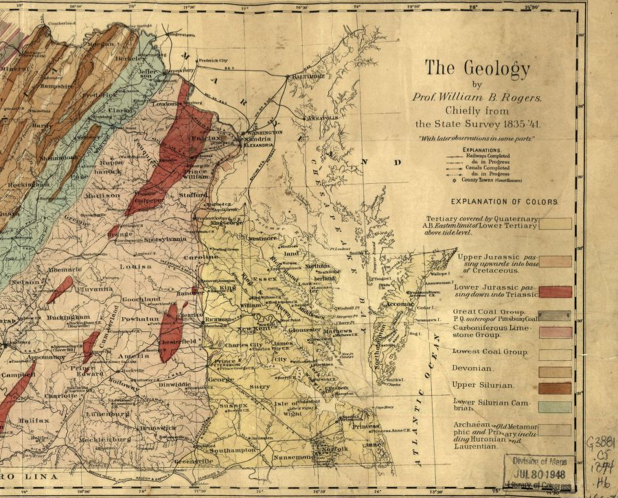
Jedediah Hotchkiss acknowledged the geologic mapping done before the Civil War by Virginia's first state geologist, William Barton Rogers
Source: Library of Congress, Map of Virginia (by Jedediah Hotchkiss, 1874)
We can identify summits from the 1:24,000 scale topographic maps produced by the US Geological Survey (USGS). Age of the maps showing the height of mountains is rarely important when checking elevations in Virginia; erosion is slow and human-induced changes are minor. A topo quadrangle map that has not been updated for 50 years will still have relatively-accurate elevation data, even though the indications of land use (especially boundaries of urban/suburban development) will be outdated. Updates to the National Elevation Dataset, using more-accurate technology, will refine summit heights only slightly.
the different speed at which different rocks erode is the reason why Virginia has mountains today, though erosion will alter elevations only slightly within a human lifetime
Source: US Geological Survey (USGS), NED Shaded Relief - Virginia
Virginia has about 1,850 features named a "summit," and about 100 are over 4,000 feet high. There are 700 records of places called a "ridge," defined by USGS as:10
- Elevation with a narrow, elongated crest which can be part of a hill or mountain (crest, cuesta, escarpment, hogback, lae, rim, spur).
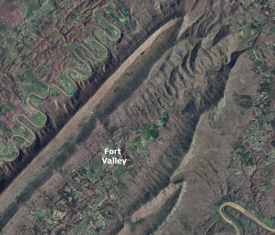
Fort Valley is located between two ridges of Massanutten Mountain
Source: Virginia Geographic Information Network (VGIN), VBMP 2011 WGS Web Mercator (VGIN)
Height is a relative feature. In Accomack County, the named ridges are low in elevation, but the slight difference in height above the surrounding land is important enough to be affect the drainage and to be noticed. Bulls Head in Accomack County is a summit - all of 2 feet high.11
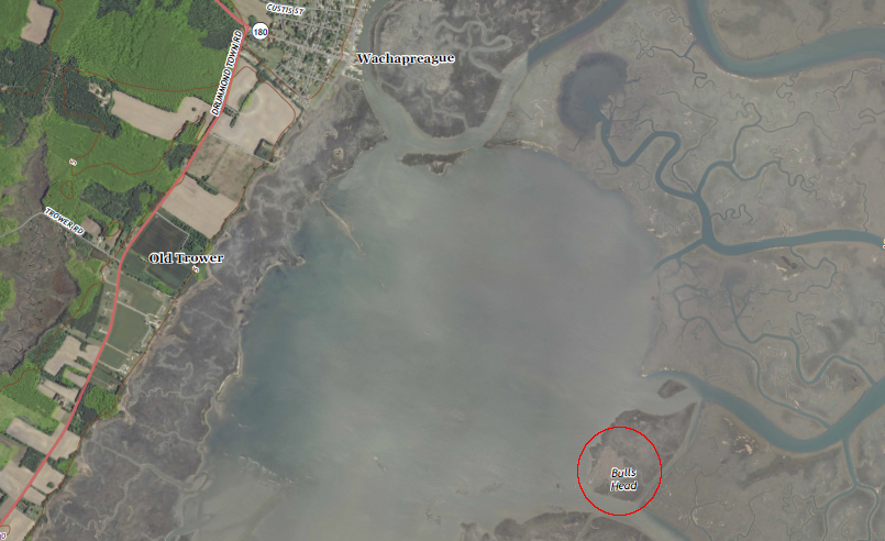
near Wachapreague on the Eastern Shore, two feet of local topographic relief was enough to justify calling Bulls Head a summit
Source: US Geological Survey (USGS), Wachapreague 7.5x7.t topographic quadrangle (2013)
- There are only two counties in Virginia with named summits above 5,000 feet:
- Grayson County:
- - Mount Rogers (5,729 feet)
- - Whitetop Mountain (5,525 feet)
- - Pine Mountain (5,525 feet)
- - Haw Orchard Mountain (5,007 feet)
- Smyth County:
- - Buzzard Rock (5,095 feet)
Grayson and Smyth counties, with highest elevations in Virginia
Source: National Oceanographic and Atmospheric Administration (NOAA), Global Land One-km Base Elevation Project (GLOBE) database
The heights of Virginia's mountains and the relief above surrounding topography are constantly changing, if measured in geologic time. Wind and water move material downhill, lowering hills and raising valleys - unless the rivers excavating those valleys are carrying away material faster than it is being supplied. Tectonic forces squeeze the North American continent as it drifts westward. That squeezing has uplifted the modern Allegheny Plateau and pushed the Blue Ridge up to 2,000 feet above sea level.
The last collision with another large chunk of continental crust capable of uplifting a mountain range was 300 million years ago, when the African and North American plates collided. The forces of erosion are strong enough to flatten the Ancestral Appalachians in as little as 20 million years. Were it not for modern uplift, Virginia should have eroded to a flat peneplain.12
Links
References
1. "View of Mount Vernon," Baltimore Museum of Art, https://artbma.org/guides/american-art/view-of-mount-vernon (last checked October 14, 2025)
2. Warren Hofstra, "Backcountry Frontier of Colonial Virginia," Encyclopedia Virginia, Virginia Humanities, December 7, 2020, https://encyclopediavirginia.org/entries/backcountry-frontier-of-colonial-virginia (last checked October 14, 2025)
3. "Fort Reno ('Point Reno') - DC," SummitPost.org, https://www.summitpost.org/fort-reno-point-reno-dc/214459; "The real height at which a hill becomes a mountain, according to data," Washington Post, October 13, 2025, https://www.washingtonpost.com/business/2025/10/13/real-height-which-hill-becomes-mountain-according-data/ (last checked October 15, 2025)
4. "Long Ride West: Many western sediments came from Appalachians," Science News, August 27, 2003, https://www.sciencenews.org/article/long-ride-west-many-western-sediments-came-appalachians (last checked March 3, 2025)
5. "What is the difference between 'mountain', 'hill', and 'peak'; 'lake' and 'pond'; or 'river' and 'creek?'," Geographic Names Information System, US Geological Survey, http://www.usgs.gov/faq/categories/9799/2973; "GNIS Domestic Names Feature Classes," Geographic Names Information System, US Geological Survey, https://www.usgs.gov/us-board-on-geographic-names/gnis-domestic-names-feature-classes; "The real height at which a hill becomes a mountain, according to data," Washington Post, October 13, 2025, https://www.washingtonpost.com/business/2025/10/13/real-height-which-hill-becomes-mountain-according-data/; C. Körner, , D. Urbach, J. Paulsen, "Mountain definitions and their consequences," Alpine Botany, Volume 131, (2021), https://doi.org/10.1007/s00035-021-00265-8 (last checked October 15, 2025)
6. Paul Larson, on Geography Education listserver GEOGED@LSV.UKY.EDU, January 14, 2008
7. Thomas Jefferson, "Notes on the State of Virginia," 1801, p.37, https://archive.org/details/notesonstateofvirg00jeff (last checked December 19, 2024)
8. "Peaks of Otter," Monticello, https://www.monticello.org/research-education/thomas-jefferson-encyclopedia/peaks-otter/; "Thomas Jefferson to George Wyche, 10 November 1818," Founders Online, National Archives, https://founders.archives.gov/documents/Jefferson/03-13-02-0346 (last checked December 19, 2024)
9. "Mean County Elevation Lists," County Highpointers, http://www.cohp.org/records/mean_elevation/mean_elevations.html; "Mount Rogers," US Geographic Names Information System, https://edits.nationalmap.gov/apps/gaz-domestic/public/search/names?loc=36.6581251,-81.5453231,16, "Buzzard Rock," US Geographic Names Information System, https://edits.nationalmap.gov/apps/gaz-domestic/public/search/names?loc=36.6351111,-81.6164998,15; "Virginia’s Five Highest Peaks," Virginia Tourism Corporation, https://blog.virginia.org/2014/10/peaks/ (last checked November 22, 2021)
10. "Feature Class Definitions," Geographic Names Information System, US Geological Survey, http://geonames.usgs.gov/apex/f?p=136:8 (last checked April 25, 2016)
11. "Bulls Head," Geographic Names Information System, US Geological Survey, http://geonames.usgs.gov/apex/f?p=gnispq:3:::NO::P3_FID:1499185 (last checked April 25, 2016)
12. Lynn S. Fichter, "Geological Evolution of Virginia and the Mid-Atlantic Region - Cross Section B," https://csmgeo.csm.jmu.edu/geollab/vageol/vahist/B-LatProt.html (last checked March 3, 2025)
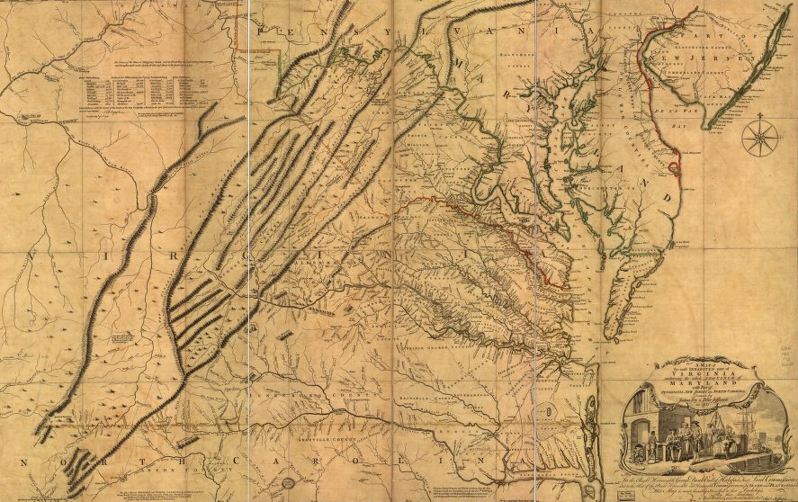
since John Lederer climbed the Blue Ridge in 1669-1670, Virginians in Tidewater have been known that there are mountains to the west
Source: Library of Congress, A map of the most inhabited part of Virginia (by Joshua Fry and Peter Jefferson, 1755)
Rocks and Ridges - The Geology of Virginia
Mapping Virginia
Virginia Places