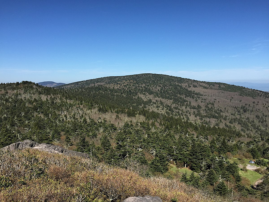
Mount Rogers, as seen from Pine Mountain, is not a high peak that stands out from its neighboring ridge summits
Source: Wikipedia, AMount Rogers (by Famartin, 2017)
Mount Rogers, as seen from Pine Mountain, is not a high peak that stands out from its neighboring ridge summits
Source: Wikipedia, AMount Rogers (by Famartin, 2017)
Mount Rogers, at 5,729 feet in elevation, is the highest spot in Virginia. The next four tall peaks are:1
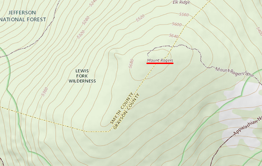
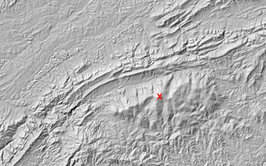
Mount Rogers is on the border of Smyth and Grayson counties, with the tip of the summit in Smyth County
Source: US Geological Survey (USGS), Geographic Names Information System
The creation of Mount Rogers started about a billion years ago during the Grenville Orogeny. Tectonic forces squeezed chunks of continental crust together, forming the supercontinent of Rodinia. The compression pushed up the Grenville Mountains, and simultaneously pushed mountain roots down towards the mantle. The "pluton" of molten rock deep underground cooled slowly. Minerals crystallized at different temperatures and pressures, and crystals aligned in light/dark layers, to create a rock formation now called the Cranberry Gneiss.2
Rodinia started to crack up about 760 million years ago, but in what today is North Carolina/Virginia the rifting failed around 735 million years ago. The rift valley filled with as much as 25,000 feet ofsediments that have since been metamorphosed. Much of the Great Smoky Mountains are formed from the Ocoee Supergroup.
From Cumberland Gap to Grayson County in Virginia, the Crossnore Complex (which includes the Mount Rogers Formation) overlies the Cranbery Gneiss. The Mount Rogers Formation is a mixture of sedimentary and volcanic rocks that accumulated in the valley during the failed rifting 735 million years ago. The rhyolite records the heavy volcanic activity triggered by the thinning crust as the rift valley opened. The sedimentary rocks indicate that erosion was strong, with rivers carrying volcanic material and eroded cobbles/pebbles of Cranberry Gneiss into the valley.
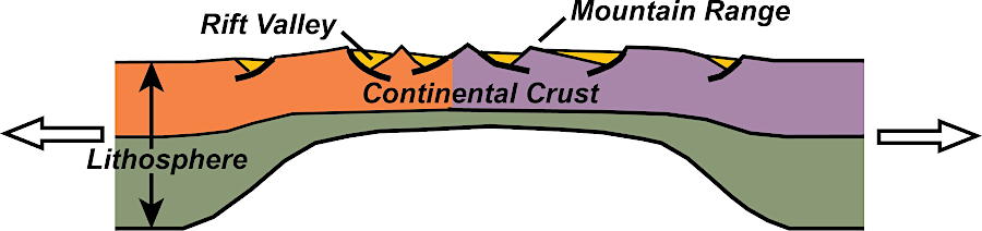
the volcanic and sedimentary rocks of Mount Rogers formed originally when Rodinia began to rift apart, 750 million years ago
Source: National Park Service, Tectonic Evolution of the Southern Appalachian Mountains - 750 Million Years Ago
The Konnarock Formation, on top of the Mount Rogers Formation and therefore younger, includes conglomerate with cobbles. The Konnarock Formation is clearly associated with glaciation; in places there are "dropstones" of Cranberry Gneiss which were encased in ice on top of a lake and then deposited when the ice melted. The glaciation occurred at a time when most or perhaps even the entire earth was encased in ice, a "Snowball Earth" period.
The pause in the rifting of Rodinia ended 570 million years ago. Rifting restarted, and the supercontinent of Rodinia broke up. In that process, lava welled up and spread across the surface. In the Blue Ridge north of Charlottesville the lava is known as the Catoctin Formation. After the rifting, the location of Mount Rogers was on the edge of the North American Plate. Marine sediments were deposited for about 100 million years. That changd when the Taconic Orogeny began the process of accreting terranes to the edge of the plate, burying the older formations.3
Heat and pressure from burial and then thrust faulting during orogenies metamorphosed the rock, realigning the cystals to create different minerals. Today Mount Rogers is 300 miles from the shoreline. Erosion has exposed the volcanic and sedimentary bedrock which was deposited over 500 million years ago and then metamorphosed.
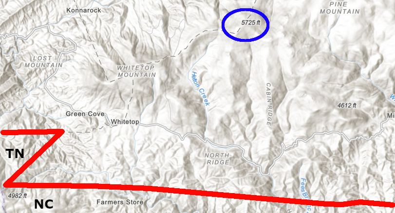
Mount Rogers is near the border with North Carolina and Tennessee
Source: ESRI, ArcGIS Online
In 1966, the US Congress created the Mount Rogers National Recreation Area and included 191,000 acres of National Forest land:4
Mount Rogers is a feature within the Blue Ridge
Source: ESRI, ArcGIS Online
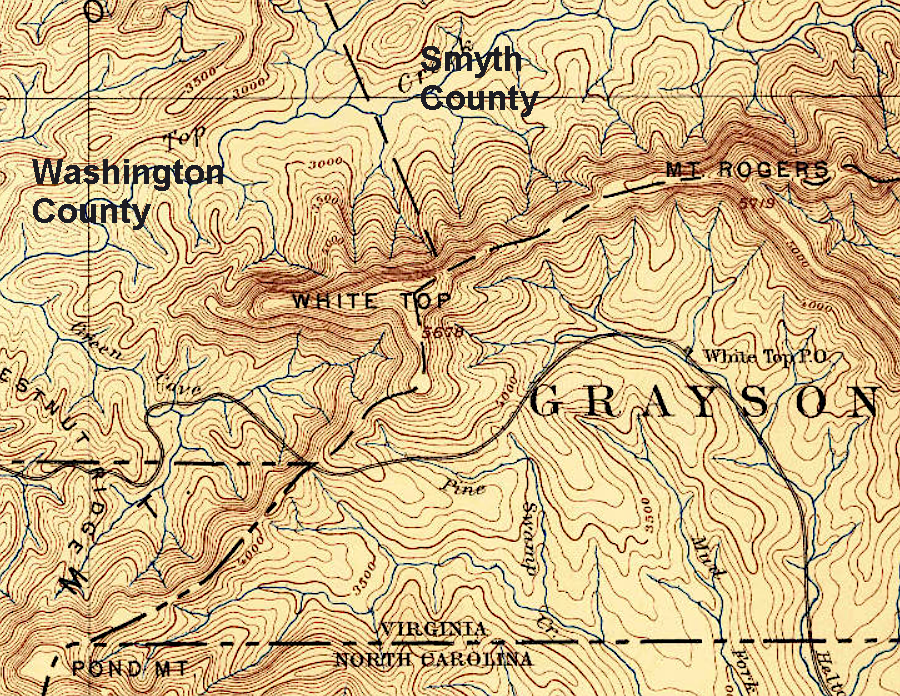
Mount Rogers and Whitetop Mountain are the tallest summits on a ridge that forms the border of Smyth, Grayson, and Washington counties
Source: US Geological Survey (USGS), Abingdon, TN 1:125,000 topographic quadrangle map (1891)