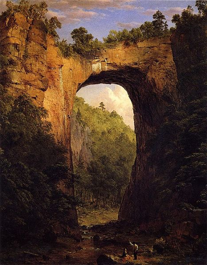
1852 painting by Frederic Edwin Church vs. 2008 scene
Source: Museum Syndicate
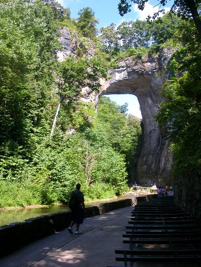
1852 painting by Frederic Edwin Church vs. 2008 scene
Source: Museum Syndicate
Natural Bridge is a geological rarity and one of Virginia's earliest tourist attractions. Rockbridge County, created in 1778, was named after the feature.
The first European to document seeing the geologic feature was John Peter Stallings. He saw it while exploring the backcountry in an expedition led by John Howard. Governor Gooch had promised Howard 10,000 acres if he would identify the geographic features between the Blue Ridge wast to the Mississippi River. That journey is an early equivalent of the Lewis and Clark Expedition in 1803-1805 to the Pacific Coast.
Stallings had settled in the upper James River valley in 1736. He wrote about seeing Natural Bridge in 1742. His writing was a reconstruction of his journal. The original document had been seized by the French when Stallings was captured during the exploration and imprisoned as an English spy in New Orleans. The recollection was still specific:1
Thomas Jefferson probably saw the Natural Bridge for the first time on August 23, 1767. He purchased it and 157 acres around it in 1774. That required getting a land warrant in 1773, followed by metes and bounds of the survey ("Beginning at 2 poplars on a line of Hugh Barkeley's land...") completed by James Tremble (not George Washington...). The survey made no reference to the Natural Bridge on the property.
Jefferson paid the equivalent of less than $200 in modern money to obtain the land warrant, get the property surveyed, and file the necessary papers with the Secretary of the Colony in Williamsburg.
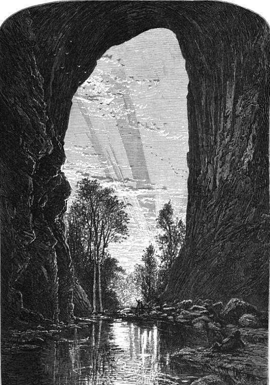
Natural Bridge, as portrayed in the 1870's
Source: Picturesque America (p.42)
Jefferson later tried to sell "one of the sublimest curiosities in nature" for development as a tourist resort. However, the property stayed in his family until 1833, and was sold only after he died.2
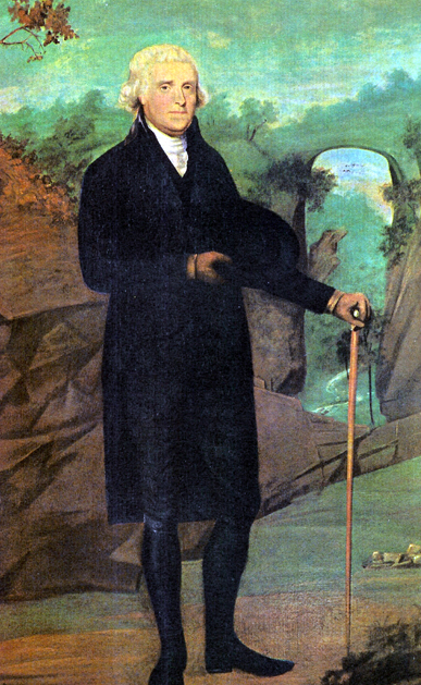
Thomas Jefferson at Natural Bridge, as portrayed by Caleb Boyle
Source: The Atlanta 100, Did Jefferson Seed National Parks? (June 28, 2016)
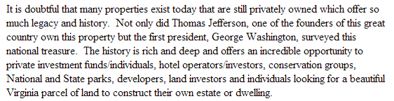
Natural Bridge stayed in private ownership after that 1774 purchase for 249 years. There were numerous proposals since at least the 1940's for the state or Federal government to purchase Natural Bridge and to preserve it in a park, ensuring public access through public ownership.
In 2013, a real estate deal was structured so the bridge was sold to a new owner, but would be transferred ultimately into public ownership and become the 37th unit of the Virginia State Park system. The Natural Bridge State Park was established in 2016, but technically the land still remained private. Before the transfer to public ownership by the Commonwealth of Virginia, the debt for purchase of the property had to be paid.3
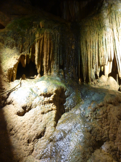
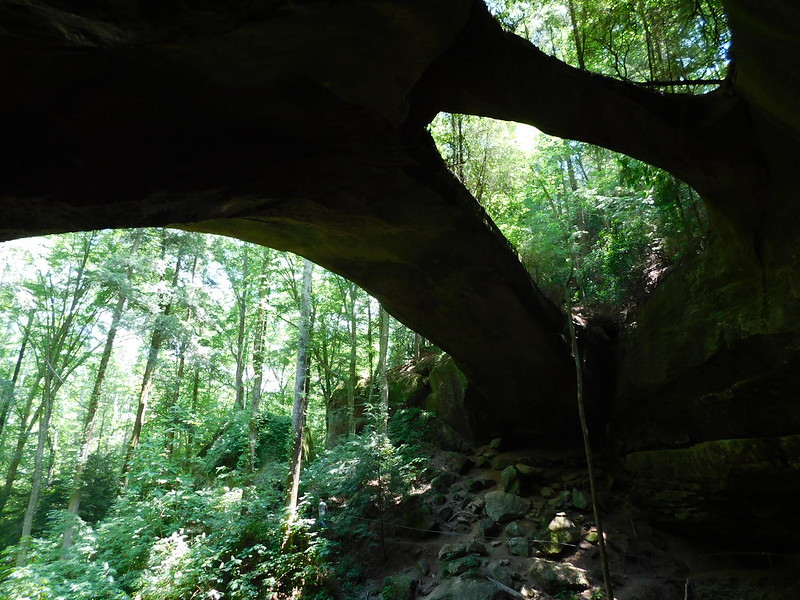
Natural Bridge is the remnant of an ancient cave roof, and Natural Bridge Caverns nearby offers public tours of an underground cave
In 1787, Thomas Jefferson described the bridge in his Notes on the State of Virginia:4
The private company that owned Natural Bridge until 2014 developed the site as a commercial tourist attraction, along with Natural Bridge Caverns. The company added additional attractions to draw 160,000 visitors annually. They paid the admission fee and purchased souvenirs at the gift shop, including 65,000 who stayed at the Natural Bridge hotel, Attractions included Professor Cline's Haunted Monster Museum, a wax museum, Dinosaur Kingdom, and a replica of a Monacan village staffed by Native Americans from that nearby tribe.
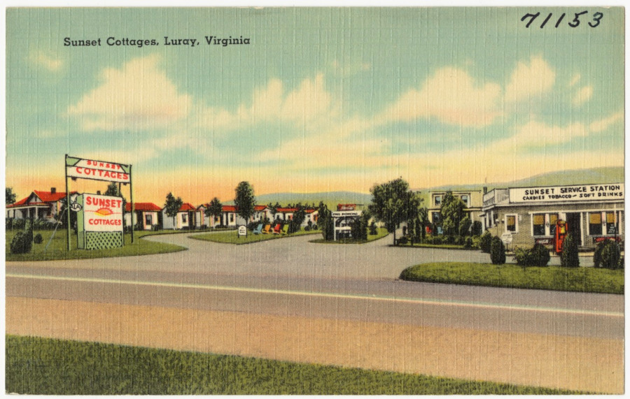
Natural Bridge stimulated development of tourist hotels on Route 11
Source: Boston Public Library, Tichnor Brothers Postcard Collection, Sunset Cottages, Luray, Virginia
The interpretation at the site has mixed myth with history. A light and music show called the Drama of Creation was provided at night. Nearby attractions, including a styrofoam replica of Stonehenge nearby called Foamhenge, sought to take advantage of the ability of Natural Bridge to attract tourists.5
Marketing by the private owner included repeating stories designed to magnify the significance of the site, "gilding the lily" in a manner that would not be acceptable for professional interpretation at a state or national park. Though there is no historical documentation to support the claim, the company website advertised:6

the website for Natural Bridge long claimed that George Washington had surveyed the site
Source: Natural Bridge of Virginia
Caveat emptor - the real estate broker trying to sell Natural Bridge in 2013 repeated the George Washington story
Source: Woltz & Associates, Inc.
The initials are visible from the trail across Cedar Creek, 23 feet above ground level. Most likely, they were carved into the stone long after George Washington died. In 1927 a stone was found with the initials "G.W." plus a surveyor's cross. At one time, there were hundreds of names and initials carved as graffiti on the wall at that spot, and the "G.W." was already there.7
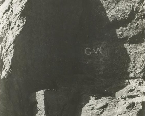
George Washington's initials, carved on the rock wall below Natural Bridge
Source: New York Public Library, Washington Series. Natural Bridge, Virginia. George Washington's initials carved in the rock by himself (prior to 1920)
The claim of a George Washington survey is as mythical as "George Washington slept here" for may sites seeking to manufacture an association with the most historic colonial Virginian. A list of all known surveys by George Washington includes none in the James River watershed. His survey work was concentrated in the Northern Neck, where Lord Fairfax allowed him to work even after he was no longer officially the surveyor for Culpeper County.
It is not documented that George Washington ever saw the Natural Bridge, though it would have made sense for him to visit the natural wonder when he was in the region. In 1780, while the Revolutionary Army which he commanded was camped at Newburgh, NY, he rode 25 miles to see recently-discovered mammoth bones.
In 1773, Thomas Jefferson paid James Tremble to survey the tract at Natural Bridge, and the land grant to Jefferson was issued on July 5, 1774. As one of Washington's biographers has noted:8
Other myths about the site involve ghost sightings, Native Americans discovering a magical "Bridge of the Gods" providing a path across Cedar Creek when fleeing from Shawnee warriors, and an arbor vitae tree that was supposedly 1,500 years old when it died in 1980. In 1873, a hoax that the limestone bridge had caught fire and burned was published by newspapers across the country.
In another invocation of George Washington, he is reported to have thrown a dollar over the bridge. That would require tossing a coin 190 feet high, and the idea that Washington threw away good money ignores his character.
The bridge has been a popular tourist attraction since Jefferson's purchase. The nomination of the site to the National Register noted:9
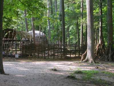
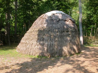
the Monacan village exhibit at Natural Bridge lasted from 1999-2020
The size and geological rarity of the bridge makes the site significant, independent of the cultural history and myths about the tourist attraction. There is only one other natural bridge in Virginia, a much-smaller arch located in Lee County.
Natural Bridge in Rockbridge County is a remnant of a cave roof that collapsed. It was not formed by an earthquake that split the land surface, though earthquakes may have cracked portions of the cave roof and triggered rockfalls.
The role of water in forming an underground channel of water and a cave at Natural Bridge, and its common relationship to the formation of Natural Tunnel in Scott County, was recognized even during Jefferson's lifetime.10
The safe answer to the question "how old is Natural Bridge" is that it was formed a long time ago. The rock itself was deposited around 450 million years ago, when the edge of the continental plate was under the Sauk Sea. During the Ordovician period, a thick accumulation of limestone developed on the ocean bottom as marine plankton and larger creatures with calcium-rich shells died.
In later collisions of tectonic plates, the limestone was buried by other sediments and shoved around. Magnesium atoms joined with the calcium atoms, perhaps as the limestone was exposed near the surface of seawater, to convert the limestone into dolomite with a chemical composition of CaMg(CO3)2.
Geologists map the bedrock of Natural Bridge in Rockbridge County as part of the Beekmantown Formation. It forms a remnant arch, overlying the Chepultepec Formation through which Cedar Creek flows.11
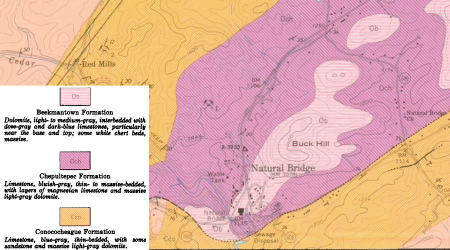
Natural Bridge is an arch of the Beekmantown Formation, roughly 450 million years old
Source: Virginia Division of Mineral Resources, Geology of the Natural Bridge, Sugarloaf Mountain, Buchanan and Arnold Valley quadrangles, Virginia (by E. W. Spencer, 1968)
The bridge itself is much younger, and may have developed only in the last 500,000-1,000,000 years. As rainwater seeped underground, it absorbed carbon dioxide and became slightly acidic. The CO(2 was added as the water traveled through the organic litter on the surface and the A horizon of the soil, which are filled with decomposing humus and animal life exhaling carbon dioxide. The water became slightly acidic as it trickled down through the topsoil into the dolomite.
The slightly-acidic water dissolved some of the calcium carbonate crystals. The groundwater carried away the calcium and carbonate ions in solution, replacing a crystal of solid rock with an empty space. As water dissolved many crystals over time, pores developed in the rock. Portions became similar to a sponge.
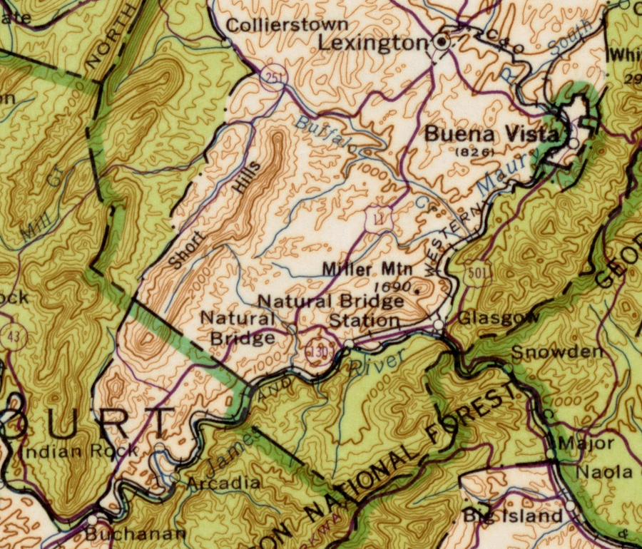
Where there were cracks in the bedrock, even more water could move underground to create channels connecting the pores. After many centuries, enough rock was removed for a cave to form underground. The "hole in the ground" expanded until it stretched west of Cedar Creek and intersected Pogue Run, near modern I-81. The roof of the underground channel that diverted the headwaters of Pogue Run was near the surface. Sinkholes probably formed above the channel, and ultimately "windows" developed where portions of the underground cave were exposed directly to the surface.
Surface water that used to flow down Pogue Run was diverted, and instead flowed through the underground limestone channel to Cedar Creek. This act of "stream piracy" changed the watershed divide on the surface. The length of Pogue Run was truncated, and its former headwaters became part of Cedar Creek.
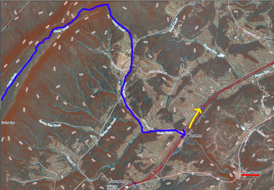
pirated portion of Cedar Creek (in blue), and current headwaters of Pogue Run (in yellow)
(former underground channel was located between I-81 and current Natural Bridge)
Source: US Geological Survey (USGS), Natural Bridge 7.5x7.5 topo map (2011)
Gradually, the dissolving power of the extra water flowing through the underground channel of Cedar Creek etched away at the cave's roof. The layer of rock at the top became thinner and thinner until portions collapsed. More of the cave was exposed to the sky, until only a small portion remains today. Modern Natural Bridge is an arch of dolomite rock that has not collapsed yet.12
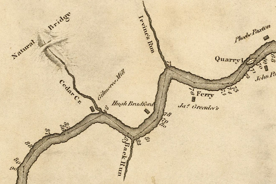
Cedar Creek, which etched out Natural Bridge, flows down to the James River
Source: Virginia Memory, A survey of the headwaters of the James River and the Greenbrier, Jackson River and the Great Kenhawa or New River, and the high road between them (Andrew Alexander, 1814)
As rocks fell from the cave roof and exposed the underground cave channel to the sky, Cedar Creek carried away the limestone debris. The process of collapse may have been gradual, but there could have been dramatic moments. At a similar natural bridge in China, Tianmen Shan:13
Calcium-saturated water that emerges at the surface is making tufa deposits in the streambed. The deposition process resembles the way cave formations such as stalactites and stalagmites are growing in nearby Natural Bridge Caverns.
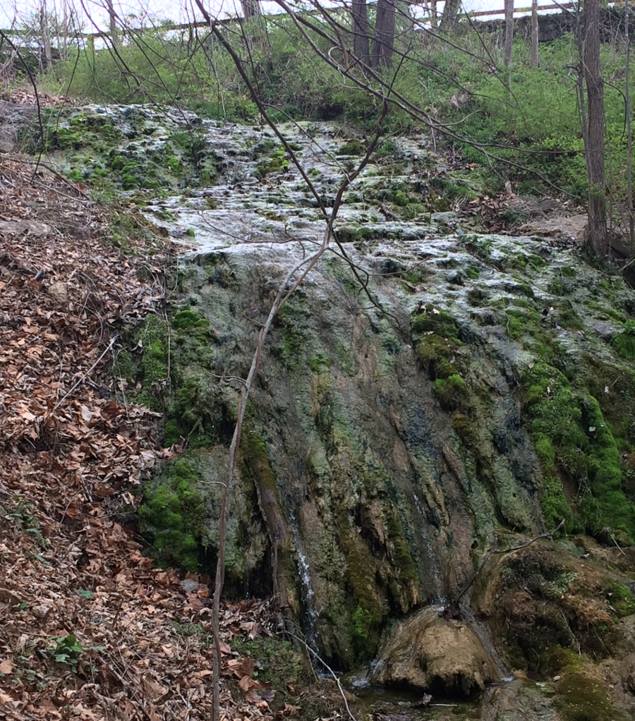
calcium is deposited on rocks in the streambed on the walk down to Natural Bridge, creating an above-ground equivalent of cave formations
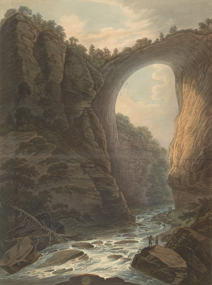
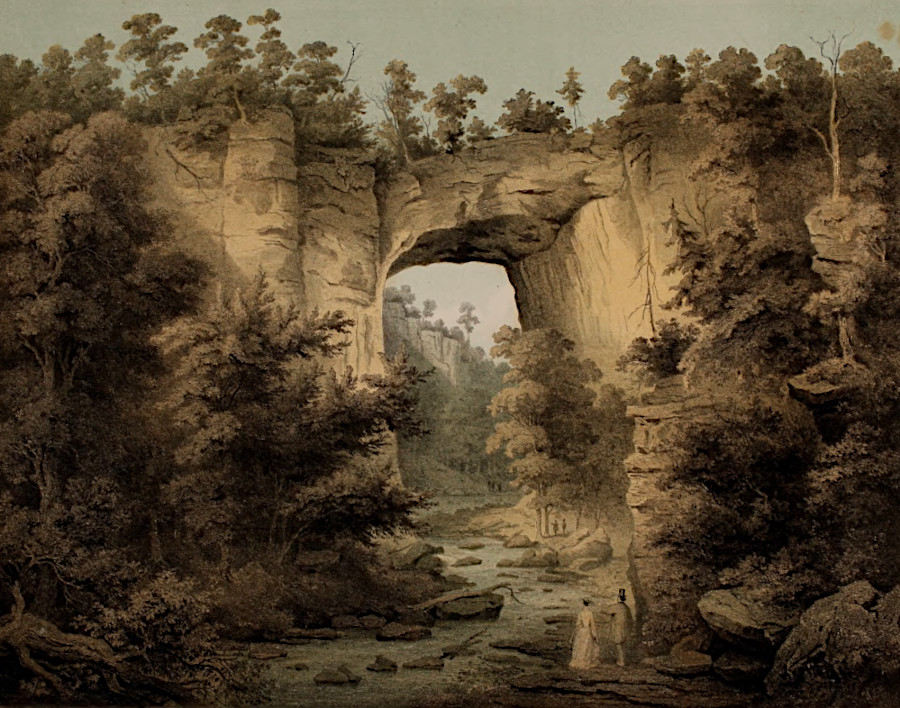
Today Natural Bridge is stable, but it is still collapsing. Inevitably, over geologic time, the remaining portion of the ancient cave roof will collapse into the creek. Jacques Gerard Milbert, who illustrated the bridge in 1828-29, recognized that the bridge would fall down eventually.14
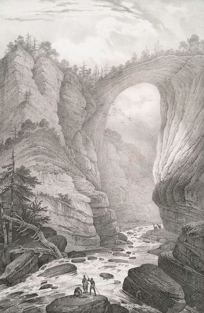
even in the 1800's, it was recognized that Natural Bridge would collapse someday
Source: New York Public Library, No. 53. View of the Natural Bridge (illustrated by Jacques Gerard Milbert, 1828-1829)
On October 23, 1999, a 6'x1' slab of dolomite spalled off the bottom of the arch, along with a shower of smaller rocks. One of the smaller rocks hit near a tourist from Georgia reading a plaque beneath the bridge, and debris from that falling rock killed her.
To prevent a repeat, loose rock was scraped away from the bridge. Holes were drilled from the top to the bottom, steel cables connected to metal plates installed on the bottom of the rock arch, and the cables were pulled tight. The plates on the bottom of Natural Bridge were camouflaged with paint to maintain the natural appearance.
Hard hats are available for visitors to wear, if they are concerned about a repeat rockfall. A hat might not provide any value if a slab landed directly on someone's head, but could reduce harm from rock shrapnel if a piece fell and shattered near a tourist again.
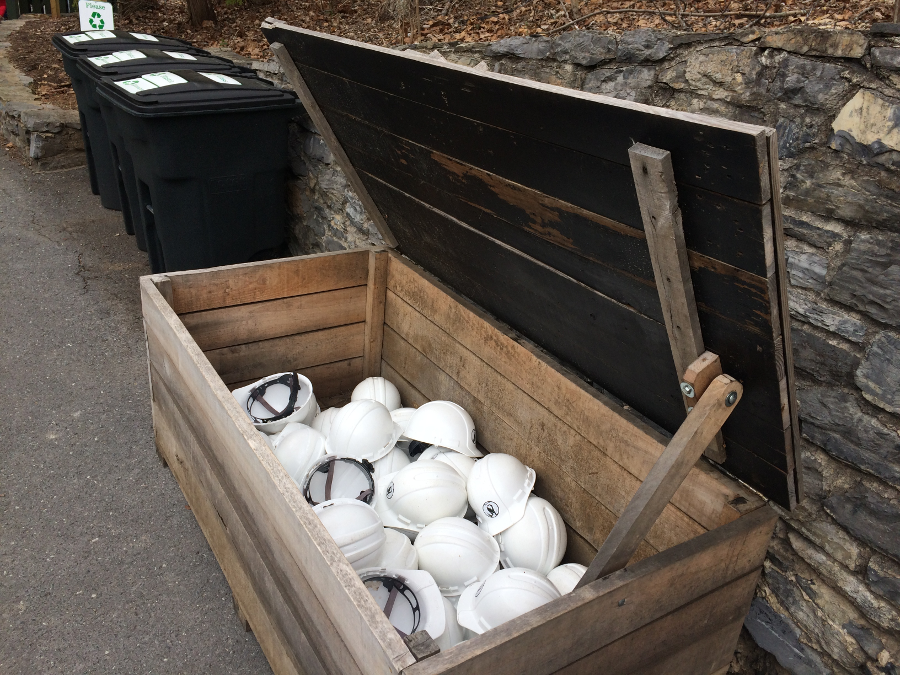
visitors to Natural Bridge now have the option of wearing a hard hat
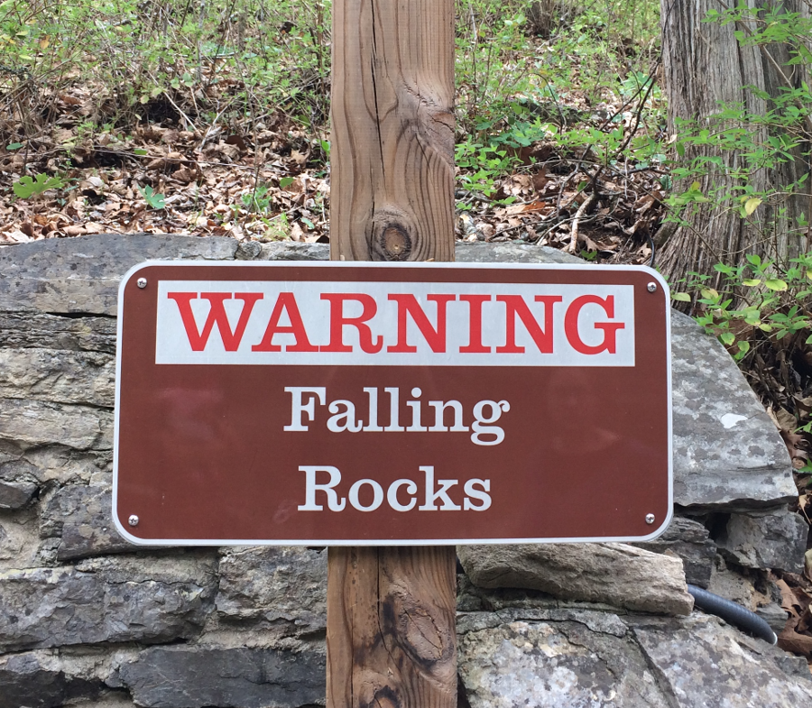
a warning sign alerts visitors to Natural Bridge that rockfalls are possible
Bolting together the rock layers was intended to reduce the chance of another rock peeling loose and dropping onto the trail below the bridge. The cabling also mitigated the effect of vibrations from traffic on Route 11.
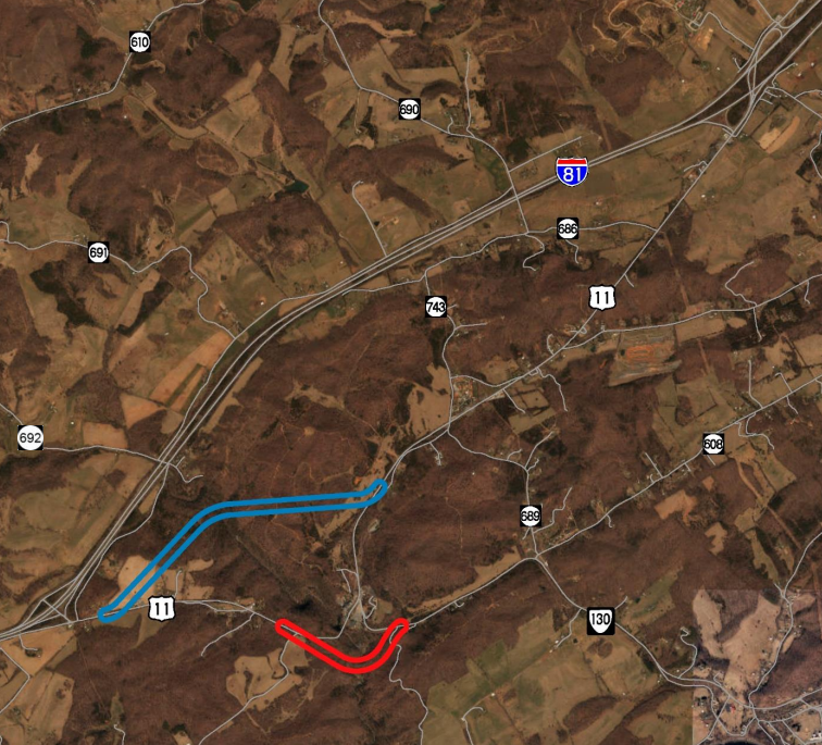
Native American trails crossed Cedar Creek on the arch for thousands of years, and there has been a road across Natural Bridge since 1753. Route 11 was constructed across it in the 1930's, and in 2017 the state estimated 2,000 vehicles/day traveled on top of Natural Bridge. Only 5% were trucks, and since 2000 there has been a 20-ton weight limit on them. However, that limit is waived when traffic must be diverted from I-81 due to an accident.
prior to construction of I-81, most north-south traffic used Route 11 over Natural Bridge
Source: Library of Congress, State of Virginia, base map with highways and contours ("Highways corrected to 1956")
The effect of 2,000 vehicles crossing the bridge each day is not clear. The natural structure is so large that engineers have assumed it could handle the weight of vehicles and whatever shaking they might stimulate.
The Virginia Department of Transportation does not consider the natural stone arch to be a "bridge" that requires regular inspections for safety. The state agency also assumes that even if there are voids in the bridge, it could be structurally sound. There are other roads in Virginia's karst country that cross unrecognized sinkholes. Since they retain a portion of their cave roof, those natural bridges are still underground, not exposed to view, and not identified as needing regular inspections.
As described by the Virginia Department of Transportation (VDOT) in a 2019 study proposing realignment of Route 11:15
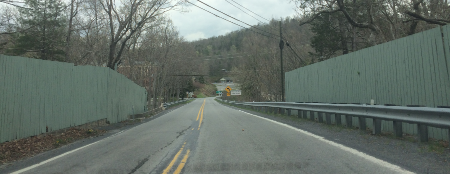
where Route 11 crosses Natural Bridge, fences block the view of Cedar Creek below
In 2017, the Virginia Department of Transportation agreed to use ground penetrating radar to identify if there were any voids in that portion of the bridge underneath Route 11. The chief engineer later recommended finding a way to close the bridge to traffic, but based that proposal on the designation of the site as a state park rather than on any data indicating a safety issue.
The initial conclusion was "the bridge itself is not a danger to the motoring public. It's not likely the bridge is going to collapse." Though reassuring, the initial concern remained that vehicle-induced vibrations could cause future rockfalls. Tourists visiting the bridge are now given the opportunity to wear a hard hat, as a precaution.16
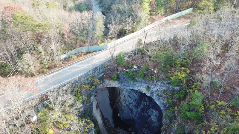
Route 11 used Natural Bridge to cross Cedar Creek
Source: Virginia Department of Transportation, Rockbridge County – Route 11 Natural Bridge State Park
In 2019, the Virginia Department of Transportation and Virginia State Parks agreed that the best strategy was to relocate Route 11. Two preferred alternatives were identified, so Route 11 traffic would no longer have to cross the natural geological feature.
Natural Bridge and 1,530 acres of undeveloped land around it was purchased for $8.6 million by the Virginia Conservation Legacy Fund in 2014. The sale price was far below the potential value if the land was fully developed with subdivisions, but the owner wanted to ensure the site was conserved in perpetuity.
The non-profit organization that purchased the land intended to transfer the site to Virginia State Parks after paying off the debt for the land acquistion. Revenue was below expectations, however, and the Virginia Conservation Legacy Fund struggled to meet the mortgage payments.
After a complex series of financial transactions, the Trust for Public Land ended up as the last private owner. The deed was transferred to the state on June 15, 2023. That was the 50th anniversary of the state park system in Virginia, and 249 years after Thomas Jefferson's purchase had first made Natural Bridge a parcel of private property.17
two alternatives were identified in 2019 to move Route 11 off Natural Bridge
Source: Virginia Department of Transportation, Route 11 Alignment Study at Natural Bridge (January 14, 2019)
Natural bridges and arches can form through various processes. Natural Tunnel in Scott County is an underground channel created by dissolution of limestone. Natural Bridge in Rockbridge County may have resembled a "natural tunnel" at one stage of its evolution. It is unclear when different parts of the roof collapsed, when dissolution of the underground cave/tunnel reached too close to the surface.
Natural Bridge formed because a portion of the cave's roof has not collapsed into Cedar Creek - yet
Source: British Museum, The Natural Bridge, Virginia (by W. Roberts, 1808)
The other natural bridge in Virginia is located in Lee County near Jonesville. Like the more-famous bridge in Rockbridge County, it was formed by the almost-complete collapse of a cave roof.
State Route 622 uses the arch as a bridge to cross Batie Creek, which flows through karst topography. The stream emerges at the base of a 25-foot high cliff of the Martin Creek limestone, at the south edge of The Cedars, and flows to the nearby Powell River. There are two sinkholes between the cliff and State Route 622, showing where the cave roof has already collapsed.
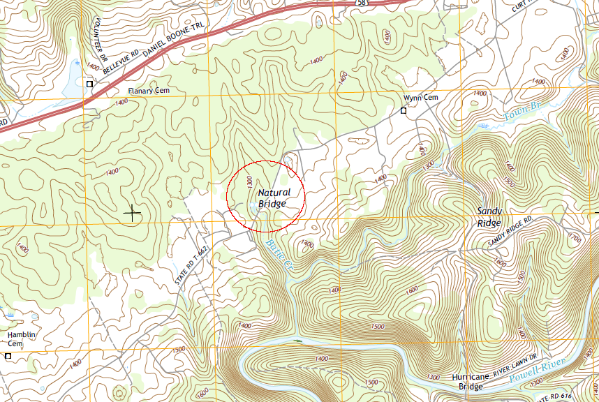
the natural bridge in Lee County crosses Batie Creek
Source: US Geological Survey (USGS), 7.5-minute topographical map for Hubbard Springs, VA-KY (2016)
A third sinkhole still has a portion of the cave roof intact, and that natural bridge in Lee County is 49 feet wide. Though the arch is 11 feet high, underneath it Batie Creek fills about half of that height. Batie Creek does not have the power, or has not had the time, to wash away the rock that has fallen from the arch. The upstream end of the stream passing below the arch is clogged with boulders.18
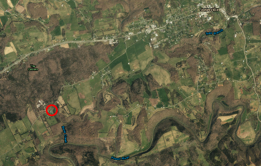
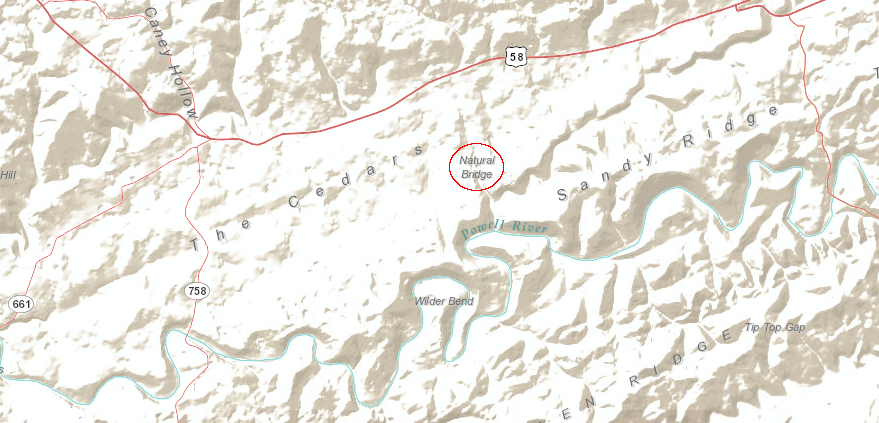
the natural bridge in Lee County is crossed by State Route 662 west of Jonesville
Source: ESRI, ArcGIS Online
The longest natural bridge east of the Mississippi River is in Alabama. Alabama's Natural Bridge crossing New River is 148 feet long, compared to the 90-foot long Natural Bridge in Virginia crossing Cedar Creek. The natural bridge in Alabama is formed from sandstone, with a relatively high iron content that resists erosion.
Natural Bridge in Alabama is a sandstone structure, unlike Virginia's limestone bridge over Cedar Creek
Source: Jimmy Emerson, The Natural Bridge
Arches and bridges can be distinguished by various definitions, including:19
Delicate Arch, a sandstone fin eroded by water and ice, and a sea arch formed by wave erosion
Source: National Park Service, Arches National Park; Bureau of Land Management, California Coastal National Monument
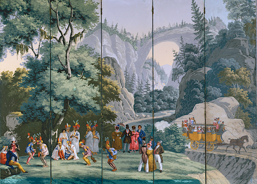
Natural Bridge has been a tourist attraction for centuries
Source: Virginia Museum of History and Culture, The History of Virginia's Natural Bridge: "So Beautiful an Arch" (Hand-printed Wallpaper Panel by Jean-Julien Deltil, for Jean Zuber et Cie, Mulhouse, France, Virginia, 1833)
Natural Bridge in 1858
Source: Edward Beyer, Album of Virginia
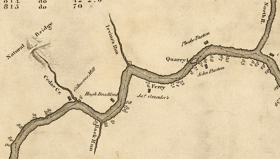
Cedar Creek is a tributary of the James River
Source: Library of Virginia, A survey of the headwaters of the James River and the Greenbrier, Jackson River and the Great Kenhawa or New River, and the high road between them (1814)