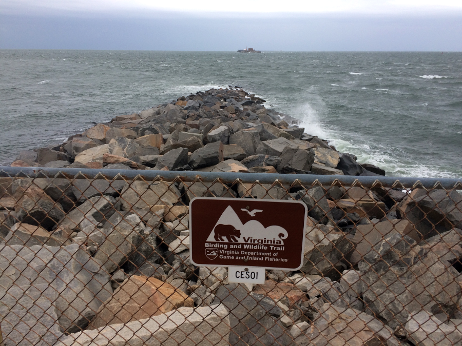
the Virginia Birding and Wildlife Trail included Island 1 on the Chesapeake Bay Bridge-Tunnel, until construction of a second Thimble Shoal tunnel closed that site in 2017
the Virginia Birding and Wildlife Trail included Island 1 on the Chesapeake Bay Bridge-Tunnel, until construction of a second Thimble Shoal tunnel closed that site in 2017
If a community can define a niche, a "we are special because..." story, then it can attract the tourist dollar.
Virginia communities advertise their sandy Atlantic beaches, Appalachian mountain vistas, waterfalls, caves, free-flowing rivers, fish-filled reservoirs, hunting opportunities on forested hillsides, etc. Mother Nature provided Virginia only two lakes - so the first state parks simply created small man-made lakes to provide desirable, if not 100% natural, swimming and fishing holes.
Buggs Island Lake (Kerr Reservoir) shows what can be accomplished if enough money is committed to reshape the land and rivers of Virginia. The reservoir is nearly as large as the District of Columbia, and the Southside town of Clarksville has more boat-oriented businesses than tobacco warehouses now.
There is a long tradition of hyping Virginia's natural areas to attract vacationers. Thomas Jefferson claimed that the vista from Harper's Ferry was worth a trip across the Atlantic Ocean, and that the Natural Bridge was one of the Seven Wonders of the World. Perhaps the "Breaks" on the Virginia-Kentucky border are slightly less-impressive than the Grand Canyon or the Black Canyon of the Gunnison, but if a park is well-advertised, plenty of tourists will go far off the beaten path to see for themselves.
the Blue Ridge Parkway was designed to attract vacationers to an isolated area
Source: National Park Service, NPS History Collection - Blue Ridge Parkway
Far, far off the beaten path, in that particular case. The Breaks is a destination, a place that requires a substantial effort to reach. It's not a place you see on the way to someplace else, or while in the neighborhood. Many of the visitors to Manassas battlefield are day-trippers exploring outside the monumental core of the national capital, but no one just casually drives over to see the Breaks.
The decline of the coal industry after the 1990's led Southwest Virginia to expand efforts to attract tourists. As noted by one observer, creating an outdoor-oriented lifestyle was also intended to maintain local economies by retaining the children born in the area:1
There is a particular tension for those who seek to finance protection of a natural area via tourist-based revenues. Tourism, while relatively "green," is not completely benign.
To extract dollars from tourists, a site must offer more than a voluntary collection box. There must be a place to stay, a place to eat, a place to buy stuff, as well as something to see. There is a reason that those having to pay the bills are often more interested in tourist-oriented facilities than in preserving the natural appearance of a site.
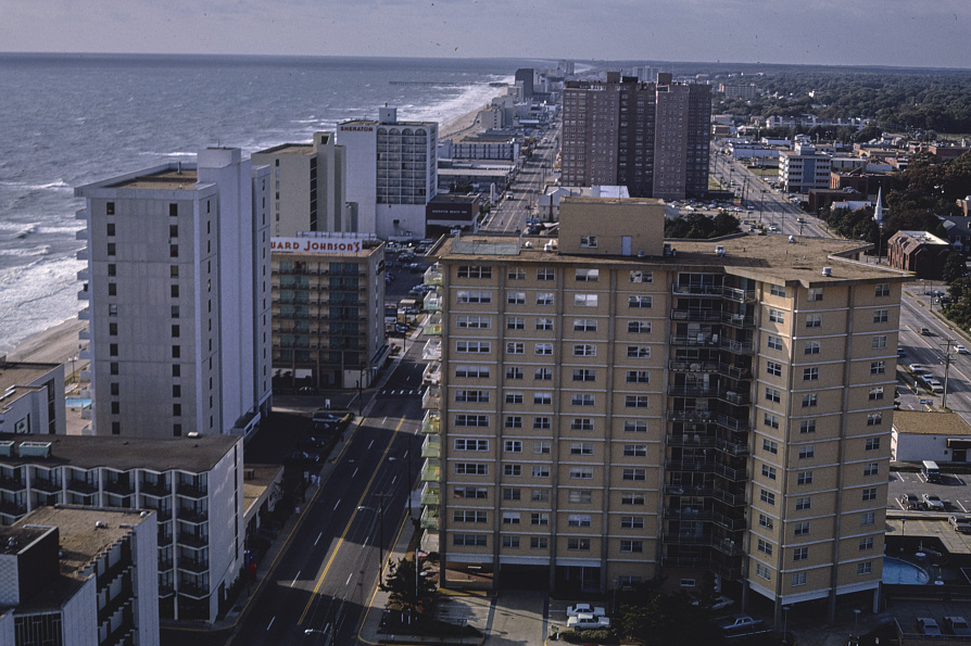
the beachfront at Virginia Beach has been developed to extract money from tourists
Source: Library of Congress, Midtown aerial south, Virginia Beach, Virginia (1985)
Birding trails, boardwalks, and campfire programs alone don't get the tourist dollars out of the wallets. Revenues come from food, lodging, and sales of T-shirts... and tourists expect to shop in air-conditioned facilities with water fountains, restrooms, and close-in parking. In particular, caves are sensitive to damage from excessive disturbance of bats and other sensitive creatures, spotlights that allow algae to grow on formations, and pollution from water draining off parking lots.
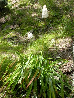
wildflowers near Big Meadows Lodge in Shenandoah National Park
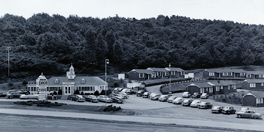
before I-64 diverted traffic off US 250, hotels and restaurants thrived on Afton Moountain next to Blue Ridge Parkway
Source: National Archives, Howard Johnson's Restaurant, Cabins, and Gasoline Station, U.S. Route 250 and Blue Ridge Parkway, Waynesboro, Virginia
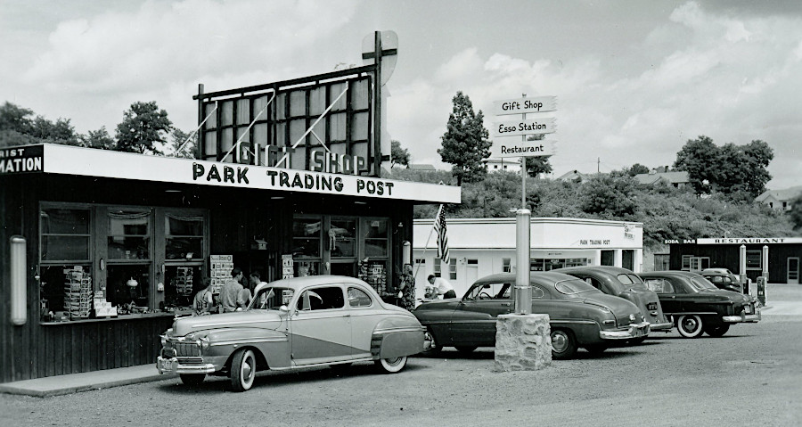
Front Royal is a gateway to Skyline Drive in Shenandoah National Park
Source: National Archives, Park Trading Post Gift Shop, Front Royal, Virginia