Nottoway Falls is a knickpoint in the gneiss bedrock, and was created by differential erosion
Source: ESRI, ArcGIS Online
Nottoway Falls is a knickpoint in the gneiss bedrock, and was created by differential erosion
Source: ESRI, ArcGIS Online
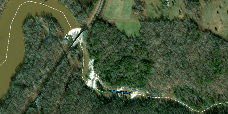
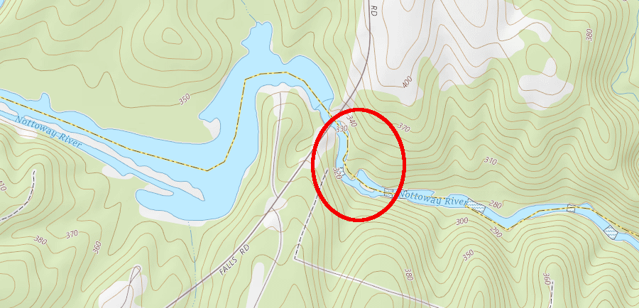
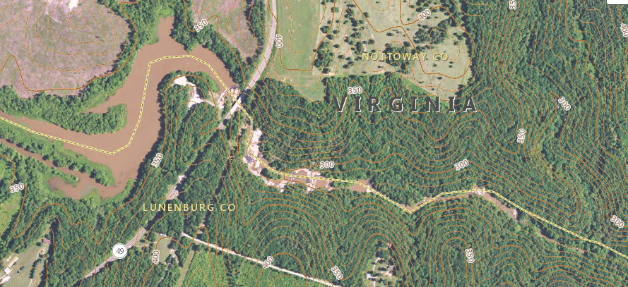
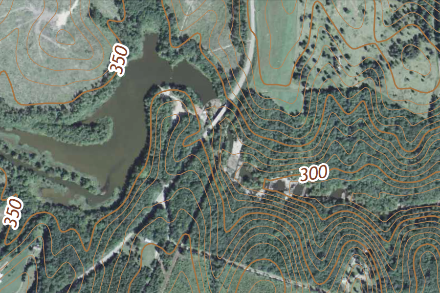
The Falls of the Nottoway River are located on the border of Nottoway and Lunenburg County. Route 49, known as Falls Road between the towns of Victoria and Crewe, crosses the Nottoway River upstream from the falls and downstream from the Nottoway Falls Reservoir. The elevation of the Nottoway River drops 100 feet in the two miles downstream of Route 49.
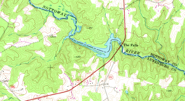
Nottoway Falls is located on the border of Nottoway and Lunenburg counties
Source: US Geological Survey, 1:24,000-scale quadrangle for Rubermont, VA
The Falls of the Nottoway River are not on the Fall Line. The Fall Line in Virginia is located 40 miles downstream, at Double Bridge where Route 619 crosses the Nottoway River. 1
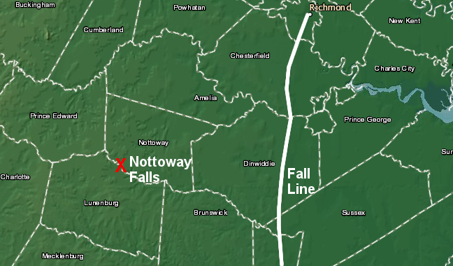
Nottoway Falls is located 40 miles upstream from the Fall Line
Source: National Oceanic and Atmospheric Administration (NOAA), National Geophysical Data Center
Nottoway Falls is located deep in the Piedmont physiographic province, 40 miles upstream from the Fall Line
Source: ESRI, ArcGIS Online
Nottoway Falls is a "knickpoint," a steeper-than-average stretch of river channel eroded into the bedrock of the Piedmont. The knickpoint may have developed at a time when sea level dropped, or uplift raised the continental crust. The river channel above Nottoway Falls is at a higher elevation than below the falls. Erosion downstream of the knickpoint has carved deeper into the underlying bedrock, but has been slow to progress upstream past the knickpoint - yet.
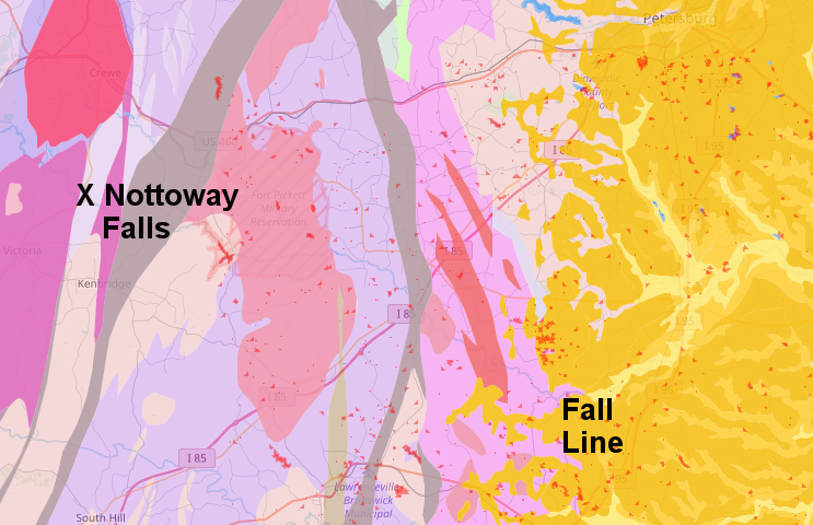
The falls are located on a fault line where the Carolina and Raleigh terranes meet. The Raleigh Terrane is located on the east side, and the Carolina Terrane on the west.
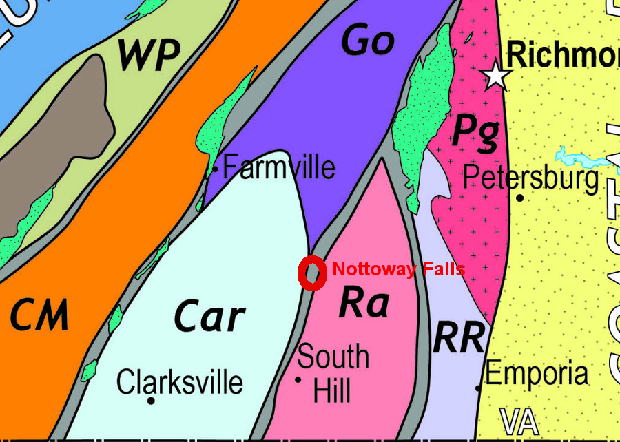
Nottoway Falls is on the boundary between the Carolina and Raleigh terranes in the Piedmont of Virginia
Source: terrane map from Geology of Virginia, Piedmont
The bedrock is a pluton formed when the terranes were isolated segments of crust not connected to Laurasia. Tectonic movement brought the crustal segments to the edge of what is today Virginia. The plutons were emplaced during the Alleghenian orogeny 250 million years ago, and later metamorphosed into gneiss.
The compression pushed mountains up 20,000 feet high on the surface. The forces pushed the same material just as far down, where heat and pressure mtamorphosed the pre-existing pluton. Geologists from the College of William and Mary have documented that a second pluton of molten (or at least plastic) rock intruded into the first pluton during the creation of Pangea.2
Erosion has exposed the plutons at the surface, and different rates of erosion of the underlying different bedrock formations has created Nottoway Falls. The drop in sea level at the maximum of glaciation 18,000 years ago, or perhaps an earlier drop in sea level during a previous glacial period, initiated a round of increased headward erosion that led to creation of the current knickpoint.
Nottoway Falls is currently 300-330 feet above sea level
Source: US Geological Survey, National Map Elevation Products (3DEP)
The creation and destruction of knickpoints is not a simple process. In some locations, differential erosion of two types of bedrock may create a knickpoint. The harder gneiss in the pluton could maintain the knickpoint for tens of thousands of additional years, though it could migrate upstream through the width of the pluton. An episodic replacement process, triggered by changes in the sea level, could trigger knickpoint migration.
If the Nottoway River shifted course and no longer crossed the pluton, the knickpoint could move upstream in a more-gradual, parallel retreat process. When the bedrock in the channel has a consistent capacity to resist erosion, the knickpoint of the Nottoway may transition into a gradual transition and finally disappear.3
![]()
Nottoway Falls was noted on the 1891 topographic map of the area
Source: US Geological Survey, 1:25,000 scale topographic quadrangle (1891)
Source: Smell 'n Roses, "The Falls" of Nottoway River in Central Virginia
| NOTE: click on images below for larger version | |||
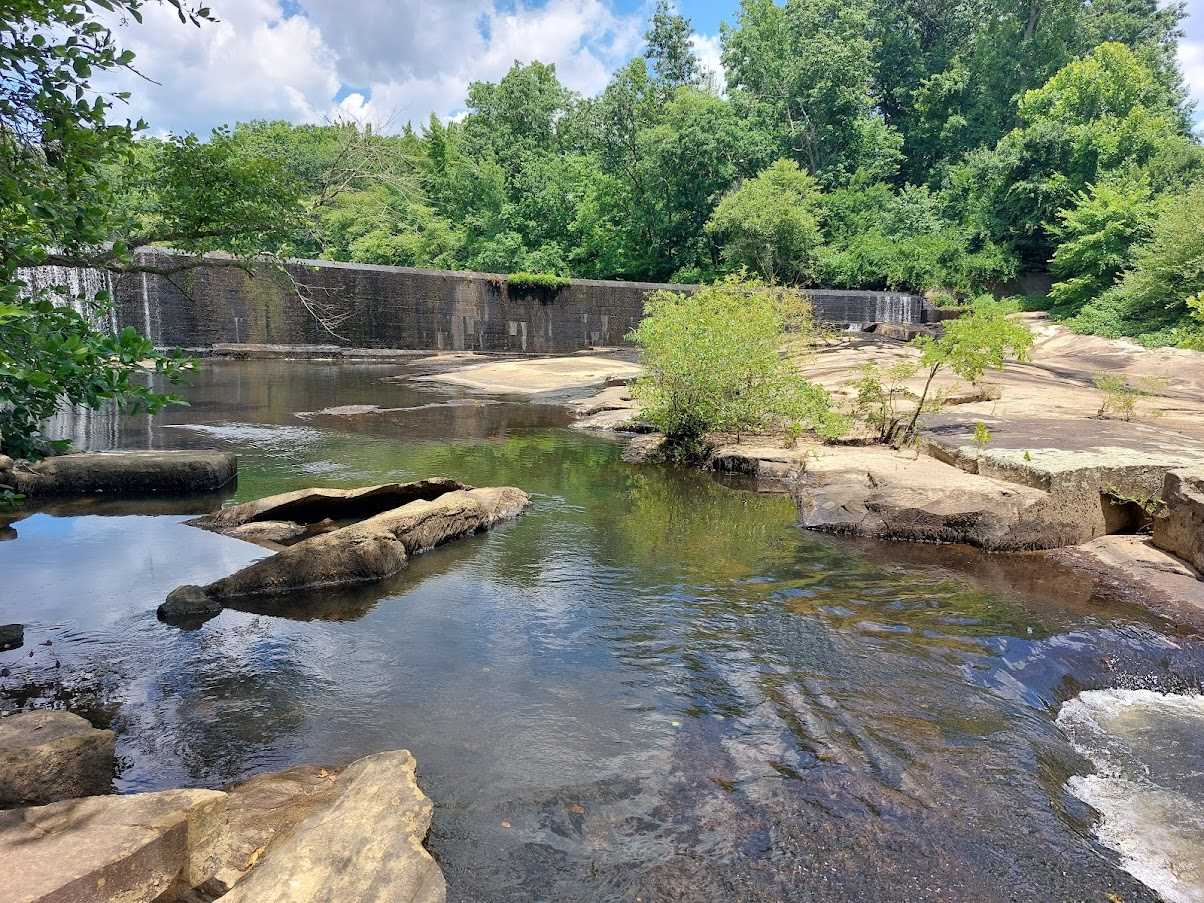 dam just upstream of Route 49 |
 Nottoway River at Route 49 |
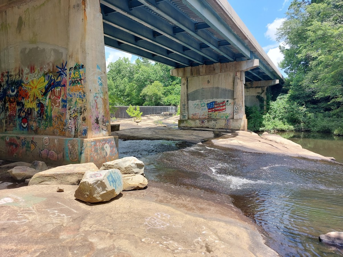
 Nottoway Falls just below Route 49 |
 Nottoway Falls just below Route 49 |
Nottoway Falls
Source: US Geological Survey, National Map Viewer
Nottoway Falls
Source: US Geological Survey, 7.5-minute topographic map for Rubermont, VA (2016)