The Initial Peopling of Virginia
| At the end of this section, you will be able to: |
|---|
- identify when Virginia was first settled, and how the first Virginians got here
- explain why Native Americans were practical geologists
- outline on a map of Virginia where different tribal groups lived in 1607
- identify how the Fall Line shaped Powhatan's area of control
- explain why Europeans sailed here before the Virginia natives "discovered" Europe
- describe how contact with Europeans changed Native American societies in Virginia
- explain why Pocahontas was sold to the English for a copper kettle
- distinguish between state and Federal recognition of Native American tribes in Virginia, and the status of recognition today
|
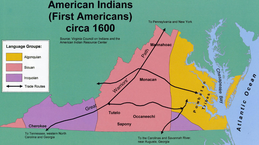
at the time of European contact, the Iroquoian-speaking Meherrin and Nottoway lived south of Powhatan's paramount chiefdom and the Iroquoian-speaking Cherokee lived in the Tennessee River watershed
Source: An Atlas of Virginia, American Indians (First Americans) circa 1600 (Map 26, produced by the Virginia Geographic Alliance)
Week 5: The Initial Peopling of Virginia
Class Syllabus and Schedule
Geography of Virginia