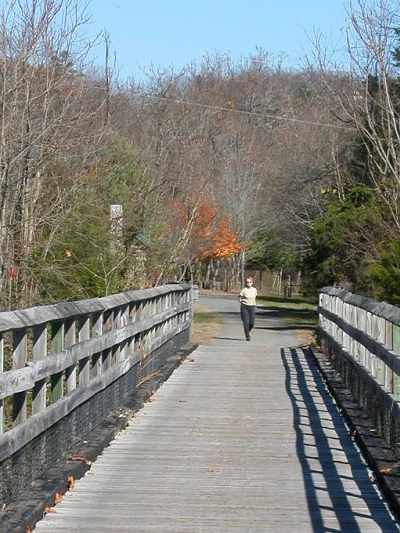
 New River Trail (Wythe County) |
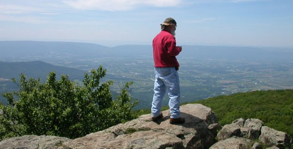
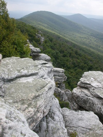 Big Schloss (Shenandoah County) |
|
New River Trail (Wythe County) |
Big Schloss (Shenandoah County) |
Course Objectives
This online learning experience should occasionally be fun, often challenging (in a constructive way), and always relevant to your real-world experiences in Virginia. There's a structure to this class, but you're invited to go "off the reservation" and explore deeper when a particular week's topic catches your interest. At the end of this semester, you should be able to:
|
- choose where you want to vacation in Virginia, entertain your friends/family with stories about how different places in Virginia evolved to become unique destinations, and determine what you want to see and do when you visit those places - describe how Virginia's boundaries evolved, from Spanish designation of "Florida" in the 1500's to the most-recent dispute with Maryland over the Potomac River, and justify your choice of the boundary between NOVA (Northern Virginia) and ROVA (Rest of Virginia) - identify distinct "physiographic" and cultural regions of Virginia, name at least one city/county within each region, and distinguish the regions from each other based on geology, topography, economics, and commute-to-work patterns - discuss how Virginia's population patterns have changed over the last 15,000 years, explain how watershed boundaries and transportation infrastructure have affected population growth in different parts of Virginia in the past, and predict how the population will change over the next 30 years in different parts of Virginia - determine the source of the utilities (drinking water, electricity, natural gas) and destination of sewage and trash, and how the sustainability of those utilities could change in the next 20 years as energy-efficient buildings replace old structures, new factories aim for "zero waste" status, and natural gas turbines/nuclear power plants/solar panels displace coal as the primary source for generating electricity - debate whether the post-World War II pattern of land use will continue, or if central cities will be revitalized by ever-faster telecommunications and ever-slower commutes from suburbs/exurbs - explain the relationships between land use patterns and transportation, and why "smart growth" advocates claim traditional development patterns (sprawling suburbia) result in higher taxes - identify why the Chesapeake Bay is polluted, how it will (or won't...) be "saved," and how coastal localities could respond to predicted sea level rise - describe in detail what has made one particular place in Virginia unique, how that place has changed over time, and how you think it will change further in the next 30 years |
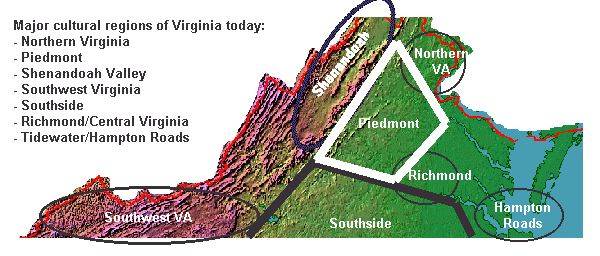 Regions of Virginia |
Online Learning
Geography of Virginia (GGS 380) is a distance learning course, without classes scheduled on campus. By design, the course includes many short assignments with weekly deadlines, so everyone stays on track. There is flexibility to skip one quiz and one report (or drop your lowest grade, if you take them all), but you can not wait until mid-September to get started or until Thanksgiving break to catch up. If you are new to online classes, check out GMU's Strategies for Online Learning Success.
Learning occurs through interaction with fellow students and the instructor, in addition to reading web pages and watching videos. Plan to participate on the class blog, and to respond to posts from others. The three optional field trips and scheduled get-togethers also offer a chance to meet and discuss the course content in real life.
You can also engage in one-on-one video chat sessions with me or arrange to meet in person at a time mutually convenient for both of us. You are encouraged to ask questions, get answers, and discuss anything that interests you regarding Virginia. Don't be shy about requesting some time. It is included in the tuition you paid for this online course; no extra charge.

|
Technology Requirements
Please check out GMU's What Technologies Do I Need? to confirm you have the necessary tools (which are pretty basic). You'll need access to the Internet using a computer with a standard web browser. You may need to download a few plug-ins to view some sites (such as zooming in on the maps at the Library of Congress). You can view most, but not all of the "Geography of Virginia" content with a smartphone (but if you use an iPhone or iPad, you will not be able to see the small number of sites that use Flash). You will need to get a free public account with ArcGIS Online. To view the streaming videos on GMU-TV, you will need a high-speed Internet connection. Don't even try with one bar on your smartphone. If you have access to a television, check the broadcast schedule and record the programs each week. Textbook To learn your way around the state, especially the rural areas, you should purchase the Virginia Atlas and Gazetteer, costing roughly $20. That is the only textbook for this class. (There are great books about Virginia, especially its history, but the last good textbook about Virginia geography was published in the 1950's.) You may find the Virginia Atlas and Gazetteer at the GMU Bookstore, or buy it directly from the publisher (DeLorme). The Virginia Atlas and Gazetteer is also available from many Wal*Mart stores, stores that serve hunters and campers, and even some large gas stations and 7-11's. |
Field Trips
We will use online text, pictures, blog posts, and video - but the best images will be those you notice with your own eyes and ears, outdoors and away from the electronic screen. Spend this semester observing the scenes around you and place what you see into context. There are geologic, political, economic, and many other factors that helped to shape the scenes you observe each day.
Your ability to connect the dots and interpret what you see may be a bit blurry right now. After finishing this class, however, your ability to focus and "see" the geographic setting, putting a particular view into context, should be substantially enhanced.
When this class is over, you should be able to define different regions of Virginia. You should be able to defend where you drew the boundaries to separate Northern Virginia from the Piedmont, or to separate Southside Virginia from Hampton Roads. If you can convince others that your definition of "Tidewater" is correct, then you earn at least a gold star.
Short field trips, near where you live or work, will be your basis for Field Trip Reports. In addition, three optional field trips led by the instructor are listed on the class schedule. Participation and reports on one, two, or all three of those field trips will give you a chance to apply in real life what you have been learning online (and earn additional extra credit).
Scheduling
Virginia has 40,000 square miles. The history of the Blue Ridge covers over a billion years; humans have been here for 15,000 or more years. As of July 1, 2016, there were 38 independent cities, 95 counties, and 190 towns in the state, each with their own stories.
This class includes substantial content to learn. There are no days when you have to be in class, but you have to study each and every week. Almost every week you will get feedback on what you learned/what you missed.
Take advantage of that feedback. You have registered and paid tuition.
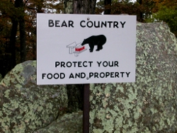 wild bears are common in Shenandoah National Park, and appear almost annually in the suburbs of Loudoun, Prince William, and even Fairfax counties |
Key Dates
|
How Will Grades Be Determined?
Grades will be based on a total of 1,000 points:
| ||||||||||||||||||
| Extra Credit | 25 points each for optional field trips, up to 75 points total |
|
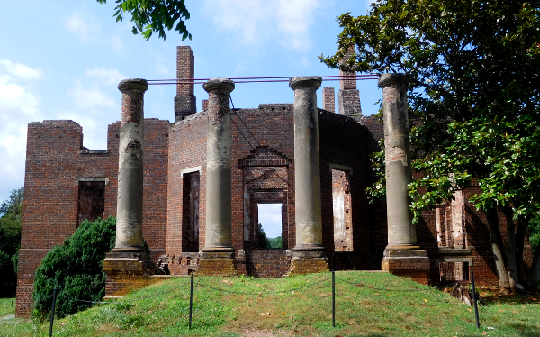 the mansion in Orange County once owned by Governor Barbour, and designed by Thomas Jefferson, burned on Christmas Day in 1884
|
Proposed Location for Field Trip Reports and Neighborhood Portfolio (10 points)
This class is not just a sit-in-front-of-the-computer experience. You will also complete analyze a particular place in Virginia, conducting field research to apply what we are studying each week.
On your own, you will explore one area that you select and get to know it in depth. The objective is to link one patch of the real world that you see often with the academic exercise of learning the geography of Virginia. You will be writing field trip reports, with pictures and maps, so pick a location that is logistically convenient as well as of interest to you.
Pick a place in Virginia near where you live or work, and draw a circle with a roughly 1/4-1/2 mile radius around that location. You'll examine and research the natural and cultural characteristics of that place, assess why it looks the way it looks today, and predict how that place will change over the next 20 years. You can pick a location that is densely urban or a rural oak-hickory forest, but look for a place with a mix of natural and cultural characteristics.
You will earn an easy 10 points by submitting that location by the deadline. Identify your proposed site, why it is interesting to you, and what you intend to learn about the site that you do not already know. You will get feedback on your proposed location, and in some cases will have to adjust the original choice to ensure you end up with a place suitable for examination during the semester.
Field Trip Reports (15 points each, 150 points total for top 10)
|
Each week, we will study one facet of Virginia geography and each week's field trip report will focus on a topic we are studying during the semester: geology, watersheds, land use, transportation networks, population, and even where the garbage goes when the trucks carry it away.
At the end of that week, post on the private class blog your latest photos and a 1-page (single-space) report about that facet of your particular location. Posting maps also helps to explain the unique character of your place and how it has changed over time. Don't worry about making a perfect map. You can make a crude one with a crayon on paper and post a photo of it, or post an image made with Geographic Information System (GIS) technology if you have expertise with those tools. Do more than just visit your chosen location. Research your place; for example, what is the origin of the local place names? The local history collection in county libraries (Arlington, Alexandria, Fairfax, Loudoun, Prince William, Stafford/Fredericksburg) are an excellent source of information. Tell your local research librarian what you are doing, and get their expert assistance to identify appropriate local resources. The Library of Virginia collections and the genealogy site Virginia GenWeb also offer useful resources to get the context of different cities/counties. Historical maps and photos are available at the Library of Congress. Feel free to click on the citations for graphics used on the class website and examine the original content, if those visuals would be useful. This is a college class. Be sure to cite your references in your weekly reports. Use whatever format for citation is comfortable for you, but provide enough detail for others to find your original source. NOTE: when you examine reports from other students, look for useful references for your reports and final Portfolio. After you post your weekly reports on the private class blog, you will be able to see what fellow students are crafting. Field trip reports will be shared via the private class blog until Thanksgiving holiday. (Two classes after the holiday address additional topics: tourism and the Chesapeake Bay. No field trip reports are required for those topics, but those two topics should be included in your final portfolio.) |
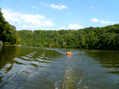 summertime fun on Lake Jackson (Prince William County)
|
At the end of the semester, you will use your reports - plus insights you get from reading reports posted by other students, my feedback about your reports, and your additional perspective regarding tourism and the Chesapeake Bay - to assemble a Neighborhood Portfolio examining your place in depth from different perspectives.
You should be able to incorporate many of these field trips in your normal routine, just by being observant as you walk/bike/drive through your slice of Virginia. Spend some time once a week, and document how you are exploring that one place in more-than-average depth.
Each field trip report is worth 15 points, and is due at the same time the quizzes are due - Sunday by midnight. You should submit 11 reports. The highest-graded, "top 10" reports will count towards the final grade.
Portfolio Outline and Format (10 points)
Submit a description of your planned portfolio format, with outline, to ensure your creative approach will be acceptable. Be clear on how you will incorporate video, maps, pictures, cartoons, audio, whatever as well as text.
Some possible formats include:
- photo album with narratives that a real estate agent could use to sell property at your chosen location
- short movie to get TV/feature film producers to set their next production at your chosen location
- analysis of a place so the governor could be well prepared when making a campaign stop at your chosen location
- grant application for Federal/state funding for a major redevelopment project, one that would tear down existing structures and replace them with new buildings at your chosen location
- video for an economic development agency designed to attract a new company to choose your location
- genealogy report for a family that once lived at your chosen location
- "current environment" chapter of an imaginary Environmental Impact Study for a major project at your chosen location
- sales presentation for an economic development initiative, to recruit a Fortune 500 company to locate a factory/regional headquarters office at your chosen location
- TV news report providing in-depth background on a major event that occured at your chosen location
- report to the mother ship of an alien civilization arriving from deep space before they land at your chosen location
Submit a description of your draft portfolio, incorporating the first eight field trip reports. Include the video, maps, pictures, cartoons, audio, etc. that you plan to use in the final Portfolio, so you get feedback and can make mid-course corrections as appropriate.
 Neighborhood Portfolio (60 points)
Tell the story about your place in your Neighborhood Portfolio. Build on the field trip reports (plus the local angle regarding tourism and the Chesapeake Bay), feedback on your reports, and what you learned during the semester to assemble a description of your place. Format is flexible. Use your creativity to determine what is most interesting for you, but find a way to incorporate key content from the different topics that we study throughout the semester.
Be sure to incorporate photos and graphics, including maps, so you document the place visually as well as in writing. Final Neighborhood Portfolio should include 4-6 pages (single-space) of writing, plus the graphics. Remember to cite your sources, just as you did in the field trip reports.
The Neighborhood Portfolio is due at the end of the semester. There's work required to revisit the field trip reports and to assemble into a portfolio, but the research part will be accomplished by Thanksgiving. Together, the field trip reports and portfolio are worth 25% of the total grade for the semester.
Top 10 Discussion Group comments (10 points each, 100 points total for top 10)
Interaction makes a distance learning course more engaging than just watching a movie, or reading a book. Each week, I will create a new blog post and invite your feedback on a particular topic, often including current events. In your response to my blog post, share your perspective and demonstrate your understanding of Virginia. Expand on my original; add new information rather than just express an opinion.
You will also be posting your Field Trip reports on the same blog as your Discussion Group comments. We are using a private blog for sharing information that only students in the Geography of Virginia class can view.
You can earn up to 10 points per response. The top 10 of your "best" responses will count towards the final grade. After the deadline for posting your response passes, you will be able to see all the comments from all of your fellow students. Review what they shared and expand your understanding of how geography shapes current events, and vice-versa.
Online Quizzes (35 points each, 350 points total for top 10)
This class includes weekly online quizzes up to the Thanksgiving holiday, so there will be regular feedback on progress. With each quiz, students will demonstrate what they know and discover what they still need to study. Each quiz is worth 35 points, and the quiz with the lowest number of points is dropped. (Points from just the best 10 quizzes are counted. You can miss a quiz, or screw up one week, and not affect your final grade.)
You'll know after the quizzes are graded if you are on track to get an A, or if you need to step up the studying several notches before final grades are submitted to the Registrar. The almost-weekly quizzes also guarantee that you can *not* wait to get serious about reading the material.
|
Quizzes will be administered online by Blackboard. (Be sure to log in at http://mymason.gmu.edu, click on the Courses tab and locate the GGS380 course link.) Quiz questions will come from the videos, reading material assigned each week (primarily as web pages), weekly blog discussions, and from online databases/mapping websites used in exercises with the assigned readings.
All quizzes will be open book. "Open Book" means you can use books, videos, newspapers, Web pages, atlases, USGS topo maps, aerial photography, the DeLorme Virginia Atlas and Gazetteer, the state highway map, etc... but you must answer all the questions yourself, without assistance. You can not get assistance on a particular question from other people. You can NOT post the questions on Facebook and hope others will do the research/remembering/thinking for you... You can earn 350 total possible points from the best 10 quizzes. Each quiz is less than 5% of the total number of points for the class, but together those top 10 quizzes make up slightly more than one-third of the final grade. The quizzes will usually have 10 questions. A few will require you to match items in one column with the appropriate item in a second column (such as "here is a list of rivers and counties - match the county with the river that runs through it") or fill in the blank. Most questions will be multiple choice. You will select what you consider to be the most correct answer for each question, and then turn in the quiz by clicking the Submit button. NOTE: Quizzes are posted on Thursday, and close at midnight on Sunday. Blackboard allows you to partially complete a quiz, save your answers, then return to the quiz and complete it later. You can start on Thursday night and finish on Sunday, or you can complete the entire quiz in one sitting. Be careful to "save" - but do not "submit" your answers until you are completely finished. Expect quizzes to ask questions from the most recent class, and from previous classes in the semester. The Final Exam will also be cumulative, with questions on the material covered in the first week as well as the last week. After all, life is cumulative - when you go to sleep at night, you don't forget how to drive a car and start life from scratch the next morning. At the end of the semester you should be able to discuss all the material we covered, from the start of the semester to the last class. Multiple choice questions will have only one correct answer, but choices may be difficult. Because the material is open book, questions typically require you to use critical thinking skills rather than just find a factoid. You should answer the questions by pick the choice that is "most correct" to you. Quizzes demonstrate that you can think with a place-based orientation ("where is Virginia Beach in relation to the Roanoke River?") and apply what you have learned ("why does Virginia Beach get some of its drinking water from the Roanoke River, requiring an expensive pipeline stretching so far away from the city?"). You may find it challenging to select the correct answer, if your previous experience with geography was to memorize-and-regurgitate the capitals of the 50 states. This is a university-level class intended to strengthen your critical thinking capabilities, not to test your memorization talents. Quizzes for this class are open book because in the real world, if you need to know the water source for the City of Fairfax or the name of the reservoir in Franklin County, you can use a search engine (or even look it up in a printed atlas). If you don't understand why you missed a quiz question, then ask for clarification. Make sure you understand the appropriate response before a similar question appears on a future quiz or the final exam. This is not an invitation to haggle for getting retroactive credit for quiz questions. The focus on the discussion should be increasing your understanding of the course material, and why one answer is "more correct" that the other choices. |
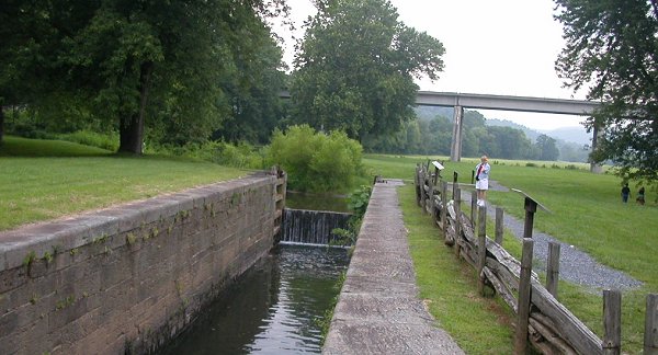 historic James River and Kanawha Canal lock, with modern Blue Ridge Parkway bridge in background (Bedford County)
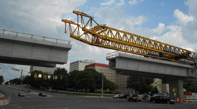
 constructing the Silver Line at Tysons Corner, September 2011 (Fairfax County) |
Critical Thinking Short Answer Exercises (50 points each, 150 points total for top 3)
The quizzes measure whether you learned the content for that week. The short answer critical thinking exercises require you to use that knowledge, to analyze why a place has developed in a certain way or why you expect a certain trend to continue/change. For example, you might be asked "why are there no wildlife refuges managed by the US Fish and Wildlife Service west of the Blue Ridge?" or "Why did the Union Army march to Manassas in 1861, instead of attack straight south towards Richmond?"
Questions can be answered in one sentence/one paragraph, typically. You may need to use online databases/mapping websites, which are assigned each week together with videos and readings, in completing the critical thinking exercises.
The best score for three of the Short Answer Critical Thinking Exercises ("Top 3") will count towards the final grade.
See other learning opportunities at:
- Department of Geography and Geoinformation Science
Commitment to Diversity StatementGeorge Mason University celebrates diversity and strives to have faculty, staff and students that reflect the diversity of our plural society. We do not discriminate on the basis of race, class, linguistic background, religion, gender identity, sex, sexual orientation, ethnicity, age, or physical ability.
Statement on the Honor Code and Academic IntegrityThe integrity of the University community is affected by the individual choices made by each of us. GMU has an Honor Code with clear guidelines regarding academic integrity. Three fundamental and rather simple principles to follow at all times are that: (1) all work submitted be your own; (2) when using the work or ideas of others, including fellow students, give full credit through accurate citations; and (3) if you are uncertain about the ground rules on a particular assignment, ask for clarification. No grade is important enough to justify academic misconduct. If you feel unusual pressure or anxiety about your grade in this or any other course, please talk with us or to a trusted friend or counselor to get your situation in perspective. The University provides a range of service to help with test anxiety, writing skills, study skills, and other related concerns. In this class, projects are designed to be undertaken individually. You may discuss your ideas with others or ask for feedback; however, it is not appropriate to give your paper to someone else to revise. You are responsible for making certain that there is no question that the work you hand in is your own. If only your name appears on an assignment, your professor has the right to expect that you have done the work yourself, fully and independently. Using someone else’s words or ideas without giving them credit is plagiarism, a very serious offense. It is very important to understand how to prevent committing plagiarism when using material from a source. If you wish to quote verbatim, you must use the exact words (including punctuation) just as it appears in the original and you must use quotation marks and page number(s) in your citation. If you want to paraphrase ideas from a source, that is, convey the author's ideas in your own words - you must still cite the source, using a format (such as MLA or APA) that enables the reader to find your source. The re-use of papers, presentations, etc., from one course in another course is not appropriate. |
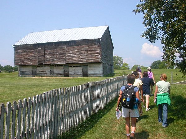 Field trip in "Virginia From the Ground Up" class, exploring German-style barn at Bushong Farm, New Market Battlefield State Historical Park |
Feel free to contact me at ![]() for further assistance.
for further assistance.