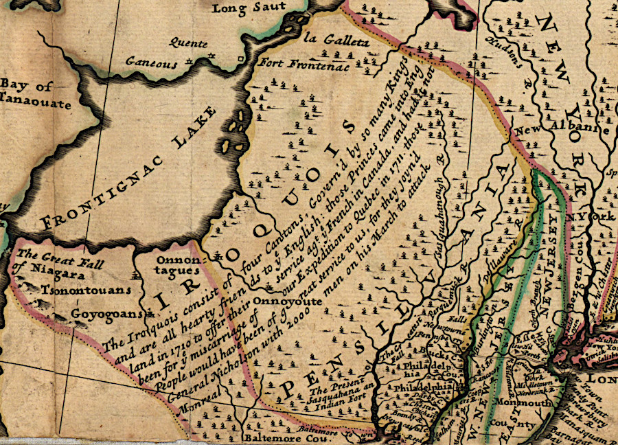
when European colonists arrived, the Iroquois controlled the lands west of the Hudson River
Source: Library of Congress, A new and exact map of the dominions of the King of Great Britain on ye continent of North America (by Herman Moll, 1731-32)
when European colonists arrived, the Iroquois controlled the lands west of the Hudson River
Source: Library of Congress, A new and exact map of the dominions of the King of Great Britain on ye continent of North America (by Herman Moll, 1731-32)
Through prehistoric migrations, different groups of Native Americans ended up living next to each other. The Meherrin and Nottoway in southeastern Virginia were Iroquoian-speaking tribes. They were bordered on the north and east by Algonquian-speaking tribes, on the west by Siouan-speaking tribes, and on the south by the Iroquoian-speaking Tuscarora.
Far to the west, across the Blue Ridge, were the Cherokee. Even further to the north were five Iroquoian-speaking tribes that dominated the St. Lawrence River valley and New York west of the Hudson River. As described by Francis Parkman in 1870, the various Iroquoian-speaking tribes were isolated and surrounded by Algonquian-speaking rivals:1
The five Iroquois tribes near the St. Lawrence River, the Mohawk, Oneida, Cayuga, Onondaga and Seneca, were habitually at war with each other until they established the Haudenosaunee (hoe-den-o-SHOW-nee) Confederacy.
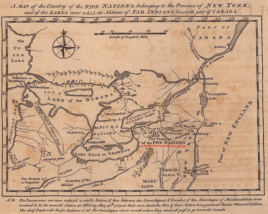
the Iroquois confederated to reduce warfare between the five tribes, before the Tuscarora migrated north to join them as the sixth tribe
Source: John Carter Brown Library, A Map of the Country of the Five Nations, belonging to the Province of New York... (by Cadwallader Colden, 1747)
According to the Haudenosaunee origin story, a Huron known as Dekanawidah (the Peacemaker) convinced an Onondaga who was living with the Mohawks to establish a Great Law of Peace among the tribes. That leader was Hiawatha. He successfully convinced the five nations to become partners, with leaders meeting at a council fire burning at the home of the Onondaga to reconcile differences. The confederacy may have been established in the mid-1400's.
As described by the Meherrin Indian tribe now organized in North Carolina:2
The Great Seal of the United States uses 13 arrows, based on the original 13 colonies, for the same symbolism.
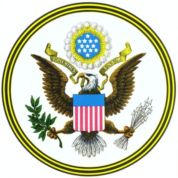
the official emblem of the United States uses the same symbolism as the Haudenosaunee, highlighting the relative strength of a bundle of arrows vs. a single arrow
Source: US Department of State, The Great Seal
Early access to guns from French, Dutch, and English traders gave the Iroquois military capacity to establish domination over peoples living west of the Hudson River and north of the Susquehanna and Ohio rivers. In the Beaver Wars between 1640-1701, the Iroquois conquered and displaced other tribes. The Iroquois conquered the Delaware and Susquehannock to their south, and the Huron-Wendat, Erie, Neutrals, Petun, Miami, and Shawnee to the west. The remnants of the defeated Iroquian-speaking tribes reformed as the Wyandots.
The Iroquois established an empire in order to gain control over the fur trade and limit the ability of rival nations to obtain weapons.
In the 1701 Great Peace of Montreal, the Iroquois agreed to stop attacking the French in Canada. Warfare between then had been initiated in 1609 when Samuel de Champlain joined with the Huron-Wendat and Algonquian warriors to attack the Mohawk south of the St. Lawrence River. After the 1701 peace treaty, the French were able to extend their fur trading operations westward to the Mississippi River.
The Iroquois agreed to be neutral in warfare between the French and British colonists, and redirected their warfare against southern tribes. They mounted regular "mourning wars" for Iroquios warriors to gain status and to increase the population through adoption of captives. The warfare targeted Creeks and Yamasees as far south as the Carolinas, along with the Cherokee and the Catawba.
The Catawba were a primary enemy because they had assisted the British in the 1711-12 war waged by colonists against the Iroquoian-speaking Tuscarora, who later migrated north and became the sixth member of the Haudemosaunee.3
When the British tried to negotiate treaties among warring tribes in 1750 at the end of King George's War, the Iroquois specifically demanded that they not try to:4
The British colonists often described the Native Americans who came south and raided throughout Virginia and North Carolina as the "Seneca," but more than just the most-western Iroquois were involved. Raids east of the Blue Ridge during the 1600's, by Cherokee and Catawba parties going north and "Seneca" moving south, disrupted the towns of the Siouan-speaking Manahoac, Monacan, Tutelo, Occaneechi and Saponi in the Piedmont.
When William Byrd II was surveying the dividing line between Virginia and North Carolina in 1733, he reached Upper and Lower Saura Towns on the Dan River. They had been unoccupied for decades. The Siouan-speaking residents had fled southeastward to escape further raids by the Iroquois. As Byrd wrote:5
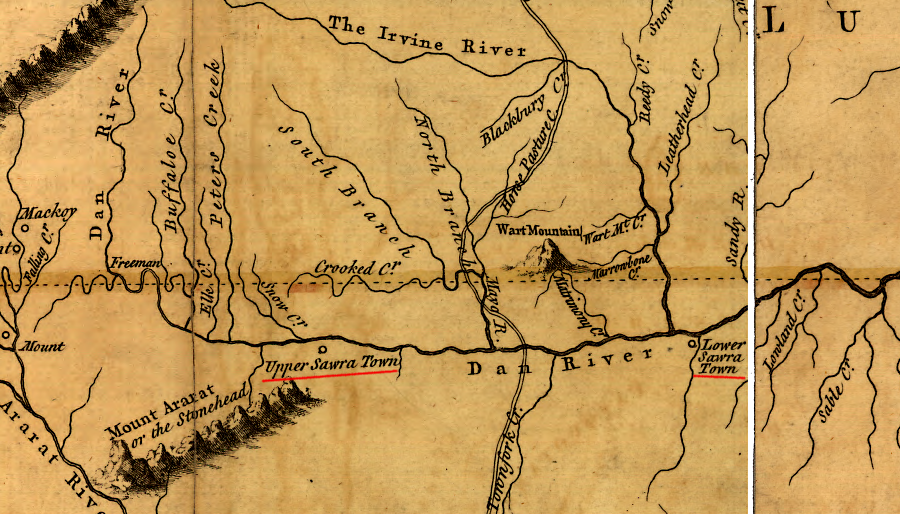
William Byrd II found in 1733 that raids by the Iroquois had displaced Siouan-speaking groups from the Virginia-Carolina Piedmont, and the Saura towns on the Dan River had been abandoned
Source: Library of Congress, A map of the most inhabited part of Virginia containing the whole province of Maryland with part of Pensilvania, New Jersey and North Carolina (by Joshua Fry and Peter Jefferson, 1755)
The Tuscarora migrated out of North Carolina after warring with colonists there. In 1722 they became the sixth nation in the Haudenosaunee confederacy.
The governors of Virginia, Pennsylvania and New York negotiated treaties with the Haudenosaunee, gradually diminishing their claim to land in western Virginia. The English had a written language, while the Iroquois relied upon their memory to document the dealings. Wampum shells were used to facilitate remembering the terms of the treaties.6
The Haudenosaunee Confederacy fragmented in the Revolutionary War. The British recruited the Seneca and Onondaga, while the American rebels recruited the Mohawk and Oneida. A smallpox epidemic in 1777 killed 90 of the top leaders and caused the Central Council fire to be extinguished. That left the individual nations free to operate independently, without a need to reach consensus on which side to support as British forces fought rebellious colonists.
At the bloody battle of Oriskany, different nations allied with different sides and fought each other. The failure to stay united enabled the Americans to displace the Iroquois tribes from their homelands.7
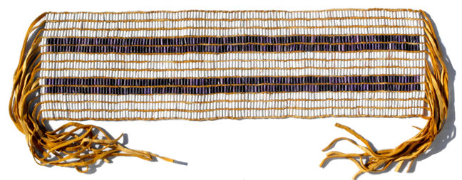
the Two Row Belt, supposedly created in 1613, is claimed to represent a 1613 agreement between the Five Nations and the Dutch in New York to trade together but live in separate communities, like people in two canoes traveling together
Map Source: Six Nations (Haudenosaunee) & the Haldimand Tract: Beliefs vs. Facts
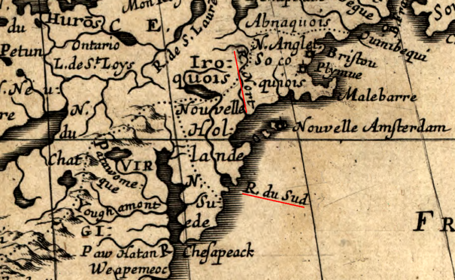
after defeat of the Dutch, the New York colony claimed all the land between the North (Hudson) River and South (Delaware) River, shown here as R. du Sud
Map Source: Library of Congress, Amerique septentrionale
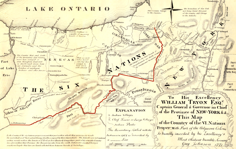
in the 1768 Treaty of Ft. Stanwix, the boundary defined by the Proclamation of 1763 was revised and the Iroquois relinquished claims to lands south of the Ohio River - but the primary territory occupied by the Oneida, Onondaga, Cayuga, Seneca, and Tuscarora were still (theoretically) off-limits to colonial settlement
Source: National Park Service, Oriskany: A Place Of Great Sadness (p.xiv)
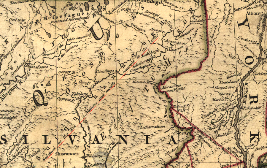
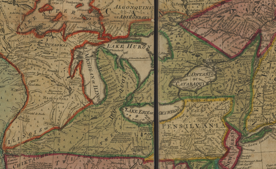
in the 1750's the British claimed sovereignty over lands west of the Susquehanna River which the Iroquois had been conquered
Source: Library of Congress, A map of the British and French dominions in North America, with the roads, distances, limits, and extent of the settlements (John Mitchell, 1755)
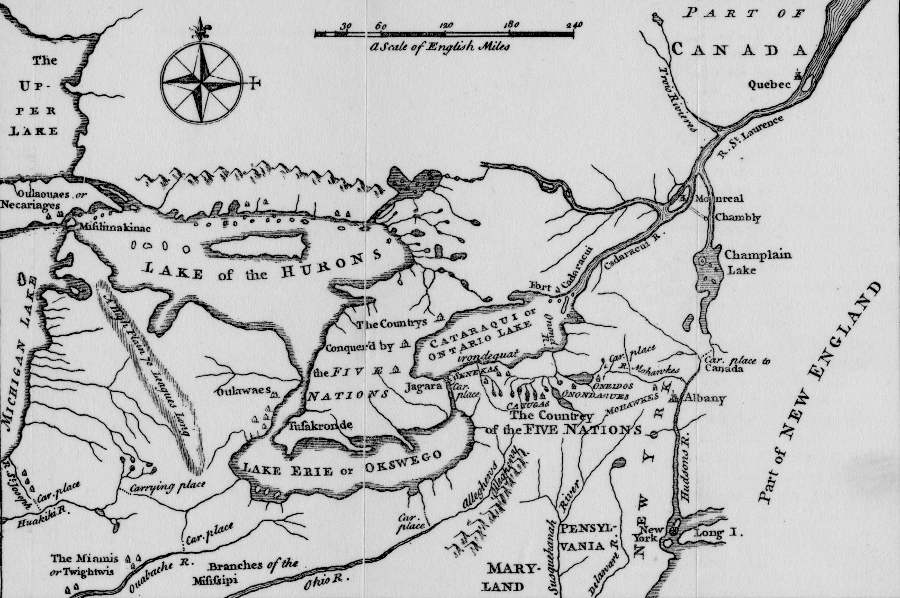
the Iroquois conquered nations to the south and west, and controlled the fur trade with the Dutch and the British at Albany
Source: A map of the country of the Five Nations belonging to the Province of New York, and of the lakes near which the nations of far Indians live, with part of Canada (by William Bradford, 1727)
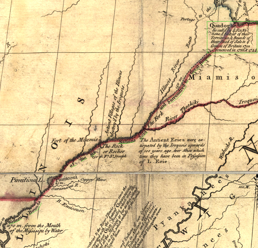
the British claim to territory of the Six Nations extended all the way to Lake Michigan (Quadoghe, now Chicago) and the Mississippi River
Source: Library of Congress, A map of the British and French dominions in North America, with the roads, distances, limits, and extent of the settlements (John Mitchell, 1755)
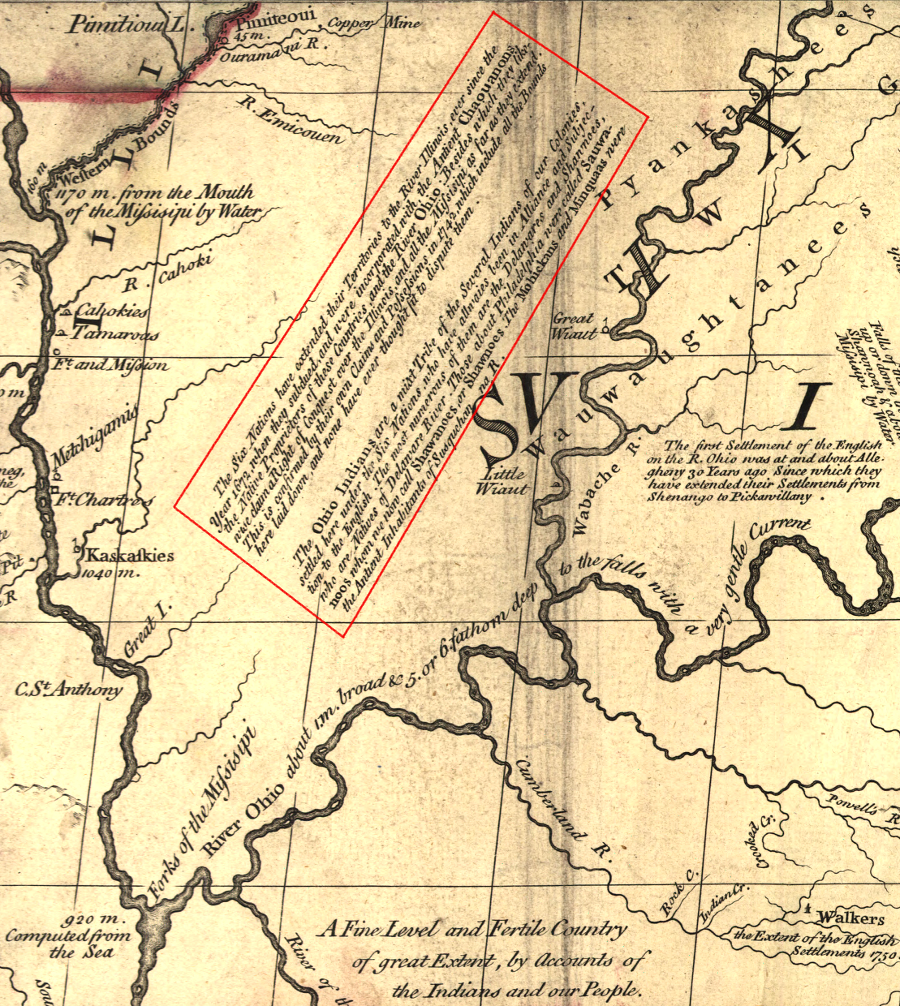
John Mitchell asserted in 1755 that "none have ever thought fit to dispute" British claims of sovereignty over the Ohio Territory based on conquest of the Iroquois - but the French and Indian War erupted because of such a dispute
Source: Library of Congress, A map of the British and French dominions in North America, with the roads, distances, limits, and extent of the settlements (John Mitchell, 1755)
Europeans claimed the Iroquois acquired by conquest the rights to lands extending as far as the Mississippi River (shaded in green)
Source: Library of Congress, An accurate map of North America. Describing and distinguishing the British, Spanish and French dominions on this great continent; according to the definitive treaty concluded at Paris 10th Feby. 1763 (Emanuel Bowen, 1767)
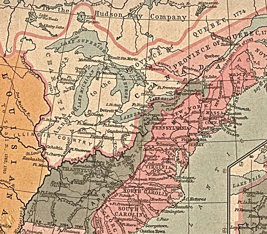
extension of Quebec's boundaries in 1774 did not affect Iroquois land claims in New York or Native American claims south of the Ohio River
Source: Perry-Castaneda Library Map Collection, The British Colonies in North America, 1763-1775 (in Historical Atlas by William R. Shepherd, 1923)
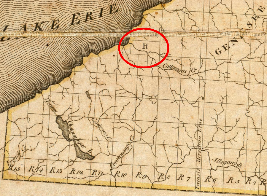
by 1804, New York mapmakers reduced Iroquois land claims to one small reservation area
Source: David Rumsey Map Collection, A Map of the State Of New York (Simeon DeWitt, 1804)
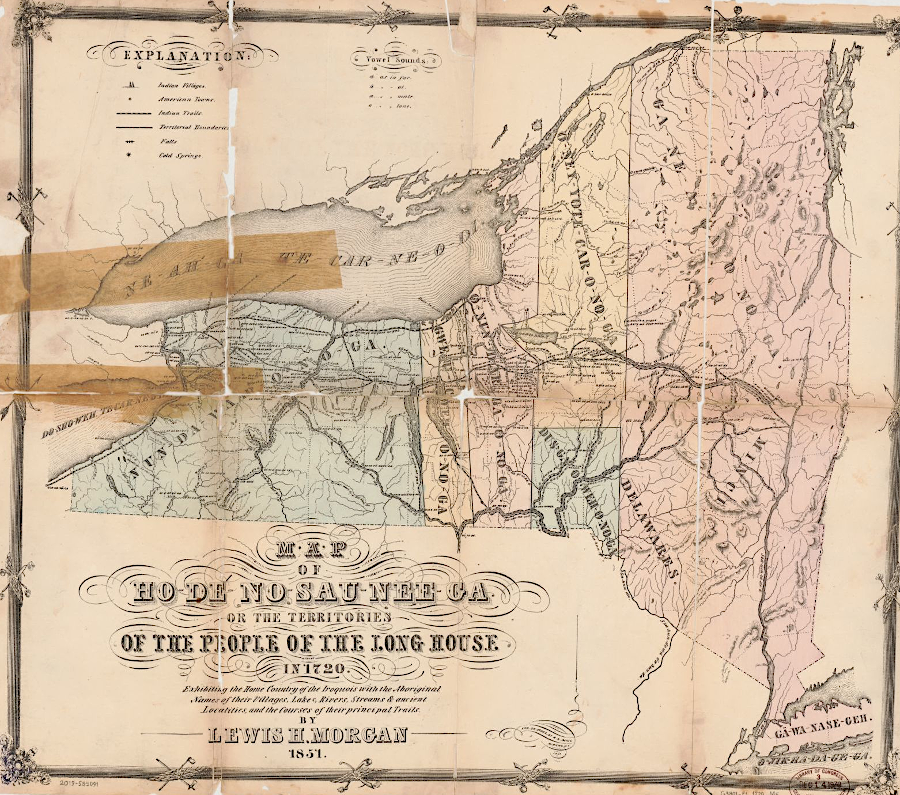
the Haudenosaunee (Iroquois Confederacy, the Six Nations) occupied territory around the Finger Lakes before being displaced by the colonists in the 1700's
Source: Library of Congress, Map of Ho-De-No-Sau-Nee-Ga: or the territories of the People of the Long House in 1720 (by Lewis Henry Morgan, 1720)