Meherrin in Virginia
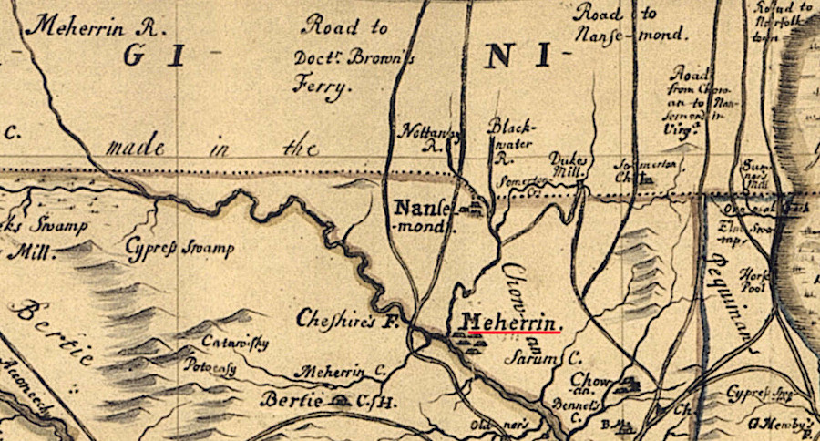
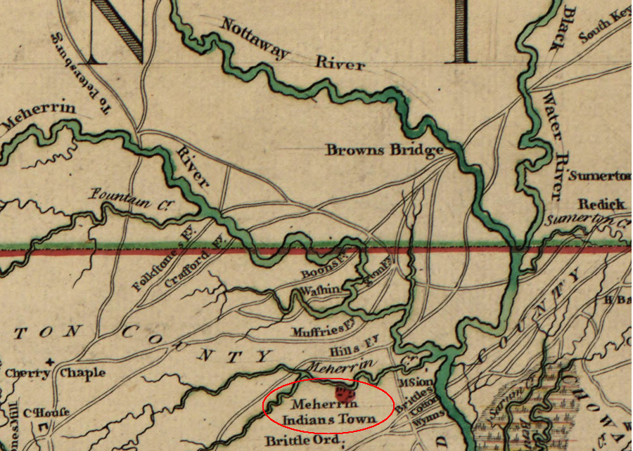
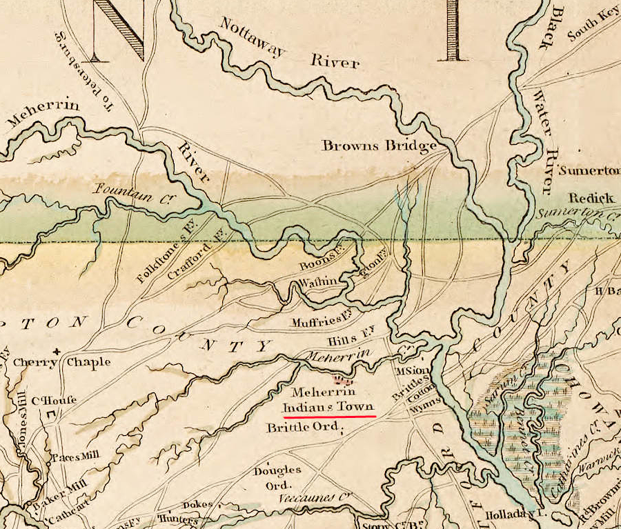
in the colonial period, the Meherrin had a town south of the Virginia-North Carolina border
Source: East Carolina University, A New and Correct Map of the Province of North Carolina (by Edward Moseley, 1733); Library of Congress and University of North Carolina, "A compleat map of North-Carolina from an actual survey" (by John Collet, 1770)
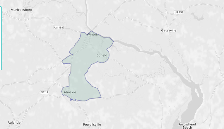
the Meherrin State Designated Tribal Statistical Area (SDTSA) is on the Chowan River in North Carolina
Source: Census Reporter, Meherrin SDTSA
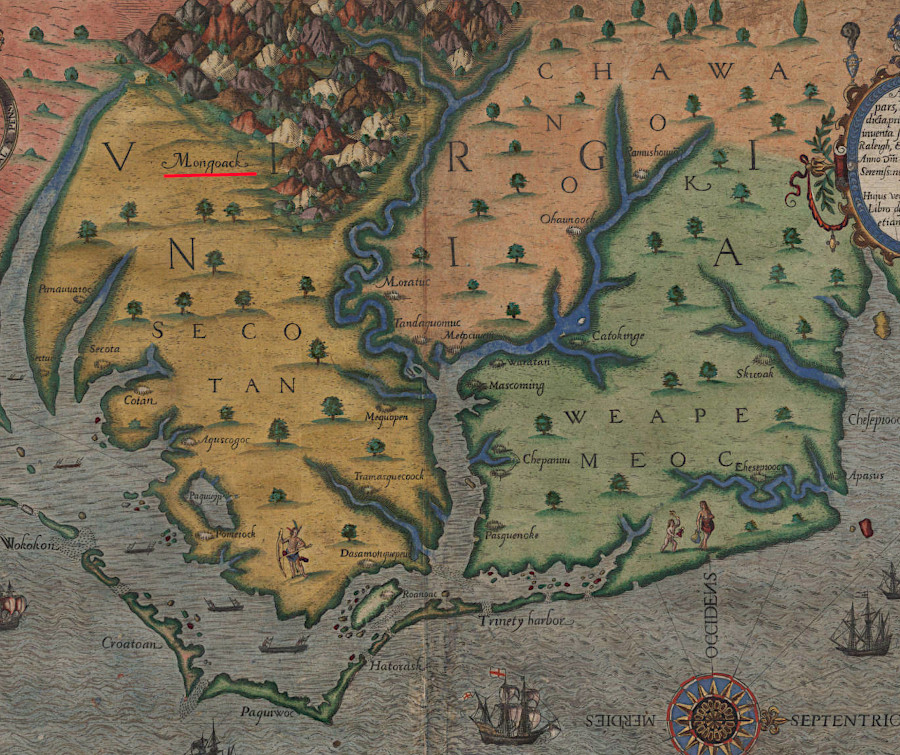
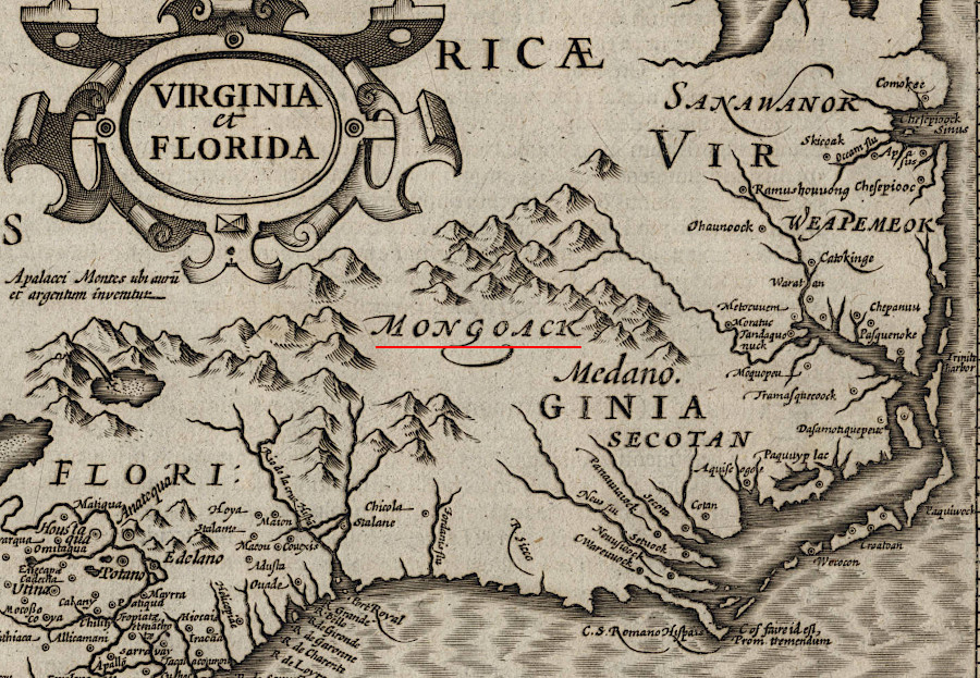
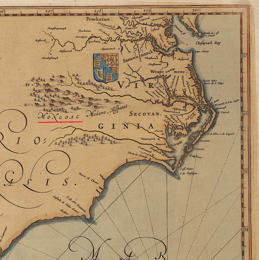
early European mapmakers showed the "Mongoacs" living south of the Chesapeake Bay watershed
Source: University of North Carolina, Americae pars, Nunc Virginia (Theodor de Bry, 1590); Virginia et Florida (Gerhard Mercator, 1610); Willem Janszoon Blaeu, Virginiae partis australis et Floridae partis orientalis interjacentiumq[ue] regionum nova descriptio (c.1640)
Links
- Meherrin Nation
- LearnNC
- Library of Virginia - Document Bank of Virginia
- Meherrin Indian Nation
- Native Heritage Project
- NCpedia
- North Carolina History Project
- Prince William Network/Virginia Department of Education
- Virginia Foundation for the Humanities
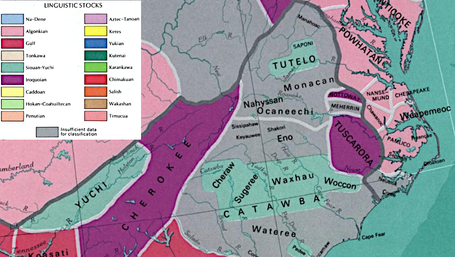
in 1970 the US Geological Survey concluded that it was unclear what language was spoken by the Meherrin
Source: National Atlas of the United States of America, Indian tribes, Cultures & Languages (1970)
"Indians" of Virginia - the Real First Families of Virginia
Exploring Land, Settling Frontiers
Virginia Places