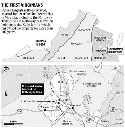
The Nottoway "circle and square" reservation in Southampton County was broken up and sold in the 1800's, but the Cheroenhaka (Nottoway) are restablishing their land base
Source: The Virginia-Pilot, Return of the Natives in Southampton County
The Nottoway "circle and square" reservation in Southampton County was broken up and sold in the 1800's, but the Cheroenhaka (Nottoway) are restablishing their land base
Source: The Virginia-Pilot, Return of the Natives in Southampton County
The Nottoway tribe was assigned a reservation in 1713, after a fellow Iroquoian-speaking tribe was defeated in the 1713 Tuscarora War in North Carolina. Surveyors marked off a six square mile tract (totally 36 square miles or 23,000 acres) south of the Nottoway River. In addition, a circle with a diameter of six miles north of the river was also surveyed and incorporated into the Nottoway reservation.
Fur traders managed to get individual members of the tribe into debt, in part by selling liquor on credit. Several times, the Nottoway obtained permission from the General Assembly to sell reservation lands and pay off debts. By 1734 the Nottoway had sold the circular tract. As the reservation shrank, the Nottoway lost territory suitable for hunting and gathering - but the remaining tribal members did not adopt colonial agricultural patterns and start intensively farming a small area.
In 1808, the last remnants of the Nottoway tribe (by now integrated with the Weyanoks) sought to sell the last remnants of the reservation "square" south of the river. The 19 members of the tribe still owned 3,900 acres, with 144 of those acres being farmed for corn. In 1818 the General Assembly authorized sale of slightly more than 25% of the remaining 3,900 acres, but in 1821 and again in 1822 the legislature refused the requests of trustees to completely terminate the reservation.
Finally, in 1824 the state permitted allotment of the reservation. Though many of the remaining Nottoway soon had their allotments surveyed and sold, others held onto the land. In 1953, the last claim of someone with Nottoway ancestry was finally sold.1
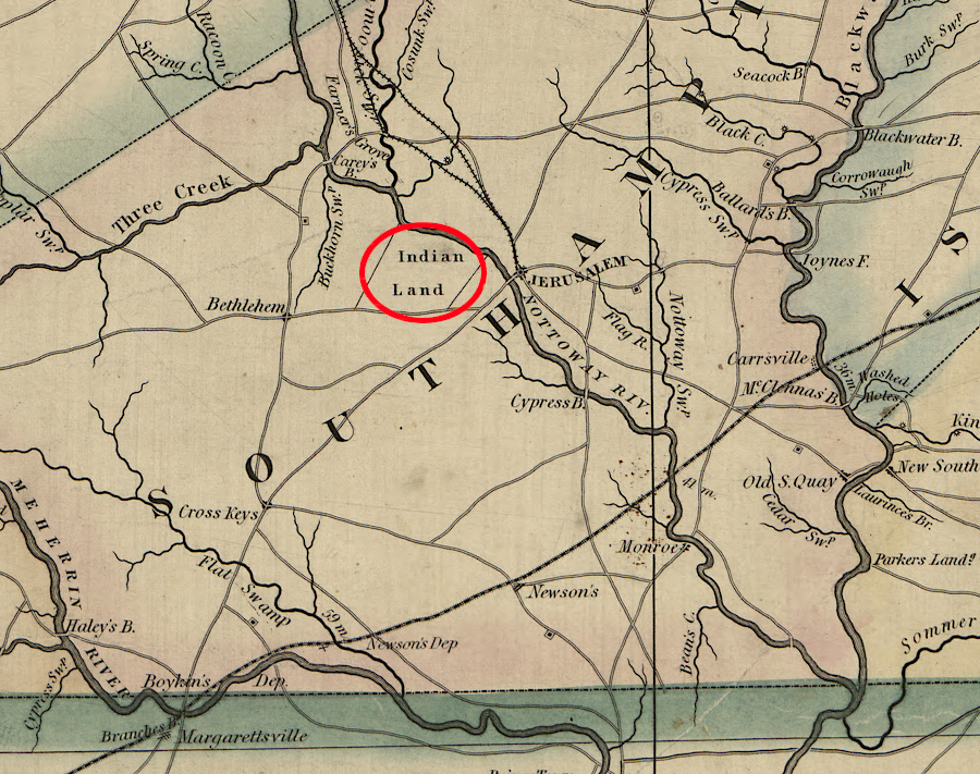
the land of the Nottoway was still acknowledged in 1859
Source: Library of Congress, A map of the state of Virginia (by Lewis Von Buchholtz, L. V., Herman Böÿe, Benjamin Tanner, 1859)
The Cheroenhaka (Nottoway) Indian Tribe reformed as an organization in 2002. In 2009, it purchased 100 acres that had once been included in the Square Tract from International Paper Company, which ran the paper mill in the city of Franklin. The tribe planted longleaf pine trees on half the land. On a portion of the remainder, it erected a palisade around a re-created Cattashowrock Town with traditional Iroquois "long houses," and started to host public events there in 2012.2
An additional 156 acres known as the "Cheroenhaka Tract" was added in 2016, providing direct access to the Nottoway River.