Lewis and Clark
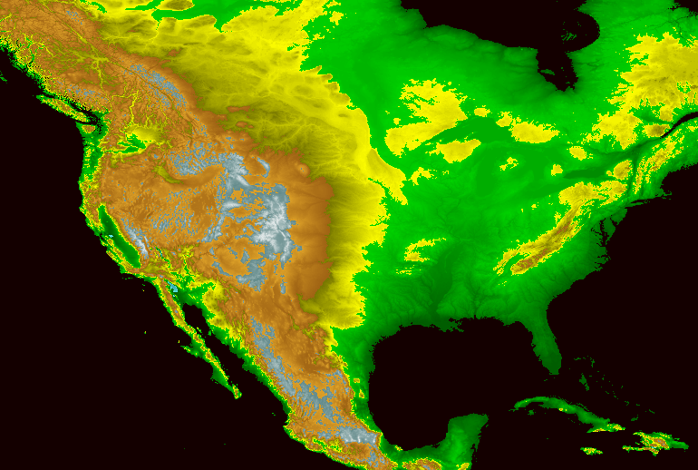
Thomas Jefferson assumed North America had symmetrical geography, and mountains west of the Mississippi would be similar to the Appalachians
Source: National Oceanic and Atmospheric Administration (NOAA), GLOBE: A Gallery of Images - Color North America
The 200th anniversary commemorations of the exploration of Meriwether Lewis and William Clark highlighted the portion of their trip from St. Louis to the Pacific Ocean and back. The Lewis and Clark National Historic Trail established by the US Congress in 1978 ended in Astoria, Oregon and started at St. Louis. In 2019, Pittsburgh was designated as the eastern end of the official trail, since Captain Meriwether Lewis had launched the expedition's keelboat there and floated it down the Ohio River to get to St, Louis.
However, their transcontinental journey started in Virginia and finished in Virginia. Some of Thomas Jefferson's planning was done at Monticello, and in 1806 Meriwether Lewis visited his mother in Charlottesville before meeting with President Jefferson in Washington.1
Long before Lewis and Clark were sent on their expedition in 1803, political leaders in Virginia had recognized the benefits of exploring and claiming territory for Virginia based on the Second Charter issued by King James I in 1609.
Throughout the 1700's, Virginia's governors sought to establish English authority through the supposed "right of discovery," through conquest, or through treaty with Natives Americans. Excluding France and Spain from the Mississippi River watershed would provide international benefits for England, and local benefits for Virginians. In particular, land companies organized by the Virginia gentry (such as the Ohio Company and the Loyal Land Company) could generate personal profits for well-placed Virginia officials - once England gained control of western lands and Virginia, rather than Pennsylvania or another colony, established its authority to manage land sales west and south of the Ohio River.
even after France ceded claims to the Mississippi River watershed in 1763, English mapmakers sought to validate ownership through a historically-questionable Right of Discovery claim
Source: Library of Congress, A new and accurate map of North America (1771)
In 1753, when the French were establishing forts along the Ohio River, Governor Dinwiddie had sent George Washington to direct them to leave the territory claimed by the colony. After the French and Indian War, Virginia officials disputed with Pennsylvania over ownership of the site of Pittsburgh.
In 1778, a military force led by George Rogers Clark captured key western forts occupied by the British. The forts were supplying guns and gunpowder to Native American allies raiding the settlements in Kentucky. British Lieutenant Governor Henry Hamilton recaptured Vincennes, but Clark's men moved though the water-saturated countryside in the middle of winter. They forced Hamilton to surrender on February 25, 1779 and took him to Williamsburg as a captive.
That military conquest by George Rogers Clark was a major factor in establishing the western boundary of the United States of America at the Mississippi River, as negotiated in the 1783 Treaty of Paris ending the American Revolution.
In 1783 Virginia finally ceded its claims to the Northwest Territory, the land between the Ohio River and the Mississippi River to the Continental Congress, after years of negotiations with other colonies. American and French explorers had traveled up the Missouri River by then, but none had documented reaching the Rocky Mountains yet.2
After the American Revolution, as settlers moved west of the Appalachians, far-seeing leaders saw political risks as well as economic opportunities for the new United States.
George Washington recognized the need to connect the population centers on the Atlantic coastline with the developing settlements in the Ohio and Mississippi River watersheds. He sought to build canals and economic links across the barrier of the Appalachians, to integrate those westerners into the political and economic life of the communities east of the Appalachians.
Washington was willing to make difficult compromises in the 1794 Jay Treaty, and they led to the British finally evacuating Detroit in 1796. The United States finally had authority over the western lands stretching to the Mississippi River, except for the lands occupied by the remaining Native Americans.
The Whiskey Rebellion revealed how topographic constraints limiting trade across the Appalachian Mountains affected political unity. Western settlers who depended upon shipping goods down the Mississippi River, through the port at New Orleans controlled by Spain or France, could decide that it was in their interest to break away from the United States and form their own nation(s).
When Secretary of State in 1793, Thomas Jefferson conspired with André Michaux to explore the land west of the Mississippi River that was controlled by Spain. This effort occurred a decade before Jefferson sponsored the Lewis and Clark Expedition.
Michaux had been sent to America originally by the French king, Louis XVI, to discover new plants which the king could plant at Versailles to enhance his prestige. The new revolutionary government in France then sent an emissary to America, Edmond-Charles Genêt, in hopes of getting American support for France in its war with Spain. André Michaux agreed to work at Genêt's direction, in part because Michaux needed funding from the French government and perhaps in part because he supported the revolutionary ideology.
In addition to trying to alter American policy, Genêt was supposed to contact George Rogers Clark in Kentucky. Clark, in financial straits and seeking French funding, had offered to raise an army which could invade Spanish-controlled Louisiana. That Spanish territory in North America appeared to be vulnerable.
Jefferson supported France in 1793, but President Washington determined that the United States would stay neutral. Because of the European war, no American could travel west of the Mississippi River and gain intelligence about the Spanish-controlled territory on the western border of the United States.
Jefferson endorsed the idea of Michaux going west to meet with George Rogers Clark. The French botanist could provide information, while the American government retained plausible deniability.
By the time Michaux met Clark in Kentucky, Genêt's machinations had been revealed and American support for the increasigly-violent French Revolution had cooled. Michaux never traveled west of the Mississippi River. Jefferson was still uninformed about the Louisiana Territory when he became president in 1801.3
As president, Thomas Jefferson sought to purchase Mobile and New Orleans in order to strengthen the economic and political connections between the East Coast and the settlers occupying lands in the Ohio, Tennessee, and Mississippi River valleys. Before concluding the Louisiana Purchase, Jefferson sent a group of explorers across the Mississippi River into what was technically Spanish territory. A voyage of discovery to the middle of the continent and to the Pacific Ocean coastline would allow the United States to strengthen its land claims by right of discovery, and clarify the value of such lands before proposing acquisition by conquest or purchase.
in 1802, territory west of the Mississippi River was essentially a mystery to residents of the United States
Source: Library of Congress, A map exhibiting all the new discoveries in the interior parts of North America (by Aaron Arrowsmith, 1802)
When Thomas Jefferson tasked Meriwether Lewis with the responsibility of traveling to the Pacific Ocean and returning with intelligence about the western country, Lewis chose William Clark as his co-leader. William Clark was the younger brother of George Rogers Clark, by 18 years.
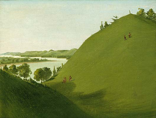
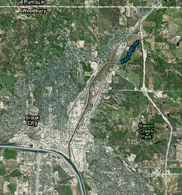
Sergeant Charles Floyd (the one member of the Lewis and Clark expedition who died on the journey) was buried on the Missouri River on August 20, 1804, on a bluff overlooking what is now Floyd River at Sioux City, Iowa
Source: Smithsonian Institution, Catlin Virtual Exhibition, Floyd's Grave, Where Lewis and Clark Buried Sergeant Floyd in 1804 and ESRI, ArcGIS Online
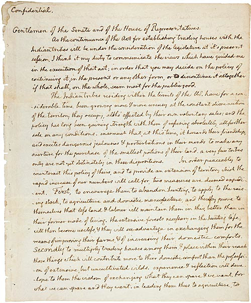
on January 18, 1803, President Jefferson asked Congress secretly to fund an expedition into lands west of the Mississippi River that were claimed by Spain
Source: National Archives, Jefferson's Secret Message to Congress Regarding the Lewis & Clark Expedition (1803)
Though Lewis and Clark have received much of the attention for their successful journey through the Louisiana Purchase, they were not an isolated expedition. They were not even the first European to cross the North American continent; that had been accomplished a decade earlier.
Alexander Mackenzie reached the Pacific Ocean at the mouth of the Bella Coola River in British Columbia on July 22, 1793. He then published a book about his expedition.
President Thomas Jefferson read it in 1802, and Lewis and Clark carried a copy of Voyages from Montreal on the river St. Laurence, through the continent of North America to the frozen and Pacific Oceans, in the years 1789 and 1793: with a preliminary account of the rise, progress, and present state of the fur trade of that country: illustrated with maps on their journey to Oregon.4
President Jefferson dispatched multiple explorers to report on the lands west of the Mississippi River:5
- Between 1804 and 1807, President Jefferson sent Lewis and Clark into the northern regions of the Purchase; Zebulon Pike into the Rocky Mountains, the southwestern areas, and two smaller forays; Thomas Freeman and Peter Custis along the Red River; and William Dunbar and Dr. George Hunter to explore the "Washita" River and "the hot springs" in what is now Arkansas and Louisiana.
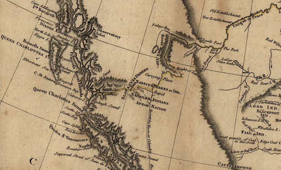
Alexander Mackenzie reached the Pacific Ocean (yellow line) a decade before Lewis and Clark
Source: Library of Congress, A map of America between latitudes 40 and 70 north and longitudes 45 and 180 west exhibiting Mackenzie's track from Montreal to Fort Chipewyan & from thence to the north sea in 1789 & to the west Pacific Ocean in 1793)
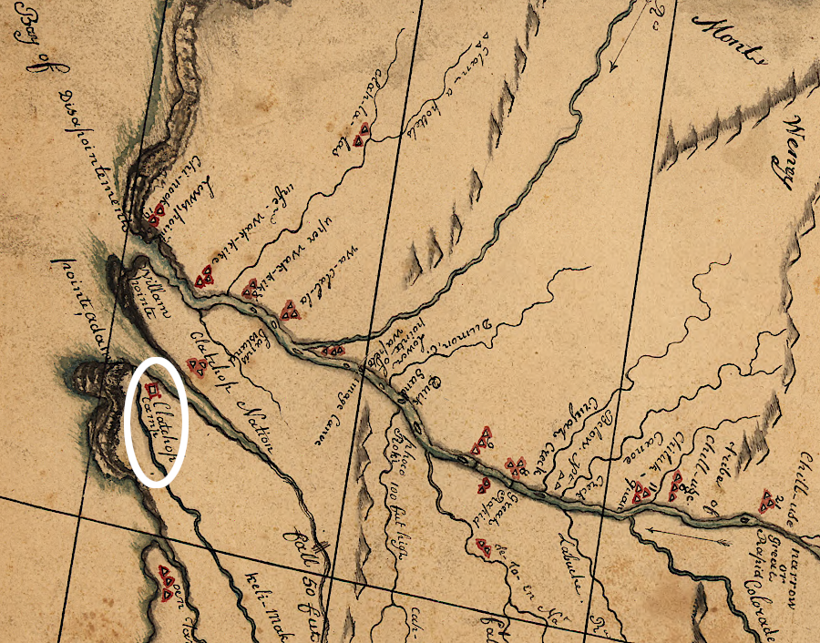
Robert Frazier, a member of the expedition, produced a map of the entire journey to the winter camp at Fort Clatsop
Source: Library of Congress, A map of the discoveries of Capt. Lewis & Clark from the Rockey Mountain and the River Lewis to the Cap of Disappointement or the Coloumbia River at the north Pacific Ocean (by Robert Frazier, 1807?)
Links
References
1. "Where Does the Lewis and Clark Trail Begin?," Governing, July 3, 2022, https://www.governing.com/context/where-does-the-lewis-and-clark-trail-begin (last checked January 2, 2023)
2. "Editorial Note: The Virginia Cession of Territory Northwest of the Ohio," The Papers of Thomas Jefferson, Volume 6, 21 May 1781-1 March 1784, ed. Julian P. Boyd, Princeton University Press, 1952, pp. 571-575, posted online in Founders Online, National Archives, http://founders.archives.gov/documents/Jefferson/01-06-02-0419-0001; "Highland, other counties came from Virginia Military District," Times-Gazette, July 26, 2016, https://www.timesgazette.com/2016/07/26/highland-other-counties-came-from-virginia-military-district/; Merrill Jensen, "The Creation of the National Domain, 1781-1784," The Mississippi Valley Historical Review, Volume 26, Number 3 (December, 1939), pp.331-335, pp.338-341, https://www.jstor.org/stable/1916463; :The Virginia Cession of Territory Northwest of the Ohio [Editorial Note],: Founders Online, National Archives, https://founders.archives.gov/documents/Jefferson/01-06-02-0419-0001 (last checked February 15, 2026)
3. "The Forgotten French Scientist Who Courted Thomas Jefferson - and Got Pulled Into Scandal," Smithsonian Magazine, July 2021, https://www.smithsonianmag.com/history/andre-michaux-scandal-thomas-jefferson-180977946/ (last checked May 23, 2026)
4. Julie Stoner, "The Crossing of a Continent: July 14, 2023," Worlds Revealed - Geography & Maps at the Library of Congress blog, Library of Congress, https://blogs.loc.gov/maps/2023/07/the-crossing-of-a-continent/ (last checked July 14, 2023)
5. "Hunter-Dunbar Expedition," Encyclopedia of Arkansas, https://encyclopediaofarkansas.net/entries/hunter-dunbar-expedition-2205/ (last checked July 3, 2022)
Exploring Land, Settling Frontiers
Virginia Places