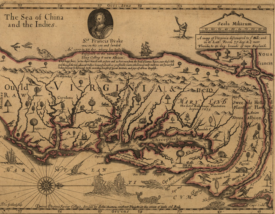
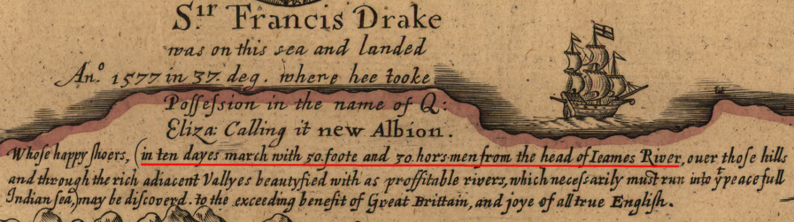
the English hypothesized that the Pacific Ocean coastline visited by Sir Francis Drake was a 10-day march west of the James River's headwaters
Source: Library of Congress, A mapp of Virginia discovered to ye hills, and in it's latt. from 35 deg. & 1/2 neer Florida to 41 deg. bounds of New England (1657 revision by Virginia Farrer of 1651 map by her father John Farrer)
On May 24, 1607, the first permanent European settlers at Jamestown quizzed the Algonquian-speaking Native Americans who lived on the James River about the neighbors. The recent immigrants learned more about the rival, Siouan-speaking Monacan and the territory they occupied west of the Fall Line, extending to the Blue Ridge or "the Mountaines Quirank." Gabriel Archer recorded the discussion about the James River valley to the west, after dinner was done:1
The English were not satisfied with the Algonquian descriptions of inland Virginia. It was immediately evident that the Native Americans in Tidewater Virginia had not gathered mineral wealth and jewels equivalent to the riches discovered by the Spanish in Central and South America, but there was always the possibility that further exploration would reveal gold and silver.
The Europeans had crossed the Atlantic Ocean for wealth, and the Virginia Company leaders were willing to take great risks in order to discover it. Despite the objections of Powhatan, the English quickly explored across the Fall Line. They walked about 20 miles inland and met the Siouan-speaking Manahoac who lived upstream of the future site of Richmond. The English exploration stopped short of the Rivanna River and did not reach the major Monacan town of Rassawek.2
The colonists found no evidence of wealth, but continued the search for navigable rivers. Land which could be accessed by ship was plentiful in Tidewater, but getting west beyond the rapids and waterfalls of the Fall Line was challenging. For over a century, there was little colonial settlement west of the Fall Line, where roads would be required to transport corn, wheat, and tobacco.
The Spanish had already explored the Chesapeake Bay, but retained their maps as state secrets. Prior to 1607 English ship captains had gone north of the James River, but there was still the potential to discover a water route westward that would cut through North America and provide access to China and the Spice Islands. At the time Jamestown was founded, Europeans had a poor understanding of longitude and were not clear how many miles away was the Pacific Ocean.
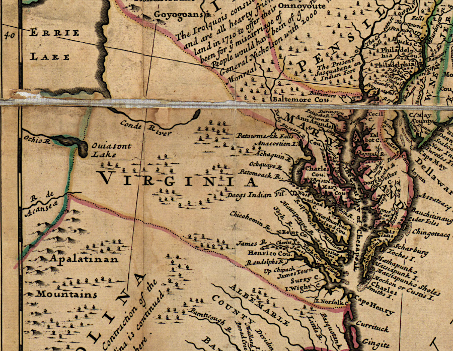
John Smith led two journeys in 1608 up the Chesapeake Bay, reaching the tip and meeting the Susquehannock residents on the northern edge. He discerned the "lay of the land," including the political relationships among the native tribes, in hopes of finding valuable resources. The investors who had funded the expedition to Jamestown expected a profit. Smith hope he too could benefit from whatever was discovered, though his extensive explorations and mapmaking suggests he may have been driven by an unusually strong curiosity as well.
The English dreamed of finding the fabled Northwest Passage that would bypass the Caribbean controlled by the Spanish. Otherwise, the Virginia Company was limited to gaining wealth from agriculture. Tobacco was profitable, but far less so than what the Spanish obtained by stealing gold and silver from the Aztec and Inca empires. Finding a new trade route to Asia would boost company profits immensely.
The Virginia Company instructed the leaders of the colonists who sailed to Jamestown:3
Building wagon roads across the Alleghenies was a challenge; boat travel would have been far easier, if only there was a Northwest Passage. In 1801 when Thomas Jefferson was inaugurated, there were just four wagon roads connecting the interior of the continent to the Atlantic Ocean.
As late as 1803, the dream of an easy water passage through North America was still alive. President Jefferson's instructions to Meriwether Lewis included:4
Trading with Native Americans offered an alternative way to acquire wealth, through acquisition of deerskins. The potential for Virginia profits was constrained by the creation of the Maryland colony in 1632. Lord Calvert's claim to lands north of the Potomac River blocked William Claiborne from maintaining or expanding his fur trading empire on the upper Chesapeake Bay.
The lack of roads west of the Fall Line meant that only small, easy-to-transport items such as deerskins could be carried far distances. Still, merchants such as Abraham Wood sent exploring parties far to the west to trade with Native American tribes.
There were always military reasons for exploring the "unknown" western lands, and interest in inland areas increased as Tidewater Virginia was settled. Indentured servants who had completed their term of service settled on new lands to the west, gradually pushing the border between colonist-Native American control upstream. The emerging Virginia gentry sought data on where land was worth accumulating through government grants.
After the end of the Third Anglo-Powhatan War in 1646, fur traders explored southwest of the Appomattox River. Edward Bland and Abraham Wood traveled from Fort Henry (modern Petersburg) in 1650, spending nine days in the backcountry in hopes of developing a trading relationship with Native Americans living on the Piedmont.
Abraham Wood established at fur trading fort on the Appomattox River, and explored south and west into the Roanoke River watershed
Source: Library of Congress, Virginia and Maryland as it is planted and inhabited this present year 1670 (by Augustine Herrman)
At the end of the 1660's, Virginia explorers crossed the Blue Ridge. John Lederer made "three marches" to explore the west. Franz Ludwig Michel explored the Shenandoah River in 1701-02.
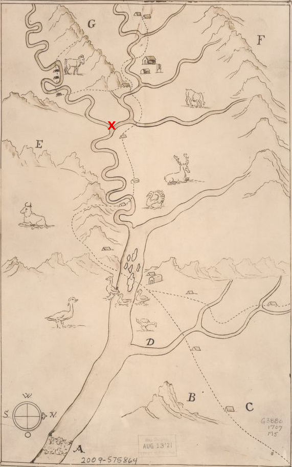
Franz Ludwig Michel documented the confluence of the North Fork and South Fork of the Shenandoah River (red X)
Source: Library of Congress, Michel's map: 1707 (by Franz Ludwig Michel, 1707)
The slow English exploration into the Piedmont and further west is in clear contrast to the French in Canada, who traveled far up the St. Lawrence River and through the Great Lakes. Samuel de Champlain reached Lake Huron in 1615, and Jesuits established missions on the Upper Peninsula of Michigan in the 1660's. Fur traders and Father James Marquette floated down the Mississippi River in 1673, reaching the mouth of the Arkansas River. In 1682 René Robert Cavelier, Sieur de La Salle led an expedition down the Mississippi River from the mouth of the Illinois River to the Gulf of Mexico, naming the region "Louisiana" in honor of French king Louis XIV.5
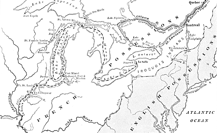
in the1680's, French explorers were floating down the Mississippi River when the English in Virginia were just beginning to cross the Blue Ridge
Source: Clipart-history.com, American Leaders and Heroes (by Wilbur Fisk Gordy, 1907)
English cartographer Herman Moll highlighted the threat of French land claims west of the Blue Ridge in 1720
Library of Congress, A new and exact map of the dominions of the King of Great Britain on ye continent of North America (by Herman Moll, 1720)
By the time Governor Spotswood led an expedition to the Shenandoah River in 1716, the journey was so safe that the trip resembled a party more than a challenging adventure. Starting in the 1730's, Governor Gooch began issuing land grants to settlers willing to occupy lands west of the Blue Ridge, creating permanent settlements deeper in the territory still claimed by various Native America groups.
The names of the earliest explorers who first moved through the Blue Ridge passes are not recorded in any historical documents. Today we have to use our imaginations to appreciate their travel through virgin territory, as far back as 15,000-20,000 years ago. It must have been far more difficult than the expeditions of the English just 400 years ago.
Many of the earliest colonial-era explorers during the 1600's and 1700's are also undocumented. Escaped servants and slaves moved past the boundaries of colonial settlement, obviously without sending official reports to Jamestown or Williamsburg. For example, when surveyors marked the boundary between Virginia and North Carolina, they encountered former servants and slaves who had entered the swamps in the southeast previously in a search for freedom.
at the end of the French and Indian War in 1763, there were few settlements west of the Blue Ridge
Source: Library of Congress, An accurate map of North America (by Emmanuel Bowen, 1763)
After the Ohio Company acquired 200,000 acres north of the Ohio River in 1749, it sent Col. Thomas Cresap to carve a road across the watershed divide. Cresap and the Delaware chief Nemacolin marked a route from the Potomac River to the Monongahela River. That 60-mile Nemacolin Trail was expected to serve settlers migrating to new lands sold by the Ohio Company. The stretch from Cumberland to the headwaters of Redstone Creek ended up first as a military road. It became the eastern section of the route used by General Edward Braddock to march to Fort Duquesne in 1755, in a failed expedition to force the French away from the site which today is Pittsburgh.6
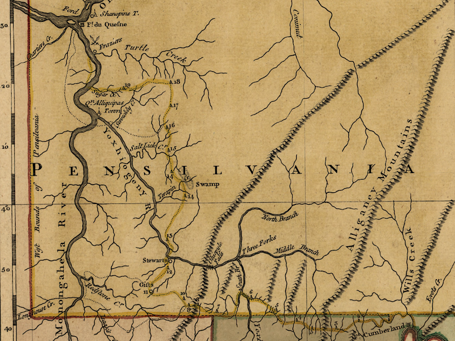
General Braddock marched from Cumberland to near Fort Duquesne in 1755, using Nemacolin's Path until turning north at the headwaters of Redstone Creek
Source: Library of Congress, A general topography of North America and the West Indies (by Thomas Jefferys, 1768)

the map published in 1754 with The Journal of Major George Washington showed Virginia's claims westward to the Mississippi River
Source: Wisconsin Historical Society, Map of the western parts of the colony of Virginia as far west as the Misssissippi (1754)
until Europeans explored lands west of the Blue Ridge, mapmakers hypothesized the locations of lakes/rivers - or just left spaces unmarked
Source: Library of Congress, A new and exact map of the dominions of the King of Great Britain on ye continent of North America (by Herman Moll, 1731)