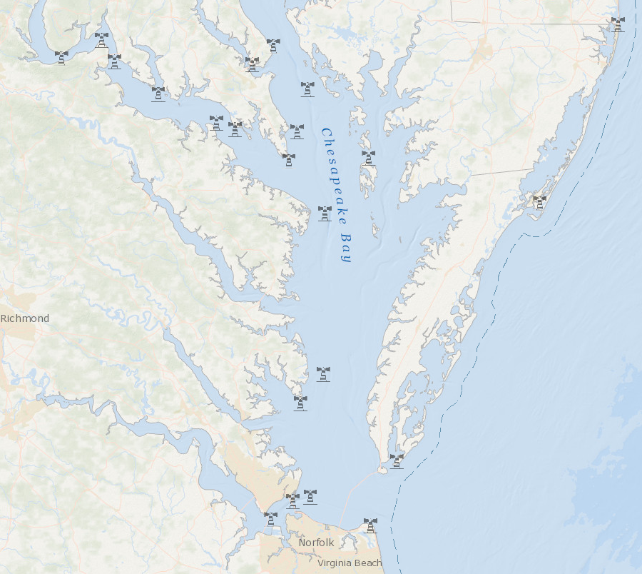
location of active lighthouses in Virginia (2025)
Source: Mid-Atlantic Ocean Data Portal
location of active lighthouses in Virginia (2025)
Source: Mid-Atlantic Ocean Data Portal
Ever since Spanish colonists arrived at Ajacan in 1570 and English colonists arrived at Jamestown in 1607, the Virginia economy has relied upon international trade. Almost all ships bringing new immigrants, supplies, and trade goods to Virginia have entered the mouth of the Chesapeake Bay and then sailed up Tidewater rivers as far as the Fall Line.
Ship captains need to know the location of the channel to avoid being wrecked on shoals or shorelines. Identifying the channel was done initially by sight and by dropping a leaded weight to the sediments on the bottom of the bay or river. Today boat captains use computerized equipment and charts to determine their location in relation to the channel. Sight is still important. Lighthouses mark entrances to river mouths and dangerous shoals, while buoys mark the edges of shipping channels.
In 1720, Governor Spotswood proposed building a lighthouse at the mouth of the Chesapeake Bay to improve safety. The General Assembly supported that proposal then, and again in 1727 and 1756, but required the colony of Maryland to share in the cost. Maryland finally agreed and construction started on a lighthouse at Cape Henry in 1774. That project was interrupted by the American Revolution.
The new Federal government created by the US Constitution included the right to regulate commerce, and it completed the first Federal public works project in 1792 with construction of the Cape Henry Lighthouse.1
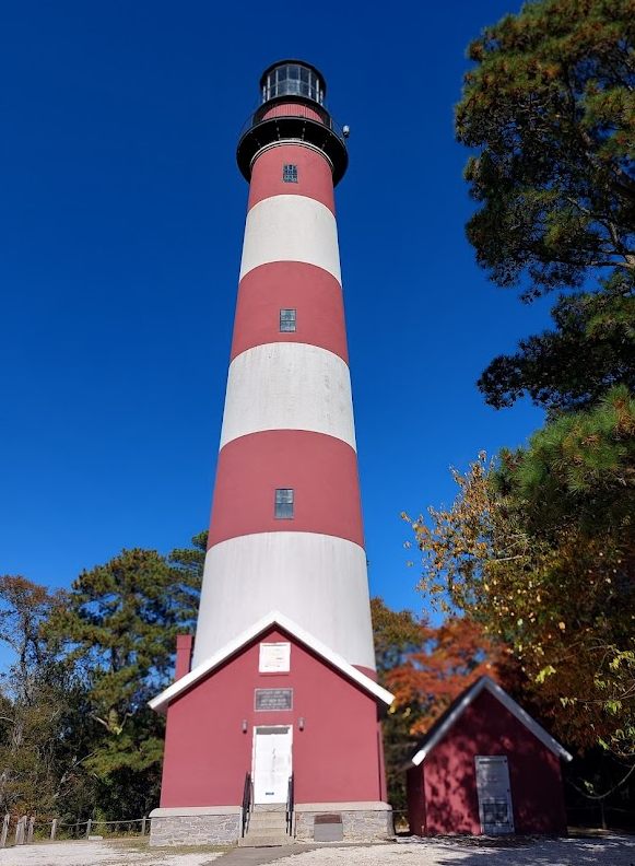
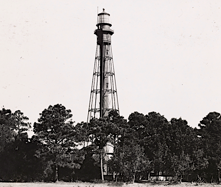
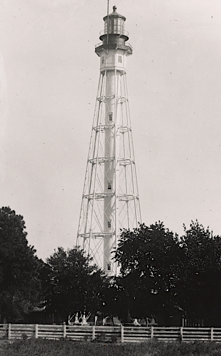
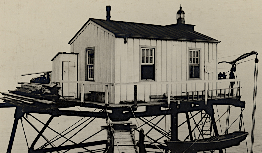
Assateague Lighthouse
In addition to lighthouses, the Federal government placed lightships offshore to identify dangerous shoals. The Winter Quarter Shoal lightship marked the shallow waters 13 miles east of Assateague Island.
The temporary removal of that lightship for maintenance in 1891 led to the wreck of President Benjamin Harrison's official yacht. The steersman on the Despatch saw the beam from the lighthouse on Assateague Island and mistakenly thought he was seeing the lightship. The ship ran aground 75 yards from the beach. The men of the U.S. Life-Saving Service rowed their surfboat to the ship ten times and rescued all 79 people aboard, along with two dogs and a cat.
The equipment and personal gear on the Despatch was a total loss. As reported in the Baltimore Sun:2
A lightship was staffed at the Winter Quarter Shoal Station from 1874-1960, except for occasional maintenance trips to port, when storms caused it to draft away, and during World War II when a buoy replaced it. Since 1960, the 6 WQS lighted bell buoy has marked the shoal.3
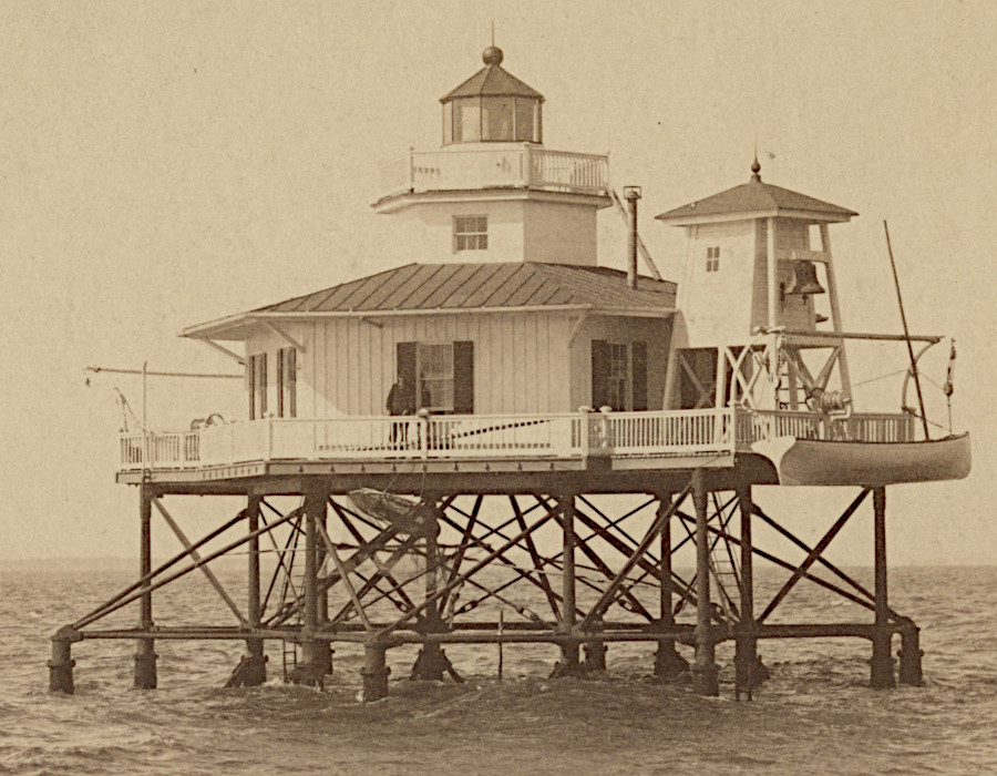
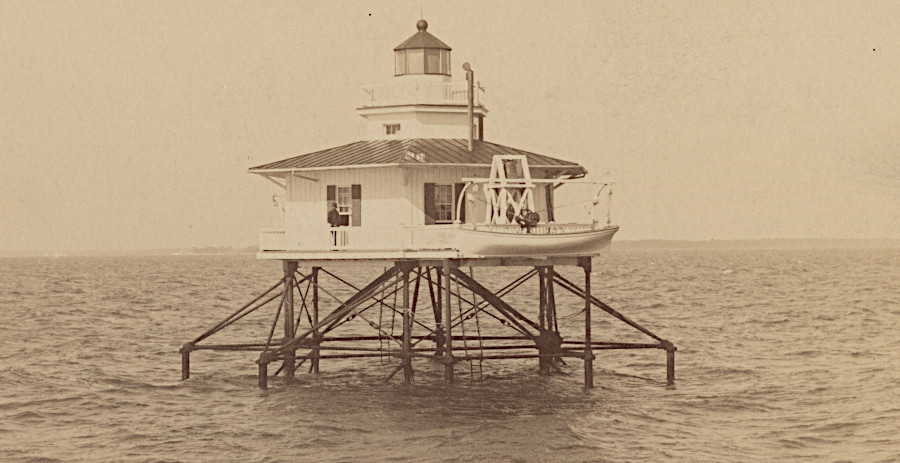
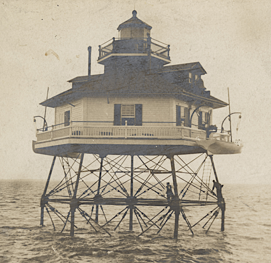
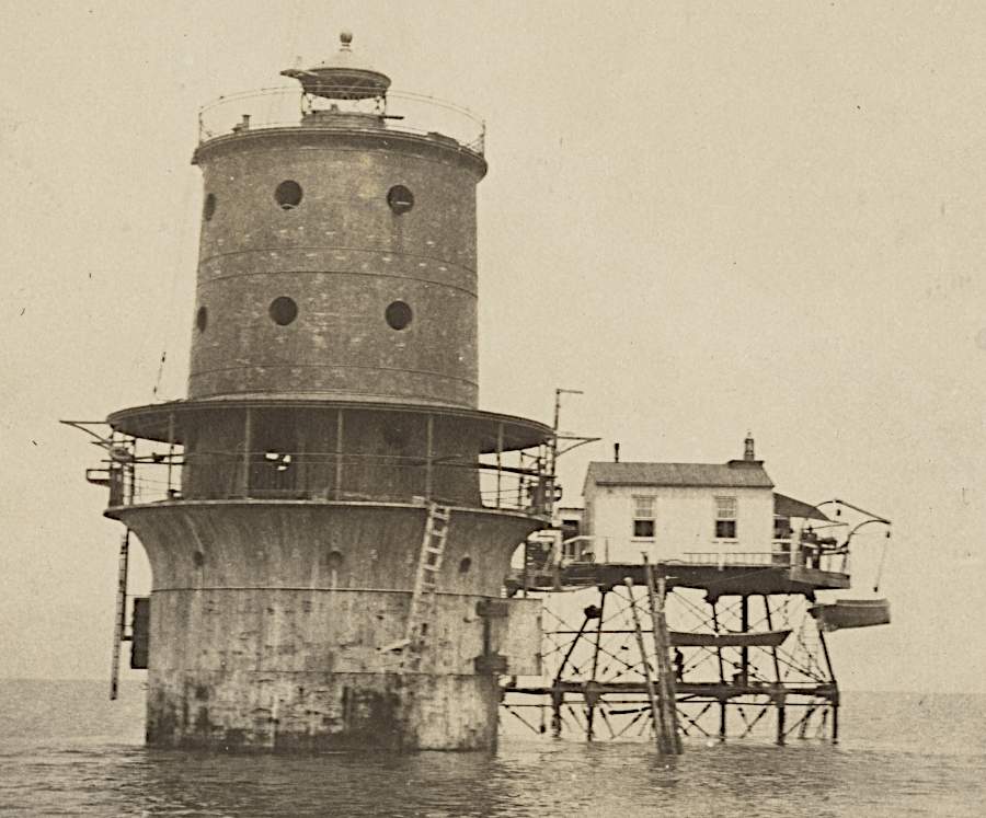
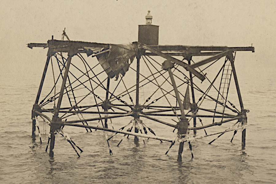
As new technology made lighthouses obsolete, the Federal government has sold some of them to private bidders under the National Historic Lighthouse Preservation Act. The Middle Ground Lighthouse in the James River near Newport News was constructed in 1891, and after 1955 no keepers staffed it. The Coast Guard sold it at public auction in 2005 for $31,000.
The new owners absorbed the cost of rehabilitating and maintaining the structure, and spent $300,000 to convert it into a vacation home. That included repainting the structure in its signature red color.
When they decided to sell it in 2026 after 20 years, they tried to list the property on Zillow with a steet address of 1 James River. There is no street address because the lighthouse is in the middle of the river; Zillow rejected the listing.4
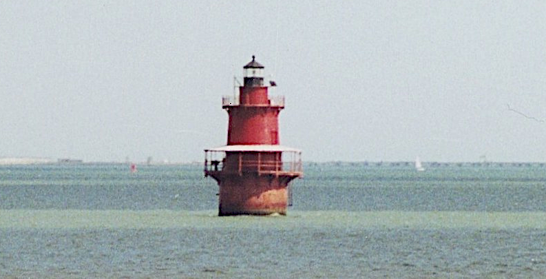
Middle Ground Lighthouse is painted red
Source: Larry Myhre, Newport News Middle Ground Light
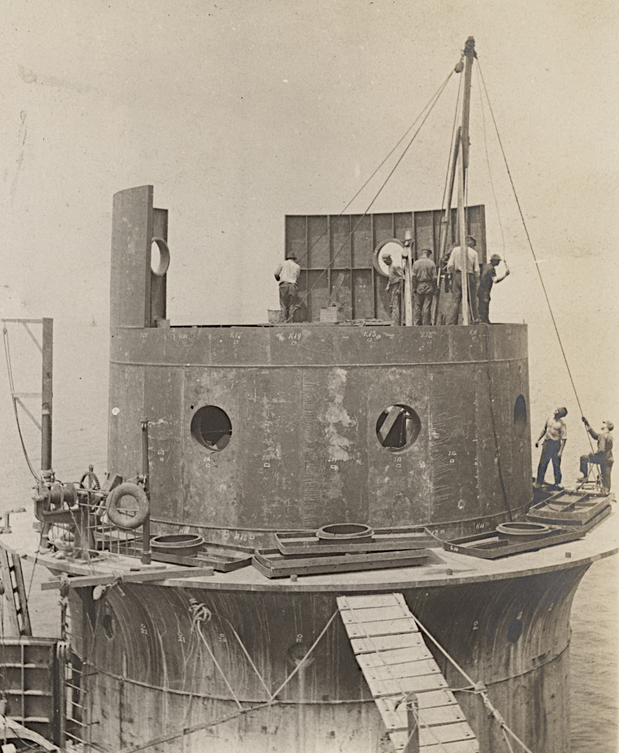
The restored lighthouse is a one-bedroom residence with a half-bathroom (using a marine sanitation system) and an enclosed outdoor shower. There are 55 steps to the sixth floor with the lantern room at the top, offering 360-degree views from 51 feet above sea level. The light is still operational, serving as a functional navigational aid for maritime traffic.
The website marketing the property displayed the restoration effort required after the original purchase. It noted:5
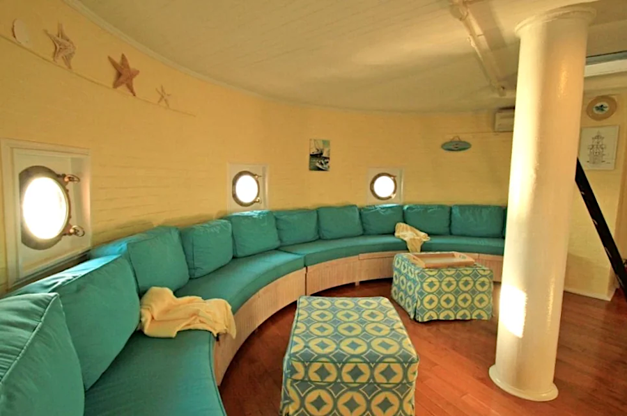
the restored porthole room at Middle Ground Lighthouse
Source: Middle Ground Lighthouse, Restoration
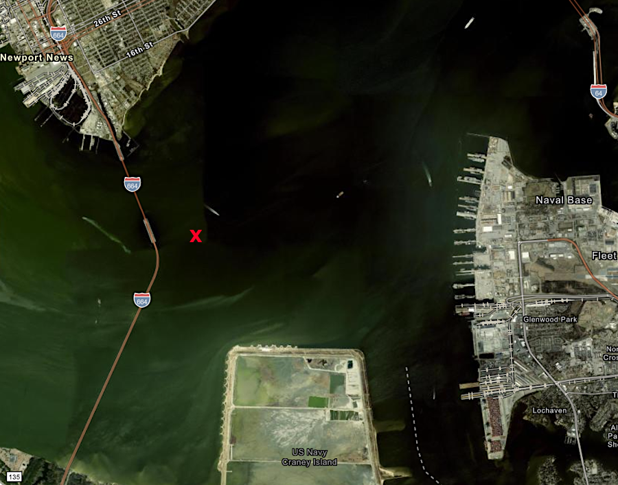
Middle Ground Lighthouse is east of the Monitor–Merrimac Memorial Bridge-Tunnel
Source: ESRI, ArcGIS Online
a lighthouse at Jones Point next to Alexandria operated between 1855-1926
Source: National Archives, Virginia - Jones Point and Library of Congress, Jones Point Lighthouse (c.1933)
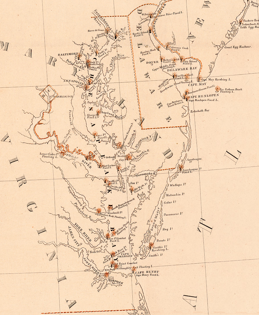
the Federal investment in lighthouses facilitated economic development on the shorelines of the Chesapeake Bay and Atlantic Ocean, and inland where transportation infrastructure supported cargo shipments to the coast
Source: Library of Congress, A chart exhibiting the light houses and light vessels on the coast of the United States of America: from Maine to Virginia inclusive (1848)
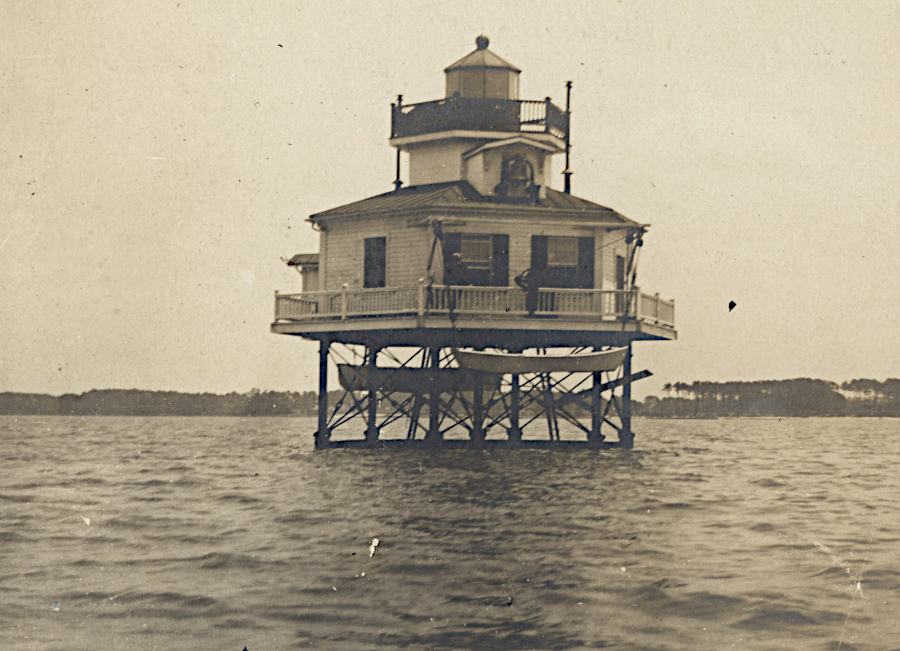
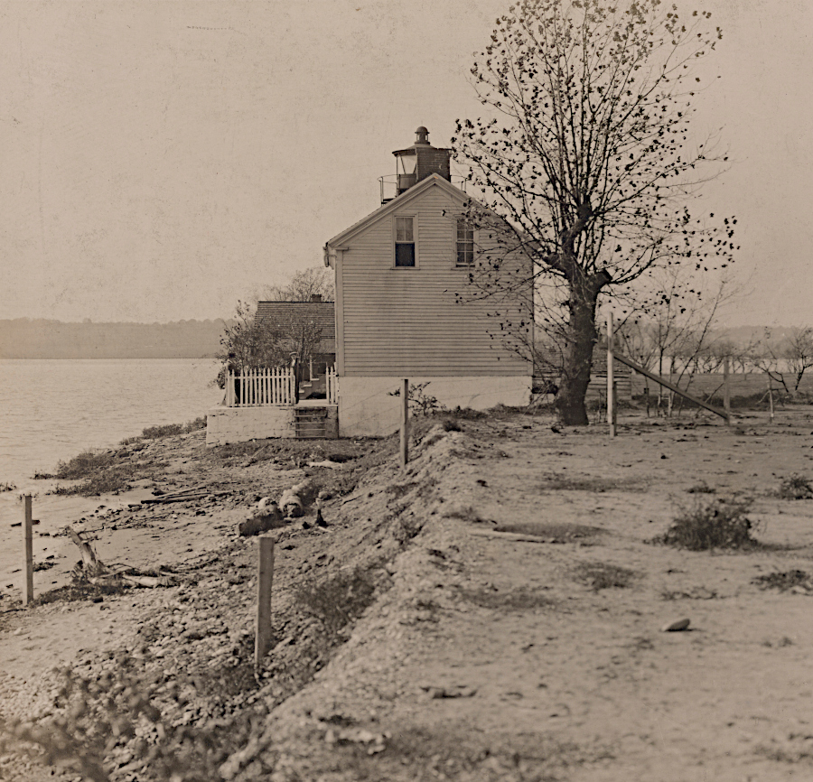
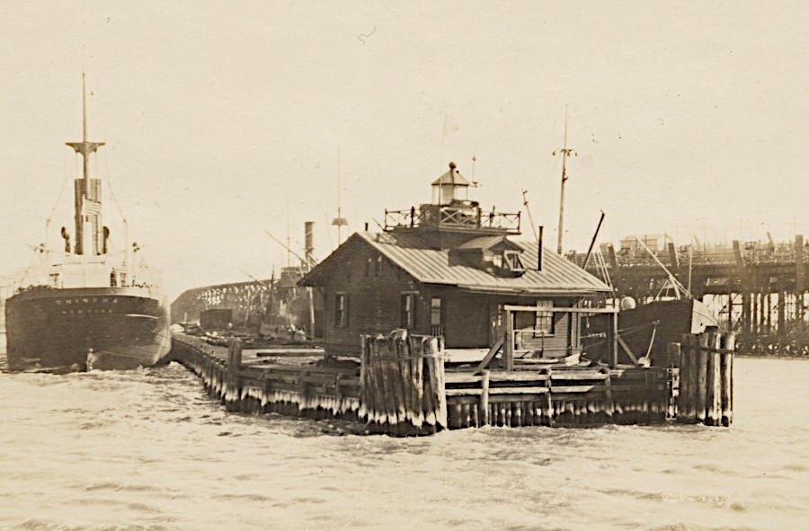
Nansemond River Light Station
Source: National Archives, Nansemond River Light Station, Virginia (1933 or earlier)
Hog Island
Source: National Archives, Virginia - Hog Island (1933 or earlier)
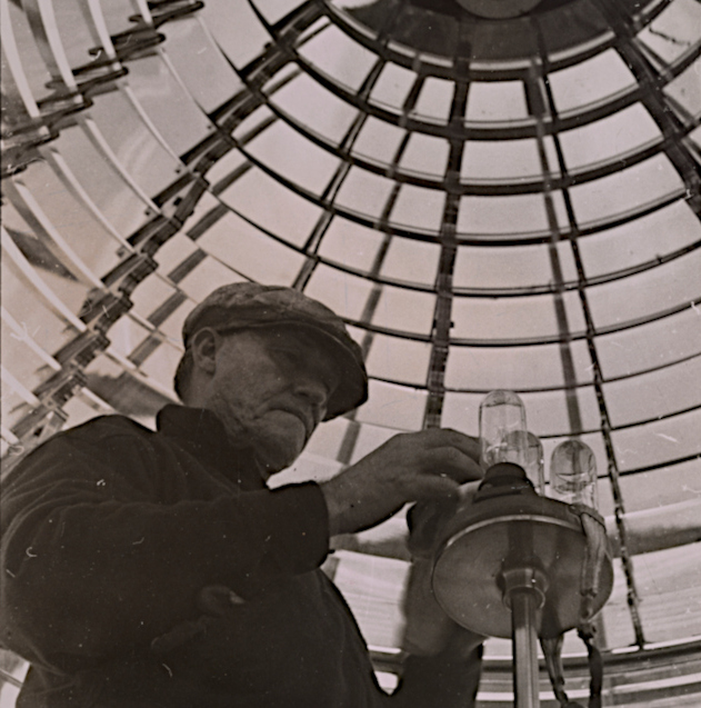
inside the Fresnel lens at Cape Henry lighthouse
Source: National Archives, Virginia - Cape Henry (1933 or earlier)
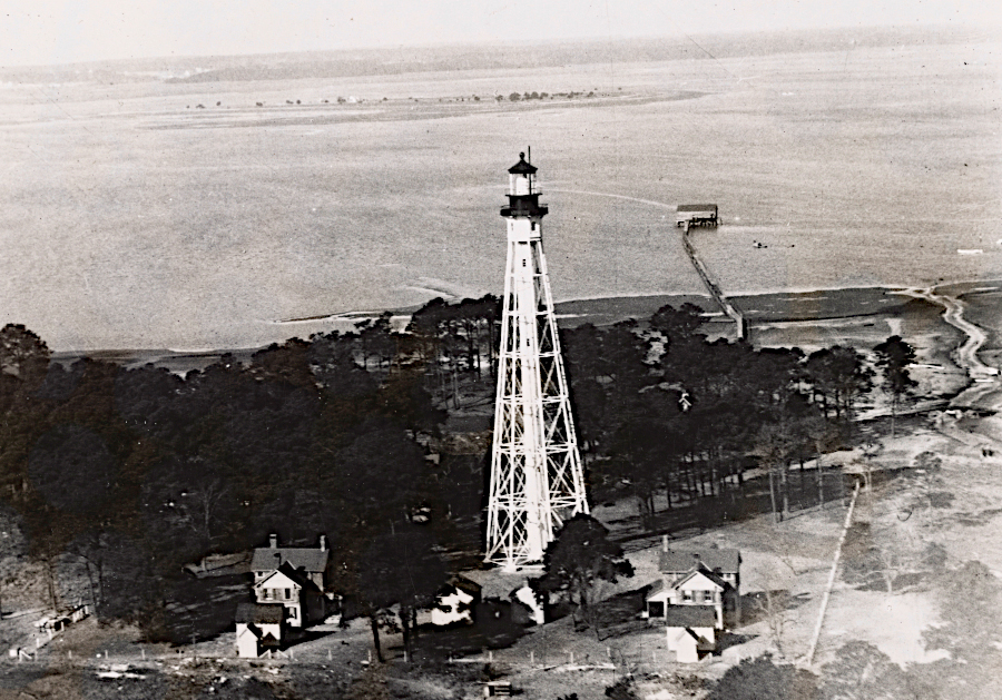
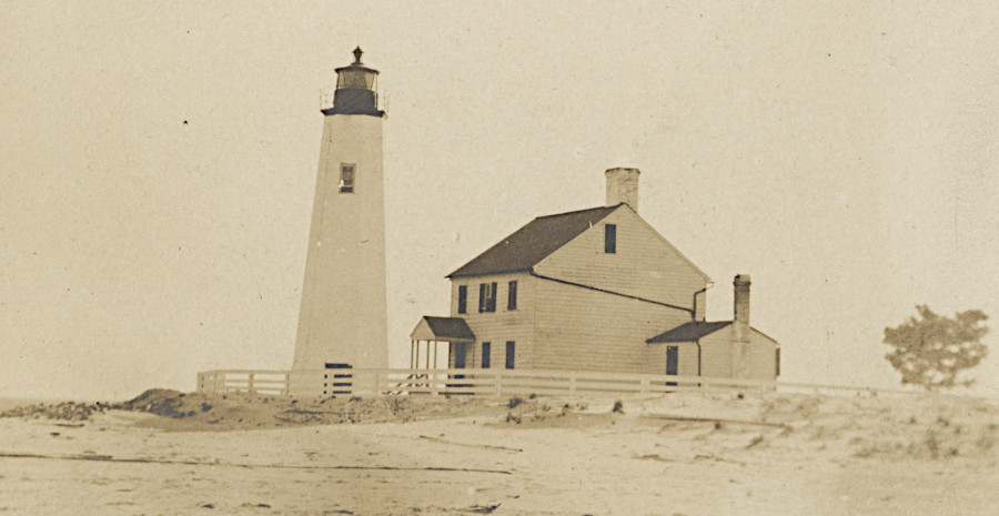
Cape Charles
Source: National Archives, Virginia - Cape Charles (1933 or earlier)
Cape Charles
Source: National Archives, Virginia - Cape Charles (1933 or earlier)
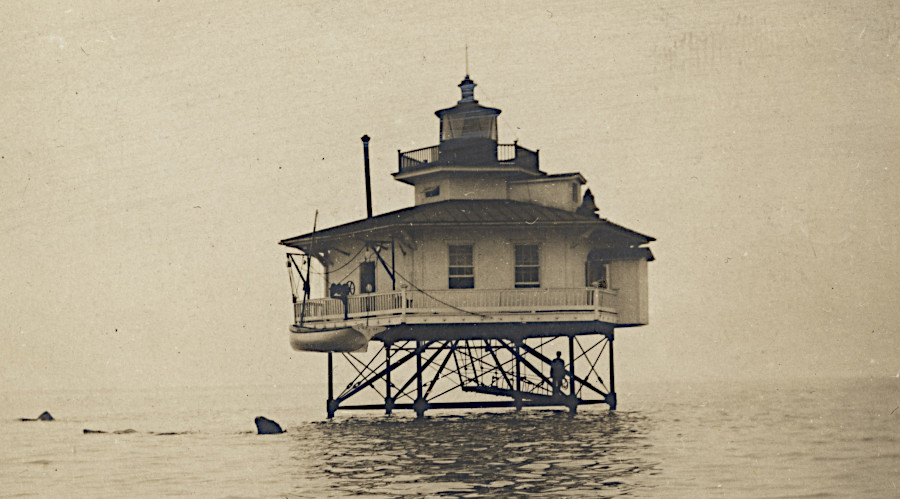
Wolf Trap
Source: National Archives, Virginia - Wolf Trap (1933 or earlier)
Windmill Point
Source: National Archives, Virginia - Windmill Point (1933 or earlier)
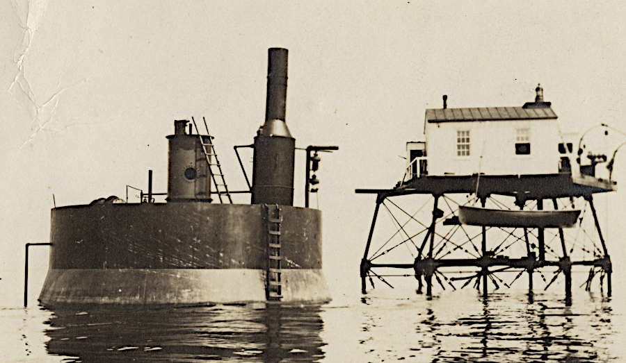
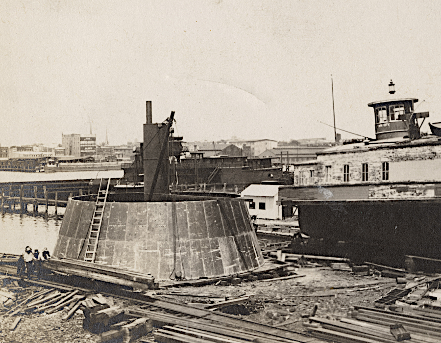
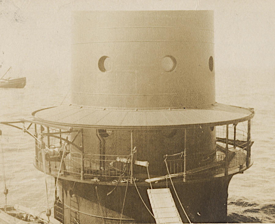
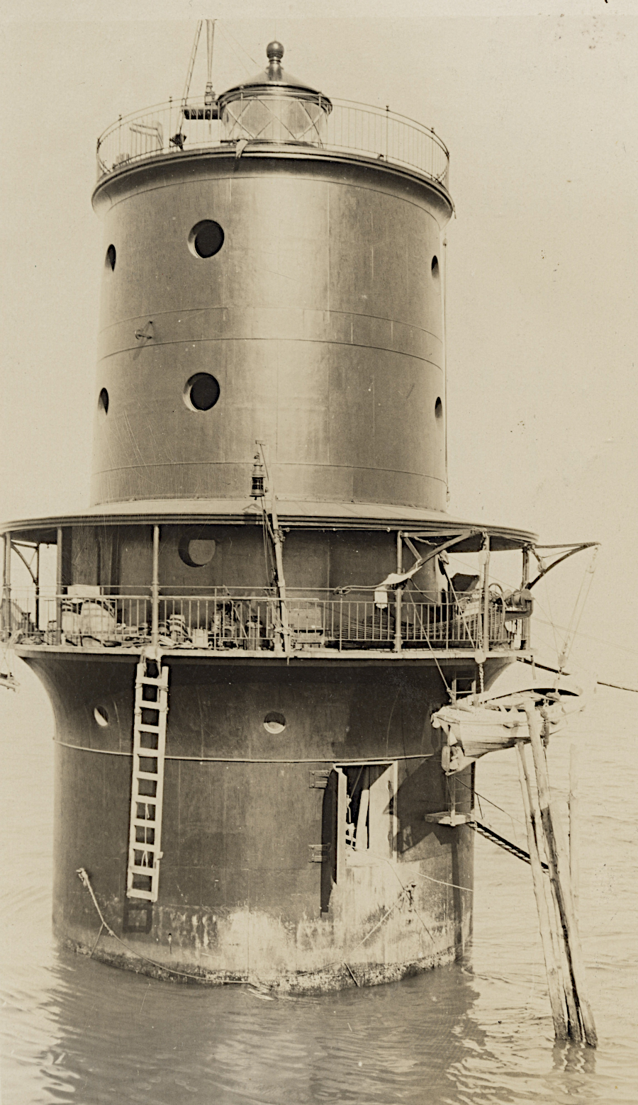
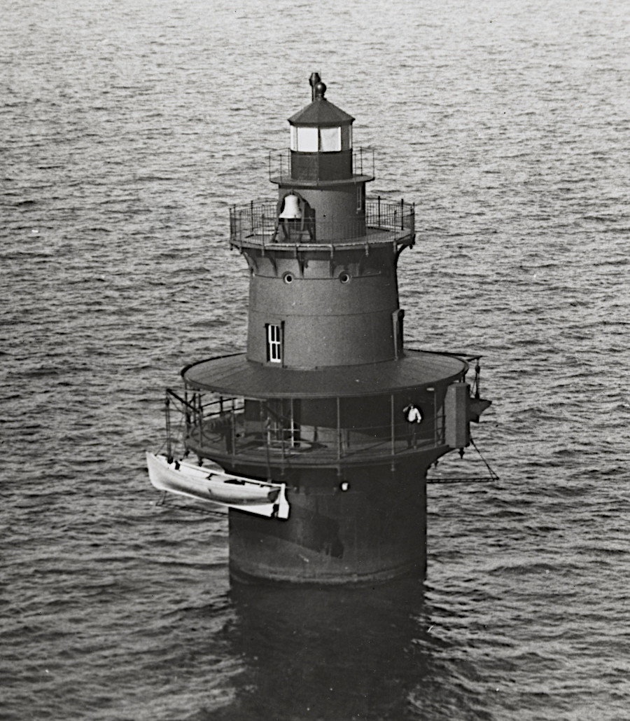
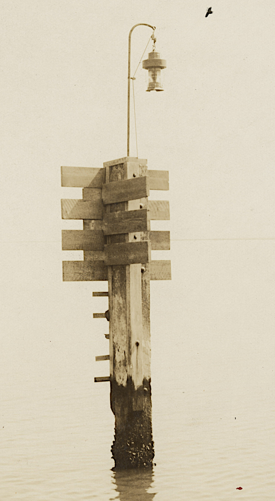
Thimble Shoal
Source: National Archives, Virginia - Thimble Shoal (1933 or earlier)
Thimble Shoal
Source: National Archives, Virginia - Thimble Shoal (1933 or earlier)
Thimble Shoal
Source: National Archives, Virginia - Thimble Shoal (1933 or earlier)
Thimble Shoal
Source: National Archives, Virginia - Thimble Shoal (1933 or earlier)
Thimble Shoal
Source: National Archives, Virginia - Thimble Shoal (1933 or earlier)
Thimble Shoal
Source: National Archives, Virginia - Thimble Shoal (1933 or earlier)
Thimble Shoal
Source: National Archives, Virginia - Thimble Shoal (1933 or earlier)
Thimble Shoal
Source: National Archives, Virginia - Thimble Shoal (1933 or earlier)
Thimble Shoal
Source: National Archives, Virginia - Thimble Shoal (1933 or earlier)
Stingray Point
Source: National Archives, Virginia - Stingray Point (1933 or earlier)
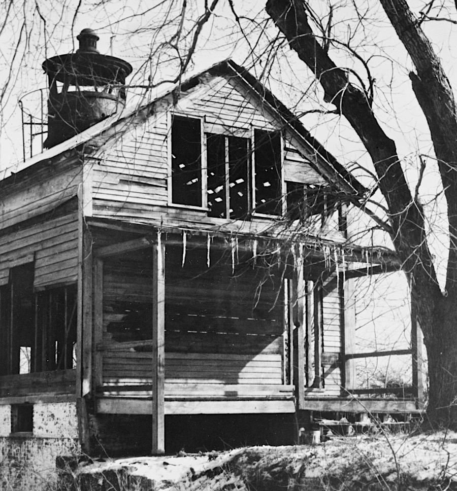
Purtan Bay
Source: National Archives, Virginia - Purtan Bay (1933 or earlier)
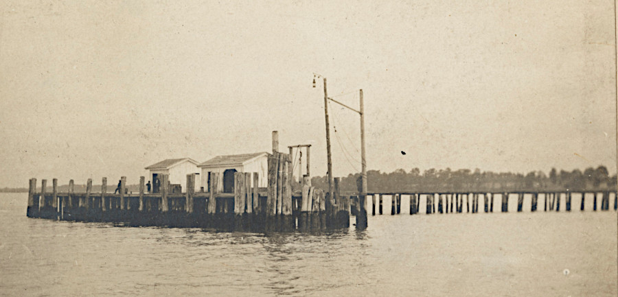
Naval Hospital
Source: National Archives, Virginia - Naval Hospital (1933 or earlier)
Newport News
Source: National Archives, Virginia - Newport News (1933 or earlier)

Matomkin Point
Source: National Archives, Virginia - Matomkin Point (1933 or earlier)
Sandy Shoal
Source: National Archives, Virginia - Sandy Shoal (1933 or earlier)
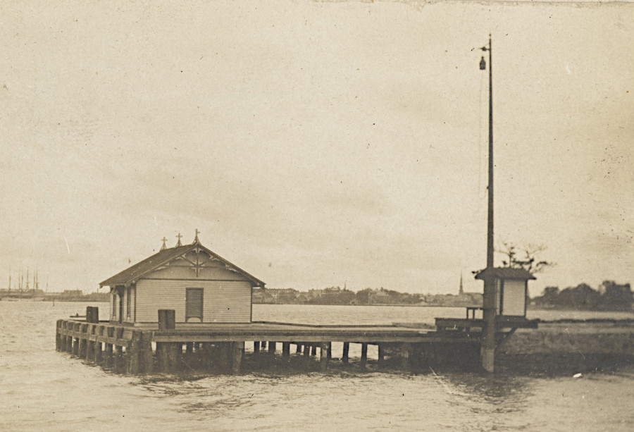
Lambert Point
Source: National Archives, Virginia - Lambert Point (1933 or earlier)
Jordan Point
Source: National Archives, Virginia - Jordan Point (1933 or earlier)
New Point Comfort
Source: National Archives, Virginia - New Point Comfort (1933 or earlier)
New Point Comfort
Source: National Archives, Virginia - New Point Comfort (1933 or earlier)
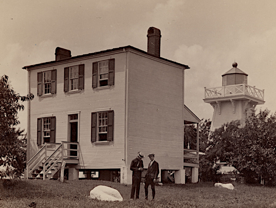
Old Point Comfort
Source: National Archives, Virginia - Old Point Comfort (1933 or earlier)
Old Point Comfort
Source: National Archives, Virginia - Old Point Comfort (1933 or earlier)

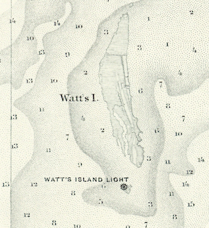
locations of the former Tangier and Watts lighthouses
Source: ESRI, ArcGIS Online
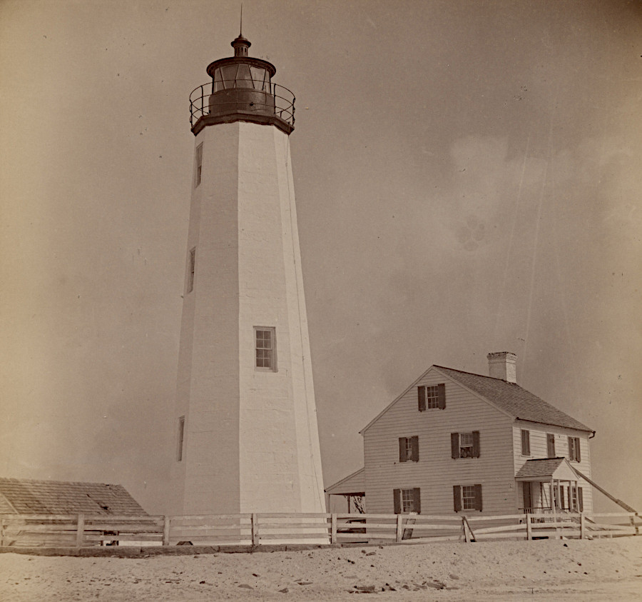
southern tip of Watts Island with lighthouse in 1866, before last lighthouse collapsed in 1944
Source: National Oceanic and Atmospheric Administration (NOAA), Historical Map and Chart Collection, Chesapeake Bay, Potomac Entrance Tangier And Pocomoke Sounds. Sheet No. 3 (1866)
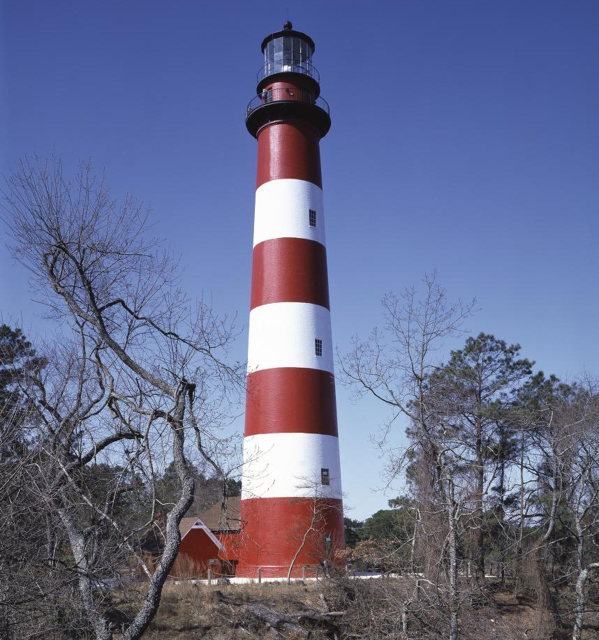
lighthouses are painted in distinctive styles so mariners can recognize where they are
Source: Library of Congress, Lighthouse on Assateague Island, Virginia