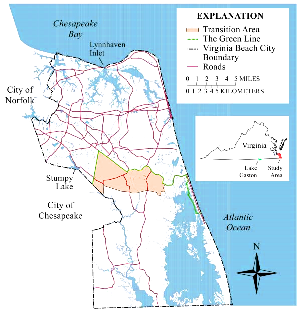
Green Line and Transitional Area, as defined in Virginia Beach land use planning
Source: US Geological Survey, The Virginia Beach Shallow Ground-Water Study (USGS Fact Sheet 173 99)
Green Line and Transitional Area, as defined in Virginia Beach land use planning
Source: US Geological Survey, The Virginia Beach Shallow Ground-Water Study (USGS Fact Sheet 173 99)
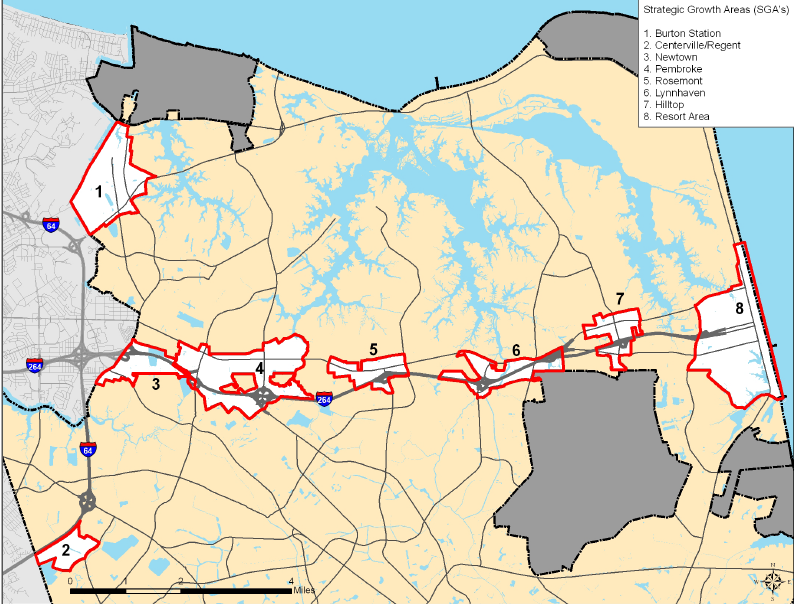
Strategic Growth Areas, where development is encouraged
Source: Virginia Beach 2009 Comprehensive Plan, Introduction
Virginia Beach merged with Princess Anne County and that county "disappeared" on January 1, 1963. It was a uniquely rural "city" at the time, and city government still has a Department of Agriculture.1
In the 1880's, the Norfolk, Virginia Beach Railroad and Improvement Company decided to create a resort on the Atlantic Ocean shoreline of Princess Anne County. The resort developer constructed the Norfolk, Virginia Beach and Southern Railroad, a narrow gauge line to carry tourists across the county from the steamship docks at Norfolk to the Atlantic Ocean shoreline at what today is the resort area of Virginia Beach. A competitor, the Chesapeake Transit Company. built a railroad to Cape Henry that carried both tourists and lumber from the forests of "The Desert."2
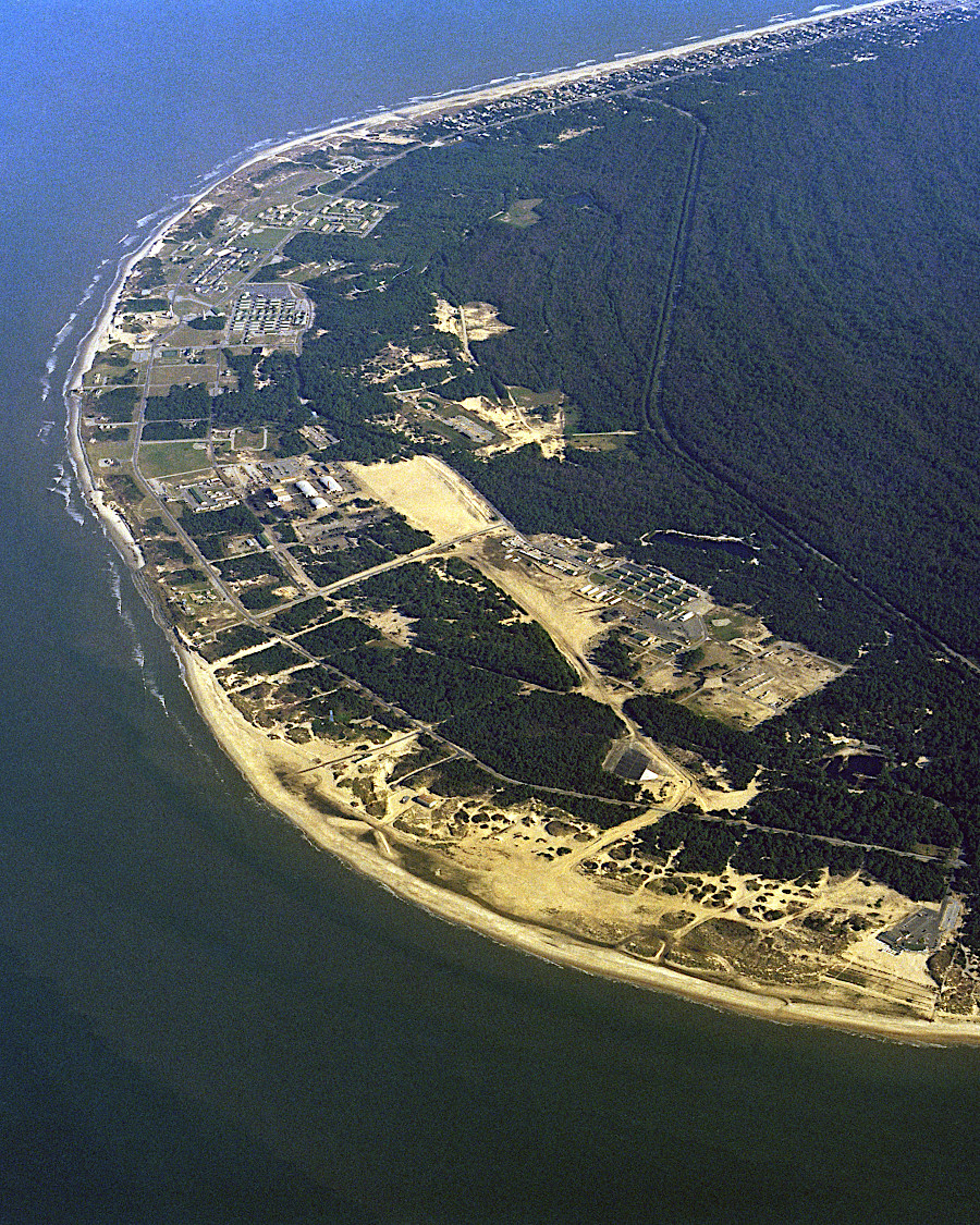
the northeastern tip of Virginia Beach now includes Joint Expeditionary Base Little Creek-Fort Story and First Landing State Park
Source: National Archives, An aerial view of Fort Story, Virginia
What is today the oceanfront resort area was originally known as Seatack. It gained that name after the British Navy shelled the area in the War of 1812. At the time, the area was occupied by free blacks who hunted, fished, and farmed the sandy soils.
The middle of the Atlantic Ocean shoreline on the eastern edge of Princess Anne County was known as Seatack when the life saving station was built there in 1878. It kept that designation until the Virginia Beach Hotel was built in 1883. Afterwards, the resort area on the waterfront was called Virginia Beach and Seatack referred to just the inland area occupied primarily by African-American farmers.
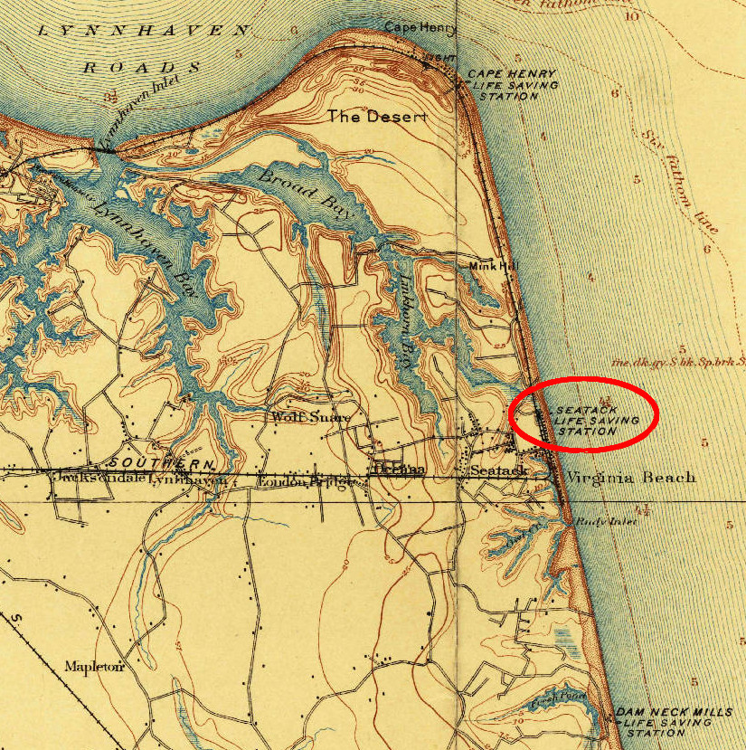
what is now the resort area of Virginia Beach was originally called Seatack
Source: US Geological Survey (USGS), Norfolk, VA 1:125,000 topographic quadrangle (1902)
Thanks to funding from a National Park Service initiative to recognize underrepresented communities, Seatack was added to the Virginia Landmarks Register in 2023. The 100 acres originally owned by Georgie Anne Williams and William Newton Williams Sr. in the 1890's were subdivided, and by 1915 Seatack was a distinct community. The Seatack Volunteer Fire Department, formed in 1948, was one of the first fire stations in the country owned and operated entirely by African Americans.
Station 12 Seatack Volunteer Fire Department was formed in 1948 because the closest fire station in Virginia Beach charged $50 to respond to fires outside the Beach Borough. In the segregated 1940's, Seatack sought to become more self sufficient. Norfolk already had an African American crew staffing a city-owned fire station, but Seatack's black community owned its facility. Today the Seatack Recreation Center occupies the site of that fire station.3
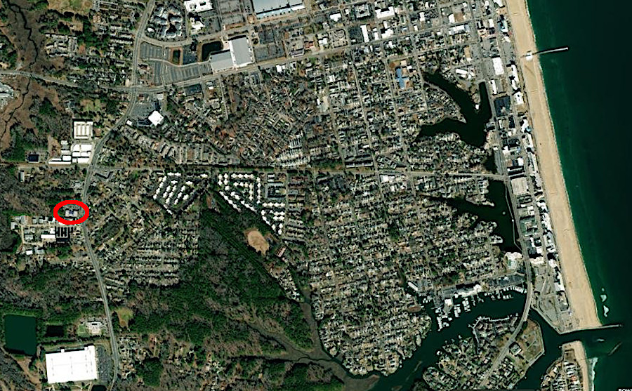
the site of historic Station 12 Seatack Volunteer Fire Department is now the Seatack Recreation Center
Source: ESRI, ArcGIS Online
The Seatack community is gradually disappearing. It is located east of Naval Air Station Oceana, in an area which is at risk if a fighter plane crashes. In 2005, the Base Realignment and Closure (BRAC) commission proposed closing Oceana because of suburban encroachment at the edges. To keep the second-largest employer in Virginia Beach, the city agreed to alter its zoning process. In Seatack, the city is approving new commercial buildings such as storage units for household goods rather than new houses.4
In addition to the military, tourism is another other key part of the city's economy.
The Forbes Salt-Water Taffy store on 17th Street and Atlantic Avenue claims to be the oldest retail outlet on the strip, selling the production from for the oldest manufacturing operation in the city. The retail outlet started in 1933.
The iconic Virginia Beach Fishing Pier was built in 1950, then repaired after the Ash Wednesday storm in 1962, Hurricane Gloria in 1985, and Hurricane Isabel in 2003. The pier is a private facility with a franchise license issued by the city.5
The shoreline has shifted in the past as well. In 1607 when the English first landed at what they named Cape Henry, the northeastern tip of Virginia may have been cut off from the rest of the city by an inlet connecting the Atlantic Ocean to Lynnhaven River. Today, Crystal Lake remains linked to Lynnhaven River thanks to dredging of Rainey Gut on the southwestern edge of First Landing State Park, but storms have moved the sand and closed the inlet on the ocean side connecting Crystal Lake to the Atlantic Ocean.6
The highest point in Virginia Beach is the top of the former landfill, Mount Trashmore. The city indicates it is 60-65 feet tall.7
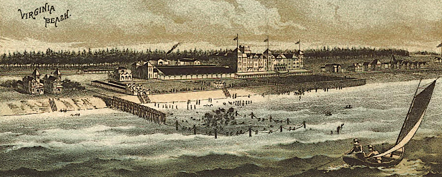
the Atlantic Ocean shoreline was developed as a tourist center by the Norfolk, Virginia Beach Railroad and Improvement Company in the 1880's
Source: Library of Congress, Panorama of Norfolk and surroundings 1892 (by Henry Wellge)
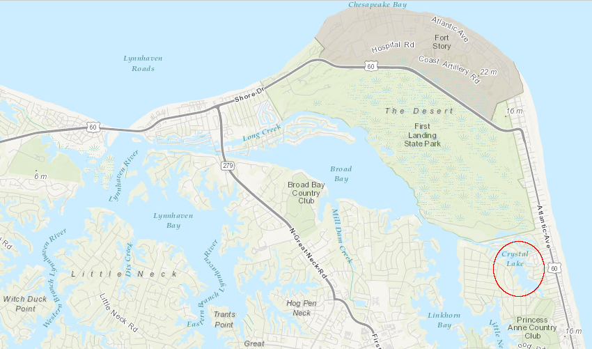
the tip of Virginia Beach with First Landing State Park and Fort Story may have been an island in 1607, with an inlet (now closed) connecting Crystal Lake to the Atlantic Ocean
Source: ESRI, ArcGIS Online
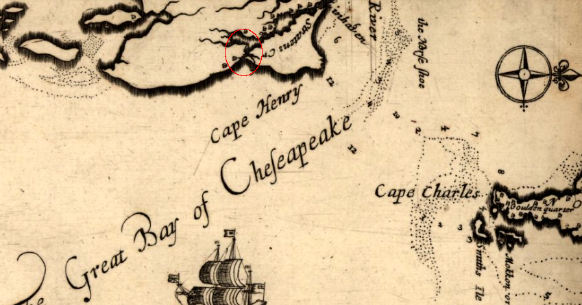
an inlet on the Atlantic Ocean linked to Lynnhaven River in 1670, isolating the northeastern tip of what became the City of Virginia Beach
Source: Library of Congress, Virginia and Maryland as it is planted and inhabited this present year 1670 (map by Augustine Herrman has north oriented to the right)
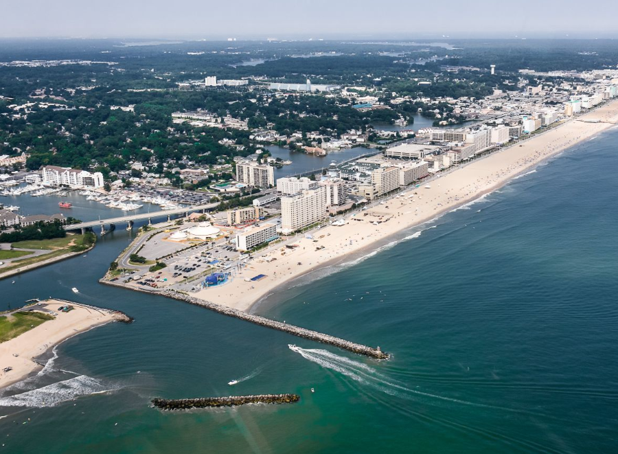 Rudee Inlet
Source: City of Virginia Beach, Virginia Beach Comprehensive Sea Level Rise and Flooding Response Plan
the resort area of Virginia Beach developed only after the railroad provided access
Source: Boston Public Library, Tichnor Brothers Postcard Collection, Cabanas, Virginia Beach, Va.
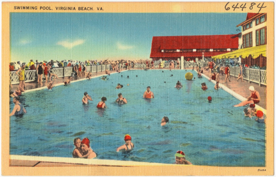
swimming pools offered a fresh water experience in Virginia Beach
Source: Boston Public Library, Tichnor Brothers Postcard Collection, Swimming pool, Virginia Beach, VA.
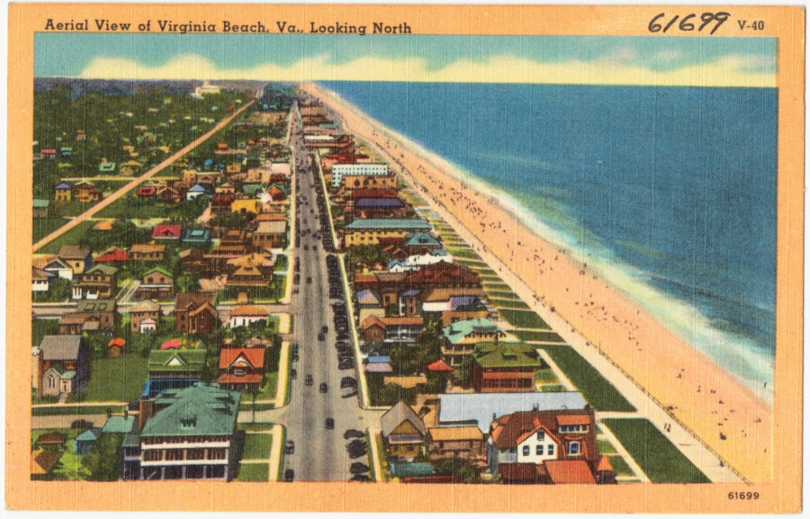
small cottages were built before large hotels along Atlantic Avenue
Source: Boston Public Library, Tichnor Brothers Postcard Collection, Aerial view of Virginia Beach, looking north
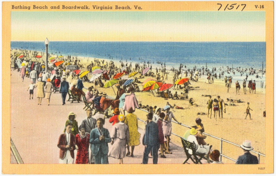
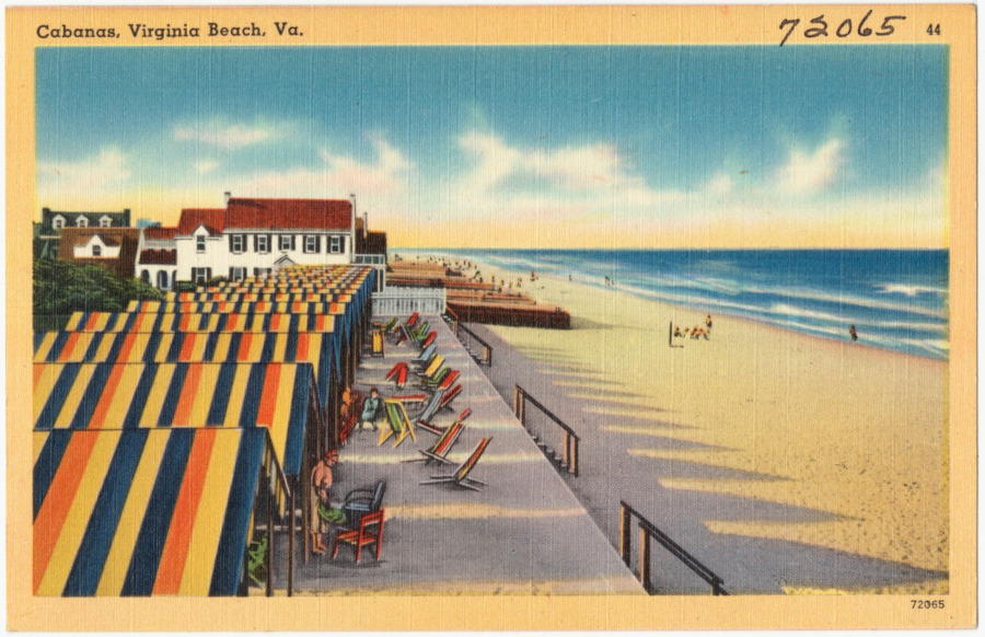
the boardwalk at the resort area of Virginia Beach
Source: Boston Public Library, Tichnor Brothers Postcard Collection, Bathing beach and boardwalk, Virginia Beach, VA
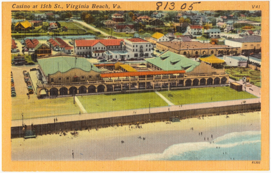
Seaside Park, started in 1906, became know as the Virginia Beach Casino prior to the United States entry into World War I
Source: Boston Public Library, Tichnor Brothers Postcard Collection, Casino at 15th St., Virginia Beach, Va
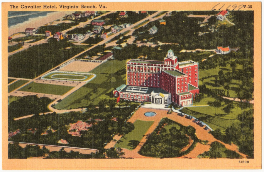
the Cavalier Hotel, prior to 1945
Source: Boston Public Library, Tichnor Brothers Postcard Collection, The Cavalier Hotel, Virginia Beach, Va.
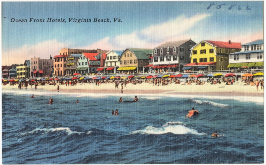
hotels on the waterfront prior to 1945 are clearly different from resort area hotels today
Source: Boston Public Library, Tichnor Brothers Postcard Collection, Ocean front hotels, Virginia Beach, Va.

an offshore barge dredged sand in 2013 for the Virginia Beach Hurricane Protection Beach Renourishment Project (Big Beach)
Source: US Army Corps of Engineers, 130110-A-ON889-144
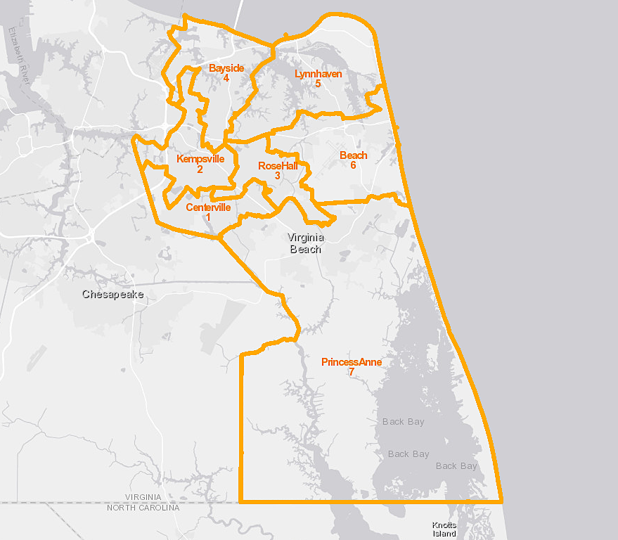
since merger of Princess Anne County and Virginia Beach in 1963, seven of the 11 candidates for city council must live within specific districts but all city residents vote for them
Source: Virginia Beach, VBgov City Map
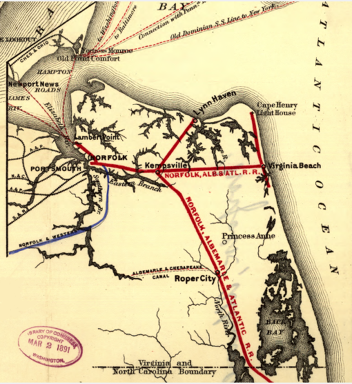 railroads in Princess Anne County, 1891
Source: Library of Congress, Maps showing the Norfolk, Albermarle & Atlantic Railroad and its connections
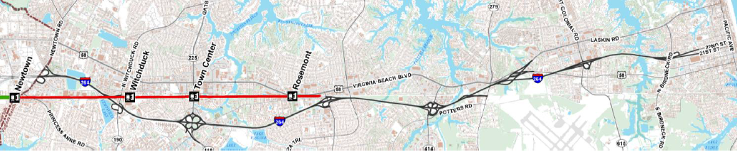 one of three proposed routes for light rail extension in Virginia Beach would reach Town Center, but not the Oceanfront
Source: Virginia Beach City Council Update, Virginia Beach Transit Extension Study (January 14, 2014)
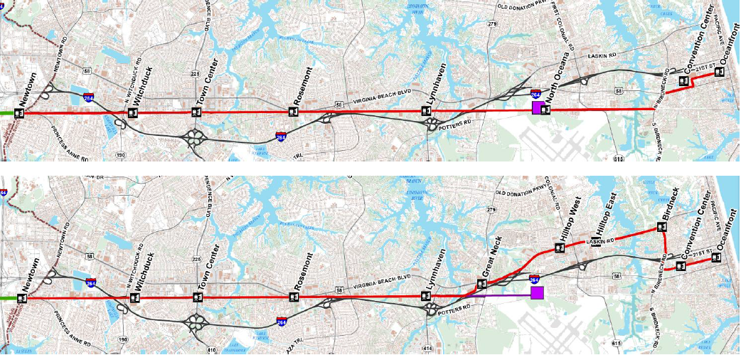
two other proposed routes for light rail extension in Virginia Beach would reach the Oceanfront, by different routes
Source: Virginia Beach City Council Update, Virginia Beach Transit Extension Study (January 14, 2014)

the United States Life Saving Service used breeches buoys to rescue shipwrecked sailors and passengers
Source: Cooper Hewitt Museum, print by Winslow Homer, 1889
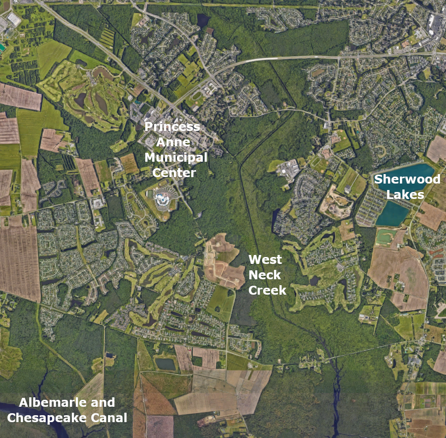
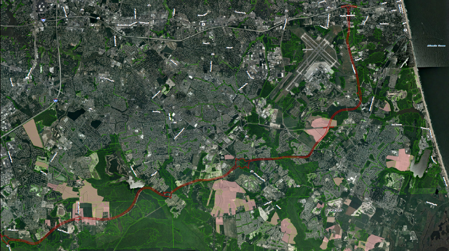
the upstream end of West Neck Creek has been channelized to create dry land and manage flooding risk
Source: GoogleMaps
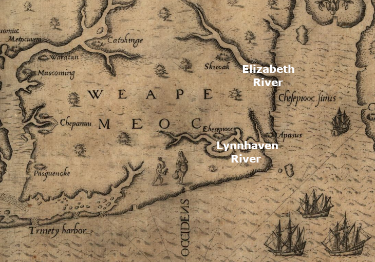
Virginia Beach was explored and mapped by the colonists on Roanoke Island
Source: Library of Congress, Americae pars, nunc Virginia dicta (by John White, 1590)
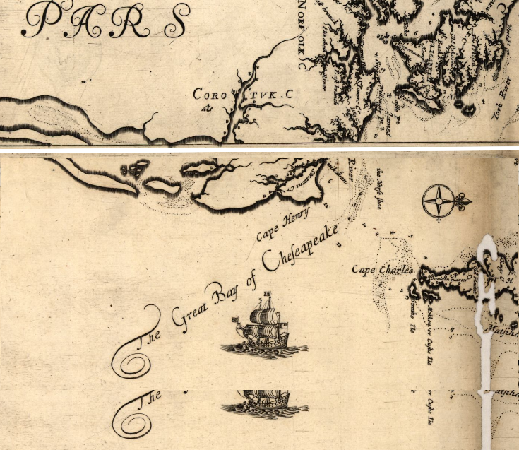
in 1672, Lynnhaven River may have been connected to the Atlantic Ocean, making Cape Henry an island
Source: Library of Congress, Virginia and Maryland as it is planted and inhabited this present year 1670 (by John White, 1590)
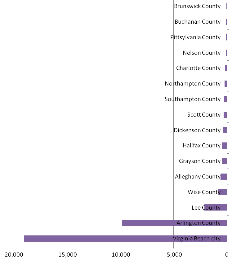
Virginia Beach is projected to lose more population in the 20 years between 2020 and 2040 (dropping from 438,114 people in 2020 to 419,103 people in 2040) than any other city or county in Virginia
Source: University of Virginia Weldon Cooper Center, Virginia Population Projections - Locality, Total Population
proposed Southeastern Parkway in Virginia Beach
Source: Federal Highway Administration and Virginia Department of Transportation, Southeastern Parkway & Greenbelt Study - Final Environmental Impact Statement (Exhibit 4-22)
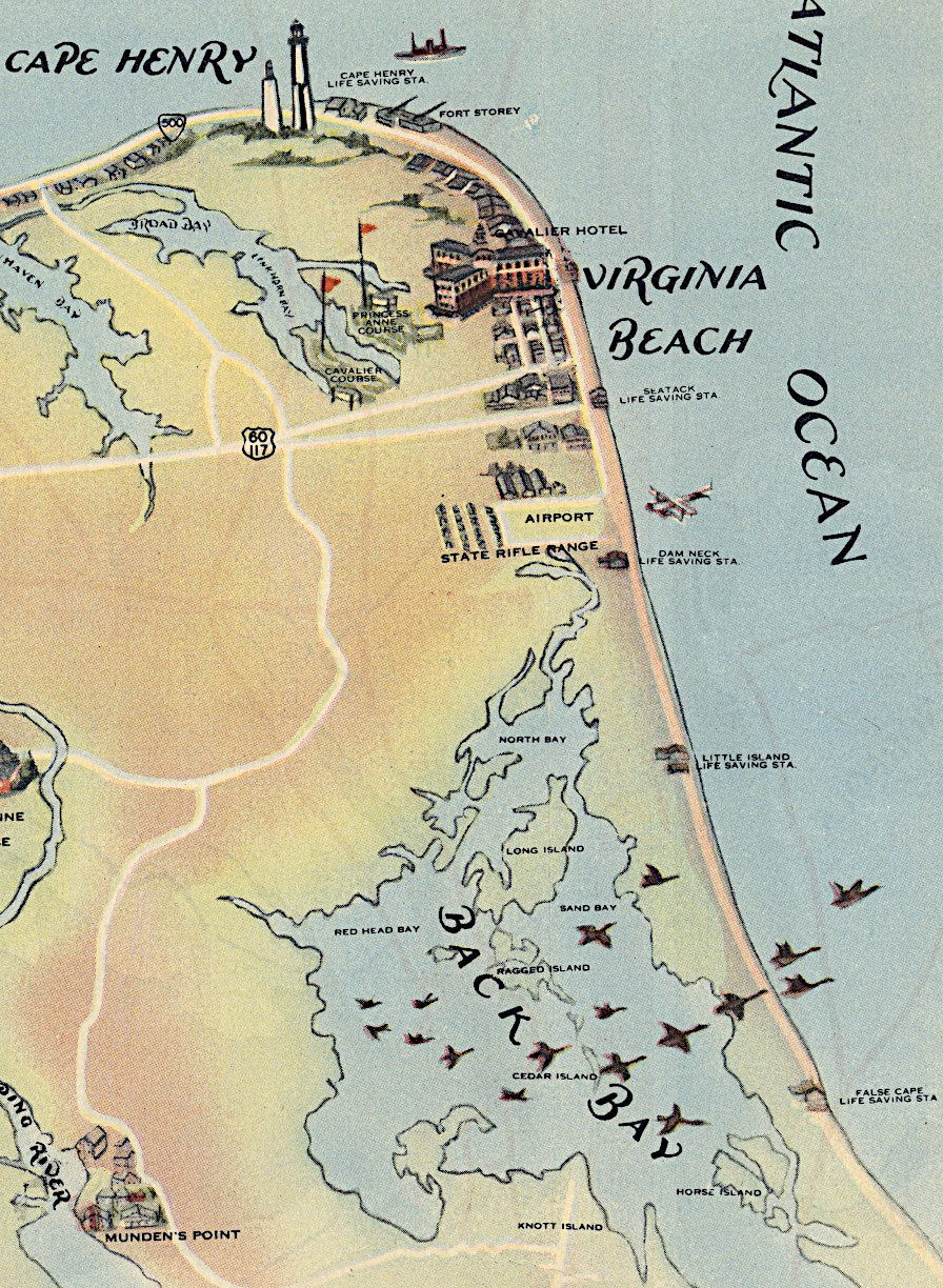
life saving stations on the Virginia Beach waterfront, 1930
Source: David Rumsey Historical Map Collection, Virginia seashore : a year round playground among historic shrines (James River Bridge Corporation, 1930)
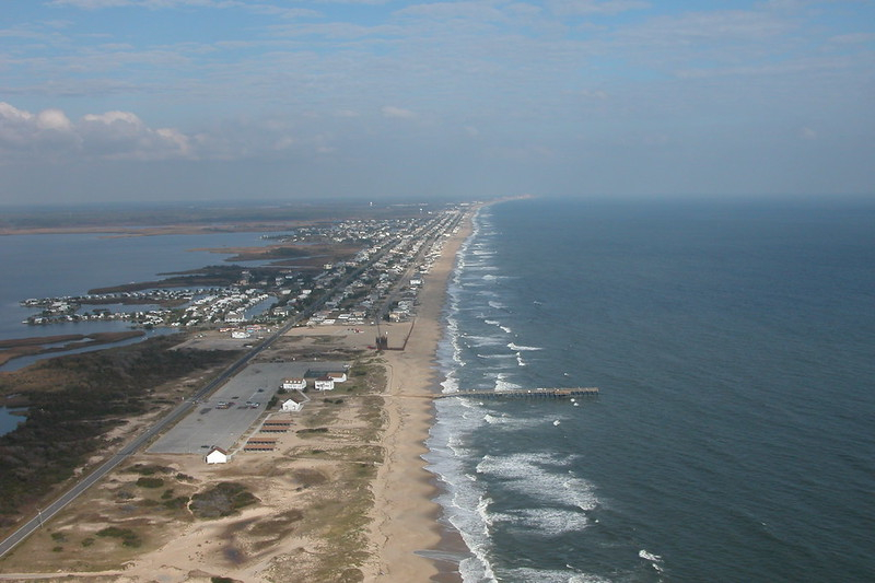
Sandbridge
Source: US Army Corps of Engineers, Sandbridge, Va. (041028-A-1111A-001)
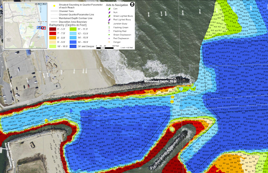
dredging by the Corps of Engineers maintains a 12' deep shipping channel at Rudy Inlet
Source: US Army Corps of Engineers, Rudee Inlet, project condition survey (after dredging): Survey dates: April 25, & 27, 2022